

Surf Forecasts:

South Haven surf forecast from 6 Jul 2026:
- Most powerful swell: Monday 6 Jul, 8PM (local time) - 3.5ft (1.0m), 5s period, N swell with 52 kJ wave energy.
Best Forecast Surf Conditions for South Haven this week:
The most powerful waves expected at South Haven in the next 16 days are 1.0m 5s and forecast to arrive on Monday (Jul 06) at 8PM. Winds are predicted to be cross-offshore at the time the swell arrives. The largest open ocean swell (not directed at the beach) is 0.7m 6s period and expected on Saturday (Jul 11) at 5AM.
| Wave Type | Time (EDT) & Date | Wave Height & Period |
|---|---|---|
| Next good surf (1 star+) | - | - |
| Best Surf | - | - |
| Most Powerful | 8PM (Mon 6th Jul) | 3.5ft (1.0m) 5s |
Table - best surf conditions forecast for South Haven over the next 16 days.
Updates in hr min s Forecast update imminent
Alright, I’m gonna level with you. South Haven is pretty much a surf desert for the next couple of weeks. The first few days have some tiny, weak, messy waves, and then it goes totally flat. There’s no standout session, no spot to get excited about. Here’s how it shakes out.
Monday afternoon (July 6th) gives you a tiny 3ft wave from the north, but it’s only got a 4-second period – that’s just wind chop, no real power. The combined energy is a low 22 – you’ll hardly feel it. Wind is cross-offshore from the north-northeast at 9 mph, so the surface cleans up, but with that short period and small size, it’s barely ridable on a longboard. South Haven is a beach-and-pier set-up, exposed to the west, and this north swell is coming from the wrong direction for the break.
Water temp is 71°, which is 7° warmer than usual for this time of year – that’s a huge anomaly. You might not need much rubber, which is nice, but that’s the only nice thing.
Tuesday morning (July 7th) gets even smaller – 1ft from the north, period still only 5 seconds, energy at 4. Tuesday afternoon shrinks more and turns onshore. The rest of the week stays weak – Wednesday, Thursday, and Friday have nothing over 2ft with short periods, mostly cross-onshore wind, and energy readings never topping 17. The data calls it “poor surf conditions” and it fits. By Saturday morning (July 11th), there’s a blink of 0.7ft with a moderate cross-shore wind, but that’s not worth getting wet for.
Then from Saturday afternoon (July 11th) straight through to Tuesday July 21st, it’s all zeros. Combined energy of 0 for every session. Wind stays variable, often cross-onshore or onshore, sometimes fresh and lumpy. Nothing for a surfer. If you’re into kiting or maybe a SUP in the wind, you might find something, but for a traditional paddle surfer, this is a 10-day flat spell without any real surf.
South Haven is usually fairly consistent, so this empty run is painful. Forecasts might change, but right now you’re looking at a long, quiet stretch after those first few poor, tiny days. Don’t get your hopes up.
Rusty
Short Range ForecastMostly dry. Warm (max 27°C on Mon afternoon, min 19°C on Mon night). Wind will be generally light. | Days 5-7 Weather SummaryHeavy rain (total 72mm), heaviest during Fri night. Warm (max 25°C on Thu afternoon, min 22°C on Fri night). Wind will be generally light. | ||||||||||||||||||||
Mon 6 | Tuesday 7 | Wednesday 8 | Thursday 9 | Friday 10 | Saturday 11 | Sunday 12 | |||||||||||||||
PM | Night | AM | PM | Night | AM | PM | Night | AM | PM | Night | AM | PM | Night | AM | PM | Night | AM | PM | Night | AM | |
Swell Height Map | 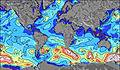 | 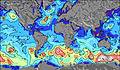 | 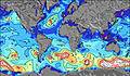 | 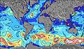 | 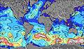 | 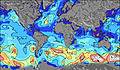 | 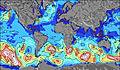 | 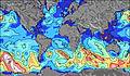 | |||||||||||||
Wave Height (m) Direction Period (s) | N 4 | N 6 | N 5 | NNW 4 | — | — | — | SSW 2 | SW 3 | SW 3 | WSW 3 | NNW 4 | N 5 | N 6 | N 5 | NNE 4 | NNE 4 | NE 2 | — | — | — |
Wave Graph | |||||||||||||||||||||
22 | 41 | 4 | 1 | 0 | 0 | 0 | 1 | 3 | 2 | 1 | 11 | 17 | 43 | 2 | 0 | 0 | 0 | 0 | 0 | 0 | |
Wind (km/h) | |||||||||||||||||||||
Wind State on-shore cross-onshore cross-shore cross-offshore off-shore glassy | cross-off | off | cross-off | cross-on | off | cross-on | cross-on | cross-on | cross-on | cross-on | cross-on | cross-on | on | cross-off | cross | cross-on | on | cross-on | cross-on | glassy | cross-on |
High Tide | |||||||||||||||||||||
Low Tide | |||||||||||||||||||||
— | — | 6:15 | — | — | 6:15 | — | — | 6:16 | — | — | 6:16 | — | — | 6:18 | — | — | 6:18 | — | — | 6:18 | |
— | 9:23 | — | — | 9:23 | — | — | 9:23 | — | — | 9:22 | — | — | 9:22 | — | — | 9:22 | — | — | 9:22 | 9:21 | |
mm | — | — | — | — | — | — | — | — | — | 2 | 1 | — | — | 69 | — | — | — | — | — | — | — |
Temp °C | 27 | 26 | 24 | 24 | 23 | 24 | 26 | 27 | 23 | 25 | 25 | 24 | 25 | 24 | 24 | 24 | 23 | 24 | 25 | 24 | 25 |
Feels °C | 27 | 27 | 23 | 24 | 23 | 24 | 26 | 28 | 24 | 26 | 27 | 27 | 28 | 27 | 24 | 23 | 23 | 25 | 27 | 25 | 26 |
Swell 1 Height (m) Direction Period (s) | — | N 6 | N 5 | — | — | — | — | — | — | — | — | — | — | N 6 | N 5 | — | NNE 4 | — | — | — | — |
— | 41 | 4 | — | — | — | — | — | — | — | — | — | — | 43 | 2 | — | 3 | — | — | — | — | |
Swell 2 Height (m) Direction Period (s) | — | — | — | — | — | — | — | — | — | — | — | — | — | — | — | — | — | — | — | — | — |
— | — | — | — | — | — | — | — | — | — | — | — | — | — | — | — | — | — | — | — | — | |
Swell 3 Height (m) Direction Period (s) | — | — | — | — | — | — | — | — | — | — | — | — | — | — | — | — | — | — | — | — | — |
— | — | — | — | — | — | — | — | — | — | — | — | — | — | — | — | — | — | — | — | — | |
Wind waves Height (m) Direction Period (s) | N 4 | — | — | NNW 4 | — | — | — | SSW 2 | SW 3 | SW 3 | WSW 3 | NNW 4 | N 5 | — | NE 3 | NNE 4 | — | NE 2 | — | — | — |
22 | — | — | 1 | — | — | — | 1 | 3 | 2 | 1 | 11 | 17 | — | 2 | 2 | — | 1 | — | — | — | |
Nearest Offshore or Glassy | |||||||||||||||||||||
Distance (km) | 2862 | 1042 | 1038 | 1097 | 1042 | 1036 | 1204 | 1044 | 1147 | 1076 | 1042 | 1050 | 1038 | 1052 | 1053 | 1853 | 1225 | 1164 | 1164 | 1033 | 1032 |
Best forecast wave conditions in Lake Michigan | |||||||||||||||||||||
Best forecast wave conditions in United States | |||||||||||||||||||||
Header Global | |||||||||||||||||||||
- Map Icons:
 Break
Break Live Wave Height (m)
 Live Wind Speed (km/h)
 Surf Rating (10 Max)
 Ocean Swells (m)
- Wind Speed (km/h)


FREE! Surf-Forecast.com widget for your website
The surf report / weather widget below is available to embed on third party websites free of charge and provides a summary of our South Haven surf forecast. Simply grab the html code snippet that we provide and paste it into your own site. You can choose your preferred language and metric/imperial units for the surf forecast feed to suit users of your site. Click here to get the code.
Information about the South Haven Surf forecast
The above surf forecast table for South Haven provides essential information for determining whether the surfing conditions will be good over the next 16 days. A general guide to surfing at South Haven can be found by selecting the local surf guide option on the grey menu. Our South Haven surf forecast is unique since it includes wave energy (power) that defines the real feel of the surf rather than just the height or the period. If you surf the same spot (South Haven) regularly then make a mental note of the wave energy from the surf forecast table each time you go. Very soon you may start to choose your surf days based on the wave energy alone combined with our forecast of favourable offshore wind conditions. Our star ratings will help here and of course you will also find the usual wave height and period predictions on our surf forecasts as well as a full break down of the swell components under our advanced users option (to reveal that, click the little Einstein character under the tide times).
Further information to help with frequently asked questions about our surf forecast for South Haven may be found under the help tab on the top menu and also by moving your mouse over the question marks on the surf forecast table itself. Please always bear in mind that the forecast is for near-shore open water and local factors at each surf break influence the actual breaking wave height, such as the beach / reef profile, water depths offshore and shelter.
South Haven is 44 km (27 miles) from the city of Holland. If you plan a vacation in Lake Michigan, look for hotels and other accommodation in Holland. Holland has rooms for a wide range of budgets as well as car hire and transport links.
 Nearest