

Surf Forecasts:

57th Street surf forecast from 3 Aug 2026:
- Best quality surf: Monday 3 Aug, 11PM (local time) - 6ft (1.8m), 8s period, S swell with cross-offshore winds.
- Most powerful swell: Monday 3 Aug, 5PM (local time) - 5.5ft (1.7m), 8s period, S swell with 383 kJ wave energy.
- Next surfable swell (1★+): Monday 3 Aug, 11PM (local time) - 6ft (1.8m), 8s period with S swell.
Best Forecast Surf Conditions for 57th Street this week:
The surf forecast for 57th Street over the next 16 days: The first swell (rated 1 star or higher) is forecast to arrive on Monday (Aug 03) at 11PM. The primary swell is predicted to be 1.8m and 8s period with a secondary swell of 1.3m and 8s. The wind is predicted to be cross-offshore as the swell arrives.
The most powerful waves expected at 57th Street in the next 16 days are 1.7m 8s and forecast to arrive on Monday (Aug 03) at 5PM. Winds are predicted to be cross-shore at the time the swell arrives. The largest open ocean swell (not directed at the beach) is 0.4m 2s period and expected on Tuesday (Aug 04) at 5AM.
| Wave Type | Time (EDT) & Date | Wave Height & Period |
|---|---|---|
| Next good surf (1 star+) | 11PM (Mon 3rd Aug) | 6ft (1.8m) 8s |
| Best Surf | 11PM (Mon 3rd Aug) | 6ft (1.8m) 8s |
| Most Powerful | 5PM (Mon 3rd Aug) | 5.5ft (1.7m) 8s |
Table - best surf conditions forecast for 57th Street over the next 16 days.
The Lowdown
Alright, Rusty here. Let’s talk about what’s on the menu for the next couple of weeks.
To be straight with you, this is a grim stretch for 57th Street. I’m looking at a solid 16-day run and there’s nothing worth paddling out for. The first week is a write-off. Monday the 3rd through to the following Sunday the 10th? It’s poor surf conditions every single day. We’ve got some cross-shore and cross-onshore winds kicking up a chop, and the swell is a mix of weak, short-period stuff. The combined wave energy is mostly in the double digits or low triple digits, maxing out at around 383 (moderate energy) on the Monday afternoon, but it’s all messy and ugly. Not a single window of clean, rideable waves.
There’s a bit of a gap of about a week with nothing to recommend. Then, from around the 11th, we start seeing some cleaner winds, but the swell is tiny. On Tuesday the 11th the wind goes cross-offshore and the conditions are clean, but the swell is only 2ft to 2ft from the south with a period of 6 seconds. That’s weak energy (around 27 to 39) and no push. Wednesday the 12th is glassy in the morning and offshore in the afternoon, but the swell is basically flat – 1ft to 2ft. It’s clean, but there’s nothing to ride.
The only day that even gets a mention as “surfable” is Saturday the 15th in the afternoon. The wind goes offshore from the northwest at 9 mph, making it clean, and we get a little 3ft swell from the south. But it’s small, with low energy (65). The morning of the 15th is slightly bigger at 5ft from the south, but it’s got a cross-offshore wind and the energy is moderate (262). Still, the overall quality is poor, so it’s not a day to get excited about.
Look, 57th Street is a sandbar setup, fairly consistent, but it needs a proper swell from the southeast to light up. We’re not getting that. The water temp is about average for this time of year, nothing unusual. For a beginner spot, this is a tough run. There’s simply no standout, no day to circle on the calendar. If you’re desperate for a paddle, maybe the clean morning of the 12th, but you’ll be floating more than surfing.
This is Rusty, signing off. Keep the board waxed and hope the forecasts change.
Short Range ForecastHeavy rain (total 40mm), heaviest during Mon afternoon. Warm (max 27°C on Wed afternoon, min 22°C on Mon night). Wind will be generally light. | Days 5-7 Weather SummaryLight rain (total 3mm), mostly falling on Wed night. Warm (max 31°C on Fri afternoon, min 24°C on Wed night). Wind will be generally light. | ||||||||||||||||||
Monday 3 | Tuesday 4 | Wednesday 5 | Thursday 6 | Friday 7 | Saturday 8 | ||||||||||||||
Night | AM | PM | Night | AM | PM | Night | AM | PM | Night | AM | PM | Night | AM | PM | Night | AM | PM | Night | |
Swell Height Map |  |  |  |  | 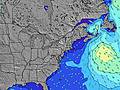 | 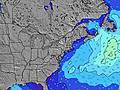 | 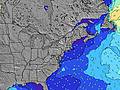 | ||||||||||||
Wave Height (m) Direction Period (s) | SSE 6 | SSE 8 | S 8 | SSE 7 | SSE 7 | SSE 7 | SE 7 | S 7 | SSE 7 | S 6 | SSE 6 | S 6 | S 6 | S 6 | S 6 | S 6 | S 6 | S 6 | SSW 6 |
Wave Graph | |||||||||||||||||||
155 | 299 | 383 | 125 | 59 | 42 | 151 | 276 | 99 | 91 | 48 | 91 | 148 | 74 | 53 | 75 | 52 | 33 | 91 | |
Wind (km/h) | |||||||||||||||||||
Wind State on-shore cross-onshore cross-shore cross-offshore off-shore glassy | cross-on | cross | cross | cross-off | cross-on | cross-on | on | cross | cross | cross | cross-on | cross-on | cross | cross | cross-on | cross | cross | cross | cross |
High Tide | 11:14PM1.26m | 11:47AM1.25m | 00:00AM1.20m | 12:33PM1.28m | 00:52AM1.15m | 1:24PM1.31m | 1:49AM1.10m | 2:20PM1.33m | 2:52AM1.07m | 3:22PM1.35m | 4:02AM1.06m | 4:31PM1.38m | |||||||
Low Tide | 5:28AM0.02m | 5:53PM0.17m | 6:03AM0.05m | 6:43PM0.20m | 6:47AM0.09m | 7:50PM0.23m | 7:44AM0.12m | 9:07PM0.23m | 8:57AM0.15m | 10:19PM0.17m | 10:10AM0.13m | 11:23PM0.10m | |||||||
— | 6:00 | — | — | 6:01 | — | — | 6:01 | — | — | 6:01 | — | — | 6:03 | — | — | 6:03 | — | — | |
8:08 | — | 8:07 | — | — | 8:07 | — | — | 8:06 | — | — | 8:05 | — | — | 8:04 | — | — | 8:02 | — | |
mm | 11 | 8 | 10 | 4 | — | — | 3 | 2 | 2 | 2 | — | — | — | — | — | — | — | 1 | 14 |
Temp °C | 25 | 25 | 25 | 26 | 24 | 24 | 24 | 24 | 27 | 26 | 27 | 29 | 27 | 29 | 31 | 27 | 28 | 30 | 27 |
Feels °C | 27 | 26 | 26 | 29 | 22 | 22 | 26 | 24 | 29 | 28 | 28 | 29 | 28 | 31 | 31 | 27 | 30 | 31 | 28 |
Swell 1 Height (m) Direction Period (s) | E 6 | — | — | SSE 7 | SSE 7 | SSE 7 | — | SSE 7 | — | — | E 9 | E 9 | — | S 6 | SE 8 | SSE 6 | S 6 | SE 7 | S 6 |
1 | — | — | 125 | 59 | 42 | — | 136 | — | — | 2 | 2 | — | 49 | 9 | 52 | 34 | 19 | 50 | |
Swell 2 Height (m) Direction Period (s) | — | — | — | — | — | SE 7 | — | E 8 | E 10 | — | — | — | — | E 11 | E 10 | E 9 | SE 8 | E 9 | SE 8 |
— | — | — | — | — | 33 | — | 1 | 2 | — | — | — | — | 2 | 2 | 2 | 21 | 1 | 9 | |
Swell 3 Height (m) Direction Period (s) | — | — | — | — | — | E 8 | — | — | E 8 | — | — | — | — | E 11 | — | — | E 9 | — | E 8 |
— | — | — | — | — | 1 | — | — | 1 | — | — | — | — | 2 | — | — | 2 | — | 1 | |
Wind waves Height (m) Direction Period (s) | SSE 6 | SSE 8 | S 8 | — | ENE 4 | E 4 | SE 7 | S 7 | SSE 7 | S 6 | SSE 6 | S 6 | S 6 | S 6 | S 6 | S 6 | S 6 | S 6 | SSW 6 |
155 | 299 | 383 | — | 27 | 26 | 151 | 276 | 99 | 91 | 48 | 91 | 148 | 74 | 53 | 75 | 52 | 33 | 91 | |
Nearest Offshore or Glassy | |||||||||||||||||||
Distance (km) | 1042 | 1204 | 135 | 0 | 193 | 282 | 282 | 63 | 62 | 5 | 135 | 338 | 148 | 121 | 338 | 5 | 5 | 62 | 5 |
Best forecast wave conditions in New Jersey | |||||||||||||||||||
Best forecast wave conditions in United States | |||||||||||||||||||
Header Global | |||||||||||||||||||
- Map Icons:
 Break
Break Live Wave Height (m)
 Live Wind Speed (km/h)
 Surf Rating (10 Max)
 Ocean Swells (m)
- Wind Speed (km/h)
Latest Updates


FREE! Surf-Forecast.com widget for your website
The surf report / weather widget below is available to embed on third party websites free of charge and provides a summary of our 57th Street surf forecast. Simply grab the html code snippet that we provide and paste it into your own site. You can choose your preferred language and metric/imperial units for the surf forecast feed to suit users of your site. Click here to get the code.
Information about the 57th Street Surf forecast
The above surf forecast table for 57th Street provides essential information for determining whether the surfing conditions will be good over the next 16 days. A general guide to surfing at 57th Street can be found by selecting the local surf guide option on the grey menu. Our 57th Street surf forecast is unique since it includes wave energy (power) that defines the real feel of the surf rather than just the height or the period. If you surf the same spot (57th Street) regularly then make a mental note of the wave energy from the surf forecast table each time you go. Very soon you may start to choose your surf days based on the wave energy alone combined with our forecast of favourable offshore wind conditions. Our star ratings will help here and of course you will also find the usual wave height and period predictions on our surf forecasts as well as a full break down of the swell components under our advanced users option (to reveal that, click the little Einstein character under the tide times).
Further information to help with frequently asked questions about our surf forecast for 57th Street may be found under the help tab on the top menu and also by moving your mouse over the question marks on the surf forecast table itself. Please always bear in mind that the forecast is for near-shore open water and local factors at each surf break influence the actual breaking wave height, such as the beach / reef profile, water depths offshore and shelter.
57th Street is 8 km (5 miles) from Ocean City. If you plan a vacation in New Jersey, look for hotels and other accommodation in Ocean City. Ocean City has rooms for a wide range of budgets as well as car hire and transport links.
 Nearest