

Surf Forecasts:

The Pier surf forecast from 8 Jul 2026:
- Best quality surf: Tuesday 14 Jul, 2AM (local time) - 5ft (1.6m), 7s period, ENE swell with cross-offshore winds.
- Most powerful swell: Tuesday 14 Jul, 5AM (local time) - 5ft (1.6m), 8s period, ENE swell with 288 kJ wave energy.
- Next surfable swell (1★+): Wednesday 8 Jul, 8AM (local time) - 3.5ft (1.0m), 5s period with SSW swell.
Best Forecast Surf Conditions for The Pier this week:
The surf forecast for The Pier over the next 16 days: The first swell (rated 1 star or higher) is forecast to arrive on Wednesday (Jul 08) at 8AM. The primary swell is predicted to be 1.0m and 5s period with a secondary swell of 0.4m and 9s. The wind is predicted to be cross-offshore as the swell arrives.
The most powerful waves expected at The Pier in the next 16 days are 1.6m 8s and forecast to arrive on Tuesday (Jul 14) at 5AM. Winds are predicted to be cross-offshore at the time the swell arrives. The largest open ocean swell (not directed at the beach) is 1.3m 6s period and expected on Saturday (Jul 11) at 5AM.
| Wave Type | Time (EDT) & Date | Wave Height & Period |
|---|---|---|
| Next good surf (1 star+) | 8AM (Wed 8th Jul) | 3.5ft (1.0m) 5s |
| Best Surf | 2AM (Tue 14th Jul) | 5ft (1.6m) 7s |
| Most Powerful | 5AM (Tue 14th Jul) | 5ft (1.6m) 8s |
Table - best surf conditions forecast for The Pier over the next 16 days.
Alright, surfers, Rusty here. Let's have a look at what The Pier has on offer for the next couple of weeks. Gotta be honest with you, it’s a pretty bleak forecast overall. We’re looking at a long stretch of mostly small, messy, or flat conditions. The only window that even gets the heart pumping a little is right around Tuesday the 14th.
Right out of the gate, Wednesday the 8th is a write-off. It's small, cross-onshore junk. We limp through the rest of the week with nothing but knee-high dribble and average winds. Saturday the 12th, you'll see glassy conditions in the morning, but the swell is nothing to write home about – just a tiny 1 ft leftover from the southeast.
The only real standout in the whole 16-day window lands on Tuesday, July 14th. The morning is where it's at. The Pier should see a clean 5 ft swell pushing in from the ENE with a moderate period of 8 seconds. The wind is a light offshore breeze, so it's going to be clean. The combined energy is solid at (270) – it's got some grunt. Now, this is a beach/pier setup, so with a 5 ft swell, it’s a bit punchy for beginners, but it's the best we're going to get. Expect a crowd because it’s a standout in a flat spell.
After that little spike, the surf drops off a cliff again. The rest of the second week is a nightmare. We’re looking at a big gap from Wednesday the 15th all the way until maybe Sunday the 19th. By Sunday the 19th morning we get a tiny flush of 3 ft from the SSE, and it’s glassy, but it’s short period and small. Keep your expectations on the floor for that one, and expect a crowd if you’re out.
It’s a tough run, folks. The forecasts can change, but based on what’s in front of me, you really only have one day to pencil in: the morning of Tuesday, July 14th.
Rusty.
Short Range ForecastMostly dry. Warm (max 34°C on Wed afternoon, min 27°C on Thu night). Mainly fresh winds. | Days 5-7 Weather SummaryHeavy rain (total 21mm), heaviest during Mon afternoon. Warm (max 35°C on Sat afternoon, min 23°C on Sun night). Winds decreasing (fresh winds from the SSW on Fri night, calm by Sun morning). | ||||||||||||||||||||
Wednesday 8 | Thursday 9 | Friday 10 | Saturday 11 | Sunday 12 | Monday 13 | Tue 14 | |||||||||||||||
Night | AM | PM | Night | AM | PM | Night | AM | PM | Night | AM | PM | Night | AM | PM | Night | AM | PM | Night | AM | PM | |
Swell Height Map |  | 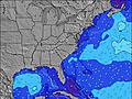 | 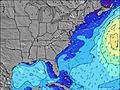 | 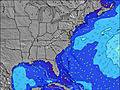 | 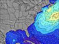 | 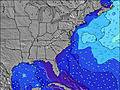 | 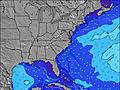 | 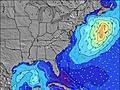 | |||||||||||||
Wave Height (m) Direction Period (s) | SSW 5 | SSW 5 | S 5 | SSW 5 | SSW 6 | S 5 | SSW 6 | SE 9 | SSW 5 | S 6 | SE 8 | SSW 4 | SE 9 | SE 9 | S 6 | SE 9 | ENE 5 | ENE 6 | ENE 7 | ENE 8 | E 7 |
Wave Graph | |||||||||||||||||||||
46 | 36 | 59 | 55 | 52 | 61 | 81 | 19 | 102 | 88 | 10 | 31 | 13 | 14 | 31 | 31 | 39 | 87 | 237 | 270 | 218 | |
Wind (km/h) | |||||||||||||||||||||
Wind State on-shore cross-onshore cross-shore cross-offshore off-shore glassy | cross | cross-off | cross-on | cross | cross-off | cross | cross | cross-off | cross | cross | cross-off | cross-off | cross | glassy | cross-on | glassy | off | cross | cross-off | cross-off | cross-off |
High Tide | 2:58AM1.31m | 3:43PM1.48m | 3:56AM1.27m | 4:43PM1.54m | 4:56AM1.23m | 5:46PM1.58m | 5:59AM1.22m | 6:53PM1.62m | 7:04AM1.22m | 8:00PM1.66m | 8:08AM1.25m | 9:02PM1.69m | 9:09AM1.29m | ||||||||
Low Tide | 8:53PM0.22m | 9:05AM-0.02m | 9:59PM0.23m | 10:02AM-0.02m | 11:06PM0.22m | 11:03AM-0.03m | 00:12AM0.19m | 12:05PM-0.05m | 1:15AM0.14m | 1:07PM-0.07m | 2:15AM0.09m | 2:07PM-0.09m | 3:09AM0.05m | 3:04PM-0.10m | |||||||
— | 6:13 | — | — | 6:13 | — | — | 6:13 | — | — | 6:15 | — | — | 6:15 | — | — | 6:16 | — | — | 6:16 | — | |
8:29 | — | 8:29 | — | — | 8:29 | — | — | 8:28 | — | — | 8:28 | — | — | 8:28 | — | — | 8:27 | — | — | 8:27 | |
mm | — | — | — | — | — | — | — | — | — | 1 | — | — | 5 | — | — | 7 | — | 8 | 3 | — | 1 |
Temp °C | 30 | 33 | 34 | 30 | 34 | 34 | 30 | 32 | 34 | 29 | 33 | 35 | 26 | 29 | 30 | 27 | 27 | 26 | 23 | 24 | 25 |
Feels °C | 31 | 34 | 33 | 30 | 35 | 33 | 31 | 32 | 33 | 30 | 33 | 34 | 27 | 32 | 32 | 30 | 30 | 28 | 23 | 25 | 26 |
Swell 1 Height (m) Direction Period (s) | SE 9 | S 5 | SE 9 | SE 9 | S 6 | SE 9 | SE 9 | S 6 | SE 9 | ESE 9 | S 6 | SE 9 | S 6 | S 6 | SE 9 | SSW 5 | SE 9 | SE 9 | SE 9 | — | SE 9 |
20 | 26 | 20 | 21 | 30 | 20 | 19 | 50 | 14 | 9 | 33 | 13 | 30 | 24 | 12 | 15 | 29 | 27 | 13 | — | 3 | |
Swell 2 Height (m) Direction Period (s) | — | SE 9 | — | — | SE 9 | — | — | SE 9 | SSE 8 | SE 8 | SE 8 | ESE 7 | SE 7 | SE 7 | SE 7 | SE 9 | — | S 6 | S 6 | — | — |
— | 20 | — | — | 21 | — | — | 19 | 6 | 2 | 10 | 5 | 8 | 14 | 8 | 31 | — | 6 | 2 | — | — | |
Swell 3 Height (m) Direction Period (s) | — | — | — | — | — | — | — | — | — | — | SE 9 | — | SE 9 | SE 9 | — | — | — | — | — | — | — |
— | — | — | — | — | — | — | — | — | — | 3 | — | 13 | 14 | — | — | — | — | — | — | — | |
Wind waves Height (m) Direction Period (s) | SSW 5 | SSW 5 | S 5 | SSW 5 | SSW 6 | S 5 | SSW 6 | S 6 | SSW 5 | S 6 | — | SSW 4 | — | — | S 6 | NE 4 | ENE 5 | ENE 6 | ENE 7 | ENE 8 | E 7 |
46 | 36 | 59 | 55 | 52 | 61 | 81 | 94 | 102 | 88 | — | 31 | — | — | 31 | 3 | 39 | 87 | 237 | 270 | 218 | |
Nearest Offshore or Glassy | |||||||||||||||||||||
Distance (km) | 318 | 4 | 382 | 401 | 4 | 479 | 402 | 139 | 651 | 388 | 139 | 1715 | 62 | 4 | 116 | 4 | 4 | 82 | 1 | 1 | 71 |
Best forecast wave conditions in South Carolina | |||||||||||||||||||||
Best forecast wave conditions in United States | |||||||||||||||||||||
Header Global | |||||||||||||||||||||
- Map Icons:
 Break
Break Live Wave Height (m)
 Live Wind Speed (km/h)
 Surf Rating (10 Max)
 Ocean Swells (m)
- Wind Speed (km/h)


FREE! Surf-Forecast.com widget for your website
The surf report / weather widget below is available to embed on third party websites free of charge and provides a summary of our The Pier surf forecast. Simply grab the html code snippet that we provide and paste it into your own site. You can choose your preferred language and metric/imperial units for the surf forecast feed to suit users of your site. Click here to get the code.
Information about the The Pier Surf forecast
The above surf forecast table for The Pier provides essential information for determining whether the surfing conditions will be good over the next 16 days. A general guide to surfing at The Pier can be found by selecting the local surf guide option on the grey menu. Our The Pier surf forecast is unique since it includes wave energy (power) that defines the real feel of the surf rather than just the height or the period. If you surf the same spot (The Pier) regularly then make a mental note of the wave energy from the surf forecast table each time you go. Very soon you may start to choose your surf days based on the wave energy alone combined with our forecast of favourable offshore wind conditions. Our star ratings will help here and of course you will also find the usual wave height and period predictions on our surf forecasts as well as a full break down of the swell components under our advanced users option (to reveal that, click the little Einstein character under the tide times).
Further information to help with frequently asked questions about our surf forecast for The Pier may be found under the help tab on the top menu and also by moving your mouse over the question marks on the surf forecast table itself. Please always bear in mind that the forecast is for near-shore open water and local factors at each surf break influence the actual breaking wave height, such as the beach / reef profile, water depths offshore and shelter.
The Pier is 14 km (9 miles) from Georgetown. If you plan a vacation in South Carolina, look for hotels and other accommodation in Georgetown. Georgetown has rooms for a wide range of budgets as well as car hire and transport links.
 Nearest