

Surf Forecasts:

Ponte Vedra surf forecast from 17 Jul 2026:
- Best quality surf: Tuesday 21 Jul, 11PM (local time) - 3.5ft (1.0m), 5s period, SE swell with cross-offshore winds.
- Most powerful swell: Thursday 23 Jul, 5PM (local time) - 2.5ft (0.8m), 8s period, SE swell with 90 kJ wave energy.
- Next surfable swell (1★+): Tuesday 21 Jul, 11PM (local time) - 3.5ft (1.0m), 5s period with SE swell.
Best Forecast Surf Conditions for Ponte Vedra this week:
The surf forecast for Ponte Vedra over the next 16 days: The first swell (rated 1 star or higher) is forecast to arrive on Tuesday (Jul 21) at 11PM. The primary swell is predicted to be 1.0m and 5s period with a secondary swell of 0.4m and 7s. The wind is predicted to be cross-offshore as the swell arrives.
The most powerful waves expected at Ponte Vedra in the next 16 days are 0.8m 8s and forecast to arrive on Thursday (Jul 23) at 5PM. Winds are predicted to be cross-offshore at the time the swell arrives. The largest open ocean swell (not directed at the beach) is 0.7m 5s period and expected on Sunday (Jul 19) at 2PM.
| Wave Type | Time (EDT) & Date | Wave Height & Period |
|---|---|---|
| Next good surf (1 star+) | 11PM (Tue 21st Jul) | 3.5ft (1.0m) 5s |
| Best Surf | 11PM (Tue 21st Jul) | 3.5ft (1.0m) 5s |
| Most Powerful | 5PM (Thu 23rd Jul) | 2.5ft (0.8m) 8s |
Table - best surf conditions forecast for Ponte Vedra over the next 16 days.
The Lowdown
Alright folks, Rusty here. Let's have a look at what's on the cards for Ponte Vedra over the next couple of weeks.
First up, I gotta be straight with you – the first week is a tough watch. From now until about the 24th of July, it's basically a write-off. We're talking a run of days with tiny, weak swell, mostly around 1 ft to 3 ft, and a lot of it is short-period, windswell stuff. The combined energy is low, kicking around 15 to 90 (weak energy), and the conditions are often cross-off or just messy. The surf is just not there. You could probably find a knee-high ripple on a glassy morning, but that's about it. It's a long stretch of flatness.
Things start to look a little more promising around the 24th of July. Friday morning brings a slight uptick, with a 2 ft swell from the SE and some clean, light cross-off wind. The energy is still weak at 67, but it's at least surfable. Then on Saturday the 25th, we get a bit of a bump. The morning session is the pick early on with a 4 ft glassy swell from the SE. The combined energy jumps to 133 (moderate wave energy), which is the most we've seen in a while. That glassy wind is a major positive, so you could get a few fun, clean ones. The period is a short 6 seconds though, so it won't be the most powerful stuff, but it's rideable.
After that, the energy drops back off into the final week of July and into August, with more tiny, weak swells and a mix of glassy and offshore winds, but nothing that's going to get your heart racing. The 29th of July offers a 3 ft swell in the morning with clean conditions, but the energy is still weak at 93.
So, the one true standout, the best on offer across the whole 16 days, is the Saturday morning of the 25th of July. The combination of the biggest swell of the window (4 ft) and that glassy, calm wind should make for the cleanest waves we'll see. The swell is from the SE, which is a bit off the optimum ESE direction, but with the conditions that clean, it's the best call. Keep in mind the period is short, so it'll be a bit bouncy and sectiony. It's a beach and reef setup, and crowds are listed as "sometimes", so expect some company.
For the rest of it, it's flat, small, and ordinary. Not much else to say.
Rusty.
Short Range ForecastModerate rain (total 10mm), heaviest on Fri night. Warm (max 32°C on Sat night, min 25°C on Sat morning). Wind will be generally light. | Days 5-7 Weather SummaryLight rain (total 6mm), mostly falling on Mon afternoon. Warm (max 33°C on Wed afternoon, min 25°C on Sun night). Wind will be generally light. | ||||||||||||||||||
Friday 17 | Saturday 18 | Sunday 19 | Monday 20 | Tuesday 21 | Wednesday 22 | ||||||||||||||
Night | AM | PM | Night | AM | PM | Night | AM | PM | Night | AM | PM | Night | AM | PM | Night | AM | PM | Night | |
Swell Height Map |  |  |  |  | 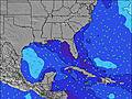 | 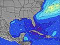 | 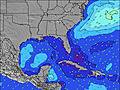 | ||||||||||||
Wave Height (m) Direction Period (s) | ESE 8 | ESE 8 | ESE 8 | ESE 8 | ESE 8 | SE 5 | SE 6 | SE 5 | SE 5 | SE 5 | SE 5 | SE 5 | SE 6 | SE 6 | SE 4 | SE 6 | ESE 7 | SE 4 | SE 5 |
Wave Graph | |||||||||||||||||||
12 | 12 | 12 | 13 | 13 | 47 | 40 | 18 | 12 | 13 | 17 | 22 | 32 | 27 | 32 | 36 | 36 | 19 | 22 | |
Wind (km/h) | |||||||||||||||||||
Wind State on-shore cross-onshore cross-shore cross-offshore off-shore glassy | off | glassy | cross-on | cross-off | cross-off | cross | off | cross-off | cross-off | cross-off | cross-off | cross-off | cross-off | cross-off | cross-off | cross-off | cross-off | cross-off | off |
High Tide | 10:40PM1.83m | 11:08AM1.60m | 11:28PM1.73m | 11:59AM1.60m | 00:17AM1.62m | 12:52PM1.58m | 1:07AM1.49m | 1:47PM1.55m | 2:01AM1.37m | 2:42PM1.53m | 2:56AM1.27m | 3:39PM1.51m | 3:54AM1.20m | ||||||
Low Tide | 5:02AM-0.23m | 5:15PM-0.16m | 5:48AM-0.19m | 6:09PM-0.06m | 6:38AM-0.13m | 7:08PM0.03m | 7:31AM-0.07m | 8:10PM0.11m | 8:24AM-0.01m | 9:10PM0.16m | 9:16AM0.04m | 10:07PM0.20m | |||||||
— | 6:33 | — | — | 6:35 | — | — | 6:35 | — | — | 6:35 | — | — | 6:37 | — | — | 6:37 | — | — | |
8:28 | — | 8:28 | — | — | 8:27 | — | — | 8:27 | — | — | 8:25 | — | — | 8:25 | — | — | 8:24 | — | |
mm | 2 | — | — | 3 | 2 | — | — | — | 3 | — | — | 1 | 1 | — | 1 | 3 | — | — | — |
Temp °C | 30 | 30 | 31 | 30 | 28 | 31 | 32 | 29 | 31 | 30 | 30 | 32 | 31 | 30 | 32 | 31 | 30 | 33 | 31 |
Feels °C | 33 | 34 | 33 | 31 | 29 | 32 | 32 | 29 | 30 | 30 | 31 | 33 | 31 | 31 | 33 | 32 | 31 | 34 | 32 |
Swell 1 Height (m) Direction Period (s) | ENE 6 | ESE 8 | ESE 8 | SE 3 | ESE 8 | NE 6 | SE 6 | SE 5 | SE 5 | SE 5 | SE 5 | SE 5 | SE 6 | SE 6 | — | SE 6 | ESE 7 | — | SE 5 |
7 | 12 | 12 | 3 | 13 | 2 | 40 | 18 | 12 | 13 | 17 | 9 | 32 | 27 | — | 36 | 36 | — | 22 | |
Swell 2 Height (m) Direction Period (s) | ESE 8 | ENE 6 | ENE 7 | ESE 8 | NE 6 | E 6 | E 10 | E 7 | E 8 | E 9 | ESE 8 | ESE 6 | — | — | — | ESE 7 | — | — | ESE 8 |
12 | 3 | 4 | 13 | 1 | 1 | 2 | 4 | 5 | 1 | 6 | 4 | — | — | — | 19 | — | — | 12 | |
Swell 3 Height (m) Direction Period (s) | — | — | — | ENE 6 | NE 6 | — | — | — | E 9 | — | — | — | — | — | — | S 5 | — | — | — |
— | — | — | 4 | 1 | — | — | — | 2 | — | — | — | — | — | — | 5 | — | — | — | |
Wind waves Height (m) Direction Period (s) | — | — | SE 2 | S 3 | SE 5 | SE 5 | SW 3 | SW 3 | SSW 3 | SW 2 | SW 2 | SE 5 | — | — | SE 4 | WSW 2 | SW 2 | SE 4 | SW 2 |
— | — | 1 | 6 | 5 | 47 | 1 | 1 | 7 | 1 | 1 | 22 | — | — | 32 | 1 | 1 | 19 | 2 | |
Nearest Offshore or Glassy | |||||||||||||||||||
Distance (km) | 1585 | 1463 | 2024 | 355 | 1423 | 65 | 1 | 881 | 1165 | 425 | 767 | 41 | 65 | 65 | 66 | 0 | 881 | 22 | 65 |
Best forecast wave conditions in North Florida | |||||||||||||||||||
Best forecast wave conditions in United States | |||||||||||||||||||
Header Global | |||||||||||||||||||
- Map Icons:
 Break
Break Live Wave Height (m)
 Live Wind Speed (km/h)
 Surf Rating (10 Max)
 Ocean Swells (m)
- Wind Speed (km/h)


FREE! Surf-Forecast.com widget for your website
The surf report / weather widget below is available to embed on third party websites free of charge and provides a summary of our Ponte Vedra surf forecast. Simply grab the html code snippet that we provide and paste it into your own site. You can choose your preferred language and metric/imperial units for the surf forecast feed to suit users of your site. Click here to get the code.
Information about the Ponte Vedra Surf forecast
The above surf forecast table for Ponte Vedra provides essential information for determining whether the surfing conditions will be good over the next 16 days. A general guide to surfing at Ponte Vedra can be found by selecting the local surf guide option on the grey menu. Our Ponte Vedra surf forecast is unique since it includes wave energy (power) that defines the real feel of the surf rather than just the height or the period. If you surf the same spot (Ponte Vedra) regularly then make a mental note of the wave energy from the surf forecast table each time you go. Very soon you may start to choose your surf days based on the wave energy alone combined with our forecast of favourable offshore wind conditions. Our star ratings will help here and of course you will also find the usual wave height and period predictions on our surf forecasts as well as a full break down of the swell components under our advanced users option (to reveal that, click the little Einstein character under the tide times).
Further information to help with frequently asked questions about our surf forecast for Ponte Vedra may be found under the help tab on the top menu and also by moving your mouse over the question marks on the surf forecast table itself. Please always bear in mind that the forecast is for near-shore open water and local factors at each surf break influence the actual breaking wave height, such as the beach / reef profile, water depths offshore and shelter.
Ponte Vedra is 2 km (1 miles) from Jacksonville Beach. If you plan a vacation in North Florida, look for hotels and other accommodation in Jacksonville Beach. Jacksonville Beach has rooms for a wide range of budgets as well as car hire and transport links.
 Nearest