

Surf Forecasts:

Camp Pendleton surf forecast from 16 Jul 2026:
- Best quality surf: Monday 20 Jul, 2AM (local time) - 2.5ft (0.7m), 8s period, SE swell with cross-offshore winds.
- Most powerful swell: Wednesday 22 Jul, 2AM (local time) - 5ft (1.5m), 7s period, SSE swell with 198 kJ wave energy.
- Next surfable swell (1★+): Monday 20 Jul, 2AM (local time) - 2.5ft (0.7m), 8s period with SE swell.
Best Forecast Surf Conditions for Camp Pendleton this week:
The surf forecast for Camp Pendleton over the next 16 days: The first swell (rated 1 star or higher) is forecast to arrive on Monday (Jul 20) at 2AM. The primary swell is predicted to be 0.7m and 8s period with a secondary swell of 0.1m and 12s. Another secondary swell of 0.6m and 3s is also forecast. The wind is predicted to be cross-offshore as the swell arrives.
The most powerful waves expected at Camp Pendleton in the next 16 days are 1.5m 7s and forecast to arrive on Wednesday (Jul 22) at 2AM. Winds are predicted to be cross-offshore at the time the swell arrives. The largest open ocean swell (not directed at the beach) is 1.3m 5s period and expected on Sunday (Jul 19) at 2AM.
| Wave Type | Time (EDT) & Date | Wave Height & Period |
|---|---|---|
| Next good surf (1 star+) | 2AM (Mon 20th Jul) | 2.5ft (0.7m) 8s |
| Best Surf | 2AM (Mon 20th Jul) | 2.5ft (0.7m) 8s |
| Most Powerful | 2AM (Wed 22nd Jul) | 5ft (1.5m) 7s |
Table - best surf conditions forecast for Camp Pendleton over the next 16 days.
The Lowdown
Alright folks, Rusty here. Let’s have a look at what’s cookin’ for the Camp Pendleton area over the next couple of weeks. I gotta be straight with you – this forecast is a bit of a flat spell for the most part. We’ve got a long stretch of small, weak conditions that are gonna test your patience. The water temp is sittin’ at 78°F, which is bang on average for this time of year, so at least the wait won’t be a cold one.
Now, lookin’ at the run of it, there’s basically nothin’ worth paddlin’ out for from Thursday the 16th of July all the way through to the end of the month. That’s a solid two-week gap where the recommendations are a big fat zero. You’ll see tiny little dribbles of swell – 0.7ft to 1.0ft – with short period energy that just won’t stand up. The wind is messy too, often cross-on or onshore, which isn’t gonna help the cause. Even when we do get a bit more energy on the charts, like on Sunday the 19th with a combined energy of 179 (moderate), the swell is only 4ft and from the SSE, but the “poor surf conditions” tag tells the real story. It’s just not gonna line up right at the beach.
If you’re really dyin’ to get wet, the one tiny glimmer in this whole outlook is buried at the very end. On Friday the 31st of July, we finally see some proper offshore wind – a light W breeze in the morning, making it clean. The swell is still tiny, at 1ft out of the ESE, but the energy is weak at 48. It’s glassy, but it’s barely a ripple. Then that Friday afternoon, it goes dead flat with glassy conditions again from a different direction. Honestly, there’s just no standout session to chase.
Bottom line: this is a blank run that’s pretty typical for the area when the swell machine shuts down. It’s a good time to wax the board, check your fins, and wait for a change. Forecasts can flip, but right now it’s a tough look.
Rusty.
Short Range ForecastMostly dry. Warm (max 34°C on Sat afternoon, min 24°C on Thu morning). Winds increasing (calm on Fri morning, fresh winds from the S by Sat afternoon). | Days 4-6 Weather SummaryHeavy rain (total 45mm), heaviest during Sun night. Warm (max 34°C on Sun afternoon, min 23°C on Sun night). Winds increasing (calm on Mon morning, fresh winds from the SSW by Tue night). | ||||||||||||||||||||
Thursday 16 | Friday 17 | Saturday 18 | Sunday 19 | Monday 20 | Tuesday 21 | Wednesday 22 | |||||||||||||||
AM | PM | Night | AM | PM | Night | AM | PM | Night | AM | PM | Night | AM | PM | Night | AM | PM | Night | AM | PM | Night | |
Swell Height Map |  | 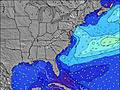 | 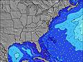 | 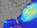 |  | 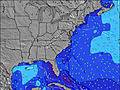 | 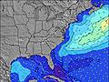 | ||||||||||||||
Wave Height (m) Direction Period (s) | ESE 8 | ESE 8 | S 4 | ESE 8 | NE 4 | NE 4 | ESE 8 | SSE 5 | E 13 | SSE 8 | SE 8 | SE 8 | SE 8 | SE 8 | SE 6 | SSE 4 | SSE 4 | SSE 7 | SE 8 | SSE 7 | NNE 4 |
Wave Graph | |||||||||||||||||||||
11 | 11 | 17 | 6 | 7 | 6 | 6 | 59 | 3 | 37 | 51 | 67 | 32 | 40 | 23 | 11 | 46 | 198 | 88 | 35 | 26 | |
Wind (km/h) | |||||||||||||||||||||
Wind State on-shore cross-onshore cross-shore cross-offshore off-shore glassy | off | cross-on | cross-off | cross-on | cross-on | cross | cross-off | cross | cross-off | cross-off | cross-off | cross-off | cross-on | cross-on | cross-off | cross-off | cross-off | cross-off | cross | cross-on | cross-on |
High Tide | 10:03AM1.13m | 10:21PM1.30m | 10:58AM1.15m | 11:12PM1.20m | 11:51AM1.16m | 00:00AM1.10m | 12:40PM1.15m | 00:46AM0.99m | 1:29PM1.12m | 1:32AM0.89m | 2:25PM1.09m | 2:28AM0.81m | 3:26PM1.08m | 3:36AM0.77m | |||||||
Low Tide | 4:01PM-0.08m | 4:47AM-0.12m | 5:01PM-0.01m | 5:37AM-0.08m | 6:01PM0.05m | 6:23AM-0.03m | 6:59PM0.12m | 7:08AM0.03m | 7:58PM0.18m | 7:53AM0.09m | 9:02PM0.23m | 8:42AM0.15m | 10:01PM0.25m | ||||||||
5:56 | — | — | 5:56 | — | — | 5:58 | — | — | 5:58 | — | — | 5:58 | — | — | 6:00 | — | — | 6:01 | — | — | |
— | 8:22 | — | — | 8:21 | — | — | 8:21 | — | — | 8:20 | — | — | 8:20 | — | — | 8:19 | — | — | 8:17 | — | |
mm | — | — | — | — | — | — | — | — | — | — | — | 23 | — | — | 3 | — | — | 19 | 5 | — | — |
Temp °C | 30 | 33 | 31 | 28 | 28 | 27 | 31 | 34 | 31 | 30 | 34 | 24 | 26 | 26 | 28 | 28 | 33 | 26 | 24 | 23 | 23 |
Feels °C | 31 | 32 | 31 | 30 | 29 | 30 | 32 | 33 | 30 | 30 | 34 | 27 | 28 | 27 | 30 | 27 | 32 | 25 | 27 | 20 | 20 |
Swell 1 Height (m) Direction Period (s) | ESE 8 | ESE 8 | ESE 8 | SSE 4 | ESE 8 | NE 4 | ESE 8 | E 8 | E 13 | SSE 8 | SE 8 | SE 8 | SE 8 | SE 8 | NE 4 | ESE 8 | NE 4 | SSE 7 | SE 8 | SSE 7 | ESE 8 |
11 | 11 | 6 | 4 | 7 | 6 | 6 | 1 | 3 | 37 | 51 | 67 | 32 | 40 | 3 | 6 | 1 | 113 | 88 | 35 | 26 | |
Swell 2 Height (m) Direction Period (s) | SE 5 | E 15 | E 15 | ESE 8 | SE 4 | ESE 8 | NE 4 | E 13 | E 9 | E 13 | SSW 4 | E 12 | SE 4 | E 12 | ESE 8 | NE 4 | — | — | — | SE 8 | SE 7 |
1 | 5 | 4 | 6 | 1 | 6 | 1 | 3 | 2 | 3 | 1 | 3 | 3 | 3 | 6 | 1 | — | — | — | 18 | 14 | |
Swell 3 Height (m) Direction Period (s) | — | E 15 | — | E 15 | E 14 | E 14 | E 13 | E 9 | E 9 | E 8 | E 13 | — | E 12 | E 12 | — | — | — | — | — | — | — |
— | 4 | — | 4 | 4 | 4 | 4 | 2 | 2 | 1 | 3 | — | 3 | 3 | — | — | — | — | — | — | — | |
Wind waves Height (m) Direction Period (s) | — | SSE 3 | S 4 | — | NE 4 | — | S 3 | SSE 5 | S 5 | SSW 4 | NNE 2 | ENE 3 | NE 4 | NE 4 | SE 6 | SSE 4 | SSE 4 | SSE 7 | N 3 | N 4 | NNE 4 |
— | 2 | 17 | — | 6 | — | 5 | 59 | 87 | 14 | 2 | 9 | 15 | 9 | 23 | 11 | 46 | 198 | 7 | 21 | 25 | |
Nearest Offshore or Glassy | |||||||||||||||||||||
Distance (km) | 1270 | 1145 | 1232 | 1232 | 1232 | 1145 | 1240 | 229 | 1955 | 1 | 5 | 99 | 137 | 623 | 1 | 419 | 229 | 137 | 256 | 251 | 176 |
Best forecast wave conditions in Virginia | |||||||||||||||||||||
Best forecast wave conditions in United States | |||||||||||||||||||||
Header Global | |||||||||||||||||||||
- Map Icons:
 Break
Break Live Wave Height (m)
 Live Wind Speed (km/h)
 Surf Rating (10 Max)
 Ocean Swells (m)
- Wind Speed (km/h)


FREE! Surf-Forecast.com widget for your website
The surf report / weather widget below is available to embed on third party websites free of charge and provides a summary of our Camp Pendleton surf forecast. Simply grab the html code snippet that we provide and paste it into your own site. You can choose your preferred language and metric/imperial units for the surf forecast feed to suit users of your site. Click here to get the code.
Information about the Camp Pendleton Surf forecast
The above surf forecast table for Camp Pendleton provides essential information for determining whether the surfing conditions will be good over the next 16 days. A general guide to surfing at Camp Pendleton can be found by selecting the local surf guide option on the grey menu. Our Camp Pendleton surf forecast is unique since it includes wave energy (power) that defines the real feel of the surf rather than just the height or the period. If you surf the same spot (Camp Pendleton) regularly then make a mental note of the wave energy from the surf forecast table each time you go. Very soon you may start to choose your surf days based on the wave energy alone combined with our forecast of favourable offshore wind conditions. Our star ratings will help here and of course you will also find the usual wave height and period predictions on our surf forecasts as well as a full break down of the swell components under our advanced users option (to reveal that, click the little Einstein character under the tide times).
Further information to help with frequently asked questions about our surf forecast for Camp Pendleton may be found under the help tab on the top menu and also by moving your mouse over the question marks on the surf forecast table itself. Please always bear in mind that the forecast is for near-shore open water and local factors at each surf break influence the actual breaking wave height, such as the beach / reef profile, water depths offshore and shelter.
Camp Pendleton is 9 km (6 miles) from the city of Virginia Beach. If you plan a vacation in Virginia, look for hotels and other accommodation in Virginia Beach. Virginia Beach has rooms for a wide range of budgets as well as car hire and transport links.
 Nearest