

Surf Forecasts:

Isle of Palms Pier surf forecast from 3 Aug 2026:
- Best quality surf: Monday 3 Aug, 8AM (local time) - 4ft (1.2m), 6s period, SSW swell with cross-offshore winds.
- Most powerful swell: Monday 3 Aug, 8PM (local time) - 4ft (1.2m), 6s period, S swell with 113 kJ wave energy.
- Next surfable swell (1★+): Monday 3 Aug, 8AM (local time) - 4ft (1.2m), 6s period with SSW swell.
Best Forecast Surf Conditions for Isle of Palms Pier this week:
The surf forecast for Isle of Palms Pier over the next 16 days: The first swell (rated 1 star or higher) is forecast to arrive on Monday (Aug 03) at 8AM. The primary swell is predicted to be 1.2m and 6s period with a secondary swell of 0.8m and 7s. Another secondary swell of 0.6m and 7s is also forecast. The wind is predicted to be cross-offshore as the swell arrives.
The most powerful waves expected at Isle of Palms Pier in the next 16 days are 1.2m 6s and forecast to arrive on Monday (Aug 03) at 8PM. Winds are predicted to be cross-shore at the time the swell arrives.
| Wave Type | Time (EDT) & Date | Wave Height & Period |
|---|---|---|
| Next good surf (1 star+) | 8AM (Mon 3rd Aug) | 4ft (1.2m) 6s |
| Best Surf | 8AM (Mon 3rd Aug) | 4ft (1.2m) 6s |
| Most Powerful | 8PM (Mon 3rd Aug) | 4ft (1.2m) 6s |
Table - best surf conditions forecast for Isle of Palms Pier over the next 16 days.
The Lowdown
Alright folks, Rusty here. Let’s break down the surf outlook for the next couple of weeks.
Truth is, it’s a quiet one. We’ve got a long stretch of nothing to get excited about. From the start of the period all the way through to the 16th of August, we’re in a real dry spell – a solid 13-day gap where the waves are either too small, too messy, or the wind is just ruining any chance of a clean wave. It’s a tough run for the Isle of Palms Pier (beach/pier) – mostly poor surf conditions with onshore or cross-shore breezes, and the combined swell energy barely gets into the weak range. Gutless little waves for days.
The first real glimmer of hope comes late in the outlook. On the morning of the 16th of August, we might get a bit of a reprieve. The wind swings to the northwest, going glassy, and a tiny 2ft S swell rolls in, with a period of 5 seconds. The combined energy is only 46 (weak), so it’s not going to have any punch, but man, those glassy conditions will make it look and feel better than it is. It’s a one-out-of-ten for surfable but ordinary waves. For a beginner, it might be a fun little paddle in the clean conditions, but you won’t be getting any barrels.
After that, we’re back into the same pattern. The morning of the 18th of August sees a small 1ft SE swell, with a light north-northeast breeze giving a clean cross-off wind. Combined energy is 53 (weak). It’s another “surfable but ordinary” scenario. Nothing to get excited about.
If you’re desperate for a paddle, the 16th of August morning is your best bet, and even that’s a stretch. For a spot that’s inconsistent, it’s a pretty normal blank run – the forecasts can change, but this one’s looking pretty flat and tired.
Rusty.
Short Range ForecastHeavy rain (total 44mm), heaviest during Tue morning. Warm (max 28°C on Sun night, min 26°C on Mon morning). Winds decreasing (fresh winds from the SSW on Sun night, light winds from the SSW by Tue morning). | Days 5-7 Weather SummaryLight rain (total 5mm), mostly falling on Wed night. Warm (max 29°C on Thu afternoon, min 26°C on Sat afternoon). Wind will be generally light. | ||||||||||||||||||
Monday 3 | Tuesday 4 | Wednesday 5 | Thursday 6 | Friday 7 | Saturday 8 | ||||||||||||||
Night | AM | PM | Night | AM | PM | Night | AM | PM | Night | AM | PM | Night | AM | PM | Night | AM | PM | Night | |
Swell Height Map |  | 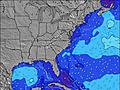 | 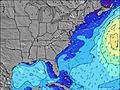 | 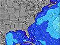 | 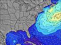 | 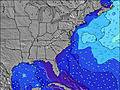 | 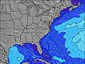 | ||||||||||||
Wave Height (m) Direction Period (s) | SE 7 | SE 7 | S 6 | S 7 | SE 7 | SSE 6 | S 5 | SE 6 | SE 6 | SSE 4 | SE 5 | SSE 5 | SSE 7 | SE 7 | SE 7 | SE 8 | SE 8 | SE 8 | SE 8 |
Wave Graph | |||||||||||||||||||
112 | 23 | 43 | 72 | 27 | 54 | 32 | 23 | 46 | 18 | 23 | 20 | 29 | 43 | 45 | 99 | 50 | 64 | 37 | |
Wind (km/h) | |||||||||||||||||||
Wind State on-shore cross-onshore cross-shore cross-offshore off-shore glassy | cross | cross | cross | cross-on | cross-on | cross-on | cross-on | cross-on | cross-on | cross-on | cross-on | cross-on | cross-on | on | on | cross-on | cross-on | on | cross-on |
High Tide | 11:13PM1.53m | 11:40AM1.52m | 11:55PM1.48m | 12:29PM1.57m | 00:45AM1.43m | 1:24PM1.61m | 1:41AM1.39m | 2:25PM1.65m | 2:44AM1.35m | 3:32PM1.69m | 3:54AM1.35m | 4:42PM1.74m | |||||||
Low Tide | 5:20AM0.04m | 5:44PM0.18m | 6:03AM0.02m | 6:39PM0.22m | 6:53AM0.02m | 7:42PM0.25m | 7:49AM0.02m | 8:51PM0.26m | 8:51AM0.01m | 9:59PM0.23m | 9:56AM-0.01m | 11:05PM0.18m | |||||||
— | 6:33 | — | — | 6:33 | — | — | 6:35 | — | — | 6:35 | — | — | 6:35 | — | — | 6:37 | — | — | |
8:15 | — | 8:15 | — | — | 8:15 | — | — | 8:14 | — | — | 8:13 | — | — | 8:12 | — | — | 8:10 | — | |
mm | 12 | 6 | 6 | 5 | 7 | 1 | 3 | 4 | — | 1 | 2 | — | 1 | — | 1 | — | — | — | — |
Temp °C | 28 | 28 | 28 | 28 | 28 | 28 | 28 | 28 | 28 | 28 | 28 | 29 | 28 | 28 | 28 | 28 | 27 | 27 | 27 |
Feels °C | 26 | 29 | 26 | 29 | 31 | 29 | 29 | 28 | 28 | 28 | 31 | 31 | 30 | 32 | 31 | 30 | 31 | 27 | 31 |
Swell 1 Height (m) Direction Period (s) | SE 7 | SE 7 | SE 7 | SE 7 | SE 7 | SE 6 | SE 6 | SE 6 | SE 6 | E 13 | — | — | — | SE 7 | SE 7 | SE 8 | SE 8 | SE 8 | SE 8 |
112 | 23 | 14 | 18 | 27 | 41 | 10 | 22 | 46 | 3 | — | — | — | 43 | 45 | 99 | 50 | 64 | 37 | |
Swell 2 Height (m) Direction Period (s) | — | — | — | — | — | — | — | SSW 5 | — | — | — | — | — | — | E 11 | — | — | — | — |
— | — | — | — | — | — | — | 9 | — | — | — | — | — | — | 2 | — | — | — | — | |
Swell 3 Height (m) Direction Period (s) | — | — | — | — | — | — | — | — | — | — | — | — | — | — | — | — | — | — | — |
— | — | — | — | — | — | — | — | — | — | — | — | — | — | — | — | — | — | — | |
Wind waves Height (m) Direction Period (s) | S 7 | S 6 | S 6 | S 7 | S 6 | SSE 6 | S 5 | SSW 5 | SSE 6 | SSE 4 | SE 5 | SSE 5 | SSE 7 | SE 6 | — | SE 8 | — | — | — |
94 | 18 | 43 | 72 | 17 | 54 | 32 | 23 | 33 | 18 | 23 | 20 | 29 | 21 | — | 45 | — | — | — | |
Nearest Offshore or Glassy | |||||||||||||||||||
Distance (km) | 307 | 357 | 981 | 561 | 78 | 217 | 322 | 205 | 219 | 353 | 205 | 1182 | 993 | 862 | 862 | 780 | 81 | 785 | 196 |
Best forecast wave conditions in South Carolina | |||||||||||||||||||
Best forecast wave conditions in United States | |||||||||||||||||||
Header Global | |||||||||||||||||||
- Map Icons:
 Break
Break Live Wave Height (m)
 Live Wind Speed (km/h)
 Surf Rating (10 Max)
 Ocean Swells (m)
- Wind Speed (km/h)
Latest Updates


FREE! Surf-Forecast.com widget for your website
The surf report / weather widget below is available to embed on third party websites free of charge and provides a summary of our Isle of Palms Pier surf forecast. Simply grab the html code snippet that we provide and paste it into your own site. You can choose your preferred language and metric/imperial units for the surf forecast feed to suit users of your site. Click here to get the code.
Information about the Isle of Palms Pier Surf forecast
The above surf forecast table for Isle of Palms Pier provides essential information for determining whether the surfing conditions will be good over the next 16 days. A general guide to surfing at Isle of Palms Pier can be found by selecting the local surf guide option on the grey menu. Our Isle of Palms Pier surf forecast is unique since it includes wave energy (power) that defines the real feel of the surf rather than just the height or the period. If you surf the same spot (Isle of Palms Pier) regularly then make a mental note of the wave energy from the surf forecast table each time you go. Very soon you may start to choose your surf days based on the wave energy alone combined with our forecast of favourable offshore wind conditions. Our star ratings will help here and of course you will also find the usual wave height and period predictions on our surf forecasts as well as a full break down of the swell components under our advanced users option (to reveal that, click the little Einstein character under the tide times).
Further information to help with frequently asked questions about our surf forecast for Isle of Palms Pier may be found under the help tab on the top menu and also by moving your mouse over the question marks on the surf forecast table itself. Please always bear in mind that the forecast is for near-shore open water and local factors at each surf break influence the actual breaking wave height, such as the beach / reef profile, water depths offshore and shelter.
Isle of Palms Pier is 21 km (13 miles) from the city of Mount Pleasant. If you plan a vacation in South Carolina, look for hotels and other accommodation in Mount Pleasant. Mount Pleasant has rooms for a wide range of budgets as well as car hire and transport links.
 Nearest