

Surf Forecasts:

Moreton Island - Cape Moreton surf forecast from 9 Jul 2026:
- Best quality surf: Saturday 11 Jul, 4AM (local time) - 4.5ft (1.4m), 11s period, SE swell with offshore winds.
- Most powerful swell: Friday 10 Jul, 7PM (local time) - 7ft (2.2m), 11s period, SSE swell with 1,228 kJ wave energy.
- Next surfable swell (1★+): Saturday 11 Jul, 4AM (local time) - 4.5ft (1.4m), 11s period with SE swell.
Best Forecast Surf Conditions for Moreton Island - Cape Moreton this week:
The surf forecast for Moreton Island - Cape Moreton over the next 16 days: The first swell (rated 1 star or higher) is forecast to arrive on Saturday (Jul 11) at 4AM. The primary swell is predicted to be 1.4m and 11s period with a secondary swell of 0.1m and 15s. The wind is predicted to be offshore as the swell arrives.
The most powerful waves expected at Moreton Island - Cape Moreton in the next 16 days are 2.2m 11s and forecast to arrive on Friday (Jul 10) at 7PM. Winds are predicted to be cross-offshore at the time the swell arrives. The largest open ocean swell (not directed at the beach) is 0.7m 4s period and expected on Thursday (Jul 16) at 4AM.
| Wave Type | Time (AEST) & Date | Wave Height & Period |
|---|---|---|
| Next good surf (1 star+) | 4AM (Sat 11th Jul) | 4.5ft (1.4m) 11s |
| Best Surf | 4AM (Sat 11th Jul) | 4.5ft (1.4m) 11s |
| Most Powerful | 7PM (Fri 10th Jul) | 7ft (2.2m) 11s |
Table - best surf conditions forecast for Moreton Island - Cape Moreton over the next 16 days.
Righto, let’s have a look at what’s on offer for Moreton Island - Cape Moreton. The water temp is sitting around 71°, which is pretty much bang on average for this time of year, so no nasty surprises there.
The next week and a half is a bit of a write-off, to be honest. We’ve got a solid run of poor surf starting Thursday afternoon with a 7 ft SE swell, but the wind is howling from the SSE at 25 mph, making it a messy cross-off. That combined energy is a hefty 1107, but it’s just not doing us any favours. Friday and Saturday have some size, but the wind keeps it ugly. Saturday morning sees a drop to 4 ft with a clean offshore wind from the S at 9 mph, and the energy is 437. It’s barely surfable, and the score reflects that. Sunday through to the following Friday is mostly tiny, wind-affected, and often under 3 ft. The energy drops right off, with some readings as low as 11. There’s a period of very ordinary conditions, but nothing to get excited about.
The real interest kicks in on the 20th of July, Monday afternoon. That’s where we see a 6 ft SE swell (12-second period) with a gentle cross-off breeze from the SSE at 9 mph. The energy is a solid 1181, and it’s looking clean. The wind is light enough that it won’t chop it up. That’s the standout window. The break is fairly consistent and fairly exposed to the E swell, and the optimum direction is E, so this SE swell is coming in nicely. Crowds are often an issue here, so expect company.
Tuesday the 21st drops back a bit, with 5 ft and 4 ft, moderate energy, and still clean enough for a session, but not the standout.
Overall, the best bet is Monday the 20th of July, afternoon. The swell direction is SE, size is 6 ft, and the wind is clean. It’s a solid intermediate wave. You’ll want to be on it.
Rusty.
Short Range ForecastHeavy rain (total 20mm), heaviest during Fri morning. Very mild (max 19°C on Thu afternoon, min 15°C on Sat morning). Winds decreasing (strong winds from the SSE on Thu afternoon, light winds from the ESE by Sat afternoon). | Days 5-7 Weather SummaryMostly dry. Warm (max 20°C on Sun afternoon, min 14°C on Tue night). Winds increasing (light winds from the SSW on Mon morning, fresh winds from the SSW by Wed morning). | ||||||||||||||||||||
Thu 9 | Friday 10 | Saturday 11 | Sunday 12 | Monday 13 | Tuesday 14 | Wednesday 15 | |||||||||||||||
PM | Night | AM | PM | Night | AM | PM | Night | AM | PM | Night | AM | PM | Night | AM | PM | Night | AM | PM | Night | AM | |
Swell Height Map |  | 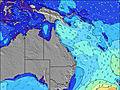 | 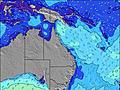 | 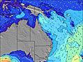 | 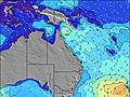 | 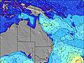 | 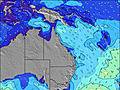 | 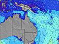 | |||||||||||||
Wave Height (m) Direction Period (s) | SE 11 | SE 10 | SE 10 | SSE 11 | SE 11 | SE 10 | ESE 12 | SE 11 | SE 11 | SE 10 | SE 10 | SE 9 | ESE 9 | ESE 10 | SE 10 | ESE 10 | ESE 10 | ESE 10 | ESE 9 | ESE 9 | NE 9 |
Wave Graph | |||||||||||||||||||||
1107 | 757 | 517 | 1144 | 471 | 310 | 264 | 403 | 254 | 170 | 100 | 70 | 55 | 38 | 25 | 20 | 19 | 9 | 8 | 8 | 12 | |
Wind (km/h) | |||||||||||||||||||||
Wind State on-shore cross-onshore cross-shore cross-offshore off-shore glassy | cross-off | cross-off | cross-off | cross-off | cross-off | off | cross | cross-on | cross-off | cross-off | cross-off | off | cross-on | cross | cross-off | cross-on | cross-off | off | cross-off | off | cross-off |
High Tide | 3:15AM1.14m | 4:33PM1.62m | 4:29AM1.08m | 5:35PM1.77m | 5:38AM1.07m | 6:32PM1.92m | 6:40AM1.10m | 7:24PM2.03m | 7:35AM1.15m | 8:13PM2.09m | 8:26AM1.19m | 9:00PM2.09m | 9:16AM1.23m | ||||||||
Low Tide | 9:51PM0.54m | 9:34AM0.20m | 11:15PM0.46m | 10:35AM0.15m | 00:23AM0.35m | 11:35AM0.08m | 1:21AM0.24m | 12:31PM0.01m | 2:12AM0.15m | 1:23PM-0.03m | 2:58AM0.10m | 2:13PM-0.04m | 3:43AM0.08m | ||||||||
— | — | 6:35 | — | — | 6:35 | — | — | 6:35 | — | — | 6:35 | — | — | 6:35 | — | — | 6:33 | — | — | 6:33 | |
5:06 | — | — | 5:07 | — | — | 5:07 | — | — | 5:07 | — | — | 5:07 | — | — | 5:08 | — | — | 5:08 | — | 5:09 | |
mm | 2 | 4 | 4 | 3 | 5 | — | — | 2 | — | — | — | — | — | — | — | — | — | — | 4 | 79 | 7 |
Temp °C | 19 | 19 | 17 | 18 | 18 | 16 | 18 | 18 | 19 | 20 | 19 | 16 | 18 | 18 | 18 | 19 | 18 | 16 | 16 | 15 | 17 |
Feels °C | 12 | 12 | 12 | 13 | 14 | 15 | 16 | 16 | 18 | 17 | 14 | 15 | 15 | 14 | 16 | 16 | 14 | 11 | 10 | 3 | 4 |
Swell 1 Height (m) Direction Period (s) | — | — | SE 15 | SE 10 | SE 11 | SE 10 | SE 9 | SE 11 | SE 11 | SE 10 | SE 10 | SE 9 | ESE 9 | ESE 10 | SE 10 | ESE 10 | ESE 10 | ESE 10 | ESE 9 | ESE 9 | NE 9 |
— | — | 109 | 603 | 471 | 310 | 166 | 403 | 254 | 170 | 100 | 70 | 55 | 38 | 25 | 20 | 19 | 9 | 8 | 8 | 12 | |
Swell 2 Height (m) Direction Period (s) | — | — | — | — | — | ESE 14 | ESE 12 | SSE 10 | SE 9 | NNW 4 | SSE 9 | SE 8 | SSE 8 | SSE 8 | SSE 7 | SE 4 | SE 7 | SSE 7 | S 6 | SSE 4 | SE 9 |
— | — | — | — | — | 127 | 264 | 10 | 3 | 2 | 8 | 3 | 6 | 12 | 5 | 1 | 2 | 5 | 2 | 2 | 3 | |
Swell 3 Height (m) Direction Period (s) | — | — | — | — | — | — | — | — | — | SE 9 | N 10 | — | — | — | S 10 | — | NE 9 | NE 10 | NE 6 | NE 6 | — |
— | — | — | — | — | — | — | — | — | 3 | 2 | — | — | — | 2 | — | 3 | 4 | 1 | 2 | — | |
Wind waves Height (m) Direction Period (s) | SE 11 | SE 10 | SE 10 | SSE 11 | — | — | — | NNW 3 | NW 3 | NW 4 | WSW 3 | SW 3 | — | — | WSW 2 | — | SW 2 | SW 3 | — | WSW 3 | WSW 3 |
1107 | 757 | 517 | 1144 | — | — | — | 3 | 7 | 7 | 7 | 2 | — | — | 1 | — | 2 | 2 | — | 3 | 4 | |
Nearest Offshore or Glassy | |||||||||||||||||||||
Distance (km) | 80 | 49 | 49 | 65 | 8 | 0 | 80 | 38 | 7 | 7 | 38 | 0 | 80 | 40 | 65 | 230 | 186 | 127 | 168 | 964 | 768 |
Best forecast wave conditions in Brisbane | |||||||||||||||||||||
Best forecast wave conditions in Australia | |||||||||||||||||||||
Header Global | |||||||||||||||||||||
- Map Icons:
 Break
Break Live Wave Height (m)
 Live Wind Speed (km/h)
 Surf Rating (10 Max)
 Ocean Swells (m)
- Wind Speed (km/h)


FREE! Surf-Forecast.com widget for your website
The surf report / weather widget below is available to embed on third party websites free of charge and provides a summary of our Moreton Island - Cape Moreton surf forecast. Simply grab the html code snippet that we provide and paste it into your own site. You can choose your preferred language and metric/imperial units for the surf forecast feed to suit users of your site. Click here to get the code.
Information about the Moreton Island - Cape Moreton Surf forecast
The above surf forecast table for Moreton Island - Cape Moreton provides essential information for determining whether the surfing conditions will be good over the next 16 days. A general guide to surfing at Moreton Island - Cape Moreton can be found by selecting the local surf guide option on the grey menu. Our Moreton Island - Cape Moreton surf forecast is unique since it includes wave energy (power) that defines the real feel of the surf rather than just the height or the period. If you surf the same spot (Moreton Island - Cape Moreton) regularly then make a mental note of the wave energy from the surf forecast table each time you go. Very soon you may start to choose your surf days based on the wave energy alone combined with our forecast of favourable offshore wind conditions. Our star ratings will help here and of course you will also find the usual wave height and period predictions on our surf forecasts as well as a full break down of the swell components under our advanced users option (to reveal that, click the little Einstein character under the tide times).
Further information to help with frequently asked questions about our surf forecast for Moreton Island - Cape Moreton may be found under the help tab on the top menu and also by moving your mouse over the question marks on the surf forecast table itself. Please always bear in mind that the forecast is for near-shore open water and local factors at each surf break influence the actual breaking wave height, such as the beach / reef profile, water depths offshore and shelter.
Moreton Island - Cape Moreton is 40 km (25 miles) from Caloundra. If you plan a holiday in Brisbane, look for hotels and other accommodation in Caloundra. Caloundra has rooms for a wide range of budgets as well as car hire and transport links.
 Nearest