

Surf Forecasts:

Moreton Island - East Coast surf forecast from 8 Jul 2026:
- Best quality surf: Saturday 11 Jul, 10AM (local time) - 3.5ft (1.1m), 10s period, SE swell with cross-offshore winds.
- Most powerful swell: Thursday 9 Jul, 10AM (local time) - 7ft (2.1m), 11s period, SE swell with 1,067 kJ wave energy.
- Next surfable swell (1★+): Saturday 11 Jul, 10AM (local time) - 3.5ft (1.1m), 10s period with SE swell.
Best Forecast Surf Conditions for Moreton Island - East Coast this week:
The surf forecast for Moreton Island - East Coast over the next 16 days: The first swell (rated 1 star or higher) is forecast to arrive on Saturday (Jul 11) at 10AM. The primary swell is predicted to be 1.1m and 10s period with a secondary swell of 0.5m and 14s. The wind is predicted to be cross-offshore as the swell arrives.
The most powerful waves expected at Moreton Island - East Coast in the next 16 days are 2.1m 11s and forecast to arrive on Thursday (Jul 09) at 10AM. Winds are predicted to be cross-shore at the time the swell arrives. The largest open ocean swell (not directed at the beach) is 0.6m 3s period and expected on Sunday (Jul 12) at 10PM.
| Wave Type | Time (AEST) & Date | Wave Height & Period |
|---|---|---|
| Next good surf (1 star+) | 10AM (Sat 11th Jul) | 3.5ft (1.1m) 10s |
| Best Surf | 10AM (Sat 11th Jul) | 3.5ft (1.1m) 10s |
| Most Powerful | 10AM (Thu 9th Jul) | 7ft (2.1m) 11s |
Table - best surf conditions forecast for Moreton Island - East Coast over the next 16 days.
Alright, Rusty here again, dialing in the same outlook but in the old-school numbers. Let’s talk about what’s coming.
The water is sitting right on 72°, which is dead average for this time of year – no surprises there.
Gotta be straight with you: the next 16 days are a mixed bag, with plenty of flat spells and blown-out slop. The first real chance for a decent paddle is Saturday the 11th. The morning is the pick, with a clean 4ft swell from the SE at a 10-second interval. The wind is a light offshore from the SSW, keeping the surface clean. The combined energy is weak though, only 380, so expect fun little waves, not barrels. The afternoon drops off.
Sunday the 12th is another solid option. The morning has a clean 4ft SE swell (11 seconds) with a solid offshore wind from the W. The wave energy is even weaker at 289, but with that offshore wind, it’ll be clean and workable. The afternoon gets lumpy.
After that, the surf just dies. Monday the 13th gives you a tiny 2ft, and then it’s flat for days. From Tuesday the 14th through Wednesday the 22nd, it’s mostly small, weak junk under 3ft, with a lot of poor conditions and onshore breezes. There’s a moment on the 22nd with a 3ft SSE swell and an offshore wind, but the period is a short 7 seconds, so it’ll be weak and crumbly.
The only true standout is the morning of Saturday the 11th. Moreton Island - East Coast is the spot. The swell is a clean 4ft from the SE, and with that light offshore SW wind, the lineup will be glassy. The 10-second period gives it a bit of push. Just know that the crowds can be *often*, so you won’t be alone, but for a clean, fun winter wave, it’s the best on offer.
The rest of the 16 days is a long, flat, and windy road. The 17th through the 19th see a massive spike in swell energy, with a 13ft SSE swell on the 17th morning (energy of 6651!) and 10ft on the 18th, but it’s all accompanied by howling gale-force winds (37-40 mph) from the SSE. That’s not surf, that’s a survival mission. For a beach break like this, that setup looks more interesting for kite surfing than paddle surfing.
So, bottom line: get out on Saturday morning the 11th for the cleanest, most fun waves of the run. Sunday morning the 12th is a solid backup. Then the taps get turned off for a while before getting blown out. That’s the story.
Rusty.
Short Range ForecastModerate rain (total 15mm), heaviest on Fri morning. Very mild (max 19°C on Sat night, min 16°C on Thu night). Winds decreasing (fresh winds from the SSE on Thu morning, light winds from the SSW by Sat morning). | Days 4-6 Weather SummaryMostly dry. Warm (max 21°C on Sun afternoon, min 15°C on Sun night). Wind will be generally light. | ||||||||||||||||||||
Thursday 9 | Friday 10 | Saturday 11 | Sunday 12 | Monday 13 | Tuesday 14 | Wednesday 15 | |||||||||||||||
AM | PM | Night | AM | PM | Night | AM | PM | Night | AM | PM | Night | AM | PM | Night | AM | PM | Night | AM | PM | Night | |
Swell Height Map | 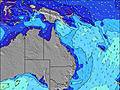 | 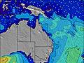 | 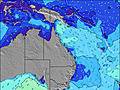 | 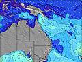 | 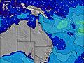 | 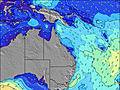 | 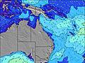 | ||||||||||||||
Wave Height (m) Direction Period (s) | SE 11 | SE 11 | SE 10 | SE 10 | SE 10 | SE 11 | SE 10 | ESE 12 | SE 11 | SE 11 | SE 10 | SE 10 | SE 9 | ESE 9 | SE 8 | ESE 10 | ESE 10 | ESE 10 | ESE 9 | SSE 4 | SSE 7 |
Wave Graph | |||||||||||||||||||||
1067 | 954 | 1039 | 517 | 551 | 471 | 270 | 268 | 403 | 286 | 204 | 100 | 68 | 55 | 21 | 38 | 19 | 18 | 8 | 10 | 529 | |
Wind (km/h) | |||||||||||||||||||||
Wind State on-shore cross-onshore cross-shore cross-offshore off-shore glassy | cross | cross | cross | cross | cross-on | cross | cross-off | on | cross-off | off | cross-off | cross-off | cross-off | on | cross-off | cross-off | on | cross-off | cross-off | cross-on | cross-off |
High Tide | 3:27PM1.46m | 3:15AM1.14m | 4:33PM1.62m | 4:29AM1.08m | 5:35PM1.77m | 5:38AM1.07m | 6:32PM1.92m | 6:40AM1.10m | 7:24PM2.03m | 7:35AM1.15m | 8:13PM2.09m | 8:26AM1.19m | 9:00PM2.09m | ||||||||
Low Tide | 9:51PM0.54m | 9:34AM0.20m | 11:15PM0.46m | 10:35AM0.15m | 00:23AM0.35m | 11:35AM0.08m | 1:21AM0.24m | 12:31PM0.01m | 2:12AM0.15m | 1:23PM-0.03m | 2:58AM0.10m | 2:13PM-0.04m | 3:43AM0.08m | ||||||||
6:35 | — | — | 6:35 | — | — | 6:35 | — | — | 6:35 | — | — | 6:35 | — | — | 6:35 | — | — | 6:33 | — | — | |
— | 5:06 | — | — | 5:07 | — | — | 5:07 | — | — | 5:07 | — | — | 5:07 | — | — | 5:08 | — | — | 5:08 | — | |
mm | — | 1 | 5 | 4 | 2 | 1 | — | — | 2 | — | — | — | — | — | — | — | — | — | — | — | 4 |
Temp °C | 18 | 18 | 17 | 17 | 18 | 18 | 16 | 18 | 19 | 20 | 21 | 19 | 16 | 18 | 18 | 18 | 19 | 19 | 16 | 18 | 17 |
Feels °C | 11 | 12 | 11 | 12 | 13 | 14 | 14 | 15 | 16 | 16 | 16 | 14 | 14 | 15 | 14 | 16 | 16 | 19 | 13 | 14 | 12 |
Swell 1 Height (m) Direction Period (s) | SE 11 | SE 11 | SE 10 | SE 15 | SE 10 | SE 11 | SE 10 | SE 9 | SE 11 | SE 11 | SE 10 | SE 10 | SE 9 | ESE 9 | SE 8 | ESE 10 | ESE 10 | ESE 10 | ESE 9 | ESE 9 | NE 8 |
315 | 147 | 1039 | 109 | 551 | 471 | 270 | 141 | 403 | 286 | 204 | 100 | 68 | 55 | 18 | 38 | 19 | 18 | 8 | 9 | 3 | |
Swell 2 Height (m) Direction Period (s) | — | — | — | SE 15 | — | — | ESE 14 | ESE 12 | SSE 10 | SE 9 | SE 9 | SSE 9 | SE 8 | SSE 8 | ESE 10 | SSE 7 | ESE 8 | NE 9 | S 8 | NE 10 | N 10 |
— | — | — | 106 | — | — | 110 | 268 | 10 | 3 | 3 | 7 | 3 | 6 | 21 | 5 | 6 | 3 | 1 | 4 | 2 | |
Swell 3 Height (m) Direction Period (s) | — | — | — | — | — | — | — | — | — | — | — | — | — | — | SSE 8 | S 10 | S 5 | S 9 | NE 10 | S 7 | — |
— | — | — | — | — | — | — | — | — | — | — | — | — | — | 6 | 2 | 2 | 2 | 4 | 1 | — | |
Wind waves Height (m) Direction Period (s) | SE 11 | SE 11 | SE 10 | SE 10 | SE 10 | — | — | — | NNW 3 | NW 3 | NW 3 | WSW 3 | WSW 3 | — | — | — | — | — | S 3 | SSE 4 | SSE 7 |
1067 | 954 | 653 | 517 | 337 | — | — | — | 3 | 2 | 2 | 7 | 2 | — | — | — | — | — | 5 | 10 | 529 | |
Nearest Offshore or Glassy | |||||||||||||||||||||
Distance (km) | 55 | 86 | 55 | 55 | 86 | 36 | 0 | 86 | 43 | 0 | 43 | 44 | 0 | 61 | 45 | 45 | 237 | 179 | 161 | 348 | 7 |
Best forecast wave conditions in Brisbane | |||||||||||||||||||||
Best forecast wave conditions in Australia | |||||||||||||||||||||
Header Global | |||||||||||||||||||||
- Map Icons:
 Break
Break Live Wave Height (m)
 Live Wind Speed (km/h)
 Surf Rating (10 Max)
 Ocean Swells (m)
- Wind Speed (km/h)


FREE! Surf-Forecast.com widget for your website
The surf report / weather widget below is available to embed on third party websites free of charge and provides a summary of our Moreton Island - East Coast surf forecast. Simply grab the html code snippet that we provide and paste it into your own site. You can choose your preferred language and metric/imperial units for the surf forecast feed to suit users of your site. Click here to get the code.
Information about the Moreton Island - East Coast Surf forecast
The above surf forecast table for Moreton Island - East Coast provides essential information for determining whether the surfing conditions will be good over the next 16 days. A general guide to surfing at Moreton Island - East Coast can be found by selecting the local surf guide option on the grey menu. Our Moreton Island - East Coast surf forecast is unique since it includes wave energy (power) that defines the real feel of the surf rather than just the height or the period. If you surf the same spot (Moreton Island - East Coast) regularly then make a mental note of the wave energy from the surf forecast table each time you go. Very soon you may start to choose your surf days based on the wave energy alone combined with our forecast of favourable offshore wind conditions. Our star ratings will help here and of course you will also find the usual wave height and period predictions on our surf forecasts as well as a full break down of the swell components under our advanced users option (to reveal that, click the little Einstein character under the tide times).
Further information to help with frequently asked questions about our surf forecast for Moreton Island - East Coast may be found under the help tab on the top menu and also by moving your mouse over the question marks on the surf forecast table itself. Please always bear in mind that the forecast is for near-shore open water and local factors at each surf break influence the actual breaking wave height, such as the beach / reef profile, water depths offshore and shelter.
Moreton Island - East Coast is 43 km (27 miles) from Deception Bay. If you plan a holiday in Brisbane, look for hotels and other accommodation in Deception Bay. Deception Bay has rooms for a wide range of budgets as well as car hire and transport links.
 Nearest