

Surf Forecasts:

The groyne surf forecast from 1 Aug 2026:
- Best quality surf: Monday 3 Aug, 4AM (local time) - 2ft (0.6m), 14s period, SE swell with cross-offshore winds.
- Most powerful swell: Monday 3 Aug, 7AM (local time) - 2.5ft (0.8m), 13s period, SE swell with 199 kJ wave energy.
- Next surfable swell (1★+): Monday 3 Aug, 4AM (local time) - 2ft (0.6m), 14s period with SE swell.
Best Forecast Surf Conditions for The groyne this week:
The surf forecast for The groyne over the next 16 days: The first swell (rated 1 star or higher) is forecast to arrive on Monday (Aug 03) at 4AM. The primary swell is predicted to be 0.6m and 14s period with a secondary swell of 1.0m and 7s. The wind is predicted to be cross-offshore as the swell arrives.
The most powerful waves expected at The groyne in the next 16 days are 0.8m 13s and forecast to arrive on Monday (Aug 03) at 7AM. Winds are predicted to be cross-shore at the time the swell arrives. The largest open ocean swell (not directed at the beach) is 0.3m 2s period and expected on Thursday (Aug 06) at 7AM.
| Wave Type | Time (AEST) & Date | Wave Height & Period |
|---|---|---|
| Next good surf (1 star+) | 4AM (Mon 3rd Aug) | 2ft (0.6m) 14s |
| Best Surf | 4AM (Mon 3rd Aug) | 2ft (0.6m) 14s |
| Most Powerful | 7AM (Mon 3rd Aug) | 2.5ft (0.8m) 13s |
Table - best surf conditions forecast for The groyne over the next 16 days.
The Lowdown
Alright folks, Rusty here. Let’s break down what we’ve got for the next couple of weeks.
Honestly, you can scratch the first few days. We’ve got a dry spell with no real surf until Tuesday morning, August 4th. The weekend and Monday are just a blown-out mess of onshore wind and junk.
Your first chance to paddle out comes Tuesday morning, the 4th of August, at The groyne (reef). It’s not going to blow your mind, but it’s the start. You’re looking at a tiny 2ft swell from the SE, with a period of 9 seconds. The juice is weak (116). The huge win here is the wind – it’s glassy. That means the surface will be smooth as butter, even if the waves are small. For a beginner, this is perfect. The water temp is about average for the season.
Wednesday the 5th is a step up. The morning offers a 3ft swell from the east (10-second period, moderate energy at 167) with a light cross-offshore breeze from the SW, keeping it clean. The afternoon turns glassy again, but the swell period drops to 8 seconds, making it weaker (122). It’s surfable, but nothing special.
The standout session, and the best of the whole forecast, is Tuesday morning, the 11th of August. The groyne should have a 2ft swell from the SE, but with a very long period of 12 seconds. That’s real groundswell. The energy is moderate (198). The kicker is the glassy conditions with a light offshore wind from the NW. Since it’s a reef, that long-period energy will wrap in nicely and hold up. It’ll be clean, and the long lulls will make it easy to get in position. Crowds are possible.
The rest of the second week is a story of onshore wind. Wednesday morning the 12th is clean with a cross-offshore breeze and a 3ft, 11-second ESE swell (179 energy), but that’s the last decent one. From Thursday the 13th onward, the wind gets nasty, with fresh breezes up to 21 mph. The swell is actually there, with some solid energy (267-415) and long period, but the wind will tear it up. This stretch is for the kite and windsurf crowd.
So, here’s the plan: skip the start. Tuesday the 4th is a tiny, clean option for beginners. Wednesday the 5th is a little better. But the one to mark on your calendar is Tuesday morning, the 11th of August – clean, glassy, long-period groundswell at The groyne.
Rusty.
Short Range ForecastModerate rain (total 11mm), heaviest on Sat night. Very mild (max 19°C on Tue morning, min 15°C on Sun night). Wind will be generally light. | Days 5-7 Weather SummaryMostly dry. Warm (max 21°C on Wed morning, min 12°C on Wed night). Wind will be generally light. | ||||||||||||||||||
Sunday 2 | Monday 3 | Tuesday 4 | Wednesday 5 | Thursday 6 | Friday 7 | ||||||||||||||
Night | AM | PM | Night | AM | PM | Night | AM | PM | Night | AM | PM | Night | AM | PM | Night | AM | PM | Night | |
Swell Height Map |  | 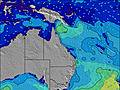 | 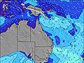 | 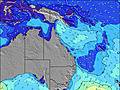 | 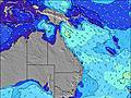 |  |  | ||||||||||||
Wave Height (m) Direction Period (s) | ESE 6 | ESE 6 | ESE 6 | SE 14 | SE 13 | SE 11 | SE 10 | SE 9 | ESE 8 | ESE 11 | E 10 | E 8 | E 8 | E 8 | E 8 | E 8 | ENE 7 | E 7 | E 7 |
Wave Graph | |||||||||||||||||||
126 | 165 | 119 | 162 | 136 | 99 | 104 | 64 | 47 | 101 | 158 | 116 | 107 | 76 | 33 | 29 | 29 | 53 | 53 | |
Wind (km/h) | |||||||||||||||||||
Wind State on-shore cross-onshore cross-shore cross-offshore off-shore glassy | cross-on | cross-on | cross-on | cross-on | cross | cross-on | off | glassy | cross-on | cross-off | cross-off | glassy | cross-off | cross-off | cross-on | glassy | cross | cross-on | cross-on |
High Tide | 10:15AM1.39m | 10:25PM1.63m | 10:57AM1.41m | 11:02PM1.51m | 11:45AM1.43m | 11:44PM1.36m | 12:44PM1.44m | 00:36AM1.21m | 1:57PM1.48m | 1:47AM1.08m | 3:19PM1.55m | 3:19AM1.01m | |||||||
Low Tide | 4:19AM0.25m | 4:08PM0.33m | 4:51AM0.26m | 4:54PM0.40m | 5:27AM0.28m | 5:50PM0.49m | 6:09AM0.31m | 7:00PM0.58m | 7:01AM0.33m | 8:30PM0.62m | 8:05AM0.34m | 10:05PM0.58m | |||||||
— | 6:26 | — | — | 6:26 | — | — | 6:26 | — | — | 6:24 | — | — | 6:24 | — | — | 6:24 | — | — | |
— | — | 5:20 | — | — | 5:20 | — | — | 5:21 | — | — | 5:21 | — | — | 5:22 | — | — | 5:22 | — | |
mm | 8 | — | — | 1 | 2 | — | — | — | — | — | — | — | — | — | — | — | — | — | — |
Temp °C | 17 | 18 | 18 | 17 | 17 | 18 | 17 | 19 | 18 | 17 | 21 | 21 | 16 | 18 | 18 | 17 | 18 | 18 | 17 |
Feels °C | 15 | 13 | 14 | 14 | 15 | 16 | 16 | 17 | 16 | 15 | 18 | 19 | 12 | 16 | 16 | 15 | 16 | 16 | 15 |
Swell 1 Height (m) Direction Period (s) | ESE 12 | ESE 12 | ESE 16 | E 7 | E 7 | E 6 | E 6 | E 6 | ENE 6 | ESE 11 | E 10 | E 8 | E 8 | E 8 | ENE 7 | E 8 | ENE 7 | E 7 | E 7 |
15 | 14 | 94 | 86 | 89 | 78 | 49 | 39 | 30 | 101 | 158 | 116 | 107 | 76 | 29 | 29 | 29 | 53 | 53 | |
Swell 2 Height (m) Direction Period (s) | SE 12 | SE 16 | E 12 | SE 14 | SE 13 | SE 11 | SE 10 | SE 9 | ESE 8 | ENE 6 | NE 9 | E 18 | E 17 | E 16 | E 8 | ENE 7 | E 7 | NE 7 | NE 7 |
5 | 10 | 3 | 162 | 136 | 99 | 104 | 64 | 47 | 28 | 3 | 6 | 6 | 5 | 33 | 19 | 16 | 17 | 17 | |
Swell 3 Height (m) Direction Period (s) | E 8 | SE 10 | ESE 12 | E 16 | SE 13 | E 14 | ESE 13 | ESE 11 | E 11 | E 19 | E 18 | — | E 17 | E 16 | E 16 | ENE 9 | ESE 8 | SE 12 | SE 10 |
4 | 4 | 14 | 5 | 128 | 15 | 33 | 13 | 10 | 7 | 6 | — | 6 | 5 | 5 | 8 | 20 | 6 | 4 | |
Wind waves Height (m) Direction Period (s) | ESE 6 | ESE 6 | ESE 6 | — | — | — | — | — | — | — | — | — | — | SSW 3 | — | ENE 3 | — | — | — |
126 | 165 | 119 | — | — | — | — | — | — | — | — | — | — | 1 | — | 2 | — | — | — | |
Nearest Offshore or Glassy | |||||||||||||||||||
Distance (km) | 47 | 47 | 47 | 13 | 1 | 13 | 0 | 0 | 19 | 0 | 0 | 0 | 0 | 0 | 13 | 0 | 1 | 13 | 13 |
Best forecast wave conditions in Sunshine Coast | |||||||||||||||||||
Best forecast wave conditions in Australia | |||||||||||||||||||
Header Global | |||||||||||||||||||
- Map Icons:
 Break
Break Live Wave Height (m)
 Live Wind Speed (km/h)
 Surf Rating (10 Max)
 Ocean Swells (m)
- Wind Speed (km/h)
Latest Updates


FREE! Surf-Forecast.com widget for your website
The surf report / weather widget below is available to embed on third party websites free of charge and provides a summary of our The groyne surf forecast. Simply grab the html code snippet that we provide and paste it into your own site. You can choose your preferred language and metric/imperial units for the surf forecast feed to suit users of your site. Click here to get the code.
Information about the The groyne Surf forecast
The above surf forecast table for The groyne provides essential information for determining whether the surfing conditions will be good over the next 16 days. A general guide to surfing at The groyne can be found by selecting the local surf guide option on the grey menu. Our The groyne surf forecast is unique since it includes wave energy (power) that defines the real feel of the surf rather than just the height or the period. If you surf the same spot (The groyne) regularly then make a mental note of the wave energy from the surf forecast table each time you go. Very soon you may start to choose your surf days based on the wave energy alone combined with our forecast of favourable offshore wind conditions. Our star ratings will help here and of course you will also find the usual wave height and period predictions on our surf forecasts as well as a full break down of the swell components under our advanced users option (to reveal that, click the little Einstein character under the tide times).
Further information to help with frequently asked questions about our surf forecast for The groyne may be found under the help tab on the top menu and also by moving your mouse over the question marks on the surf forecast table itself. Please always bear in mind that the forecast is for near-shore open water and local factors at each surf break influence the actual breaking wave height, such as the beach / reef profile, water depths offshore and shelter.
 Nearest