

Surf Forecasts:

The Groin (Noosa) surf forecast from 3 Aug 2026:
- Best quality surf: Saturday 8 Aug, 7PM (local time) - 4ft (1.2m), 9s period, ESE swell with cross-offshore winds.
- Most powerful swell: Sunday 9 Aug, 4AM (local time) - 4ft (1.2m), 9s period, E swell with 235 kJ wave energy.
- Next surfable swell (1★+): Tuesday 4 Aug, 1AM (local time) - 2.5ft (0.7m), 6s period with E swell.
Best Forecast Surf Conditions for The Groin (Noosa) this week:
The surf forecast for The Groin (Noosa) over the next 16 days: The first swell (rated 1 star or higher) is forecast to arrive on Tuesday (Aug 04) at 1AM. The primary swell is predicted to be 0.7m and 6s period. The wind is predicted to be glassy as the swell arrives.
The most powerful waves expected at The Groin (Noosa) in the next 16 days are 1.2m 9s and forecast to arrive on Sunday (Aug 09) at 4AM. Winds are predicted to be cross-offshore at the time the swell arrives. The largest open ocean swell (not directed at the beach) is 0.8m 10s period and expected on Monday (Aug 03) at 10PM.
| Wave Type | Time (AEST) & Date | Wave Height & Period |
|---|---|---|
| Next good surf (1 star+) | 1AM (Tue 4th Aug) | 2.5ft (0.7m) 6s |
| Best Surf | 7PM (Sat 8th Aug) | 4ft (1.2m) 9s |
| Most Powerful | 4AM (Sun 9th Aug) | 4ft (1.2m) 9s |
Table - best surf conditions forecast for The Groin (Noosa) over the next 16 days.
The Lowdown
Alright folks, Rusty here. Let's have a look at what's on the table for the Noosa region.
Overall, it's a pretty quiet run ahead. We've got a solid week of small, average conditions before a real standout window pops up. The Groin is the only break on the cards, so that's where we're focusing.
The water temperature is sitting at 69°, which is about 1° cooler than average for this time of year – nothing too wild, just a touch on the fresh side.
The first few days are a bit of a write-off. Monday the 3rd has tiny 3ft easterly windswell with a weak period of 6 seconds, and the combined energy is a measly (64). It's cross-off but the conditions are just too ordinary to get excited about. Tuesday the 4th and Wednesday the 5th stay small and messy, with the best being Wednesday morning when a 3ft easterly swell bumps the energy up to (206) and we get a clean, offshore wind from the SW. It's surfable, but nothing to write home about. Thursday the 6th through to Saturday the 8th are all pretty average with moderate cross-off breezes keeping the surface clean but the swell small and weak.
Now, here's the one to circle. Sunday the 9th morning. We get a jump in the swell to 4ft from the east, with a period of 9 seconds, pushing the combined energy to a solid (272). The wind goes glassy, with a slight air from the SSE. That's about as good as it gets in this forecast. It's a breakwater, so it handles a bit of direction, and that easterly swell is right in the groove for the optimum ENE direction. The conditions are set to be clean and the waves should have some shape. It's a beginner-friendly spot, but with crowds listed as "often", expect company out there.
After that, it drops back down. Monday the 10th has a clean 3ft swell with offshore winds in the morning, but the energy is halved to (158). From there, it's a slow decline into the second week. The 11th through the 18th are all very small, with waves dropping to 2ft and barely any energy (51 or less). The winds are a mix of cross-off and onshore, but the swell just isn't there. We're looking at a long stretch of flat or near-flat conditions from the 11th right through to the end of the forecast on the 18th.
So, if you're chasing a wave, target Sunday the 9th morning. It's the only real standout. The rest is a waiting game.
Rusty.
Short Range ForecastMostly dry. Warm (max 20°C on Wed morning, min 15°C on Mon night). Wind will be generally light. | Days 5-7 Weather SummaryMostly dry. Very mild (max 19°C on Sat afternoon, min 15°C on Thu night). Wind will be generally light. | |||||||||||||||||||
Mon 3 | Tuesday 4 | Wednesday 5 | Thursday 6 | Friday 7 | Saturday 8 | Sunday 9 | ||||||||||||||
PM | Night | AM | PM | Night | AM | PM | Night | AM | PM | Night | AM | PM | Night | AM | PM | Night | AM | PM | Night | |
Swell Height Map | 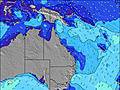 |  |  | 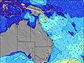 | 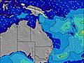 | 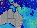 |  | |||||||||||||
Wave Height (m) Direction Period (s) | E 6 | E 6 | ENE 6 | ENE 7 | ENE 7 | E 10 | E 8 | ENE 8 | ENE 7 | ENE 7 | ENE 7 | ENE 8 | ENE 8 | E 8 | E 8 | E 8 | E 9 | E 9 | E 9 | E 9 |
Wave Graph | ||||||||||||||||||||
64 | 38 | 31 | 34 | 40 | 194 | 140 | 85 | 53 | 48 | 55 | 85 | 99 | 146 | 115 | 55 | 225 | 230 | 192 | 155 | |
Wind (km/h) | ||||||||||||||||||||
Wind State on-shore cross-onshore cross-shore cross-offshore off-shore glassy | cross-off | glassy | glassy | cross-on | cross | off | cross-on | cross-off | cross-off | cross-off | off | cross-off | cross-off | cross-off | cross-off | cross-off | cross-off | glassy | cross-on | cross |
High Tide | 10:58PM1.67m | 11:39AM1.50m | 11:41PM1.55m | 12:39PM1.52m | 00:32AM1.41m | 1:53PM1.55m | 1:41AM1.29m | 3:18PM1.63m | 3:11AM1.22m | 4:35PM1.76m | 4:38AM1.23m | 5:38PM1.89m | ||||||||
Low Tide | 4:43PM0.50m | 5:24AM0.41m | 5:35PM0.60m | 6:07AM0.44m | 6:41PM0.71m | 7:01AM0.46m | 8:12PM0.78m | 8:08AM0.48m | 9:55PM0.76m | 9:26AM0.45m | 11:17PM0.66m | 10:39AM0.38m | 00:18AM0.52m | |||||||
— | — | 6:24 | — | — | 6:24 | — | — | 6:24 | — | — | 6:22 | — | — | 6:22 | — | — | 6:22 | — | — | |
5:21 | — | — | 5:22 | — | — | 5:22 | — | — | 5:22 | — | — | 5:22 | — | — | 5:23 | — | — | 5:23 | — | |
mm | — | — | — | — | — | — | — | — | — | — | — | — | — | — | — | — | — | — | — | — |
Temp °C | 18 | 17 | 18 | 18 | 17 | 20 | 19 | 17 | 18 | 18 | 18 | 18 | 18 | 17 | 18 | 19 | 18 | 19 | 19 | 17 |
Feels °C | 16 | 16 | 17 | 16 | 16 | 17 | 17 | 17 | 16 | 16 | 17 | 15 | 15 | 16 | 14 | 16 | 16 | 20 | 17 | 17 |
Swell 1 Height (m) Direction Period (s) | E 6 | SE 10 | SE 9 | ENE 7 | ENE 7 | E 10 | E 8 | ENE 8 | ENE 7 | ENE 7 | ENE 7 | ENE 8 | ENE 8 | E 8 | E 8 | E 8 | E 9 | E 9 | E 9 | E 9 |
64 | 147 | 81 | 34 | 40 | 194 | 140 | 85 | 53 | 48 | 55 | 85 | 99 | 146 | 115 | 55 | 225 | 230 | 192 | 155 | |
Swell 2 Height (m) Direction Period (s) | SE 12 | E 6 | ENE 6 | ESE 8 | ESE 10 | E 18 | E 18 | ESE 9 | ESE 8 | ESE 8 | ESE 8 | ESE 8 | ESE 10 | SE 10 | SSE 10 | NE 7 | NE 8 | NE 8 | NE 8 | NE 8 |
197 | 38 | 31 | 26 | 61 | 6 | 6 | 84 | 53 | 36 | 21 | 19 | 20 | 4 | 10 | 23 | 57 | 42 | 40 | 37 | |
Swell 3 Height (m) Direction Period (s) | ESE 13 | ESE 13 | ESE 12 | SE 9 | ESE 11 | E 18 | E 18 | E 17 | E 16 | NE 9 | ENE 9 | NE 9 | SE 10 | E 15 | E 14 | ESE 9 | SE 10 | SE 10 | SE 9 | S 9 |
16 | 33 | 13 | 40 | 25 | 6 | 6 | 6 | 5 | 3 | 8 | 3 | 4 | 4 | 4 | 27 | 4 | 4 | 3 | 2 | |
Wind waves Height (m) Direction Period (s) | — | — | — | — | — | — | E 3 | — | — | — | — | S 3 | SE 3 | — | S 4 | SE 5 | — | — | E 3 | — |
— | — | — | — | — | — | 1 | — | — | — | — | 1 | 3 | — | 10 | 25 | — | — | 1 | — | |
Nearest Offshore or Glassy | ||||||||||||||||||||
Distance (km) | 0 | 0 | 1 | 2 | 3 | 0 | 2 | 0 | 0 | 0 | 0 | 1 | 2 | 0 | 1 | 2 | 0 | 0 | 27 | 3 |
Best forecast wave conditions in Sunshine Coast | ||||||||||||||||||||
Best forecast wave conditions in Australia | ||||||||||||||||||||
Header Global | ||||||||||||||||||||
- Map Icons:
 Break
Break Live Wave Height (m)
 Live Wind Speed (km/h)
 Surf Rating (10 Max)
 Ocean Swells (m)
- Wind Speed (km/h)
Latest Updates


FREE! Surf-Forecast.com widget for your website
The surf report / weather widget below is available to embed on third party websites free of charge and provides a summary of our The Groin (Noosa) surf forecast. Simply grab the html code snippet that we provide and paste it into your own site. You can choose your preferred language and metric/imperial units for the surf forecast feed to suit users of your site. Click here to get the code.
Information about the The Groin (Noosa) Surf forecast
The above surf forecast table for The Groin (Noosa) provides essential information for determining whether the surfing conditions will be good over the next 16 days. A general guide to surfing at The Groin (Noosa) can be found by selecting the local surf guide option on the grey menu. Our The Groin (Noosa) surf forecast is unique since it includes wave energy (power) that defines the real feel of the surf rather than just the height or the period. If you surf the same spot (The Groin (Noosa)) regularly then make a mental note of the wave energy from the surf forecast table each time you go. Very soon you may start to choose your surf days based on the wave energy alone combined with our forecast of favourable offshore wind conditions. Our star ratings will help here and of course you will also find the usual wave height and period predictions on our surf forecasts as well as a full break down of the swell components under our advanced users option (to reveal that, click the little Einstein character under the tide times).
Further information to help with frequently asked questions about our surf forecast for The Groin (Noosa) may be found under the help tab on the top menu and also by moving your mouse over the question marks on the surf forecast table itself. Please always bear in mind that the forecast is for near-shore open water and local factors at each surf break influence the actual breaking wave height, such as the beach / reef profile, water depths offshore and shelter.
 Nearest