

Surf Forecasts:

Noosa - Tea Tree Bay surf forecast from 15 Jul 2026:
- Best quality surf: Thursday 16 Jul, 1PM (local time) - 10ft (3.0m), 8s period, SSE swell with cross-offshore winds.
- Most powerful swell: Sunday 19 Jul, 4AM (local time) - 15ft (4.5m), 11s period, SE swell with 4,135 kJ wave energy.
- Next surfable swell (1★+): Thursday 16 Jul, 1PM (local time) - 10ft (3.0m), 8s period with SSE swell.
Best Forecast Surf Conditions for Noosa - Tea Tree Bay this week:
The surf forecast for Noosa - Tea Tree Bay over the next 16 days: The first swell (rated 1 star or higher) is forecast to arrive on Thursday (Jul 16) at 1PM. The primary swell is predicted to be 3.0m and 8s period with a secondary swell of 0.3m and 8s. The wind is predicted to be cross-offshore as the swell arrives.
The most powerful waves expected at Noosa - Tea Tree Bay in the next 16 days are 4.5m 11s and forecast to arrive on Sunday (Jul 19) at 4AM. Winds are predicted to be cross-offshore at the time the swell arrives. The largest open ocean swell (not directed at the beach) is 1.0m 4s period and expected on Wednesday (Jul 15) at 4PM.
| Wave Type | Time (AEST) & Date | Wave Height & Period |
|---|---|---|
| Next good surf (1 star+) | 1PM (Thu 16th Jul) | 10ft (3.0m) 8s |
| Best Surf | 1PM (Thu 16th Jul) | 10ft (3.0m) 8s |
| Most Powerful | 4AM (Sun 19th Jul) | 15ft (4.5m) 11s |
Table - best surf conditions forecast for Noosa - Tea Tree Bay over the next 16 days.
The Lowdown
G’day, Rusty here. Let’s have a look at what’s coming up for Noosa – Tea Tree Bay over the next couple of weeks.
Right off the bat, there’s a bit of a wait. Wednesday morning the 15th is tiny and messy, with just 1ft of weak ESE swell (23) and cross-off winds. Not worth paddling out for. That’s the first couple of days gone – nothing to get excited about.
Things start to get interesting on Thursday the 16th, but it’s a wild one. The morning brings 8ft SSE swell (911) with a short 8-second period and 19 mph cross-off winds – bumpy and tough. By the afternoon, it jumps to 12ft (1422), still 8 seconds, and 25 mph SSE cross-off winds. That’s too big for most, and the wind is strong. The water temp is about 69°F, which is pretty normal for this time of year.
Friday the 17th stays big but the wind swings offshore in the morning – 7ft SE swell (465) with 19 mph offshore. That’s clean, but the swell’s still short-period (7 seconds) and the size is edging into expert territory. The afternoon is messy again.
Saturday the 18th and Sunday the 19th are the standout days but only for the brave. Saturday morning sees 10ft SSE swell (1377) and offshore wind, but the period is short (9 seconds) and the size is big. Sunday morning is 13ft SE swell (3451) with 25 mph offshore wind – strong offshore and clean, but hard to paddle into. This is expert-only territory. The combined energy is massive (3451), and the swell direction (SE) matches the optimum ENE for Tea Tree Bay fairly well, but the size is the limiting factor.
Monday the 20th is the best on offer for experienced surfers. 15ft SE swell (3821) with 22 mph offshore wind – fresh offshore and clean. The period is 10 seconds, so it has some push. This is a true stand-out for big-wave chargers. The swell direction is good, the wind is clean, but the size is only for those with serious skills.
From Tuesday the 21st through to Friday the 24th, things settle into a more manageable range. Tuesday afternoon sees 8ft ESE swell (1140) with 16 mph offshore wind – clean and good for intermediates. The period is 10 seconds, so decent shape. Wednesday the 22nd is similar with 7ft ESE swell (947) and gentle offshore winds. Thursday the 23rd is a highlight with a 8ft ESE swell (1702) and a 12-second period – that’s a groundswell, and it’ll be clean with gentle offshore winds. Great for experienced surfers, and the longer period means better waves. Friday the 24th keeps it going with 8ft ESE swell (1256) and an 11-second period, moderate offshore wind.
The weekend of the 25th and 26th sees a slight drop in size but still surfable, with 6ft to 7ft ESE swell, but the wind picks up to 19 mph offshore. The period drops to 7-10 seconds, so the quality is a bit mixed.
The final few days, from the 29th to the 30th, are small and glassy. Wednesday the 29th morning has 4ft E swell (289) with glassy conditions – perfect for a longboard or a beginner. The period is 10 seconds, so there’s some shape. Thursday the 30th is similar, with 4ft to 4ft ESE swell. Crowds are often at Tea Tree Bay, so expect company.
The absolute best on offer is Monday the 20th for the big-wave crew – 15ft SE swell, fresh offshore, massive energy. For the rest of us, Thursday the 23rd through Friday the 24th is the sweet spot: 8ft to 8ft, clean, longer period, and good shape. That’s your pick for a solid session without the hazard.
Rusty.
Short Range ForecastHeavy rain (total 45mm), heaviest during Thu morning. Very mild (max 18°C on Fri morning, min 13°C on Wed night). Winds increasing (light winds from the S on Wed morning, strong winds from the SSE by Thu afternoon). | Days 4-6 Weather SummaryHeavy rain (total 25mm), heaviest during Sat night. Warm (max 20°C on Mon morning, min 17°C on Sat morning). Mainly strong winds. | ||||||||||||||||||||
Wednesday 15 | Thursday 16 | Friday 17 | Saturday 18 | Sunday 19 | Monday 20 | Tuesday 21 | |||||||||||||||
AM | PM | Night | AM | PM | Night | AM | PM | Night | AM | PM | Night | AM | PM | Night | AM | PM | Night | AM | PM | Night | |
Swell Height Map | 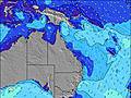 |  |  | 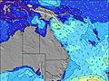 | 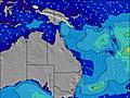 | 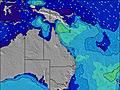 | 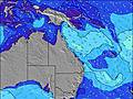 | ||||||||||||||
Wave Height (m) Direction Period (s) | ESE 10 | ESE 9 | SSE 8 | SSE 8 | SSE 8 | SSE 7 | SE 7 | SSE 7 | SSE 8 | SSE 9 | SE 10 | SE 11 | SE 10 | SE 10 | SE 10 | SE 10 | SE 10 | ESE 11 | ESE 10 | ESE 10 | ESE 10 |
Wave Graph | |||||||||||||||||||||
18 | 9 | 810 | 904 | 1405 | 655 | 447 | 396 | 969 | 1368 | 2203 | 3795 | 3422 | 2893 | 3512 | 3821 | 3006 | 2438 | 1463 | 1140 | 1053 | |
Wind (km/h) | |||||||||||||||||||||
Wind State on-shore cross-onshore cross-shore cross-offshore off-shore glassy | cross-off | cross-off | cross-off | cross-off | cross-off | off | off | cross-off | cross-off | cross-off | cross-off | cross-off | off | off | off | off | off | off | off | off | off |
High Tide | 9:07PM2.14m | 9:21AM1.46m | 9:51PM2.06m | 10:10AM1.46m | 10:34PM1.94m | 10:58AM1.44m | 11:15PM1.79m | 11:49AM1.43m | 11:56PM1.63m | 12:44PM1.41m | 00:36AM1.48m | 1:45PM1.42m | 1:19AM1.35m | ||||||||
Low Tide | 2:24PM0.15m | 3:40AM0.29m | 3:13PM0.19m | 4:24AM0.29m | 4:01PM0.26m | 5:05AM0.32m | 4:48PM0.38m | 5:47AM0.36m | 5:38PM0.52m | 6:28AM0.42m | 6:32PM0.67m | 7:10AM0.47m | 7:38PM0.80m | ||||||||
6:33 | — | — | 6:33 | — | — | 6:33 | — | — | 6:33 | — | — | 6:33 | — | — | 6:33 | — | — | 6:31 | — | — | |
— | 5:12 | — | — | 5:12 | — | — | 5:13 | — | — | 5:13 | — | — | 5:14 | — | — | 5:14 | — | — | 5:15 | — | |
mm | — | 1 | 8 | 7 | 8 | 10 | 4 | 3 | 4 | — | — | 8 | 6 | 5 | 5 | — | — | 1 | — | — | — |
Temp °C | 17 | 17 | 14 | 17 | 17 | 17 | 18 | 18 | 17 | 19 | 19 | 18 | 19 | 19 | 19 | 20 | 19 | 19 | 19 | 19 | 19 |
Feels °C | 12 | 12 | 8 | 10 | 10 | 13 | 13 | 12 | 12 | 12 | 12 | 11 | 14 | 13 | 13 | 13 | 13 | 13 | 14 | 15 | 15 |
Swell 1 Height (m) Direction Period (s) | ESE 10 | ESE 9 | NE 10 | ENE 8 | NE 8 | NE 8 | NE 7 | ENE 7 | NE 8 | E 21 | E 20 | ESE 18 | ESE 17 | — | — | — | — | — | — | — | E 10 |
18 | 9 | 4 | 7 | 17 | 22 | 18 | 75 | 11 | 9 | 8 | 33 | 29 | — | — | — | — | — | — | — | 31 | |
Swell 2 Height (m) Direction Period (s) | NE 9 | NE 6 | — | — | — | — | — | — | — | — | — | — | — | — | — | — | — | — | — | — | — |
3 | 1 | — | — | — | — | — | — | — | — | — | — | — | — | — | — | — | — | — | — | — | |
Swell 3 Height (m) Direction Period (s) | E 9 | E 10 | — | — | — | — | — | — | — | — | — | — | — | — | — | — | — | — | — | — | — |
2 | 2 | — | — | — | — | — | — | — | — | — | — | — | — | — | — | — | — | — | — | — | |
Wind waves Height (m) Direction Period (s) | S 3 | SSE 4 | SSE 8 | SSE 8 | SSE 8 | SSE 7 | SE 7 | SSE 7 | SSE 8 | SSE 9 | SE 10 | SE 11 | SE 10 | SE 10 | SE 10 | SE 10 | SE 10 | ESE 11 | ESE 10 | ESE 10 | ESE 10 |
6 | 39 | 810 | 904 | 1405 | 655 | 447 | 396 | 969 | 1368 | 2203 | 3795 | 3422 | 2893 | 3512 | 3821 | 3006 | 2438 | 1463 | 1140 | 1053 | |
Nearest Offshore or Glassy | |||||||||||||||||||||
Distance (km) | 520 | 244 | 199 | 629 | 199 | 586 | 520 | 739 | 341 | 782 | 947 | 707 | 832 | 848 | 341 | 257 | 341 | 204 | 204 | 0 | 0 |
Best forecast wave conditions in Sunshine Coast | |||||||||||||||||||||
Best forecast wave conditions in Australia | |||||||||||||||||||||
Header Global | |||||||||||||||||||||
- Map Icons:
 Break
Break Live Wave Height (m)
 Live Wind Speed (km/h)
 Surf Rating (10 Max)
 Ocean Swells (m)
- Wind Speed (km/h)


FREE! Surf-Forecast.com widget for your website
The surf report / weather widget below is available to embed on third party websites free of charge and provides a summary of our Noosa - Tea Tree Bay surf forecast. Simply grab the html code snippet that we provide and paste it into your own site. You can choose your preferred language and metric/imperial units for the surf forecast feed to suit users of your site. Click here to get the code.
Information about the Noosa - Tea Tree Bay Surf forecast
The above surf forecast table for Noosa - Tea Tree Bay provides essential information for determining whether the surfing conditions will be good over the next 16 days. A general guide to surfing at Noosa - Tea Tree Bay can be found by selecting the local surf guide option on the grey menu. Our Noosa - Tea Tree Bay surf forecast is unique since it includes wave energy (power) that defines the real feel of the surf rather than just the height or the period. If you surf the same spot (Noosa - Tea Tree Bay) regularly then make a mental note of the wave energy from the surf forecast table each time you go. Very soon you may start to choose your surf days based on the wave energy alone combined with our forecast of favourable offshore wind conditions. Our star ratings will help here and of course you will also find the usual wave height and period predictions on our surf forecasts as well as a full break down of the swell components under our advanced users option (to reveal that, click the little Einstein character under the tide times).
Further information to help with frequently asked questions about our surf forecast for Noosa - Tea Tree Bay may be found under the help tab on the top menu and also by moving your mouse over the question marks on the surf forecast table itself. Please always bear in mind that the forecast is for near-shore open water and local factors at each surf break influence the actual breaking wave height, such as the beach / reef profile, water depths offshore and shelter.
Noosa - Tea Tree Bay is 34 km (21 miles) from Sunshine Coast. If you plan a holiday in Sunshine Coast, look for hotels and other accommodation in Sunshine Coast. Sunshine Coast has rooms for a wide range of budgets as well as car hire and transport links.
 Nearest