

Surf Forecasts:

Coolum Beach surf forecast from 7 Jul 2026:
- Best quality surf: Friday 10 Jul, 7AM (local time) - 7ft (2.1m), 10s period, SE swell with cross-offshore winds.
- Most powerful swell: Wednesday 8 Jul, 7AM (local time) - 8ft (2.5m), 12s period, SE swell with 1,775 kJ wave energy.
- Next surfable swell (1★+): Thursday 9 Jul, 1AM (local time) - 4.5ft (1.4m), 12s period with SE swell.
Best Forecast Surf Conditions for Coolum Beach this week:
The surf forecast for Coolum Beach over the next 16 days: The first swell (rated 1 star or higher) is forecast to arrive on Thursday (Jul 09) at 1AM. The primary swell is predicted to be 1.4m and 12s period with a secondary swell of 1.8m and 7s. The wind is predicted to be cross-offshore as the swell arrives.
The most powerful waves expected at Coolum Beach in the next 16 days are 2.5m 12s and forecast to arrive on Wednesday (Jul 08) at 7AM. Winds are predicted to be cross-offshore at the time the swell arrives. The largest open ocean swell (not directed at the beach) is 0.9m 4s period and expected on Tuesday (Jul 14) at 7PM.
| Wave Type | Time (AEST) & Date | Wave Height & Period |
|---|---|---|
| Next good surf (1 star+) | 1AM (Thu 9th Jul) | 4.5ft (1.4m) 12s |
| Best Surf | 7AM (Fri 10th Jul) | 7ft (2.1m) 10s |
| Most Powerful | 7AM (Wed 8th Jul) | 8ft (2.5m) 12s |
Table - best surf conditions forecast for Coolum Beach over the next 16 days.
Alright, Rusty here. Let's have a look at what the next couple of weeks are serving up for us.
Well, to be brutally honest, it’s a slow start with a few days that will test your patience. The real action doesn't kick off until the back half of the run. From early next week, we see the swell dropping right out, leaving us with tiny, weak waves for the best part of a week. From Monday the 14th through to Thursday the 17th, it’s pretty much a write-off, with barely anything to ride. But don't write the whole period off just yet.
The only real standout worth paddling out for is Coolum Beach. On the morning of Wednesday the 8th of July, we’ve got a solid SE groundswell running at 6 ft with a 12-second period. That’s got proper energy, registering 1123 on the juice scale. The wind is a bit of a cross-off at 16 mph, so you’ll get some clean lines on offer. It’s a consistent spot, so you won’t be waiting forever between sets. The water temp is sitting about average for the time of year, so no surprises there.
If you can hold out, the Saturday morning of the 11th looks special. The swell drops a little to 4 ft, but the wind goes glass – absolute zero – dead calm. That’s a major positive. You’ll get clean, smooth faces with that 10-second SE swell. It’s a beginner-friendly break anyway, so it’ll be a proper fun session for everyone. Just be aware it can get a crowd here sometimes.
The other window to keep in mind is the very end of the run. On Monday the 20th and Tuesday the 21st of July, we see a pulse of shorter-period swell coming in at 5-5 ft. The wind eases right off on Tuesday morning with a light 6 mph breeze, making for good conditions. It won’t be as powerful as that early groundswell, but after a week of tiny waves, it’ll feel like a proper return to form.
So, to sum it up: chase the clean glassy Saturday morning for the best quality, or the early Wednesday for the biggest, punchiest swell. Stay patient through the flat spell mid-period.
Rusty.
Short Range ForecastModerate rain (total 16mm), heaviest on Thu night. Very mild (max 19°C on Wed morning, min 14°C on Wed night). Wind will be generally light. | Days 5-7 Weather SummaryLight rain (total 2mm), mostly falling on Sat night. Warm (max 21°C on Sun morning, min 13°C on Sun night). Wind will be generally light. | ||||||||||||||||||||
Wednesday 8 | Thursday 9 | Friday 10 | Saturday 11 | Sunday 12 | Monday 13 | Tue 14 | |||||||||||||||
Night | AM | PM | Night | AM | PM | Night | AM | PM | Night | AM | PM | Night | AM | PM | Night | AM | PM | Night | AM | PM | |
Swell Height Map | 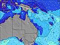 |  |  | 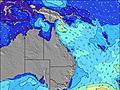 | 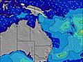 | 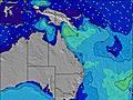 | 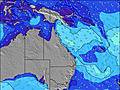 | 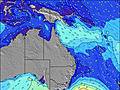 | |||||||||||||
Wave Height (m) Direction Period (s) | SE 8 | SE 12 | SE 12 | SE 12 | SE 11 | SE 11 | SE 10 | SE 10 | SE 10 | SE 11 | SE 10 | ESE 13 | ESE 11 | ESE 11 | SE 10 | SE 10 | ESE 10 | ESE 9 | SE 10 | ESE 10 | ESE 10 |
Wave Graph | |||||||||||||||||||||
636 | 872 | 1525 | 497 | 930 | 332 | 222 | 753 | 355 | 375 | 240 | 181 | 347 | 242 | 160 | 100 | 61 | 56 | 47 | 38 | 19 | |
Wind (km/h) | |||||||||||||||||||||
Wind State on-shore cross-onshore cross-shore cross-offshore off-shore glassy | cross-off | cross-off | cross-off | cross-off | cross-off | cross-off | cross-off | cross-off | cross-off | off | glassy | on | cross-off | cross-off | off | off | cross-off | off | off | cross-off | cross-off |
High Tide | 1:06AM1.36m | 2:19PM1.33m | 2:07AM1.24m | 3:26PM1.45m | 3:18AM1.15m | 4:30PM1.59m | 4:32AM1.11m | 5:31PM1.74m | 5:41AM1.11m | 6:27PM1.87m | 6:42AM1.14m | 7:20PM1.98m | 7:37AM1.19m | ||||||||
Low Tide | 7:44AM0.23m | 8:21PM0.55m | 8:38AM0.23m | 9:50PM0.52m | 9:37AM0.21m | 11:10PM0.42m | 10:38AM0.16m | 00:18AM0.31m | 11:37AM0.10m | 1:15AM0.19m | 12:33PM0.04m | 2:06AM0.10m | 1:25PM-0.01m | ||||||||
— | 6:35 | — | — | 6:35 | — | — | 6:35 | — | — | 6:35 | — | — | 6:35 | — | — | 6:35 | — | — | 6:35 | — | |
— | — | 5:07 | — | — | 5:08 | — | — | 5:08 | — | — | 5:09 | — | — | 5:09 | — | — | 5:10 | — | — | 5:10 | |
mm | 1 | — | 1 | 1 | 2 | — | 9 | 1 | 1 | — | — | — | 2 | — | — | — | — | — | — | — | — |
Temp °C | 17 | 19 | 18 | 17 | 18 | 18 | 16 | 17 | 17 | 16 | 19 | 18 | 16 | 21 | 21 | 16 | 19 | 20 | 15 | 17 | 17 |
Feels °C | 13 | 15 | 14 | 13 | 14 | 15 | 14 | 14 | 15 | 15 | 18 | 17 | 15 | 18 | 17 | 13 | 15 | 16 | 11 | 14 | 14 |
Swell 1 Height (m) Direction Period (s) | SE 12 | SE 12 | — | SE 12 | SE 11 | SE 11 | SE 10 | SE 10 | SE 13 | SE 11 | SE 10 | SE 10 | ESE 11 | ESE 11 | SE 10 | SE 10 | ESE 10 | ESE 9 | SE 10 | ESE 10 | ESE 10 |
386 | 872 | — | 497 | 638 | 332 | 222 | 509 | 88 | 375 | 240 | 160 | 347 | 242 | 160 | 100 | 61 | 56 | 47 | 38 | 19 | |
Swell 2 Height (m) Direction Period (s) | — | — | — | — | — | — | — | SE 14 | ESE 13 | — | ESE 14 | ESE 13 | SSE 10 | SSE 9 | NE 10 | NE 10 | — | S 8 | S 8 | NE 9 | NE 9 |
— | — | — | — | — | — | — | 48 | 69 | — | 113 | 181 | 19 | 32 | 4 | 4 | — | 1 | 1 | 3 | 3 | |
Swell 3 Height (m) Direction Period (s) | — | — | — | — | — | — | — | — | — | — | — | — | — | — | — | NE 10 | NE 10 | — | NE 10 | S 7 | E 13 |
— | — | — | — | — | — | — | — | — | — | — | — | — | — | — | 4 | 4 | — | 4 | 1 | 4 | |
Wind waves Height (m) Direction Period (s) | SE 8 | SSE 7 | SE 12 | SE 7 | SE 11 | SE 6 | SE 6 | SE 10 | SE 10 | — | — | — | NW 2 | WNW 2 | WSW 2 | SW 3 | SW 3 | S 3 | — | S 3 | SSE 4 |
636 | 251 | 1525 | 336 | 930 | 162 | 194 | 753 | 355 | — | — | — | 1 | 1 | 1 | 3 | 4 | 1 | — | 6 | 15 | |
Nearest Offshore or Glassy | |||||||||||||||||||||
Distance (km) | 182 | 187 | 187 | 0 | 17 | 17 | 17 | 17 | 0 | 0 | 0 | 11 | 0 | 8 | 0 | 0 | 0 | 0 | 0 | 0 | 176 |
Best forecast wave conditions in Sunshine Coast | |||||||||||||||||||||
Best forecast wave conditions in Australia | |||||||||||||||||||||
Header Global | |||||||||||||||||||||
- Map Icons:
 Break
Break Live Wave Height (m)
 Live Wind Speed (km/h)
 Surf Rating (10 Max)
 Ocean Swells (m)
- Wind Speed (km/h)


FREE! Surf-Forecast.com widget for your website
The surf report / weather widget below is available to embed on third party websites free of charge and provides a summary of our Coolum Beach surf forecast. Simply grab the html code snippet that we provide and paste it into your own site. You can choose your preferred language and metric/imperial units for the surf forecast feed to suit users of your site. Click here to get the code.
Information about the Coolum Beach Surf forecast
The above surf forecast table for Coolum Beach provides essential information for determining whether the surfing conditions will be good over the next 16 days. A general guide to surfing at Coolum Beach can be found by selecting the local surf guide option on the grey menu. Our Coolum Beach surf forecast is unique since it includes wave energy (power) that defines the real feel of the surf rather than just the height or the period. If you surf the same spot (Coolum Beach) regularly then make a mental note of the wave energy from the surf forecast table each time you go. Very soon you may start to choose your surf days based on the wave energy alone combined with our forecast of favourable offshore wind conditions. Our star ratings will help here and of course you will also find the usual wave height and period predictions on our surf forecasts as well as a full break down of the swell components under our advanced users option (to reveal that, click the little Einstein character under the tide times).
Further information to help with frequently asked questions about our surf forecast for Coolum Beach may be found under the help tab on the top menu and also by moving your mouse over the question marks on the surf forecast table itself. Please always bear in mind that the forecast is for near-shore open water and local factors at each surf break influence the actual breaking wave height, such as the beach / reef profile, water depths offshore and shelter.
Coolum Beach is 17 km (11 miles) from Sunshine Coast. If you plan a holiday in Sunshine Coast, look for hotels and other accommodation in Sunshine Coast. Sunshine Coast has rooms for a wide range of budgets as well as car hire and transport links.
 Nearest