

Surf Forecasts:

Laguna (Os Molhes) surf forecast from 9 Jul 2026:
- Best quality surf: Saturday 11 Jul, 12AM (local time) - 4.5ft (1.3m), 14s period, ESE swell with cross-offshore winds.
- Most powerful swell: Saturday 11 Jul, 12AM (local time) - 4.5ft (1.3m), 14s period, ESE swell with 569 kJ wave energy.
- Next surfable swell (1★+): Friday 10 Jul, 12AM (local time) - 2.5ft (0.8m), 10s period with ESE swell.
Best Forecast Surf Conditions for Laguna (Os Molhes) this week:
The surf forecast for Laguna (Os Molhes) over the next 16 days: The first swell (rated 1 star or higher) is forecast to arrive on Friday (Jul 10) at 12AM. The primary swell is predicted to be 0.8m and 10s period with a secondary swell of 0.5m and 5s. The wind is predicted to be cross-offshore as the swell arrives.
The most powerful waves expected at Laguna (Os Molhes) in the next 16 days are 1.3m 14s and forecast to arrive on Saturday (Jul 11) at 12AM. Winds are predicted to be cross-offshore at the time the swell arrives. The largest open ocean swell (not directed at the beach) is 1.5m 10s period and expected on Monday (Jul 13) at 12AM.
| Wave Type | Time (-03) & Date | Wave Height & Period |
|---|---|---|
| Next good surf (1 star+) | 12AM (Fri 10th Jul) | 2.5ft (0.8m) 10s |
| Best Surf | 12AM (Sat 11th Jul) | 4.5ft (1.3m) 14s |
| Most Powerful | 12AM (Sat 11th Jul) | 4.5ft (1.3m) 14s |
Table - best surf conditions forecast for Laguna (Os Molhes) over the next 16 days.
Alright folks, Rusty here. Let’s have a look at what’s shaping up for Laguna (Os Molhes) over the next couple of weeks.
The first few days are a bit of a write-off, but hang in there. We’ve got a slow start with poor conditions on Thursday the 9th; the wind is all over the place and the waves are small and messy. You’ll be better off waiting. The real action starts to kick off on Friday morning, July 10th. That’s when we finally see some clean conditions with a light offshore wind from the SW. The swell is a tidy 3 ft from the ESE, with a period of 12 seconds – that’s got some decent energy behind it (combined energy of 259). It’s not huge, but it’ll be clean and lined up. If you’re keen, Friday morning is your first real look.
The standout of the whole run, though, is going to be Saturday morning, July 11th. This is the one. We’re looking at glassy conditions, absolutely no wind, and a clean 4 ft swell from the ESE with a 13-second period. The combined energy is pumping at 536, which is a solid moderate energy. The water temp is about average for this time of year – nothing unusual, just your standard winter water. This is a proper morning session; the waves will have shape, power, and that glassy surface is a dream. Get out there early.
Sunday the 12th keeps the good run going, with a morning offshore WSW wind and a 5 ft swell from the SSE, period at 11 seconds. That’s clean and punchy, with combined energy of 837 – that’s a solid push of water. The wind stays favourable through Sunday afternoon too, so you’ve got a full day of options.
Into the next week, things get a bit more mixed. Monday the 13th still has clean offshore wind, but the swell drops back to 3 ft. Tuesday the 14th morning is clean with a cross-offshore breeze and 4 ft swell, but the afternoon turns onshore and messy. Wednesday the 15th and Thursday the 16th are mostly poor – onshore winds and choppy conditions. Not worth paddling out.
Now, there’s a promising little window on Friday the 17th. The morning has a light cross-offshore breeze and 5 ft swell from the ENE, but the period is short at 8 seconds. The afternoon goes glassy, with a 4 ft swell and no wind. It’s not the best quality swell, but it’ll be clean and rideable. Saturday the 18th is messy again.
Looking further ahead, Sunday the 19th morning is glassy with a 4 ft NE swell, but again, short period (8 seconds). The real long-range hope is Monday the 21st and Tuesday the 22nd. Monday the 21st has glassy conditions in the morning with a 5 ft NE swell, and Tuesday the 22nd morning has a gentle offshore SW breeze with the same 5 ft NE swell. That’s the biggest swell of the forecast, and with clean wind, it’ll be a good option for experienced surfers. The combined energy is around 477 – solid moderate. Keep an eye on that one, but remember it’s a week and a half away, so things can change.
After that, the last few days of the outlook look pretty poor again with strong onshore winds and small, messy surf. So, your best bets are Saturday morning July 11th for the glassy, dreamy conditions, and then the Monday/Tuesday of July 21-22 for the bigger, cleaner swell. Don’t waste your energy on the flat days.
Stay stoked,
Rusty
Short Range ForecastLight rain (total 3mm), mostly falling on Fri night. Very mild (max 17°C on Thu afternoon, min 13°C on Wed night). Wind will be generally light. | Days 5-7 Weather SummaryLight rain (total 3mm), mostly falling on Sat night. Very mild (max 18°C on Sun morning, min 14°C on Mon night). Wind will be generally light. | ||||||||||||||||||||
Thursday 9 | Friday 10 | Saturday 11 | Sunday 12 | Monday 13 | Tuesday 14 | Wed 15 | |||||||||||||||
Night | AM | PM | Night | AM | PM | Night | AM | PM | Night | AM | PM | Night | AM | PM | Night | AM | PM | Night | AM | PM | |
Swell Height Map |  |  |  |  |  |  |  | 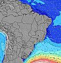 | |||||||||||||
Wave Height (m) Direction Period (s) | ESE 10 | ESE 10 | ESE 10 | ESE 10 | ESE 12 | ESE 12 | ESE 14 | ESE 13 | ESE 13 | ESE 13 | SSE 11 | SSE 11 | SSE 10 | SSE 7 | SSE 10 | SE 10 | SSE 9 | SE 9 | SE 9 | SE 9 | ESE 9 |
Wave Graph | |||||||||||||||||||||
116 | 116 | 114 | 116 | 255 | 341 | 569 | 536 | 458 | 346 | 492 | 308 | 295 | 166 | 120 | 108 | 242 | 242 | 210 | 123 | 154 | |
Wind (km/h) | |||||||||||||||||||||
Wind State on-shore cross-onshore cross-shore cross-offshore off-shore glassy | cross-on | cross-on | on | cross-off | off | cross-off | cross-off | glassy | on | cross-off | off | cross-off | off | off | off | off | cross-off | on | cross-on | cross-on | on |
High Tide | 10:22PM0.40m | 11:33AM0.42m | 11:55PM0.38m | 12:58PM0.44m | 00:50AM0.39m | 2:00PM0.46m | 1:33AM0.40m | 3:34PM0.48m | 2:23AM0.42m | 4:20PM0.51m | 3:22AM0.45m | 4:50PM0.52m | 4:07AM0.48m | 5:17PM0.52m | |||||||
Low Tide | 3:49AM0.26m | 4:28PM0.26m | 4:34AM0.21m | 5:24PM0.25m | 5:22AM0.18m | 6:31PM0.24m | 6:21AM0.14m | 7:24PM0.24m | 7:14AM0.11m | 8:01PM0.24m | 7:55AM0.10m | 8:32PM0.25m | 8:31AM0.10m | ||||||||
— | 7:07 | — | — | 7:07 | — | — | 7:07 | — | — | 7:07 | — | — | 7:05 | — | — | 7:05 | — | — | 7:05 | — | |
— | — | 5:31 | — | — | 5:32 | — | — | 5:32 | — | — | 5:34 | — | — | 5:34 | — | — | 5:35 | — | — | 5:35 | |
mm | — | — | — | — | — | — | 1 | 2 | — | 3 | — | — | — | — | — | — | — | — | — | — | — |
Temp °C | 14 | 16 | 17 | 17 | 17 | 17 | 15 | 15 | 16 | 16 | 18 | 18 | 16 | 17 | 16 | 16 | 16 | 16 | 16 | 17 | 18 |
Feels °C | 12 | 12 | 13 | 16 | 15 | 14 | 14 | 15 | 15 | 17 | 18 | 17 | 14 | 13 | 12 | 14 | 15 | 14 | 14 | 16 | 17 |
Swell 1 Height (m) Direction Period (s) | S 10 | ESE 10 | ESE 10 | ESE 10 | ESE 12 | ESE 12 | ESE 14 | ESE 13 | ESE 13 | SSE 9 | SSE 11 | SSE 11 | SSE 10 | SSE 7 | SSE 10 | S 7 | SSE 9 | SE 9 | SE 9 | SE 9 | ESE 9 |
121 | 116 | 114 | 116 | 255 | 341 | 569 | 536 | 458 | 222 | 492 | 308 | 295 | 144 | 120 | 150 | 242 | 242 | 210 | 123 | 154 | |
Swell 2 Height (m) Direction Period (s) | ESE 10 | S 9 | S 8 | NE 5 | NE 5 | ENE 5 | S 6 | S 6 | SSE 7 | ESE 13 | ESE 12 | SE 12 | SE 12 | SSE 11 | ESE 7 | SE 10 | ESE 7 | ESE 7 | S 16 | ESE 9 | SE 13 |
116 | 74 | 49 | 13 | 4 | 2 | 57 | 38 | 99 | 346 | 273 | 223 | 172 | 166 | 51 | 108 | 15 | 15 | 5 | 99 | 61 | |
Swell 3 Height (m) Direction Period (s) | — | S 14 | S 14 | S 8 | S 7 | S 7 | S 14 | S 13 | — | SSE 11 | SSE 19 | ESE 6 | SSE 16 | SE 11 | SE 11 | ESE 6 | S 12 | S 11 | ESE 8 | NE 5 | S 14 |
— | 4 | 4 | 19 | 8 | 4 | 4 | 4 | — | 25 | 72 | 25 | 25 | 64 | 61 | 14 | 11 | 10 | 22 | 7 | 4 | |
Wind waves Height (m) Direction Period (s) | — | NNE 3 | NE 4 | — | — | S 4 | — | — | — | — | — | SSW 2 | S 10 | S 6 | S 6 | S 7 | — | — | NNE 3 | NNE 5 | NE 5 |
— | 2 | 9 | — | — | 9 | — | — | — | — | — | 1 | 426 | 139 | 91 | 235 | — | — | 6 | 42 | 40 | |
Nearest Offshore or Glassy | |||||||||||||||||||||
Distance (km) | 2 | 2 | 17 | 0 | 0 | 3 | 0 | 0 | 14 | 0 | 0 | 0 | 0 | 0 | 0 | 0 | 0 | 17 | 6 | 2 | 14 |
Best forecast wave conditions in Santa Catarina - Sul | |||||||||||||||||||||
Best forecast wave conditions in Brazil | |||||||||||||||||||||
Header Global | |||||||||||||||||||||
- Map Icons:
 Break
Break Live Wave Height (m)
 Live Wind Speed (km/h)
 Surf Rating (10 Max)
 Ocean Swells (m)
- Wind Speed (km/h)


FREE! Surf-Forecast.com widget for your website
The surf report / weather widget below is available to embed on third party websites free of charge and provides a summary of our Laguna (Os Molhes) surf forecast. Simply grab the html code snippet that we provide and paste it into your own site. You can choose your preferred language and metric/imperial units for the surf forecast feed to suit users of your site. Click here to get the code.
Information about the Laguna (Os Molhes) Surf forecast
The above surf forecast table for Laguna (Os Molhes) provides essential information for determining whether the surfing conditions will be good over the next 16 days. A general guide to surfing at Laguna (Os Molhes) can be found by selecting the local surf guide option on the grey menu. Our Laguna (Os Molhes) surf forecast is unique since it includes wave energy (power) that defines the real feel of the surf rather than just the height or the period. If you surf the same spot (Laguna (Os Molhes)) regularly then make a mental note of the wave energy from the surf forecast table each time you go. Very soon you may start to choose your surf days based on the wave energy alone combined with our forecast of favourable offshore wind conditions. Our star ratings will help here and of course you will also find the usual wave height and period predictions on our surf forecasts as well as a full break down of the swell components under our advanced users option (to reveal that, click the little Einstein character under the tide times).
Further information to help with frequently asked questions about our surf forecast for Laguna (Os Molhes) may be found under the help tab on the top menu and also by moving your mouse over the question marks on the surf forecast table itself. Please always bear in mind that the forecast is for near-shore open water and local factors at each surf break influence the actual breaking wave height, such as the beach / reef profile, water depths offshore and shelter.
Are you planning a holiday in Santa Catarina - Sul? If you are looking for accommodation near Laguna (Os Molhes), camping, hotels and holiday cottages in Santa Catarina - Sul, consider staying in Laguna which is 3 km (2 miles) away. Other places in and around Santa Catarina - Sul where you can find information about places to rent, and car hire include Tubarao which is 25 km (16 miles) away, Imbituba, Braco do Norte and Sao Jose.
 Nearest