

Surf Forecasts:

Mystos surf forecast from 14 Jul 2026:
- Best quality surf: Wednesday 15 Jul, 5AM (local time) - 5.5ft (1.7m), 7s period, WNW swell with cross-offshore winds.
- Most powerful swell: Friday 17 Jul, 11PM (local time) - 6ft (1.9m), 7s period, WNW swell with 362 kJ wave energy.
- Next surfable swell (1★+): Monday 13 Jul, 11PM (local time) - 2.5ft (0.7m), 13s period with SSW swell.
Best Forecast Surf Conditions for Mystos this week:
The surf forecast for Mystos over the next 16 days: The first swell (rated 1 star or higher) is forecast to arrive on Monday (Jul 13) at 11PM. The primary swell is predicted to be 0.7m and 13s period with a secondary swell of 1.1m and 8s. The wind is predicted to be cross-offshore as the swell arrives.
The most powerful waves expected at Mystos in the next 16 days are 1.9m 7s and forecast to arrive on Friday (Jul 17) at 11PM. Winds are predicted to be cross-offshore at the time the swell arrives. The largest open ocean swell (not directed at the beach) is 1.8m 7s period and expected on Monday (Jul 13) at 11PM.
| Wave Type | Time (PDT) & Date | Wave Height & Period |
|---|---|---|
| Next good surf (1 star+) | 11PM (Mon 13th Jul) | 2.5ft (0.7m) 13s |
| Best Surf | 5AM (Wed 15th Jul) | 5.5ft (1.7m) 7s |
| Most Powerful | 11PM (Fri 17th Jul) | 6ft (1.9m) 7s |
Table - best surf conditions forecast for Mystos over the next 16 days.
The Lowdown
Alright, Rusty here. Let’s have a look at what’s on the table for the next couple of weeks.
Honestly, it’s a slow, frustrating start. We’re looking at a solid block of nothing worth paddling out for, lasting from now through the 16th of July. Thursday the 17th is the first day we might get something marginally rideable, but even then, it’s not going to be pretty.
Let’s get into it. The only real spot to talk about is Mystos, a reef break that’s fairly consistent and exposed to the SSW. Right now, the water temp is sitting at 55°F, which is about average for this time of year, no real shocker there.
Monday 13th through Wednesday 16th – Forget it. The combined energy is weak, reading between 303 and 466 on the scale all through these days, with swell heights barely getting to 6 ft. The wind is a mess, mostly cross-shore from the WNW, blowing at 12 to 22 mph and kicking up a lumpy cross-chop. Periods are short, mostly 6 to 8 seconds, so no real push or shape. These are just write-off days. Not worth getting wet.
Thursday 17th July morning – The first hint of something. Swell is 6 ft from the WNW at 8 seconds, and the combined energy jumps to 804. That’s moderate energy, but the wind is still cross-shore at 12 mph. It’s marginal – definitely not clean, but you *might* find a lumpy wave if you’re desperate. The afternoon session sees that energy drop back to 656. It's still just poor surf overall, but keep an eye on the morning.
Saturday 19th July morning – This is where it gets a little interesting. The wind swings to light onshore from the WSW at only 6 mph with an 8-second period from the W. The waves are small at 2 ft, but the combined energy is 552. The wind is light, so there’s a chance for cleaner conditions than we’ve seen. It's marginal, but the light breeze is a big positive compared to the previous mess. Not a standout, just a slight improvement.
The real highlight comes on Thursday 24th July. The morning session looks promising with 4 ft swell from the SSW at 14 seconds. That’s a long-period groundswell coming from the optimum direction for Mystos. The wind is light offshore from the SW at only 3 mph – glassy conditions. Combined energy reaches 705. This is the best bet of the whole outlook: clean, lined-up waves for intermediates, and the offshore wind will have the reef working nicely. The afternoon stays decent with similar size and energy at 867, but a light cross-onshore breeze creeps in. Crowds are sometimes a factor here, so you might have to share.
Saturday 26th July – This is an interesting one for experts. The morning shows a very long-period swell at 2 ft from the SW with a period of 21 seconds. Combined energy is 785. The wind is light offshore. That kind of period is rare – the waves will have incredible shape but will be very fat and slow, prone to closing out at a beach break. But Mystos is a reef, so it could really shine, offering long, peeling walls. The afternoon holds similar size and period but gets a bit of a cross-onshore breeze. If you’re a longboarder or a smooth stylist, keep this date marked, but it’s still a week and a half out, so don't book your flight yet.
Monday 28th July afternoon – Another possible session. 5 ft from the WNW at 9 seconds with light cross-onshore wind at 3 mph. Combined energy hits 675. It’s marginal, but the light wind could make it workable.
So, to keep it simple: Thursday 24th July morning is your standout. It’s a proper groundswell from the right direction, clean offshore wind, and solid energy. The Saturday after that has a very special, very long swell that could be magic for the right board and the right crew. The rest of the time? Honestly, you’re waiting for the wind to play ball.
Stay patient.
Rusty.
Short Range ForecastMostly dry. Warm (max 24°C on Mon afternoon, min 12°C on Wed night). Winds increasing (calm on Tue morning, fresh winds from the NW by Wed afternoon). | Days 5-7 Weather SummaryMostly dry. Very mild (max 19°C on Thu afternoon, min 11°C on Thu night). Winds decreasing (fresh winds from the WNW on Thu afternoon, calm by Sat morning). | ||||||||||||||||||||
Mon 13 | Tuesday 14 | Wednesday 15 | Thursday 16 | Friday 17 | Saturday 18 | Sunday 19 | |||||||||||||||
PM | Night | AM | PM | Night | AM | PM | Night | AM | PM | Night | AM | PM | Night | AM | PM | Night | AM | PM | Night | AM | |
Swell Height Map |  |  |  |  |  |  |  | 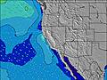 | |||||||||||||
Wave Height (m) Direction Period (s) | SSW 13 | WNW 8 | WNW 8 | WNW 6 | WNW 7 | WNW 8 | WNW 7 | WNW 7 | SW 16 | WNW 6 | WNW 7 | WNW 8 | WNW 7 | WNW 7 | W 16 | SW 18 | W 16 | SW 15 | SW 17 | SW 16 | SW 16 |
Wave Graph | |||||||||||||||||||||
154 | 278 | 178 | 103 | 277 | 135 | 268 | 162 | 124 | 203 | 352 | 327 | 280 | 243 | 251 | 255 | 177 | 178 | 297 | 264 | 242 | |
Wind (km/h) | |||||||||||||||||||||
Wind State on-shore cross-onshore cross-shore cross-offshore off-shore glassy | cross | cross-off | cross-on | cross | cross-off | cross | cross | cross | cross | cross | cross-off | cross | cross | cross-off | cross-on | cross | glassy | on | cross-on | glassy | on |
High Tide | 10:09PM2.10m | 12:33PM1.48m | 11:03PM2.07m | 1:14PM1.52m | 11:56PM1.98m | 1:55PM1.57m | 00:49AM1.83m | 2:35PM1.61m | 1:44AM1.64m | 3:14PM1.64m | 2:43AM1.43m | 3:54PM1.67m | 3:53AM1.24m | ||||||||
Low Tide | 4:20PM0.89m | 5:36AM-0.48m | 5:17PM0.83m | 6:22AM-0.45m | 6:14PM0.76m | 7:06AM-0.37m | 7:12PM0.69m | 7:49AM-0.23m | 8:13PM0.62m | 8:30AM-0.05m | 9:16PM0.55m | 9:12AM0.16m | 10:23PM0.48m | 9:56AM0.39m | |||||||
— | — | 6:00 | — | — | 6:00 | — | — | 6:01 | — | — | 6:01 | — | — | 6:03 | — | — | 6:03 | — | — | 6:03 | |
8:37 | — | — | 8:37 | — | — | 8:36 | — | — | 8:36 | — | — | 8:35 | — | — | 8:34 | — | — | 8:34 | — | 8:32 | |
mm | — | — | — | — | — | — | — | — | — | — | — | — | — | — | — | — | — | — | — | — | — |
Temp °C | 24 | 21 | 20 | 23 | 19 | 21 | 22 | 18 | 19 | 19 | 16 | 18 | 19 | 16 | 18 | 18 | 14 | 16 | 17 | 13 | 18 |
Feels °C | 21 | 17 | 19 | 17 | 14 | 16 | 16 | 12 | 14 | 13 | 11 | 14 | 15 | 12 | 16 | 15 | 11 | 15 | 16 | 12 | 17 |
Swell 1 Height (m) Direction Period (s) | SSW 13 | WNW 8 | WNW 8 | SSW 12 | WNW 7 | SSW 12 | SSW 12 | SW 16 | WNW 8 | SW 16 | WNW 7 | WNW 8 | W 17 | WNW 7 | WNW 8 | W 16 | WNW 7 | SW 15 | SW 17 | SW 16 | SW 16 |
154 | 116 | 85 | 85 | 104 | 59 | 56 | 125 | 39 | 124 | 147 | 130 | 212 | 97 | 58 | 183 | 57 | 178 | 297 | 264 | 242 | |
Swell 2 Height (m) Direction Period (s) | W 14 | SSW 13 | SSW 12 | W 14 | SSW 12 | SW 18 | W 13 | W 12 | SW 16 | W 19 | SW 15 | W 17 | SW 14 | W 16 | W 16 | SW 18 | W 16 | WNW 9 | WNW 9 | WNW 9 | S 11 |
37 | 151 | 104 | 65 | 58 | 108 | 54 | 27 | 124 | 113 | 107 | 217 | 74 | 188 | 251 | 255 | 177 | 65 | 62 | 42 | 59 | |
Swell 3 Height (m) Direction Period (s) | WSW 20 | SW 19 | W 14 | SW 18 | SW 18 | W 13 | SW 17 | SSW 12 | W 19 | SSW 12 | W 18 | SW 19 | SW 19 | SW 14 | SW 17 | SW 13 | SW 16 | W 15 | W 15 | S 12 | W 9 |
37 | 96 | 36 | 50 | 152 | 55 | 74 | 27 | 113 | 26 | 162 | 130 | 90 | 103 | 243 | 44 | 94 | 172 | 112 | 69 | 38 | |
Wind waves Height (m) Direction Period (s) | WNW 8 | WNW 8 | WNW 8 | WNW 6 | WNW 7 | WNW 8 | WNW 7 | WNW 7 | WNW 6 | WNW 6 | WNW 7 | WNW 8 | WNW 7 | WNW 7 | — | WNW 7 | — | — | — | — | — |
128 | 278 | 178 | 103 | 277 | 135 | 268 | 162 | 75 | 203 | 352 | 327 | 280 | 243 | — | 54 | — | — | — | — | — | |
Nearest Offshore or Glassy | |||||||||||||||||||||
Distance (km) | 59 | 0 | 59 | 156 | 0 | 103 | 203 | 100 | 204 | 204 | 0 | 83 | 204 | 0 | 59 | 156 | 0 | 103 | 59 | 0 | 16 |
Best forecast wave conditions in Sonoma County | |||||||||||||||||||||
Best forecast wave conditions in United States | |||||||||||||||||||||
Header Global | |||||||||||||||||||||
- Map Icons:
 Break
Break Live Wave Height (m)
 Live Wind Speed (km/h)
 Surf Rating (10 Max)
 Ocean Swells (m)
- Wind Speed (km/h)


FREE! Surf-Forecast.com widget for your website
The surf report / weather widget below is available to embed on third party websites free of charge and provides a summary of our Mystos surf forecast. Simply grab the html code snippet that we provide and paste it into your own site. You can choose your preferred language and metric/imperial units for the surf forecast feed to suit users of your site. Click here to get the code.
Information about the Mystos Surf forecast
The above surf forecast table for Mystos provides essential information for determining whether the surfing conditions will be good over the next 16 days. A general guide to surfing at Mystos can be found by selecting the local surf guide option on the grey menu. Our Mystos surf forecast is unique since it includes wave energy (power) that defines the real feel of the surf rather than just the height or the period. If you surf the same spot (Mystos) regularly then make a mental note of the wave energy from the surf forecast table each time you go. Very soon you may start to choose your surf days based on the wave energy alone combined with our forecast of favourable offshore wind conditions. Our star ratings will help here and of course you will also find the usual wave height and period predictions on our surf forecasts as well as a full break down of the swell components under our advanced users option (to reveal that, click the little Einstein character under the tide times).
Further information to help with frequently asked questions about our surf forecast for Mystos may be found under the help tab on the top menu and also by moving your mouse over the question marks on the surf forecast table itself. Please always bear in mind that the forecast is for near-shore open water and local factors at each surf break influence the actual breaking wave height, such as the beach / reef profile, water depths offshore and shelter.
Mystos is 37 km (23 miles) from the city of Windsor. If you plan a vacation in Sonoma County, look for hotels and other accommodation in Windsor. Windsor has rooms for a wide range of budgets as well as car hire and transport links.
 Nearest