

Surf Forecasts:

Middles surf forecast from 28 Jul 2026:
- Best quality surf: Monday 3 Aug, 5PM (local time) - 3.5ft (1.1m), 5s period, SE swell with cross-offshore winds.
- Most powerful swell: Monday 3 Aug, 5PM (local time) - 3.5ft (1.1m), 5s period, SE swell with 73 kJ wave energy.
- Next surfable swell (1★+): Monday 3 Aug, 5PM (local time) - 3.5ft (1.1m), 5s period with SE swell.
Best Forecast Surf Conditions for Middles this week:
The surf forecast for Middles over the next 16 days: The first swell (rated 1 star or higher) is forecast to arrive on Monday (Aug 03) at 5PM. The primary swell is predicted to be 1.1m and 5s period with a secondary swell of 0.6m and 7s. The wind is predicted to be cross-offshore as the swell arrives.
The most powerful waves expected at Middles in the next 16 days are 1.1m 5s and forecast to arrive on Monday (Aug 03) at 5PM. Winds are predicted to be cross-offshore at the time the swell arrives. The largest open ocean swell (not directed at the beach) is 0.8m 3s period and expected on Wednesday (Jul 29) at 11PM.
| Wave Type | Time (EDT) & Date | Wave Height & Period |
|---|---|---|
| Next good surf (1 star+) | 5PM (Mon 3rd Aug) | 3.5ft (1.1m) 5s |
| Best Surf | 5PM (Mon 3rd Aug) | 3.5ft (1.1m) 5s |
| Most Powerful | 5PM (Mon 3rd Aug) | 3.5ft (1.1m) 5s |
Table - best surf conditions forecast for Middles over the next 16 days.
The Lowdown
Alright, Rusty here. Let’s have a look at what’s cookin’ for this stretch.
Straight up, folks, it’s gonna be a long, flat spell. We’re looking at nearly two weeks of barely a ripple at Middles. The first recommendation doesn’t pop up until Monday, August 3rd, and even then it’s a pretty sad story. The whole run before that is just tiny, weak waves with combined energy readings barely making it past double digits – we’re talking 15, 13, even as low as 2. That’s not surf, that’s a lake. The wind is mostly offshore or cross-off, which is a tease, but there’s nothing to ride.
Finally, on the afternoon of Monday, August 3rd, we get a little pulse. A 4ft swell from the ESE, but with a short, choppy period of 5 seconds. The combined energy climbs to 110, so there’s some juice for a minute, but it’s described as “surfable waves but very ordinary conditions.” It’s just not gonna be pretty. The wind is light and cross-off, so it’ll be clean, but that won’t save the shape.
The rest of the outlook is more of the same – tiny little bumps, mostly around 1ft to 2ft, with periods that never get above 8 seconds, and energy readings that mostly hover in the teens or low twenties. There are a few glassy mornings, like on August 4th, 5th, and 6th, but they’re all on tiny, weak swell. It’s heartbreaking to see such clean conditions go to waste.
The one tiny highlight, and I mean tiny, is the morning of Monday, August 10th. It’s glassy with a 0.7ft, 7-second swell from the E. The combined energy is a pathetic 6. That’s not a surf session, that’s a meditation float. For a beginner, this is basically a non-event. For an expert, it’s a day to fix your dings.
So, the honest truth? There are no standouts here. Nothing. The best on offer is that mediocre Monday afternoon on August 3rd, and even that’s a weak claim. The rest is just a flat, poor run. The wave energy is just too weak across the board. Keep your board in the car and your eyes on the forecast – it tends not to stay this poor for long.
Rusty
Short Range ForecastModerate rain (total 13mm), heaviest on Wed night. Warm (max 36°C on Wed afternoon, min 25°C on Wed night). Wind will be generally light. | Days 5-7 Weather SummaryModerate rain (total 12mm), heaviest on Thu night. Warm (max 34°C on Fri afternoon, min 25°C on Thu night). Wind will be generally light. | ||||||||||||||||||
Tuesday 28 | Wednesday 29 | Thursday 30 | Friday 31 | Saturday 1 | Sunday 2 | ||||||||||||||
Night | AM | PM | Night | AM | PM | Night | AM | PM | Night | AM | PM | Night | AM | PM | Night | AM | PM | Night | |
Swell Height Map |  |  |  |  | 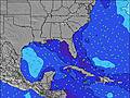 | 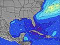 | 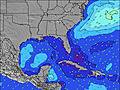 | ||||||||||||
Wave Height (m) Direction Period (s) | E 8 | E 8 | E 8 | E 8 | ESE 9 | E 9 | E 8 | ESE 8 | ESE 8 | E 7 | E 10 | E 10 | E 9 | E 9 | E 9 | ESE 8 | ESE 8 | ESE 8 | ESE 8 |
Wave Graph | |||||||||||||||||||
19 | 10 | 11 | 12 | 15 | 13 | 12 | 12 | 6 | 4 | 2 | 7 | 2 | 6 | 6 | 14 | 13 | 25 | 23 | |
Wind (km/h) | |||||||||||||||||||
Wind State on-shore cross-onshore cross-shore cross-offshore off-shore glassy | cross-off | off | cross-off | off | cross-off | off | off | cross-off | off | off | cross-off | cross-off | off | off | off | off | off | off | cross-off |
High Tide | 8:01AM1.17m | 8:25PM1.55m | 8:43AM1.22m | 9:04PM1.56m | 9:23AM1.26m | 9:43PM1.55m | 10:03AM1.30m | 10:22PM1.53m | 10:43AM1.34m | 11:00PM1.49m | 11:24AM1.38m | 11:40PM1.43m | |||||||
Low Tide | 2:08AM0.15m | 1:55PM0.07m | 2:46AM0.11m | 2:36PM0.06m | 3:21AM0.07m | 3:14PM0.06m | 3:56AM0.05m | 3:52PM0.08m | 4:31AM0.04m | 4:32PM0.11m | 5:07AM0.04m | 5:17PM0.14m | |||||||
— | 6:41 | — | — | 6:41 | — | — | 6:41 | — | — | 6:43 | — | — | 6:43 | — | — | 6:43 | — | — | |
8:21 | — | 8:21 | — | — | 8:20 | — | — | 8:19 | — | — | 8:19 | — | — | 8:17 | — | — | 8:16 | — | |
mm | 1 | — | — | — | — | — | 6 | 3 | 3 | 6 | 1 | — | 2 | — | — | — | — | 3 | — |
Temp °C | 28 | 31 | 32 | 29 | 32 | 36 | 30 | 29 | 33 | 25 | 29 | 34 | 28 | 30 | 33 | 29 | 30 | 30 | 26 |
Feels °C | 30 | 34 | 36 | 30 | 33 | 37 | 30 | 30 | 33 | 26 | 32 | 36 | 30 | 32 | 35 | 30 | 30 | 29 | 27 |
Swell 1 Height (m) Direction Period (s) | E 8 | E 8 | E 8 | E 8 | ESE 9 | E 9 | E 8 | ESE 8 | ESE 8 | E 7 | SE 7 | E 10 | ESE 4 | E 9 | E 9 | ESE 8 | ESE 8 | ESE 8 | ESE 8 |
19 | 10 | 11 | 12 | 15 | 13 | 12 | 12 | 6 | 4 | 2 | 7 | 1 | 6 | 6 | 14 | 13 | 25 | 23 | |
Swell 2 Height (m) Direction Period (s) | NE 6 | NE 6 | NE 6 | SE 4 | NE 6 | NE 6 | ESE 5 | — | E 9 | E 9 | E 10 | SE 7 | E 9 | SE 6 | — | SE 4 | — | — | — |
6 | 5 | 1 | 3 | 1 | 1 | 3 | — | 2 | 2 | 2 | 2 | 2 | 1 | — | 2 | — | — | — | |
Swell 3 Height (m) Direction Period (s) | — | — | — | NE 6 | — | — | — | E 9 | — | — | — | E 8 | SE 7 | — | — | E 5 | — | E 7 | — |
— | — | — | 1 | — | — | — | 2 | — | — | — | 1 | 2 | — | — | 1 | — | 1 | — | |
Wind waves Height (m) Direction Period (s) | ESE 3 | — | SE 2 | SW 2 | SW 2 | — | WNW 3 | — | SW 3 | WSW 3 | — | ESE 2 | — | SSW 4 | ESE 2 | — | — | SW 2 | SW 3 |
1 | — | 1 | 1 | 1 | — | 4 | — | 3 | 1 | — | 2 | — | 1 | 1 | — | — | 1 | 2 | |
Nearest Offshore or Glassy | |||||||||||||||||||
Distance (km) | 680 | 431 | 565 | 680 | 335 | 236 | 141 | 430 | 614 | 835 | 540 | 672 | 1084 | 911 | 732 | 1180 | 1180 | 22 | 238 |
Best forecast wave conditions in North Florida | |||||||||||||||||||
Best forecast wave conditions in United States | |||||||||||||||||||
Header Global | |||||||||||||||||||
- Map Icons:
 Break
Break Live Wave Height (m)
 Live Wind Speed (km/h)
 Surf Rating (10 Max)
 Ocean Swells (m)
- Wind Speed (km/h)


FREE! Surf-Forecast.com widget for your website
The surf report / weather widget below is available to embed on third party websites free of charge and provides a summary of our Middles surf forecast. Simply grab the html code snippet that we provide and paste it into your own site. You can choose your preferred language and metric/imperial units for the surf forecast feed to suit users of your site. Click here to get the code.
Information about the Middles Surf forecast
The above surf forecast table for Middles provides essential information for determining whether the surfing conditions will be good over the next 16 days. A general guide to surfing at Middles can be found by selecting the local surf guide option on the grey menu. Our Middles surf forecast is unique since it includes wave energy (power) that defines the real feel of the surf rather than just the height or the period. If you surf the same spot (Middles) regularly then make a mental note of the wave energy from the surf forecast table each time you go. Very soon you may start to choose your surf days based on the wave energy alone combined with our forecast of favourable offshore wind conditions. Our star ratings will help here and of course you will also find the usual wave height and period predictions on our surf forecasts as well as a full break down of the swell components under our advanced users option (to reveal that, click the little Einstein character under the tide times).
Further information to help with frequently asked questions about our surf forecast for Middles may be found under the help tab on the top menu and also by moving your mouse over the question marks on the surf forecast table itself. Please always bear in mind that the forecast is for near-shore open water and local factors at each surf break influence the actual breaking wave height, such as the beach / reef profile, water depths offshore and shelter.
Middles is 33 km (20 miles) from Palm Valley. If you plan a vacation in North Florida, look for hotels and other accommodation in Palm Valley. Palm Valley has rooms for a wide range of budgets as well as car hire and transport links.
 Nearest