

Surf Forecasts:

Ogunquit Beach surf forecast from 1 Aug 2026:
- Best quality surf: Friday 31 Jul, 11PM (local time) - 1.5ft (0.5m), 9s period, SE swell with cross-offshore winds.
- Most powerful swell: Sunday 2 Aug, 8PM (local time) - 4.5ft (1.3m), 6s period, SSE swell with 100 kJ wave energy.
- Next surfable swell (1★+): Friday 31 Jul, 11PM (local time) - 1.5ft (0.5m), 9s period with SE swell.
Best Forecast Surf Conditions for Ogunquit Beach this week:
The surf forecast for Ogunquit Beach over the next 16 days: The first swell (rated 1 star or higher) is forecast to arrive on Friday (Jul 31) at 11PM. The primary swell is predicted to be 0.5m and 9s period with a secondary swell of 0.3m and 3s. Another secondary swell of 0.5m and 3s is also forecast. The wind is predicted to be cross-offshore as the swell arrives.
The most powerful waves expected at Ogunquit Beach in the next 16 days are 1.3m 6s and forecast to arrive on Sunday (Aug 02) at 8PM. Winds are predicted to be cross-shore at the time the swell arrives.
| Wave Type | Time (EDT) & Date | Wave Height & Period |
|---|---|---|
| Next good surf (1 star+) | 11PM (Fri 31st Jul) | 1.5ft (0.5m) 9s |
| Best Surf | 11PM (Fri 31st Jul) | 1.5ft (0.5m) 9s |
| Most Powerful | 8PM (Sun 2nd Aug) | 4.5ft (1.3m) 6s |
Table - best surf conditions forecast for Ogunquit Beach over the next 16 days.
The Lowdown
Alright, this is Rusty. Let's talk about what's on offer for the upcoming stretch.
Honestly, it's a tough outlook for Ogunquit Beach. We're looking at a long, dry spell with barely a ripple to get excited about for the entire 16-day window. The forecast is basically a flat-line for any decent surf. There are a few moments where the ocean wakes up, but the conditions are so poor it's a no-go.
The first real chance of anything rideable shows up on Tuesday, August 4th, in the afternoon. Now, I'm not gonna lie, it's not much. The swell is tiny, a mere 2ft from the SSE, and the combined energy is a weak 44. The only saving grace? It's glassy. The wind is calm, so the surface will be clean. But it's so small and weak, it's really just a chance to sit on a board and bob around. It's better than nothing, but don't expect a wave you can actually do much with.
After that, it's back to the same story. The next slight glimmer is on Sunday, August 9th, in the afternoon. Again, glassy conditions with a slight air, but the swell is even smaller at 1ft and the energy is a measly 9. It's a lake out there.
The rest of the period is a continuous run of tiny, weak, onshore-chop slop. The swell is consistently below 2ft, the wind is mostly cross or onshore, and the scores are all zeros. The water at Ogunquit Beach is sitting at 64°, which is a bit colder than normal for this time of year, so don't be fooled by the summer air.
Honestly, for the whole 16 days, there's nothing that a surfer would call a 'session'. The best advice I can give is to leave the boards in the car and maybe bring a kite. On some of those windier, choppier days like Sunday, August 2nd afternoon with a 3ft SSE swell and 16 mph onshore wind, the setup looks more interesting for kite surfing than paddle surfing. The combined energy of 48 is still weak, but there's enough wind to play with.
It's a blank run. It's normal for this area to have these flat spells, but it's a bummer. Forecasts can change, so keep your eyes peeled, but for now, there's nothing to recommend.
- Rusty
Short Range ForecastLight rain (total 8mm), mostly falling on Sun night. Warm (max 25°C on Sun afternoon, min 19°C on Fri night). Wind will be generally light. | Days 5-7 Weather SummaryLight rain (total 6mm), mostly falling on Thu morning. Warm (max 29°C on Thu afternoon, min 20°C on Mon night). Wind will be generally light. | ||||||||||||||||||
Saturday 1 | Sunday 2 | Monday 3 | Tuesday 4 | Wednesday 5 | Thursday 6 | ||||||||||||||
Night | AM | PM | Night | AM | PM | Night | AM | PM | Night | AM | PM | Night | AM | PM | Night | AM | PM | Night | |
Swell Height Map | 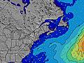 | 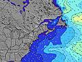 | 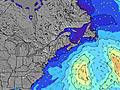 | 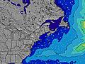 | 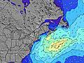 | 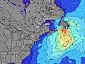 | 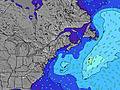 | ||||||||||||
Wave Height (m) Direction Period (s) | SE 9 | SE 9 | SE 8 | S 5 | SE 7 | SSE 5 | S 5 | SE 5 | SSE 6 | SSE 8 | SE 7 | SE 7 | SE 7 | SSE 7 | SE 7 | SSE 5 | SSE 5 | SSE 5 | SSE 6 |
Wave Graph | |||||||||||||||||||
37 | 38 | 14 | 29 | 14 | 59 | 51 | 11 | 41 | 80 | 44 | 30 | 21 | 18 | 11 | 9 | 10 | 37 | 40 | |
Wind (km/h) | |||||||||||||||||||
Wind State on-shore cross-onshore cross-shore cross-offshore off-shore glassy | glassy | on | cross-on | cross | cross | cross-on | cross | cross | cross-off | off | cross | cross-on | cross-off | cross-on | cross-on | cross-off | cross-off | cross-on | cross-off |
High Tide | 1:24AM2.93m | 1:54PM2.72m | 2:03AM2.90m | 2:31PM2.78m | 2:44AM2.84m | 3:10PM2.84m | 3:28AM2.77m | 3:53PM2.89m | 4:17AM2.68m | 4:40PM2.93m | 5:11AM2.59m | 5:34PM2.95m | |||||||
Low Tide | 7:34AM0.05m | 7:46PM0.24m | 8:10AM0.06m | 8:28PM0.19m | 8:48AM0.08m | 9:13PM0.16m | 9:29AM0.12m | 10:02PM0.14m | 10:15AM0.17m | 10:57PM0.14m | 11:07AM0.24m | 11:57PM0.13m | |||||||
— | 5:31 | — | — | 5:33 | — | — | 5:33 | — | — | 5:35 | — | — | 5:35 | — | — | 5:37 | — | — | |
8:05 | — | 8:04 | — | — | 8:02 | — | — | 8:01 | — | — | 8:00 | — | — | 7:59 | — | — | 7:58 | — | |
mm | — | — | — | — | — | — | 3 | 4 | 1 | 2 | — | — | — | — | — | 2 | 2 | — | — |
Temp °C | 22 | 22 | 22 | 22 | 24 | 25 | 24 | 20 | 22 | 21 | 25 | 26 | 24 | 24 | 25 | 23 | 24 | 29 | 29 |
Feels °C | 22 | 22 | 21 | 23 | 23 | 23 | 22 | 22 | 24 | 22 | 25 | 24 | 22 | 26 | 25 | 25 | 26 | 28 | 30 |
Swell 1 Height (m) Direction Period (s) | SE 9 | SE 9 | SE 8 | SSE 5 | SE 7 | ESE 9 | SSE 5 | SE 5 | SE 6 | SSE 8 | SE 7 | SE 7 | SE 7 | SSE 7 | SE 7 | SSE 5 | SSE 5 | SSE 5 | SSE 6 |
37 | 38 | 14 | 14 | 12 | 8 | 42 | 11 | 29 | 80 | 44 | 30 | 21 | 18 | 11 | 9 | 10 | 17 | 40 | |
Swell 2 Height (m) Direction Period (s) | S 3 | S 4 | SE 9 | SE 8 | ESE 9 | — | SE 9 | SE 6 | SE 9 | E 9 | E 9 | SE 8 | SE 9 | SE 8 | SE 8 | SSE 6 | SE 8 | SE 8 | — |
2 | 1 | 13 | 9 | 8 | — | 3 | 6 | 3 | 2 | 2 | 3 | 3 | 3 | 3 | 4 | 3 | 3 | — | |
Swell 3 Height (m) Direction Period (s) | E 6 | E 6 | — | SE 9 | S 8 | — | — | SE 9 | — | — | — | — | E 10 | E 10 | E 9 | SE 8 | E 9 | — | E 9 |
3 | 1 | — | 3 | 1 | — | — | 3 | — | — | — | — | 2 | 2 | 2 | 3 | 2 | — | 2 | |
Wind waves Height (m) Direction Period (s) | SSW 4 | — | — | S 5 | SSE 5 | SSE 5 | S 5 | — | SSE 6 | — | — | — | — | — | — | — | — | SSE 5 | — |
4 | — | — | 29 | 14 | 59 | 51 | — | 41 | — | — | — | — | — | — | — | — | 37 | — | |
Nearest Offshore or Glassy | |||||||||||||||||||
Distance (km) | 0 | 220 | 470 | 470 | 615 | 1779 | 431 | 235 | 0 | 0 | 199 | 223 | 235 | 223 | 478 | 436 | 235 | 235 | 646 |
Best forecast wave conditions in Maine | |||||||||||||||||||
Best forecast wave conditions in United States | |||||||||||||||||||
Header Global | |||||||||||||||||||
- Map Icons:
 Break
Break Live Wave Height (m)
 Live Wind Speed (km/h)
 Surf Rating (10 Max)
 Ocean Swells (m)
- Wind Speed (km/h)
Latest Updates


FREE! Surf-Forecast.com widget for your website
The surf report / weather widget below is available to embed on third party websites free of charge and provides a summary of our Ogunquit Beach surf forecast. Simply grab the html code snippet that we provide and paste it into your own site. You can choose your preferred language and metric/imperial units for the surf forecast feed to suit users of your site. Click here to get the code.
Information about the Ogunquit Beach Surf forecast
The above surf forecast table for Ogunquit Beach provides essential information for determining whether the surfing conditions will be good over the next 16 days. A general guide to surfing at Ogunquit Beach can be found by selecting the local surf guide option on the grey menu. Our Ogunquit Beach surf forecast is unique since it includes wave energy (power) that defines the real feel of the surf rather than just the height or the period. If you surf the same spot (Ogunquit Beach) regularly then make a mental note of the wave energy from the surf forecast table each time you go. Very soon you may start to choose your surf days based on the wave energy alone combined with our forecast of favourable offshore wind conditions. Our star ratings will help here and of course you will also find the usual wave height and period predictions on our surf forecasts as well as a full break down of the swell components under our advanced users option (to reveal that, click the little Einstein character under the tide times).
Further information to help with frequently asked questions about our surf forecast for Ogunquit Beach may be found under the help tab on the top menu and also by moving your mouse over the question marks on the surf forecast table itself. Please always bear in mind that the forecast is for near-shore open water and local factors at each surf break influence the actual breaking wave height, such as the beach / reef profile, water depths offshore and shelter.
Are you planning a vacation in Maine? If you are looking for accommodation near Ogunquit Beach, camping, hotels and condos and appartments in Maine, consider staying in Dover which is 24 km (15 miles) away. Other places in and around Maine where you can find information about places to rent, and car hire include Sanford which is 25 km (16 miles) away, Portsmouth, Biddeford and Saco.
 Nearest