

Surf Forecasts:

1st street surf forecast from 11 Jul 2026:
- Best quality surf: Wednesday 15 Jul, 5AM (local time) - 1.5ft (0.5m), 9s period, SE swell with cross-offshore winds.
- Most powerful swell: Monday 13 Jul, 2AM (local time) - 6.5ft (2.0m), 7s period, ENE swell with 405 kJ wave energy.
- Next surfable swell (1★+): Wednesday 15 Jul, 5AM (local time) - 1.5ft (0.5m), 9s period with SE swell.
Best Forecast Surf Conditions for 1st street this week:
The surf forecast for 1st street over the next 16 days: The first swell (rated 1 star or higher) is forecast to arrive on Wednesday (Jul 15) at 5AM. The primary swell is predicted to be 0.5m and 9s period with a secondary swell of 0.6m and 7s. The wind is predicted to be cross-offshore as the swell arrives.
The most powerful waves expected at 1st street in the next 16 days are 2.0m 7s and forecast to arrive on Monday (Jul 13) at 2AM. Winds are predicted to be onshore at the time the swell arrives. The largest open ocean swell (not directed at the beach) is 1.1m 6s period and expected on Friday (Jul 10) at 11PM.
| Wave Type | Time (EDT) & Date | Wave Height & Period |
|---|---|---|
| Next good surf (1 star+) | 5AM (Wed 15th Jul) | 1.5ft (0.5m) 9s |
| Best Surf | 5AM (Wed 15th Jul) | 1.5ft (0.5m) 9s |
| Most Powerful | 2AM (Mon 13th Jul) | 6.5ft (2.0m) 7s |
Table - best surf conditions forecast for 1st street over the next 16 days.
Alright folks, Rusty here. Let’s have a look at what’s cookin’ for 1st Street over the next couple of weeks. Gotta be straight with you right up front: it’s a pretty bleak stretch, no sugar-coating it. We’re looking at a long, dry run here. The first real glimmer of anything even close to surfable doesn’t show up until Thursday the 23rd of July, and even that’s a stretch. We’re talking about a gap of nearly two weeks with absolutely nothing worth paddling out for.
From Friday the 10th all the way through to Wednesday the 22nd, it’s just a parade of poor surf conditions. The swell is tiny or non-existent, and when there is a little bump of energy, like on Sunday the 12th with a 4ft to 5ft windswell, it’s blown out by strong onshore winds. That Sunday afternoon pulse has combined energy of 230 – moderate – but it’s wind-chop from the ENE at 19 mph. That’s a kite-surfing setup, not a surfing one. Not for us.
Then finally, on the morning of Thursday the 23rd of July, we get a tiny window. The wind goes glassy, dead calm. The swell is a pathetic 2ft from the ESE at a period of 8 seconds, with combined energy of just 67 (weak). The water temperature is about average for the time of year, no major anomaly to speak of. “Surfable waves but very ordinary conditions” is the best we get, and that’s a score of 1 out of 10. It’s a sandbar break that’s fairly consistent, but with no swell to speak of, that doesn’t mean much.
After that little tease, it’s right back to junk. Friday the 24th and Saturday the 25th of July see a bit more cross-offshore wind with small, weak swell in the 1ft to 3ft range, but the period stays short and the energy is low (42 or less). Clean enough to look at, but not enough push to ride.
The Verdict: There are no standouts here. This is a blank run. The only moment that even deserves a mention is Thursday morning, the 23rd of July. If you are absolutely desperate for a glide on a longboard and don’t mind thigh-high slop, the glassy conditions will make it the cleanest you’ll see all forecast. But keep your expectations on the floor.
Rusty.
Short Range ForecastModerate rain (total 12mm), heaviest on Sat night. Warm (max 32°C on Fri afternoon, min 24°C on Sun afternoon). Winds increasing (light winds from the SSE on Fri night, fresh winds from the ENE by Sun night). | Days 5-7 Weather SummaryMostly dry. Warm (max 28°C on Wed afternoon, min 23°C on Wed morning). Wind will be generally light. | ||||||||||||||||||||
Fri 10 | Saturday 11 | Sunday 12 | Monday 13 | Tuesday 14 | Wednesday 15 | Thursday 16 | |||||||||||||||
PM | Night | AM | PM | Night | AM | PM | Night | AM | PM | Night | AM | PM | Night | AM | PM | Night | AM | PM | Night | AM | |
Swell Height Map | 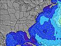 | 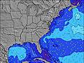 | 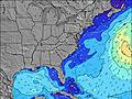 | 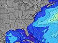 | 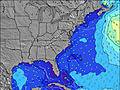 | 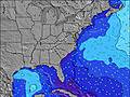 | 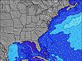 | 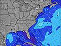 | |||||||||||||
Wave Height (m) Direction Period (s) | NE 7 | ESE 9 | ESE 9 | ESE 9 | ESE 9 | NE 5 | NE 6 | ENE 7 | ENE 7 | ENE 7 | E 6 | E 6 | E 6 | E 6 | E 7 | ENE 7 | ESE 8 | ESE 8 | ESE 8 | ESE 8 | ESE 8 |
Wave Graph | |||||||||||||||||||||
14 | 8 | 9 | 9 | 8 | 59 | 184 | 405 | 233 | 152 | 84 | 49 | 54 | 41 | 25 | 16 | 14 | 6 | 12 | 6 | 13 | |
Wind (km/h) | |||||||||||||||||||||
Wind State on-shore cross-onshore cross-shore cross-offshore off-shore glassy | cross | off | off | off | cross-off | cross-on | cross-on | on | on | cross-on | cross-on | cross-on | on | cross-off | off | cross | cross-off | off | cross | cross-off | cross-off |
High Tide | 4:29PM1.32m | 4:47AM0.97m | 5:29PM1.37m | 5:50AM0.98m | 6:30PM1.41m | 6:52AM1.01m | 7:29PM1.43m | 7:52AM1.04m | 8:26PM1.42m | 8:50AM1.07m | 9:21PM1.38m | 9:46AM1.11m | 10:14PM1.32m | 10:41AM1.13m | |||||||
Low Tide | 10:59PM0.15m | 10:48AM0.04m | 00:03AM0.11m | 11:49AM0.02m | 1:03AM0.08m | 12:51PM-0.00m | 2:01AM0.06m | 1:51PM-0.01m | 2:56AM0.04m | 2:51PM-0.00m | 3:47AM0.04m | 3:49PM0.02m | 4:36AM0.05m | ||||||||
— | — | 5:54 | — | — | 5:54 | — | — | 5:54 | — | — | 5:56 | — | — | 5:56 | — | — | 5:56 | — | — | 5:58 | |
8:21 | — | — | 8:21 | — | — | 8:20 | — | — | 8:20 | — | — | 8:20 | — | — | 8:19 | — | — | 8:19 | — | 8:17 | |
mm | — | — | — | — | 5 | 2 | 4 | 1 | — | — | — | — | — | — | — | — | — | — | — | — | — |
Temp °C | 32 | 32 | 27 | 31 | 27 | 25 | 24 | 25 | 24 | 24 | 25 | 24 | 24 | 25 | 25 | 28 | 27 | 27 | 30 | 28 | 29 |
Feels °C | 32 | 35 | 28 | 32 | 27 | 26 | 23 | 21 | 21 | 22 | 25 | 25 | 26 | 26 | 27 | 27 | 25 | 28 | 30 | 28 | 31 |
Swell 1 Height (m) Direction Period (s) | NE 7 | SSE 7 | SSE 7 | SSE 8 | SSE 8 | ESE 9 | SE 10 | S 7 | ESE 9 | ESE 9 | ESE 9 | E 6 | E 6 | E 6 | E 7 | ENE 7 | E 7 | SE 5 | ESE 8 | ESE 8 | ESE 8 |
14 | 16 | 11 | 12 | 20 | 17 | 23 | 8 | 8 | 16 | 17 | 49 | 54 | 41 | 25 | 16 | 8 | 4 | 12 | 6 | 13 | |
Swell 2 Height (m) Direction Period (s) | ESE 10 | S 4 | ESE 9 | ESE 9 | ESE 9 | SSE 7 | SE 10 | S 6 | S 6 | — | SE 9 | ESE 9 | ESE 9 | ESE 9 | SE 6 | SE 6 | ESE 8 | ESE 8 | E 6 | SSE 5 | SE 5 |
9 | 2 | 9 | 9 | 8 | 5 | 23 | 7 | 3 | — | 22 | 17 | 16 | 16 | 9 | 9 | 14 | 6 | 3 | 2 | 1 | |
Swell 3 Height (m) Direction Period (s) | ENE 9 | ESE 9 | NE 7 | ENE 9 | ENE 8 | — | — | — | — | — | — | ESE 9 | — | — | ESE 9 | ESE 9 | E 16 | E 6 | E 15 | SE 5 | E 14 |
8 | 8 | 2 | 8 | 7 | — | — | — | — | — | — | 32 | — | — | 16 | 15 | 5 | 3 | 4 | 1 | 4 | |
Wind waves Height (m) Direction Period (s) | SSE 7 | — | W 3 | — | N 2 | NE 5 | NE 6 | ENE 7 | ENE 7 | ENE 7 | E 6 | — | — | — | WSW 2 | S 3 | SSW 4 | SW 3 | S 3 | SSW 4 | SSW 3 |
15 | — | 1 | — | 1 | 59 | 184 | 405 | 233 | 152 | 84 | — | — | — | 1 | 2 | 21 | 2 | 7 | 12 | 2 | |
Nearest Offshore or Glassy | |||||||||||||||||||||
Distance (km) | 251 | 46 | 215 | 46 | 46 | 171 | 175 | 246 | 1174 | 1058 | 175 | 190 | 436 | 46 | 3 | 92 | 364 | 603 | 1058 | 632 | 1979 |
Best forecast wave conditions in North Carolina | |||||||||||||||||||||
Best forecast wave conditions in United States | |||||||||||||||||||||
Header Global | |||||||||||||||||||||
- Map Icons:
 Break
Break Live Wave Height (m)
 Live Wind Speed (km/h)
 Surf Rating (10 Max)
 Ocean Swells (m)
- Wind Speed (km/h)


FREE! Surf-Forecast.com widget for your website
The surf report / weather widget below is available to embed on third party websites free of charge and provides a summary of our 1st street surf forecast. Simply grab the html code snippet that we provide and paste it into your own site. You can choose your preferred language and metric/imperial units for the surf forecast feed to suit users of your site. Click here to get the code.
Information about the 1st street Surf forecast
The above surf forecast table for 1st street provides essential information for determining whether the surfing conditions will be good over the next 16 days. A general guide to surfing at 1st street can be found by selecting the local surf guide option on the grey menu. Our 1st street surf forecast is unique since it includes wave energy (power) that defines the real feel of the surf rather than just the height or the period. If you surf the same spot (1st street) regularly then make a mental note of the wave energy from the surf forecast table each time you go. Very soon you may start to choose your surf days based on the wave energy alone combined with our forecast of favourable offshore wind conditions. Our star ratings will help here and of course you will also find the usual wave height and period predictions on our surf forecasts as well as a full break down of the swell components under our advanced users option (to reveal that, click the little Einstein character under the tide times).
Further information to help with frequently asked questions about our surf forecast for 1st street may be found under the help tab on the top menu and also by moving your mouse over the question marks on the surf forecast table itself. Please always bear in mind that the forecast is for near-shore open water and local factors at each surf break influence the actual breaking wave height, such as the beach / reef profile, water depths offshore and shelter.
Are you planning a vacation in North Carolina? If you are looking for accommodation near 1st street, camping, hotels and condos and appartments in North Carolina, consider staying in Elizabeth City which is 64 km (40 miles) away. Other places in and around North Carolina where you can find information about places to rent, and car hire include Cape Hatteras which is 85 km (53 miles) away and Virginia Beach, 99 km (61 miles) away.
 Nearest