

Surf Forecasts:

Indian Wells surf forecast from 2 Aug 2026:
- Best quality surf: Monday 3 Aug, 11PM (local time) - 7ft (2.1m), 8s period, S swell with cross-offshore winds.
- Most powerful swell: Monday 3 Aug, 2PM (local time) - 7.5ft (2.3m), 8s period, S swell with 682 kJ wave energy.
- Next surfable swell (1★+): Monday 3 Aug, 11PM (local time) - 7ft (2.1m), 8s period with S swell.
Best Forecast Surf Conditions for Indian Wells this week:
The surf forecast for Indian Wells over the next 16 days: The first swell (rated 1 star or higher) is forecast to arrive on Monday (Aug 03) at 11PM. The primary swell is predicted to be 2.1m and 8s period. The wind is predicted to be cross-offshore as the swell arrives.
The most powerful waves expected at Indian Wells in the next 16 days are 2.3m 8s and forecast to arrive on Monday (Aug 03) at 2PM. Winds are predicted to be cross-shore at the time the swell arrives.
| Wave Type | Time (EDT) & Date | Wave Height & Period |
|---|---|---|
| Next good surf (1 star+) | 11PM (Mon 3rd Aug) | 7ft (2.1m) 8s |
| Best Surf | 11PM (Mon 3rd Aug) | 7ft (2.1m) 8s |
| Most Powerful | 2PM (Mon 3rd Aug) | 7.5ft (2.3m) 8s |
Table - best surf conditions forecast for Indian Wells over the next 16 days.
The Lowdown
Alright folks, Rusty here. Let's take a long, hard look at what Indian Wells has got cookin' over the next couple of weeks. I gotta be straight with you – it's a tough stretch.
Right off the bat, we're looking at a bit of a slow start. The first few days are a write-off with weak, short-period windswell and messy, cross-onshore winds. There's nothing to get excited about.
Things try to pick up a little on Monday the 3rd of August. We get a pulse of 8ft swell from the S, but it comes with a fresh cross-shore breeze and lumpy conditions. The energy is moderate (663), but the quality is poor. It might be too much for beginners at that size, but it's not clean enough for the rest of us. Monday afternoon cleans up slightly with a gentle breeze, but the surf is still pretty average.
Tuesday the 4th sees the swell drop back to a modest 5ft, but it's still a bit messy. The rest of the first week is a frustrating mix of small, weak swell and onshore or cross-shore winds. There are a few brief windows of clean conditions, like Wednesday the 5th morning and Friday the 7th morning, but the swell is tiny and weak – only around 3ft to 4ft. The energy is barely there (93 and 161). You could get a knee-high wave on a longboard, but it's not really worth the drive.
The second week is more of the same, I'm afraid. There's a real dry spell from the 12th through the 15th, with almost no energy and tiny waves. We're looking at swell heights of 1.0ft to 3ft and energy readings barely cracking 50. A couple of mornings look glassy or clean, but there's nothing to surf.
The one and only highlight in this whole 16-day outlook is the morning of Tuesday the 11th of August. The wind swings offshore from the NNW with a light breeze, and the swell direction is from the SSW at 4ft. The period is short at 6 seconds, so it's not a groundswell, but the energy is moderate (103). It's the cleanest, most surfable window in the entire forecast, and while the waves won't be big, they'll be the best we've got. It's the standout simply because everything else is so poor.
Other than that, this is a grim run for Indian Wells. A lot of days with onshore slop and no real swell to speak of. I'd keep an eye on the forecasts for that Tuesday morning, but don't hold your breath.
Rusty.
Short Range ForecastHeavy rain (total 20mm), heaviest during Mon afternoon. Warm (max 24°C on Sun morning, min 23°C on Sat night). Winds decreasing (fresh winds from the SSW on Mon morning, calm by Mon night). | Days 5-7 Weather SummarySome drizzle, heaviest during Thu night. Warm (max 28°C on Fri morning, min 23°C on Tue night). Winds increasing (calm on Wed morning, fresh winds from the SSW by Thu night). | ||||||||||||||||||
Sunday 2 | Monday 3 | Tuesday 4 | Wednesday 5 | Thursday 6 | Friday 7 | ||||||||||||||
Night | AM | PM | Night | AM | PM | Night | AM | PM | Night | AM | PM | Night | AM | PM | Night | AM | PM | Night | |
Swell Height Map |  |  |  |  | 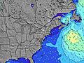 | 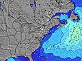 | 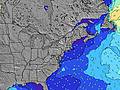 | ||||||||||||
Wave Height (m) Direction Period (s) | S 8 | S 7 | SE 7 | S 5 | S 8 | S 8 | S 9 | SSW 8 | SSW 8 | SSW 7 | SSW 7 | SSW 7 | SSW 6 | SSW 6 | SSW 6 | SSW 7 | SSW 6 | SSW 6 | SSW 6 |
Wave Graph | |||||||||||||||||||
41 | 61 | 18 | 90 | 663 | 624 | 676 | 273 | 155 | 74 | 63 | 79 | 156 | 139 | 161 | 323 | 149 | 136 | 150 | |
Wind (km/h) | |||||||||||||||||||
Wind State on-shore cross-onshore cross-shore cross-offshore off-shore glassy | cross-on | cross-on | cross-on | cross | cross | cross | cross-off | cross-on | on | cross-on | cross-off | cross | cross | cross | cross | cross | cross-off | cross | off |
High Tide | 10:15PM0.84m | 10:47AM0.84m | 10:53PM0.80m | 11:24AM0.86m | 11:36PM0.76m | 12:08PM0.87m | 00:24AM0.72m | 12:59PM0.88m | 1:20AM0.68m | 1:59PM0.89m | 2:26AM0.65m | 3:09PM0.90m | 3:44AM0.66m | ||||||
Low Tide | 4:17AM0.02m | 4:38PM0.11m | 4:55AM0.03m | 5:27PM0.13m | 5:36AM0.05m | 6:22PM0.15m | 6:22AM0.07m | 7:27PM0.17m | 7:17AM0.09m | 8:46PM0.17m | 8:21AM0.10m | 10:10PM0.14m | |||||||
— | 5:45 | — | — | 5:46 | — | — | 5:47 | — | — | 5:47 | — | — | 5:48 | — | — | 5:48 | — | — | |
8:04 | — | 8:02 | — | — | 8:01 | — | — | 8:00 | — | — | 8:00 | — | — | 7:59 | — | — | 7:58 | — | |
mm | — | — | — | 7 | 4 | 9 | — | — | — | — | — | — | — | — | — | 1 | — | — | 3 |
Temp °C | 23 | 24 | 24 | 23 | 24 | 23 | 24 | 23 | 24 | 25 | 25 | 25 | 25 | 27 | 27 | 25 | 28 | 28 | 28 |
Feels °C | 22 | 24 | 24 | 23 | 22 | 21 | 26 | 24 | 26 | 28 | 28 | 26 | 25 | 28 | 27 | 24 | 31 | 30 | 29 |
Swell 1 Height (m) Direction Period (s) | S 8 | SE 7 | SE 7 | SE 9 | — | S 8 | S 9 | SSW 8 | SSW 8 | SSW 7 | SSW 7 | SE 7 | E 10 | E 10 | SE 8 | ESE 8 | SE 8 | SE 8 | SE 8 |
41 | 17 | 17 | 3 | — | 624 | 676 | 273 | 155 | 74 | 63 | 21 | 2 | 2 | 10 | 6 | 10 | 10 | 32 | |
Swell 2 Height (m) Direction Period (s) | SE 7 | S 9 | SSW 7 | — | — | — | — | SE 7 | SE 7 | SE 7 | SE 7 | E 10 | E 12 | — | E 9 | E 9 | E 10 | E 10 | E 9 |
12 | 6 | 15 | — | — | — | — | 37 | 55 | 37 | 28 | 2 | 3 | — | 2 | 2 | 2 | 2 | 2 | |
Swell 3 Height (m) Direction Period (s) | SE 8 | SE 9 | S 8 | — | — | — | — | — | — | — | E 10 | — | SE 8 | — | — | — | — | — | — |
11 | 3 | 1 | — | — | — | — | — | — | — | 2 | — | 3 | — | — | — | — | — | — | |
Wind waves Height (m) Direction Period (s) | SSW 4 | S 7 | S 4 | S 5 | S 8 | — | — | ENE 3 | ENE 3 | — | — | SSW 7 | SSW 6 | SSW 6 | SSW 6 | SSW 7 | SSW 6 | SSW 6 | SSW 6 |
14 | 61 | 18 | 90 | 663 | — | — | 3 | 1 | — | — | 79 | 156 | 139 | 161 | 323 | 149 | 136 | 150 | |
Nearest Offshore or Glassy | |||||||||||||||||||
Distance (km) | 284 | 816 | 1515 | 293 | 167 | 23 | 0 | 44 | 50 | 50 | 0 | 2543 | 50 | 50 | 50 | 167 | 0 | 50 | 0 |
Best forecast wave conditions in Long Island New York | |||||||||||||||||||
Best forecast wave conditions in United States | |||||||||||||||||||
Header Global | |||||||||||||||||||
- Map Icons:
 Break
Break Live Wave Height (m)
 Live Wind Speed (km/h)
 Surf Rating (10 Max)
 Ocean Swells (m)
- Wind Speed (km/h)
Latest Updates


FREE! Surf-Forecast.com widget for your website
The surf report / weather widget below is available to embed on third party websites free of charge and provides a summary of our Indian Wells surf forecast. Simply grab the html code snippet that we provide and paste it into your own site. You can choose your preferred language and metric/imperial units for the surf forecast feed to suit users of your site. Click here to get the code.
Information about the Indian Wells Surf forecast
The above surf forecast table for Indian Wells provides essential information for determining whether the surfing conditions will be good over the next 16 days. A general guide to surfing at Indian Wells can be found by selecting the local surf guide option on the grey menu. Our Indian Wells surf forecast is unique since it includes wave energy (power) that defines the real feel of the surf rather than just the height or the period. If you surf the same spot (Indian Wells) regularly then make a mental note of the wave energy from the surf forecast table each time you go. Very soon you may start to choose your surf days based on the wave energy alone combined with our forecast of favourable offshore wind conditions. Our star ratings will help here and of course you will also find the usual wave height and period predictions on our surf forecasts as well as a full break down of the swell components under our advanced users option (to reveal that, click the little Einstein character under the tide times).
Further information to help with frequently asked questions about our surf forecast for Indian Wells may be found under the help tab on the top menu and also by moving your mouse over the question marks on the surf forecast table itself. Please always bear in mind that the forecast is for near-shore open water and local factors at each surf break influence the actual breaking wave height, such as the beach / reef profile, water depths offshore and shelter.
Indian Wells is 43 km (27 miles) from New London. If you plan a vacation in Long Island New York, look for hotels and other accommodation in New London. New London has rooms for a wide range of budgets as well as car hire and transport links.
 Nearest