

Surf Forecasts:

Broad Cove surf forecast from 3 Aug 2026:
- Best quality surf: Wednesday 5 Aug, 3AM (local time) - 3ft (0.9m), 8s period, SSW swell with cross-offshore winds.
- Most powerful swell: Tuesday 4 Aug, 9AM (local time) - 7.5ft (2.3m), 8s period, SW swell with 716 kJ wave energy.
- Next surfable swell (1★+): Wednesday 5 Aug, 3AM (local time) - 3ft (0.9m), 8s period with SSW swell.
Best Forecast Surf Conditions for Broad Cove this week:
The surf forecast for Broad Cove over the next 16 days: The first swell (rated 1 star or higher) is forecast to arrive on Wednesday (Aug 05) at 3AM. The primary swell is predicted to be 0.9m and 8s period with a secondary swell of 0.2m and 9s. The wind is predicted to be cross-offshore as the swell arrives.
The most powerful waves expected at Broad Cove in the next 16 days are 2.3m 8s and forecast to arrive on Tuesday (Aug 04) at 9AM. Winds are predicted to be cross-offshore at the time the swell arrives. The largest open ocean swell (not directed at the beach) is 0.4m 3s period and expected on Wednesday (Aug 05) at 3AM.
| Wave Type | Time (ADT) & Date | Wave Height & Period |
|---|---|---|
| Next good surf (1 star+) | 3AM (Wed 5th Aug) | 3ft (0.9m) 8s |
| Best Surf | 3AM (Wed 5th Aug) | 3ft (0.9m) 8s |
| Most Powerful | 9AM (Tue 4th Aug) | 7.5ft (2.3m) 8s |
Table - best surf conditions forecast for Broad Cove over the next 16 days.
The Lowdown
Alright, let’s have a look at what’s coming up for Broad Cove. Gotta be straight with you – this is a pretty grim stretch. We’re looking at a massive gap with no real surf on offer, and when something finally does show up, it’s not much to write home about.
The whole 16-day window starts with nothing. Monday the 3rd is a write-off with tiny, choppy, poor surf. Tuesday the 4th has a bit more size, with a 8ft SW swell rolling in, and the wind is a clean cross-off in the morning, but the numbers tell me it’s marginal, with questionable conditions. The combined energy hits 966 (moderate to strong), but this is a point break, and that size at 8 seconds period might be a bit raw. It’s probably the best you’ll see, but it’s not a standout. After that, it drops off again. Wednesday the 5th has tiny waves, and the rest of the week is a total dud – flat, weak, and messy.
We’ve got a long, dry spell from Wednesday the 5th all the way through to Sunday the 16th. There’s nothing worth paddling out for. The only faint glimmer is on the morning of Sunday the 16th, when a small 3ft E swell shows up with clean cross-off winds from the north. The combined energy is 101 (weak to moderate), but it’s surfable, just ordinary. After that, it’s back to tiny, onshore junk for the rest of the window.
Honestly, for a spot that’s fairly consistent, this is a brutal run. The water temp is about 59°, which is a little cooler than average for this time of year, but that’s the least of your worries. If you’re desperate, Tuesday the 4th morning is your only real shot, but don’t expect much. Otherwise, it’s a waiting game.
Rusty.
Short Range ForecastLight rain (total 2mm), mostly falling on Mon night. Warm (max 29°C on Wed afternoon, min 19°C on Mon night). Winds decreasing (fresh winds from the SSW on Mon night, light winds from the S by Wed night). | Days 4-6 Weather SummaryLight rain (total 3mm), mostly falling on Sat afternoon. Warm (max 30°C on Thu afternoon, min 19°C on Thu morning). Wind will be generally light. | ||||||||||||||||||||
Monday 3 | Tuesday 4 | Wednesday 5 | Thursday 6 | Friday 7 | Saturday 8 | Sunday 9 | |||||||||||||||
AM | PM | Night | AM | PM | Night | AM | PM | Night | AM | PM | Night | AM | PM | Night | AM | PM | Night | AM | PM | Night | |
Swell Height Map | 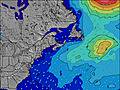 | 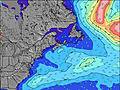 | 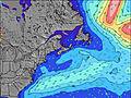 | 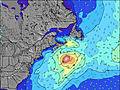 | 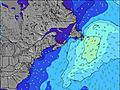 | 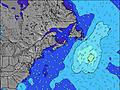 | 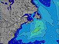 | ||||||||||||||
Wave Height (m) Direction Period (s) | S 7 | S 4 | S 6 | SW 8 | SSW 8 | SW 9 | SSW 8 | SSW 7 | S 6 | SW 8 | S 6 | SSW 6 | SSW 7 | SSW 6 | SSW 6 | SW 7 | SSW 6 | SW 4 | SSW 6 | E 8 | E 8 |
Wave Graph | |||||||||||||||||||||
63 | 38 | 184 | 716 | 244 | 430 | 83 | 71 | 26 | 18 | 25 | 31 | 15 | 14 | 23 | 11 | 24 | 16 | 8 | 5 | 12 | |
Wind (km/h) | |||||||||||||||||||||
Wind State on-shore cross-onshore cross-shore cross-offshore off-shore glassy | cross-on | cross-on | cross | cross-off | cross-off | cross-off | cross-off | cross | cross | glassy | cross | off | cross-off | cross-on | cross | cross | cross-on | cross-off | glassy | cross-on | cross |
High Tide | 12:16PM1.62m | 00:31AM1.51m | 12:58PM1.63m | 1:20AM1.44m | 1:47PM1.63m | 2:18AM1.38m | 2:43PM1.62m | 3:24AM1.34m | 3:47PM1.63m | 4:37AM1.34m | 4:55PM1.66m | 5:49AM1.39m | 6:03PM1.72m | ||||||||
Low Tide | 6:28PM0.34m | 6:38AM0.30m | 7:17PM0.34m | 7:23AM0.35m | 8:14PM0.35m | 8:16AM0.41m | 9:18PM0.35m | 9:19AM0.45m | 10:27PM0.32m | 10:29AM0.45m | 11:37PM0.26m | 11:40AM0.42m | 00:41AM0.18m | ||||||||
6:07 | — | — | 6:07 | — | — | 6:09 | — | — | 6:09 | — | — | 6:11 | — | — | 6:11 | — | — | 6:13 | — | — | |
— | 8:39 | — | — | 8:37 | — | — | 8:37 | — | — | 8:36 | — | — | 8:34 | — | — | 8:32 | — | — | 8:31 | — | |
mm | — | — | 2 | — | — | — | — | — | — | — | — | — | — | — | — | — | 3 | — | — | — | — |
Temp °C | 21 | 23 | 20 | 25 | 27 | 22 | 27 | 29 | 24 | 24 | 30 | 28 | 28 | 28 | 23 | 26 | 26 | 24 | 28 | 28 | 22 |
Feels °C | 21 | 23 | 20 | 20 | 21 | 19 | 24 | 25 | 25 | 27 | 31 | 28 | 27 | 25 | 24 | 27 | 26 | 28 | 29 | 26 | 22 |
Swell 1 Height (m) Direction Period (s) | SE 9 | SE 8 | SSE 8 | S 7 | E 10 | SSW 8 | SSW 8 | E 9 | SW 7 | S 6 | SW 7 | SSW 6 | SSW 7 | E 8 | SSW 6 | SW 7 | E 8 | SSW 4 | SSW 6 | E 8 | E 8 |
3 | 3 | 7 | 158 | 7 | 157 | 83 | 6 | 13 | 18 | 14 | 31 | 15 | 5 | 23 | 11 | 5 | 7 | 8 | 5 | 12 | |
Swell 2 Height (m) Direction Period (s) | E 9 | E 9 | E 9 | SSW 8 | — | E 9 | E 9 | SE 8 | E 9 | SW 8 | E 9 | E 9 | E 8 | SSE 8 | E 8 | E 8 | SE 8 | SSW 6 | E 8 | SE 9 | SE 9 |
2 | 6 | 2 | 84 | — | 7 | 6 | 3 | 6 | 16 | 6 | 6 | 5 | 6 | 6 | 5 | 2 | 4 | 5 | 3 | 3 | |
Swell 3 Height (m) Direction Period (s) | E 7 | — | E 7 | E 10 | — | SE 8 | SE 8 | — | SE 8 | E 9 | SE 8 | SSE 8 | SSE 8 | SSE 8 | SSE 8 | SSE 8 | — | E 8 | SE 9 | — | S 11 |
1 | — | 1 | 8 | — | 3 | 3 | — | 3 | 6 | 2 | 6 | 6 | 6 | 6 | 6 | — | 5 | 3 | — | 2 | |
Wind waves Height (m) Direction Period (s) | S 7 | S 4 | S 6 | SW 8 | SSW 8 | SW 9 | — | SSW 7 | S 6 | — | S 6 | — | — | SSW 6 | — | — | SSW 6 | SW 4 | — | SSW 3 | SSW 4 |
63 | 38 | 184 | 716 | 244 | 430 | — | 71 | 26 | — | 25 | — | — | 14 | — | — | 24 | 16 | — | 5 | 11 | |
Nearest Offshore or Glassy | |||||||||||||||||||||
Distance (km) | 1066 | 867 | 501 | 501 | 525 | 501 | 0 | 510 | 97 | 27 | 37 | 27 | 99 | 895 | 631 | 694 | 1066 | 772 | 706 | 890 | 1010 |
Best forecast wave conditions in Nova Scotia | |||||||||||||||||||||
Best forecast wave conditions in Canada | |||||||||||||||||||||
Header Global | |||||||||||||||||||||
- Map Icons:
 Break
Break Live Wave Height (m)
 Live Wind Speed (km/h)
 Surf Rating (10 Max)
 Ocean Swells (m)
- Wind Speed (km/h)
Latest Updates


FREE! Surf-Forecast.com widget for your website
The surf report / weather widget below is available to embed on third party websites free of charge and provides a summary of our Broad Cove surf forecast. Simply grab the html code snippet that we provide and paste it into your own site. You can choose your preferred language and metric/imperial units for the surf forecast feed to suit users of your site. Click here to get the code.
Information about the Broad Cove Surf forecast
The above surf forecast table for Broad Cove provides essential information for determining whether the surfing conditions will be good over the next 16 days. A general guide to surfing at Broad Cove can be found by selecting the local surf guide option on the grey menu. Our Broad Cove surf forecast is unique since it includes wave energy (power) that defines the real feel of the surf rather than just the height or the period. If you surf the same spot (Broad Cove) regularly then make a mental note of the wave energy from the surf forecast table each time you go. Very soon you may start to choose your surf days based on the wave energy alone combined with our forecast of favourable offshore wind conditions. Our star ratings will help here and of course you will also find the usual wave height and period predictions on our surf forecasts as well as a full break down of the swell components under our advanced users option (to reveal that, click the little Einstein character under the tide times).
Further information to help with frequently asked questions about our surf forecast for Broad Cove may be found under the help tab on the top menu and also by moving your mouse over the question marks on the surf forecast table itself. Please always bear in mind that the forecast is for near-shore open water and local factors at each surf break influence the actual breaking wave height, such as the beach / reef profile, water depths offshore and shelter.
Are you planning a holiday in Nova Scotia? If you are looking for accommodation near Broad Cove, camping, hotels and holiday cottages in Nova Scotia, consider staying in Liverpool which is 23 km (14 miles) away. Other places in and around Nova Scotia where you can find information about places to rent, and car hire include Bridgewater which is 25 km (16 miles) away, Lunenburg, Shelburne and Halifax.
 Nearest