

Surf Forecasts:

Condos surf forecast from 3 Aug 2026:
- Most powerful swell: Thursday 6 Aug, 10PM (local time) - 3.5ft (1.1m), 6s period, SE swell with 82 kJ wave energy.
Best Forecast Surf Conditions for Condos this week:
The most powerful waves expected at Condos in the next 16 days are 1.1m 6s and forecast to arrive on Thursday (Aug 06) at 10PM. Winds are predicted to be cross-onshore at the time the swell arrives.
| Wave Type | Time (CDT) & Date | Wave Height & Period |
|---|---|---|
| Next good surf (1 star+) | - | - |
| Best Surf | - | - |
| Most Powerful | 10PM (Thu 6th Aug) | 3.5ft (1.1m) 6s |
Table - best surf conditions forecast for Condos over the next 16 days.
The Lowdown
Alright, I'm looking at the Condos area, and I've got to be honest with you – it's a rough 16 days ahead. We're looking at a long stretch of nothing special, with no real sessions to get excited about. The water is a warm 84°, which is about normal for the time of year, so you won't freeze while you're staring at the flat, bumpy ocean.
The pattern is set. From Sunday, August 2nd, all the way through to Monday, August 17th, every single window is a write-off. The swell is coming from the SSE to SE, but it's tiny, never getting over a knee-high 3 ft, with a period of around 5 to 6 seconds. That's just weak windswell, not enough to do anything.
The wind is the main problem. It's mostly a cross-onshore breeze from the SE or SSE, blowing between 6 and 16 mph, which is just enough to mess up the surface. The combined wave energy is weak, barely hitting triple digits. The only time we see a bit more energy, a value of 108, is on the afternoon of Saturday, August 15th, but even then it's side-on and choppy.
It's a long stretch of poor conditions. This is more of a setup for kite surfing than paddle surfing. A blank run like this is more normal for this spot, so don't get your hopes up. The forecast can always change, but right now, there's no reason to get wet.
Rusty.
Short Range ForecastMostly dry. Warm (max 29°C on Sun afternoon, min 27°C on Sun night). Wind will be generally light. | Days 5-7 Weather SummarySome drizzle, heaviest during Sat morning. Warm (max 29°C on Wed afternoon, min 27°C on Thu night). Mainly fresh winds. | |||||||||||||||||||
Sun 2 | Monday 3 | Tuesday 4 | Wednesday 5 | Thursday 6 | Friday 7 | Saturday 8 | ||||||||||||||
PM | Night | AM | PM | Night | AM | PM | Night | AM | PM | Night | AM | PM | Night | AM | PM | Night | AM | PM | Night | |
Swell Height Map | 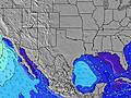 | 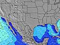 | 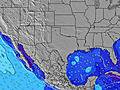 | 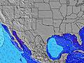 | 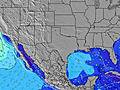 | 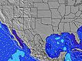 | 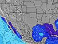 | |||||||||||||
Wave Height (m) Direction Period (s) | SSE 5 | S 4 | SSE 5 | SSE 5 | SSE 5 | SSE 5 | SSE 5 | SSE 5 | SE 5 | SE 5 | SE 5 | SE 6 | SE 6 | SE 6 | SE 6 | SE 6 | SE 6 | SE 6 | SE 6 | ESE 6 |
Wave Graph | ||||||||||||||||||||
18 | 18 | 21 | 15 | 30 | 27 | 23 | 31 | 41 | 34 | 54 | 43 | 54 | 67 | 58 | 64 | 52 | 47 | 52 | 63 | |
Wind (km/h) | ||||||||||||||||||||
Wind State on-shore cross-onshore cross-shore cross-offshore off-shore glassy | on | cross | cross-on | cross-on | cross-on | cross-on | cross-on | cross-on | cross-on | on | cross-on | cross-on | on | cross-on | cross-on | on | on | on | on | on |
High Tide | 10:07AM0.03m | 9:17AM0.05m | 8:47AM0.06m | 8:52AM0.08m | 9:25AM0.10m | 10:13AM0.11m | ||||||||||||||
Low Tide | 6:47PM-0.02m | 6:54PM-0.03m | 7:15PM-0.05m | 7:50PM-0.06m | 8:40PM-0.07m | 9:44PM-0.07m | 10:58PM-0.08m | |||||||||||||
— | — | 6:52 | — | — | 6:52 | — | — | 6:52 | — | — | 6:54 | — | — | 6:54 | — | — | 6:54 | — | — | |
8:16 | — | — | 8:15 | — | — | 8:15 | — | — | 8:15 | — | — | 8:14 | — | — | 8:13 | — | — | 8:12 | — | |
mm | — | — | — | — | — | — | — | — | — | — | — | — | — | — | — | — | — | 1 | — | — |
Temp °C | 29 | 28 | 28 | 29 | 28 | 28 | 29 | 28 | 28 | 29 | 28 | 28 | 29 | 28 | 29 | 29 | 28 | 29 | 29 | 28 |
Feels °C | 32 | 30 | 32 | 31 | 29 | 31 | 31 | 29 | 31 | 31 | 29 | 30 | 30 | 28 | 32 | 31 | 30 | 32 | 31 | 29 |
Swell 1 Height (m) Direction Period (s) | SSE 5 | SE 10 | SSE 5 | ESE 9 | ESE 9 | SSE 5 | ESE 9 | SE 8 | E 8 | E 8 | — | — | — | — | — | — | SE 9 | SE 6 | — | — |
18 | 4 | 21 | 8 | 8 | 27 | 8 | 3 | 1 | 1 | — | — | — | — | — | — | 3 | 47 | — | — | |
Swell 2 Height (m) Direction Period (s) | SE 9 | SE 7 | ESE 10 | — | — | ESE 9 | — | — | — | — | — | — | — | — | — | — | — | SE 9 | — | — |
3 | 2 | 9 | — | — | 8 | — | — | — | — | — | — | — | — | — | — | — | 3 | — | — | |
Swell 3 Height (m) Direction Period (s) | — | SE 5 | ESE 9 | — | — | ESE 9 | — | — | — | — | — | — | — | — | — | — | — | — | — | — |
— | 1 | 9 | — | — | 8 | — | — | — | — | — | — | — | — | — | — | — | — | — | — | |
Wind waves Height (m) Direction Period (s) | — | S 4 | S 4 | SSE 5 | SSE 5 | — | SSE 5 | SSE 5 | SE 5 | SE 5 | SE 5 | SE 6 | SE 6 | SE 6 | SE 6 | SE 6 | SE 6 | — | SE 6 | ESE 6 |
— | 18 | 10 | 15 | 30 | — | 23 | 31 | 41 | 34 | 54 | 43 | 54 | 67 | 58 | 64 | 52 | — | 52 | 63 | |
Nearest Offshore or Glassy | ||||||||||||||||||||
Distance (km) | 1055 | 1019 | 1042 | 1375 | 1038 | 1042 | 1202 | 1038 | 1042 | 1141 | 1038 | 1042 | 1143 | 1038 | 1042 | 1055 | 1038 | 1042 | 1051 | 1042 |
Best forecast wave conditions in Texas | ||||||||||||||||||||
Best forecast wave conditions in United States | ||||||||||||||||||||
Header Global | ||||||||||||||||||||
- Map Icons:
 Break
Break Live Wave Height (m)
 Live Wind Speed (km/h)
 Surf Rating (10 Max)
 Ocean Swells (m)
- Wind Speed (km/h)
Latest Updates


FREE! Surf-Forecast.com widget for your website
The surf report / weather widget below is available to embed on third party websites free of charge and provides a summary of our Condos surf forecast. Simply grab the html code snippet that we provide and paste it into your own site. You can choose your preferred language and metric/imperial units for the surf forecast feed to suit users of your site. Click here to get the code.
Information about the Condos Surf forecast
The above surf forecast table for Condos provides essential information for determining whether the surfing conditions will be good over the next 16 days. A general guide to surfing at Condos can be found by selecting the local surf guide option on the grey menu. Our Condos surf forecast is unique since it includes wave energy (power) that defines the real feel of the surf rather than just the height or the period. If you surf the same spot (Condos) regularly then make a mental note of the wave energy from the surf forecast table each time you go. Very soon you may start to choose your surf days based on the wave energy alone combined with our forecast of favourable offshore wind conditions. Our star ratings will help here and of course you will also find the usual wave height and period predictions on our surf forecasts as well as a full break down of the swell components under our advanced users option (to reveal that, click the little Einstein character under the tide times).
Further information to help with frequently asked questions about our surf forecast for Condos may be found under the help tab on the top menu and also by moving your mouse over the question marks on the surf forecast table itself. Please always bear in mind that the forecast is for near-shore open water and local factors at each surf break influence the actual breaking wave height, such as the beach / reef profile, water depths offshore and shelter.
Condos is 26 km (16 miles) from Corpus Christi. If you plan a vacation in Texas, look for hotels and other accommodation in Corpus Christi. Corpus Christi has rooms for a wide range of budgets as well as car hire and transport links.
 Nearest