

Surf Forecasts:

The Washout surf forecast from 2 Aug 2026:
- Best quality surf: Saturday 8 Aug, 8AM (local time) - 2.5ft (0.7m), 9s period, SE swell with glassy winds.
- Most powerful swell: Sunday 9 Aug, 8AM (local time) - 3.5ft (1.1m), 7s period, SE swell with 126 kJ wave energy.
- Next surfable swell (1★+): Saturday 8 Aug, 8AM (local time) - 2.5ft (0.7m), 9s period with SE swell.
Best Forecast Surf Conditions for The Washout this week:
The surf forecast for The Washout over the next 16 days: The first swell (rated 1 star or higher) is forecast to arrive on Saturday (Aug 08) at 8AM. The primary swell is predicted to be 0.7m and 9s period. The wind is predicted to be glassy as the swell arrives.
The most powerful waves expected at The Washout in the next 16 days are 1.1m 7s and forecast to arrive on Sunday (Aug 09) at 8AM. Winds are predicted to be cross-offshore at the time the swell arrives.
| Wave Type | Time (EDT) & Date | Wave Height & Period |
|---|---|---|
| Next good surf (1 star+) | 8AM (Sat 8th Aug) | 2.5ft (0.7m) 9s |
| Best Surf | 8AM (Sat 8th Aug) | 2.5ft (0.7m) 9s |
| Most Powerful | 8AM (Sun 9th Aug) | 3.5ft (1.1m) 7s |
Table - best surf conditions forecast for The Washout over the next 16 days.
The Lowdown
Alright, this is Rusty comin' at ya from the sand. Let's be real straight up: the next 16 days are a tough watch for The Washout. This ain't one of those classic setups where you're frothin' to get in the water. We're lookin' at a long, dry spell with next to no quality surf on offer.
The pattern is pretty grim. For the first week, from Sunday the 2nd of August right through to Saturday the 9th, it's a write-off. We're talkin' small, weak swell with energy readings barely breakin' triple digits. The best we see is a combined energy of 101 on the Friday afternoon, but even that's a junky 1.0 ft southeasterly with a short 7-second period. The wind is a constant problem—mostly cross or cross-onshore, with a few onshore slop sessions thrown in. There's a risk of thunderstorms hangin' around, too. The water temp is a touch warmer than normal at 86°, but that's no consolation when the waves are mush.
There's a bit of a glimmer, but it's barely a flicker. The only real opportunities come on the mornings of Sunday the 9th, Monday the 10th, Tuesday the 11th, and Wednesday the 12th. These are the only times you'll see "clean" conditions in the forecast, with light cross-offshore winds. The swell is tiny, though—around 2 ft to 3 ft, with short periods of 5 to 7 seconds. The combined energy is weak, maxin' out at 59 on the Wednesday morning. This is strictly for the longboard or a foamie, and only if you're desperate to get wet. The crowd factor is "sometimes" here, so you might have a few other souls out there.
Thursday the 13th of August morning is another standout, but only for the novelty. We get a "glassy" wind state with a light westerly breeze, and the waves are 3 ft from the east. The energy is still weak at 57. It's a rare moment of peace, but the swell is tiny and inconsistent.
After that, from the 14th onwards, it's back to the same story: small, weak, and messy. The wind swings back to cross-onshore, and the swell just dribbles away. The last week is a total blank.
So, if you're lookin' for the best on offer, it's the Thursday 13th morning. Glassy conditions and a tiny bit of east swell. That's your one true standout. The rest of the time, this setup looks more interesting for a kite surfer than a paddle surfer, given the significant wind and poor surf quality. It's a tough run, but it tends not to stay this poor for long. Forecasts can change.
Rusty, signing off.
Short Range ForecastHeavy rain (total 41mm), heaviest during Tue morning. Warm (max 29°C on Sun afternoon, min 26°C on Sun morning). Winds decreasing (fresh winds from the S on Sun afternoon, light winds from the SSW by Tue morning). | Days 4-6 Weather SummaryModerate rain (total 17mm), heaviest on Thu morning. Warm (max 29°C on Thu afternoon, min 27°C on Wed afternoon). Wind will be generally light. | ||||||||||||||||||||
Sunday 2 | Monday 3 | Tuesday 4 | Wednesday 5 | Thursday 6 | Friday 7 | Saturday 8 | |||||||||||||||
AM | PM | Night | AM | PM | Night | AM | PM | Night | AM | PM | Night | AM | PM | Night | AM | PM | Night | AM | PM | Night | |
Swell Height Map |  | 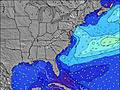 | 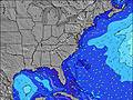 | 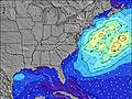 |  | 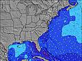 | 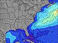 | ||||||||||||||
Wave Height (m) Direction Period (s) | SE 6 | S 5 | S 7 | S 7 | S 6 | S 6 | SSE 6 | S 6 | S 5 | SSW 5 | SE 7 | SE 7 | SE 5 | SE 7 | SE 7 | SE 7 | SE 7 | SE 8 | SE 8 | SE 8 | SE 8 |
Wave Graph | |||||||||||||||||||||
19 | 64 | 94 | 85 | 68 | 102 | 52 | 60 | 23 | 36 | 16 | 15 | 28 | 63 | 21 | 27 | 71 | 63 | 68 | 64 | 58 | |
Wind (km/h) | |||||||||||||||||||||
Wind State on-shore cross-onshore cross-shore cross-offshore off-shore glassy | cross | cross-on | cross | cross | cross | cross-on | cross | cross-on | cross-on | cross-on | on | cross-on | cross | cross-on | cross-on | on | on | cross-on | cross-on | on | cross |
High Tide | 11:21AM1.61m | 11:38PM1.67m | 12:05PM1.67m | 00:20AM1.62m | 12:54PM1.72m | 1:10AM1.57m | 1:49PM1.76m | 2:06AM1.52m | 2:50PM1.81m | 3:09AM1.48m | 3:57PM1.85m | 4:19AM1.48m | 5:07PM1.91m | ||||||||
Low Tide | 5:06PM0.15m | 5:32AM0.04m | 5:56PM0.20m | 6:15AM0.03m | 6:51PM0.24m | 7:05AM0.02m | 7:54PM0.27m | 8:01AM0.02m | 9:03PM0.27m | 9:03AM0.01m | 10:11PM0.25m | 10:08AM-0.01m | 11:17PM0.19m | ||||||||
6:33 | — | — | 6:33 | — | — | 6:35 | — | — | 6:35 | — | — | 6:35 | — | — | 6:37 | — | — | 6:37 | — | — | |
— | 8:16 | — | — | 8:15 | — | — | 8:15 | — | — | 8:14 | — | — | 8:13 | — | — | 8:12 | — | — | 8:10 | — | |
mm | 4 | 2 | 8 | 5 | 5 | 5 | 5 | 2 | 5 | 5 | 1 | 2 | 9 | — | — | — | — | — | 1 | — | — |
Temp °C | 28 | 29 | 28 | 28 | 27 | 28 | 28 | 28 | 28 | 28 | 28 | 28 | 28 | 29 | 28 | 29 | 29 | 28 | 28 | 29 | 27 |
Feels °C | 28 | 27 | 26 | 28 | 26 | 29 | 30 | 29 | 28 | 30 | 30 | 29 | 30 | 31 | 31 | 33 | 31 | 30 | 32 | 31 | 28 |
Swell 1 Height (m) Direction Period (s) | SE 6 | — | SE 7 | — | S 6 | — | SE 6 | ESE 7 | SE 7 | SE 6 | SE 7 | SE 7 | — | SE 7 | — | SE 7 | SE 7 | SE 8 | SE 8 | SE 8 | — |
19 | — | 34 | — | 68 | — | 43 | 30 | 11 | 15 | 16 | 15 | — | 63 | — | 27 | 71 | 63 | 68 | 64 | — | |
Swell 2 Height (m) Direction Period (s) | — | — | — | — | — | — | — | — | — | — | — | — | — | E 11 | — | E 11 | — | — | — | — | — |
— | — | — | — | — | — | — | — | — | — | — | — | — | 2 | — | 2 | — | — | — | — | — | |
Swell 3 Height (m) Direction Period (s) | — | — | — | — | — | — | — | — | — | — | — | — | — | — | — | — | — | — | — | — | — |
— | — | — | — | — | — | — | — | — | — | — | — | — | — | — | — | — | — | — | — | — | |
Wind waves Height (m) Direction Period (s) | SSW 5 | S 5 | S 7 | S 7 | — | S 6 | SSE 6 | S 6 | S 5 | SSW 5 | SSW 5 | SSE 4 | SE 5 | SSE 5 | SE 7 | — | SE 7 | — | — | — | SE 8 |
14 | 64 | 94 | 85 | — | 102 | 52 | 60 | 23 | 36 | 4 | 9 | 28 | 22 | 21 | — | 30 | — | — | — | 58 | |
Nearest Offshore or Glassy | |||||||||||||||||||||
Distance (km) | 531 | 531 | 353 | 302 | 287 | 300 | 287 | 591 | 287 | 64 | 238 | 298 | 114 | 1203 | 1013 | 240 | 854 | 762 | 102 | 800 | 99 |
Best forecast wave conditions in South Carolina | |||||||||||||||||||||
Best forecast wave conditions in United States | |||||||||||||||||||||
Header Global | |||||||||||||||||||||
- Map Icons:
 Break
Break Live Wave Height (m)
 Live Wind Speed (km/h)
 Surf Rating (10 Max)
 Ocean Swells (m)
- Wind Speed (km/h)
Latest Updates


FREE! Surf-Forecast.com widget for your website
The surf report / weather widget below is available to embed on third party websites free of charge and provides a summary of our The Washout surf forecast. Simply grab the html code snippet that we provide and paste it into your own site. You can choose your preferred language and metric/imperial units for the surf forecast feed to suit users of your site. Click here to get the code.
Information about the The Washout Surf forecast
The above surf forecast table for The Washout provides essential information for determining whether the surfing conditions will be good over the next 16 days. A general guide to surfing at The Washout can be found by selecting the local surf guide option on the grey menu. Our The Washout surf forecast is unique since it includes wave energy (power) that defines the real feel of the surf rather than just the height or the period. If you surf the same spot (The Washout) regularly then make a mental note of the wave energy from the surf forecast table each time you go. Very soon you may start to choose your surf days based on the wave energy alone combined with our forecast of favourable offshore wind conditions. Our star ratings will help here and of course you will also find the usual wave height and period predictions on our surf forecasts as well as a full break down of the swell components under our advanced users option (to reveal that, click the little Einstein character under the tide times).
Further information to help with frequently asked questions about our surf forecast for The Washout may be found under the help tab on the top menu and also by moving your mouse over the question marks on the surf forecast table itself. Please always bear in mind that the forecast is for near-shore open water and local factors at each surf break influence the actual breaking wave height, such as the beach / reef profile, water depths offshore and shelter.
The Washout is 7 km (4 miles) from the city of Mount Pleasant. If you plan a vacation in South Carolina, look for hotels and other accommodation in Mount Pleasant. Mount Pleasant has rooms for a wide range of budgets as well as car hire and transport links.
 Nearest