

Surf Forecasts:

Croatan surf forecast from 3 Aug 2026:
- Best quality surf: Monday 3 Aug, 11PM (local time) - 4ft (1.2m), 7s period, SSE swell with cross-offshore winds.
- Most powerful swell: Monday 3 Aug, 11AM (local time) - 5ft (1.5m), 8s period, SSE swell with 263 kJ wave energy.
- Next surfable swell (1★+): Monday 3 Aug, 11PM (local time) - 4ft (1.2m), 7s period with SSE swell.
Best Forecast Surf Conditions for Croatan this week:
The surf forecast for Croatan over the next 16 days: The first swell (rated 1 star or higher) is forecast to arrive on Monday (Aug 03) at 11PM. The primary swell is predicted to be 1.2m and 7s period with a secondary swell of 0.1m and 13s. The wind is predicted to be cross-offshore as the swell arrives.
The most powerful waves expected at Croatan in the next 16 days are 1.5m 8s and forecast to arrive on Monday (Aug 03) at 11AM. Winds are predicted to be cross-offshore at the time the swell arrives. The largest open ocean swell (not directed at the beach) is 0.6m 3s period and expected on Sunday (Aug 09) at 8AM.
| Wave Type | Time (EDT) & Date | Wave Height & Period |
|---|---|---|
| Next good surf (1 star+) | 11PM (Mon 3rd Aug) | 4ft (1.2m) 7s |
| Best Surf | 11PM (Mon 3rd Aug) | 4ft (1.2m) 7s |
| Most Powerful | 11AM (Mon 3rd Aug) | 5ft (1.5m) 8s |
Table - best surf conditions forecast for Croatan over the next 16 days.
The Lowdown
Alright, this is Rusty. Let's look at what's happening.
Honestly, I gotta be straight with you – the outlook for the next couple of weeks is a real bummer. We're looking at a long stretch of tiny, weak surf that's just not gonna get the heart pumping. The combined swell energy is barely registering, with most values under 100, and it's gonna stay that way for a while.
The first real chance of a wave doesn't even show up until Monday, August 3rd. We're talking about a 5 ft swell from the SSE at a short 8 seconds, but it’s a messy situation. The wind is a cross-off from the SSW, but it's a solid 16 mph, which is a lot of breeze to be fighting. The water temp is about 78°, which is pretty normal for this time of year, so at least you won't be cold while you're getting skunked. The wave comment says it all: "marginal surf forecast." It's a score of 1 out of 10, and I'd say that's generous. This is a beginner-friendly beach break, but even a beginner won't have much fun here.
After that, the whole forecast just flat-lines. From Tuesday morning, August 4th all the way through to Tuesday, August 18th, there's literally nothing. The heights drop to 0.7 ft or 1 ft, the periods are all under 8 seconds, and the combined energy is mostly in the single digits or low teens. The wind is all over the place, but it doesn't matter because there's nothing to ride. The file calls it "poor surf conditions" for every single session, and it's not wrong.
There's no one stand-out, no hidden gem, no session to get excited about. It's a flat spell, plain and simple. For a spot like Croatan that's exposed, this is just a bad run. The forecasts can change, but for now, I'd leave the boards in the car and find something else to do.
Rusty.
Short Range ForecastModerate rain (total 10mm), heaviest on Mon night. Warm (max 29°C on Wed afternoon, min 23°C on Tue night). Wind will be generally light. | Days 4-6 Weather SummaryMostly dry. Warm (max 32°C on Thu afternoon, min 24°C on Sat night). Wind will be generally light. | ||||||||||||||||||||
Monday 3 | Tuesday 4 | Wednesday 5 | Thursday 6 | Friday 7 | Saturday 8 | Sunday 9 | |||||||||||||||
AM | PM | Night | AM | PM | Night | AM | PM | Night | AM | PM | Night | AM | PM | Night | AM | PM | Night | AM | PM | Night | |
Swell Height Map | 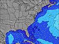 | 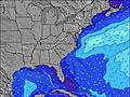 | 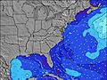 | 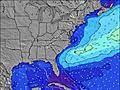 | 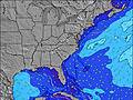 | 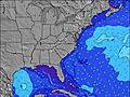 | 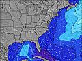 | ||||||||||||||
Wave Height (m) Direction Period (s) | SSE 8 | SSE 8 | SSE 7 | SE 8 | SSE 7 | SSE 7 | SSE 6 | SE 4 | SSE 5 | SE 6 | SSE 4 | S 5 | SSE 6 | SSE 4 | S 5 | SE 8 | ESE 8 | S 5 | SE 7 | SE 7 | SSE 5 |
Wave Graph | |||||||||||||||||||||
263 | 199 | 93 | 77 | 77 | 83 | 54 | 21 | 32 | 19 | 37 | 36 | 26 | 17 | 27 | 49 | 23 | 31 | 12 | 16 | 34 | |
Wind (km/h) | |||||||||||||||||||||
Wind State on-shore cross-onshore cross-shore cross-offshore off-shore glassy | cross-off | cross-off | cross-off | cross-on | cross | cross-off | cross-off | cross-off | cross-off | cross-off | cross | cross-off | cross-off | cross | cross-off | cross-off | cross | cross-off | cross-off | cross-off | cross-off |
High Tide | 11:44AM1.09m | 11:56PM0.99m | 12:29PM1.12m | 00:42AM0.94m | 1:20PM1.14m | 1:35AM0.90m | 2:16PM1.16m | 2:36AM0.87m | 3:20PM1.18m | 3:44AM0.87m | 4:28PM1.21m | 4:54AM0.91m | 5:33PM1.25m | ||||||||
Low Tide | 5:59PM0.15m | 6:09AM0.03m | 6:54PM0.16m | 6:58AM0.04m | 7:53PM0.17m | 7:51AM0.05m | 8:54PM0.16m | 8:48AM0.05m | 9:58PM0.15m | 9:50AM0.03m | 11:03PM0.12m | 10:55AM0.01m | 00:05AM0.07m | ||||||||
6:09 | — | — | 6:11 | — | — | 6:11 | — | — | 6:13 | — | — | 6:13 | — | — | 6:13 | — | — | 6:15 | — | — | |
— | 8:07 | — | — | 8:07 | — | — | 8:06 | — | — | 8:05 | — | — | 8:04 | — | — | 8:02 | — | — | 8:01 | — | |
mm | 1 | 1 | 3 | 1 | 2 | 2 | — | — | — | — | — | — | — | — | — | — | — | — | — | — | 2 |
Temp °C | 26 | 27 | 26 | 27 | 27 | 25 | 26 | 29 | 28 | 29 | 32 | 29 | 28 | 32 | 29 | 29 | 32 | 30 | 29 | 33 | 29 |
Feels °C | 27 | 28 | 28 | 31 | 29 | 28 | 28 | 30 | 31 | 31 | 32 | 30 | 30 | 32 | 30 | 31 | 32 | 31 | 30 | 33 | 29 |
Swell 1 Height (m) Direction Period (s) | — | — | SSE 7 | SE 8 | NNE 4 | SE 7 | NE 5 | NE 5 | SE 6 | SE 6 | E 10 | SE 6 | SSE 6 | E 9 | ESE 8 | SE 8 | ESE 8 | SE 7 | SE 7 | SE 7 | SSE 5 |
— | — | 93 | 77 | 2 | 44 | 4 | 1 | 11 | 19 | 2 | 10 | 26 | 2 | 24 | 49 | 23 | 14 | 12 | 16 | 34 | |
Swell 2 Height (m) Direction Period (s) | — | — | E 13 | E 14 | — | NE 5 | E 9 | E 9 | NE 4 | E 10 | E 11 | E 9 | E 9 | E 9 | E 10 | E 9 | E 9 | E 9 | E 8 | E 9 | E 9 |
— | — | 4 | 4 | — | 4 | 2 | 2 | 1 | 2 | 2 | 2 | 2 | 2 | 2 | 2 | 2 | 1 | 1 | 2 | 1 | |
Swell 3 Height (m) Direction Period (s) | — | — | — | — | — | E 8 | — | E 11 | E 10 | — | — | E 11 | — | — | — | — | — | E 8 | — | E 11 | E 10 |
— | — | — | — | — | 1 | — | 2 | 2 | — | — | 2 | — | — | — | — | — | 1 | — | 2 | 2 | |
Wind waves Height (m) Direction Period (s) | SSE 8 | SSE 8 | — | — | SSE 7 | SSE 7 | SSE 6 | SE 4 | SSE 5 | S 5 | SSE 4 | S 5 | WSW 3 | SSE 4 | S 5 | SW 3 | S 4 | S 5 | S 5 | SSW 3 | SW 3 |
263 | 199 | — | — | 77 | 83 | 54 | 21 | 32 | 12 | 37 | 36 | 1 | 17 | 27 | 2 | 13 | 31 | 11 | 3 | 3 | |
Nearest Offshore or Glassy | |||||||||||||||||||||
Distance (km) | 210 | 210 | 0 | 46 | 0 | 0 | 204 | 14 | 290 | 352 | 2301 | 443 | 267 | 418 | 217 | 95 | 481 | 204 | 196 | 228 | 878 |
Best forecast wave conditions in Virginia | |||||||||||||||||||||
Best forecast wave conditions in United States | |||||||||||||||||||||
Header Global | |||||||||||||||||||||
- Map Icons:
 Break
Break Live Wave Height (m)
 Live Wind Speed (km/h)
 Surf Rating (10 Max)
 Ocean Swells (m)
- Wind Speed (km/h)
Latest Updates


FREE! Surf-Forecast.com widget for your website
The surf report / weather widget below is available to embed on third party websites free of charge and provides a summary of our Croatan surf forecast. Simply grab the html code snippet that we provide and paste it into your own site. You can choose your preferred language and metric/imperial units for the surf forecast feed to suit users of your site. Click here to get the code.
Information about the Croatan Surf forecast
The above surf forecast table for Croatan provides essential information for determining whether the surfing conditions will be good over the next 16 days. A general guide to surfing at Croatan can be found by selecting the local surf guide option on the grey menu. Our Croatan surf forecast is unique since it includes wave energy (power) that defines the real feel of the surf rather than just the height or the period. If you surf the same spot (Croatan) regularly then make a mental note of the wave energy from the surf forecast table each time you go. Very soon you may start to choose your surf days based on the wave energy alone combined with our forecast of favourable offshore wind conditions. Our star ratings will help here and of course you will also find the usual wave height and period predictions on our surf forecasts as well as a full break down of the swell components under our advanced users option (to reveal that, click the little Einstein character under the tide times).
Further information to help with frequently asked questions about our surf forecast for Croatan may be found under the help tab on the top menu and also by moving your mouse over the question marks on the surf forecast table itself. Please always bear in mind that the forecast is for near-shore open water and local factors at each surf break influence the actual breaking wave height, such as the beach / reef profile, water depths offshore and shelter.
Croatan is 7 km (4 miles) from the city of Virginia Beach. If you plan a vacation in Virginia, look for hotels and other accommodation in Virginia Beach. Virginia Beach has rooms for a wide range of budgets as well as car hire and transport links.
 Nearest