

Surf Forecasts:

The Mayport Poles surf forecast from 29 Jul 2026:
- Best quality surf: Sunday 2 Aug, 8AM (local time) - 2.5ft (0.8m), 7s period, SE swell with cross-offshore winds.
- Most powerful swell: Sunday 2 Aug, 8PM (local time) - 5ft (1.5m), 6s period, SE swell with 161 kJ wave energy.
- Next surfable swell (1★+): Sunday 2 Aug, 8AM (local time) - 2.5ft (0.8m), 7s period with SE swell.
Best Forecast Surf Conditions for The Mayport Poles this week:
The surf forecast for The Mayport Poles over the next 16 days: The first swell (rated 1 star or higher) is forecast to arrive on Sunday (Aug 02) at 8AM. The primary swell is predicted to be 0.8m and 7s period. The wind is predicted to be cross-offshore as the swell arrives.
The most powerful waves expected at The Mayport Poles in the next 16 days are 1.5m 6s and forecast to arrive on Sunday (Aug 02) at 8PM. Winds are predicted to be cross-offshore at the time the swell arrives. The largest open ocean swell (not directed at the beach) is 0.6m 3s period and expected on Wednesday (Jul 29) at 11PM.
| Wave Type | Time (EDT) & Date | Wave Height & Period |
|---|---|---|
| Next good surf (1 star+) | 8AM (Sun 2nd Aug) | 2.5ft (0.8m) 7s |
| Best Surf | 8AM (Sun 2nd Aug) | 2.5ft (0.8m) 7s |
| Most Powerful | 8PM (Sun 2nd Aug) | 5ft (1.5m) 6s |
Table - best surf conditions forecast for The Mayport Poles over the next 16 days.
The Lowdown
Alright, Rusty here, and I gotta be straight with you—this 16-day window for The Mayport Poles is a tough one. I’ve been staring at the charts and there’s just no good surf on offer. The whole period is a blank run of poor surf conditions, so don’t bother paddling out just yet.
Let’s start with the overall pattern. We’ve got a tiny, weak swell hanging around, mostly from the southeast or east-southeast, with heights barely tickling 2 feet on the best days. The combined energy never gets out of the weak zone, often sitting in the low double digits (55) or even dropping to single digits (5). That’s barely enough to move a sea turtle, let alone a surfer. The water temperature is sitting at 84° and that anomaly is only 0.4°, so it’s about average for this time of year—warm, but nothing to get excited about.
From Tuesday, July 28, right through to Wednesday, August 12, it’s a long, grim stretch. There are no standouts, no hidden gems. The swell is too small, the period is short (mostly 3 to 8 seconds), and the winds are often cross-on or cross-off, but even when it’s glassy or offshore, there’s just no wave to ride. The swell heights are stuck between 0.7 feet and 4 feet, but even the 4 feet on Sunday, August 2, is a messy, short-period southeastern swell with no energy behind it (energy at 53). It’s a beach break setup, so that short period just means weak, crumbly closeouts.
For a beginner, the size is fine, but the quality is so poor it’s not worth the drive. The only time you see a glassy morning is on August 5, 6, and 8, with 1 feet to 2 feet of swell, but the period is low and the energy is weak. It’s clean, but you’d be floating more than surfing. The break is exposed to the east, and the optimum swell direction is from the east, but the swells that do show up are mostly from the southeast or east-southeast, so it’s not even hitting the break right. The crowd profile says “sometimes,” but with no surf, there won’t be anyone out.
Look, if you’re desperate for a paddle, the glassy mornings on August 5, 6, or 8 might give you a few ankle-biters, but don’t kid yourself into thinking it’s good. This is one of those blank runs that’s more normal for the area—the forecasts can change, but right now, there’s nothing. Put the board away and come back another week.
Rusty.
Short Range ForecastHeavy rain (total 23mm), heaviest during Wed night. Warm (max 36°C on Wed afternoon, min 24°C on Wed night). Wind will be generally light. | Days 5-7 Weather SummaryHeavy rain (total 25mm), heaviest during Sat night. Warm (max 32°C on Fri afternoon, min 25°C on Sat night). Wind will be generally light. | |||||||||||||||||||
Tue 28 | Wednesday 29 | Thursday 30 | Friday 31 | Saturday 1 | Sunday 2 | Monday 3 | ||||||||||||||
PM | Night | AM | PM | Night | AM | PM | Night | AM | PM | Night | AM | PM | Night | AM | PM | Night | AM | PM | Night | |
Swell Height Map | 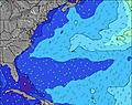 | 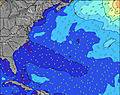 | 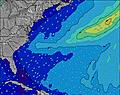 | 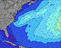 | 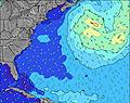 | 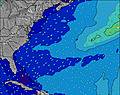 | 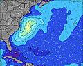 | |||||||||||||
Wave Height (m) Direction Period (s) | SE 8 | ESE 8 | ESE 8 | ESE 8 | SE 6 | ESE 7 | ESE 7 | S 5 | S 5 | SE 3 | SSE 4 | SE 6 | ESE 9 | SE 5 | SE 7 | SE 5 | SE 6 | ESE 6 | SE 4 | SE 5 |
Wave Graph | ||||||||||||||||||||
51 | 13 | 14 | 12 | 15 | 10 | 5 | 25 | 2 | 6 | 17 | 12 | 8 | 30 | 65 | 53 | 80 | 49 | 44 | 35 | |
Wind (km/h) | ||||||||||||||||||||
Wind State on-shore cross-onshore cross-shore cross-offshore off-shore glassy | cross-on | cross-off | cross-off | cross-off | off | off | off | cross-off | off | cross-on | cross-off | cross-off | cross | cross-off | cross-off | cross | cross-off | cross-off | cross-off | cross-off |
High Tide | 8:39PM1.89m | 8:47AM1.62m | 9:18PM1.90m | 9:29AM1.65m | 9:55PM1.89m | 10:10AM1.68m | 10:32PM1.87m | 10:50AM1.71m | 11:08PM1.82m | 11:30AM1.74m | 11:46PM1.76m | 12:12PM1.77m | 00:27AM1.70m | |||||||
Low Tide | 2:16PM0.20m | 3:05AM0.22m | 2:57PM0.17m | 3:41AM0.16m | 3:37PM0.15m | 4:16AM0.12m | 4:16PM0.14m | 4:51AM0.09m | 4:56PM0.15m | 5:26AM0.08m | 5:39PM0.18m | 6:05AM0.07m | 6:28PM0.22m | |||||||
— | — | 6:41 | — | — | 6:41 | — | — | 6:43 | — | — | 6:43 | — | — | 6:43 | — | — | 6:43 | — | — | |
8:22 | — | — | 8:21 | — | — | 8:21 | — | — | 8:20 | — | — | 8:19 | — | — | 8:19 | — | — | 8:17 | — | |
mm | — | — | — | — | 14 | — | 1 | 7 | 1 | 1 | 5 | 3 | 2 | 11 | — | 1 | — | 2 | 3 | 2 |
Temp °C | 33 | 31 | 32 | 36 | 34 | 30 | 34 | 29 | 29 | 32 | 29 | 30 | 31 | 27 | 27 | 30 | 28 | 27 | 30 | 26 |
Feels °C | 36 | 32 | 33 | 37 | 34 | 31 | 35 | 30 | 32 | 35 | 30 | 33 | 32 | 29 | 28 | 31 | 28 | 28 | 31 | 27 |
Swell 1 Height (m) Direction Period (s) | NE 6 | SSE 4 | ESE 8 | ESE 8 | SE 6 | ESE 7 | ESE 7 | S 5 | S 5 | E 9 | E 9 | SE 6 | ESE 9 | SE 5 | — | — | SE 6 | ESE 6 | — | ESE 8 |
1 | 11 | 14 | 12 | 15 | 10 | 5 | 25 | 2 | 2 | 6 | 12 | 8 | 30 | — | — | 80 | 49 | — | 19 | |
Swell 2 Height (m) Direction Period (s) | ENE 6 | ESE 8 | SE 4 | E 6 | — | SSE 5 | SSE 5 | NNE 4 | NE 4 | NE 4 | SE 7 | E 9 | NE 5 | ESE 8 | — | — | — | — | — | ESE 8 |
3 | 13 | 3 | 1 | — | 3 | 3 | 2 | 1 | 1 | 2 | 6 | 1 | 7 | — | — | — | — | — | 19 | |
Swell 3 Height (m) Direction Period (s) | — | NE 6 | NE 6 | — | E 6 | — | NNE 3 | E 7 | SE 7 | E 9 | — | NE 6 | — | NE 5 | — | — | — | — | — | — |
— | 1 | 1 | — | 1 | — | 1 | 1 | 2 | 1 | — | 1 | — | 1 | — | — | — | — | — | — | |
Wind waves Height (m) Direction Period (s) | SE 8 | WSW 3 | SW 3 | S 4 | SW 4 | WNW 3 | — | WSW 3 | — | SE 3 | SSE 4 | — | SE 3 | WSW 3 | SE 7 | SE 5 | — | — | SE 4 | SE 5 |
51 | 2 | 1 | 5 | 10 | 1 | — | 2 | — | 6 | 17 | — | 6 | 1 | 65 | 53 | — | — | 44 | 35 | |
Nearest Offshore or Glassy | ||||||||||||||||||||
Distance (km) | 719 | 449 | 577 | 577 | 577 | 388 | 454 | 291 | 610 | 525 | 802 | 642 | 34 | 77 | 41 | 25 | 1 | 8 | 8 | 0 |
Best forecast wave conditions in North Florida | ||||||||||||||||||||
Best forecast wave conditions in United States | ||||||||||||||||||||
Header Global | ||||||||||||||||||||
- Map Icons:
 Break
Break Live Wave Height (m)
 Live Wind Speed (km/h)
 Surf Rating (10 Max)
 Ocean Swells (m)
- Wind Speed (km/h)


FREE! Surf-Forecast.com widget for your website
The surf report / weather widget below is available to embed on third party websites free of charge and provides a summary of our The Mayport Poles surf forecast. Simply grab the html code snippet that we provide and paste it into your own site. You can choose your preferred language and metric/imperial units for the surf forecast feed to suit users of your site. Click here to get the code.
Information about the The Mayport Poles Surf forecast
The above surf forecast table for The Mayport Poles provides essential information for determining whether the surfing conditions will be good over the next 16 days. A general guide to surfing at The Mayport Poles can be found by selecting the local surf guide option on the grey menu. Our The Mayport Poles surf forecast is unique since it includes wave energy (power) that defines the real feel of the surf rather than just the height or the period. If you surf the same spot (The Mayport Poles) regularly then make a mental note of the wave energy from the surf forecast table each time you go. Very soon you may start to choose your surf days based on the wave energy alone combined with our forecast of favourable offshore wind conditions. Our star ratings will help here and of course you will also find the usual wave height and period predictions on our surf forecasts as well as a full break down of the swell components under our advanced users option (to reveal that, click the little Einstein character under the tide times).
Further information to help with frequently asked questions about our surf forecast for The Mayport Poles may be found under the help tab on the top menu and also by moving your mouse over the question marks on the surf forecast table itself. Please always bear in mind that the forecast is for near-shore open water and local factors at each surf break influence the actual breaking wave height, such as the beach / reef profile, water depths offshore and shelter.
The Mayport Poles is 10 km (6 miles) from Jacksonville Beach. If you plan a vacation in North Florida, look for hotels and other accommodation in Jacksonville Beach. Jacksonville Beach has rooms for a wide range of budgets as well as car hire and transport links.
 Nearest