

Surf Forecasts:

Pilgrim Avenue surf forecast from 3 Aug 2026:
- Best quality surf: Monday 3 Aug, 11PM (local time) - 7ft (2.1m), 8s period, S swell with cross-offshore winds.
- Most powerful swell: Monday 3 Aug, 2PM (local time) - 10ft (3.0m), 9s period, S swell with 1,291 kJ wave energy.
- Next surfable swell (1★+): Monday 3 Aug, 11PM (local time) - 7ft (2.1m), 8s period with S swell.
Best Forecast Surf Conditions for Pilgrim Avenue this week:
The surf forecast for Pilgrim Avenue over the next 16 days: The first swell (rated 1 star or higher) is forecast to arrive on Monday (Aug 03) at 11PM. The primary swell is predicted to be 2.1m and 8s period. The wind is predicted to be cross-offshore as the swell arrives.
The most powerful waves expected at Pilgrim Avenue in the next 16 days are 3.0m 9s and forecast to arrive on Monday (Aug 03) at 2PM. Winds are predicted to be cross-offshore at the time the swell arrives. The largest open ocean swell (not directed at the beach) is 1.1m 6s period and expected on Sunday (Aug 09) at 11PM.
| Wave Type | Time (EDT) & Date | Wave Height & Period |
|---|---|---|
| Next good surf (1 star+) | 11PM (Mon 3rd Aug) | 7ft (2.1m) 8s |
| Best Surf | 11PM (Mon 3rd Aug) | 7ft (2.1m) 8s |
| Most Powerful | 2PM (Mon 3rd Aug) | 10ft (3.0m) 9s |
Table - best surf conditions forecast for Pilgrim Avenue over the next 16 days.
The Lowdown
Alright folks, Rusty here. Let’s take a honest look at what’s coming our way for Pilgrim Avenue. I’m not gonna sugarcoat it—this outlook is a tough one, with a long stretch of pretty ordinary conditions.
The first real sniff of anything surfable comes on the morning of Tuesday, the 4th of August. We’ve got a 4ft swell from the south, with a period of 8 seconds. The wind is light offshore from the WSW, glassing things up nicely. The combined energy is moderate (207). It’s not pumping, but for a reef and point setup, that offshore wind will make it clean and rideable for an intermediate. The water temp is about average for the time of year, nothing crazy.
From Tuesday afternoon onward, things go flat and messy. We’ll have a few days of tiny, weak waves and mostly cross-off or cross-shore winds. The combined energy drops into double digits, barely registering. By the 7th of August, the Friday morning, there’s a pulse of 5ft from the SSW with a 7-second period, but the wind is a moderate cross-off, and the energy is still moderate (351). It’s a marginal call, not a standout.
Saturday the 8th of August starts with a tiny 3ft swell, but it fades fast. From there, we hit a major gap. From the 8th all the way through to the 14th of August, the swell is tiny—under 3ft most days—and the energy is weak. The wind is often cross-off or even cross-on, keeping the quality poor. Honestly, there’s nothing here worth paddling out for.
The end of the forecast window, around the 15th and 16th of August, sees a small bump. On the morning of Saturday the 15th, we get 4ft from the SSW with a 7-second period, but the wind is a fresh cross-shore from the SSE, making it lumpy. The energy is moderate (160). Sunday the 16th is similar in size but with cleaner cross-off winds. Still, it’s nothing special.
The only real standout in this entire 16-day window is the Tuesday morning, the 4th of August. That 4ft, 8-second south swell with that light offshore wind is the best you’re going to get for Pilgrim Avenue. It’s clean, it’s rideable, and it’s the only time the stars align. After that, it’s a long wait for the next decent pulse.
Keep your eyes on the forecasts, but for now, this is a week of rest and repair.
Rusty.
Short Range ForecastHeavy rain (total 38mm), heaviest during Mon afternoon. Warm (max 26°C on Tue afternoon, min 19°C on Mon night). Winds decreasing (strong winds from the SSW on Mon morning, calm by Tue night). | Days 5-7 Weather SummaryLight rain (total 5mm), mostly falling on Fri night. Warm (max 29°C on Sat afternoon, min 23°C on Wed night). Wind will be generally light. | ||||||||||||||||||
Monday 3 | Tuesday 4 | Wednesday 5 | Thursday 6 | Friday 7 | Saturday 8 | ||||||||||||||
Night | AM | PM | Night | AM | PM | Night | AM | PM | Night | AM | PM | Night | AM | PM | Night | AM | PM | Night | |
Swell Height Map |  |  |  |  | 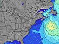 | 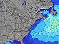 | 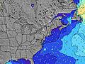 | ||||||||||||
Wave Height (m) Direction Period (s) | SSE 5 | S 8 | S 9 | S 8 | S 8 | SSW 8 | SSW 7 | S 7 | S 7 | S 7 | S 7 | SSW 6 | SSW 6 | SSW 7 | SSW 7 | SSW 6 | SSW 6 | SE 8 | SE 7 |
Wave Graph | |||||||||||||||||||
43 | 961 | 1093 | 432 | 207 | 96 | 71 | 117 | 306 | 225 | 126 | 115 | 200 | 205 | 121 | 80 | 64 | 15 | 14 | |
Wind (km/h) | |||||||||||||||||||
Wind State on-shore cross-onshore cross-shore cross-offshore off-shore glassy | cross | cross-off | cross-off | cross-off | off | cross-off | cross-off | cross | cross | cross-off | cross-off | cross-off | cross-off | cross-off | cross-off | cross-off | cross-off | cross-off | off |
High Tide | 11:14PM0.97m | 11:43AM1.02m | 11:59PM0.91m | 12:32PM1.03m | 00:49AM0.86m | 1:27PM1.04m | 1:47AM0.82m | 2:28PM1.05m | 2:52AM0.80m | 3:32PM1.08m | 4:00AM0.82m | 4:37PM1.12m | |||||||
Low Tide | 4:54AM0.01m | 5:24PM0.09m | 5:33AM0.02m | 6:16PM0.12m | 6:20AM0.04m | 7:19PM0.15m | 7:16AM0.06m | 8:35PM0.16m | 8:24AM0.07m | 10:01PM0.14m | 9:43AM0.07m | 11:18PM0.08m | |||||||
— | 5:41 | — | — | 5:43 | — | — | 5:43 | — | — | 5:45 | — | — | 5:46 | — | — | 5:47 | — | — | |
8:01 | — | 8:00 | — | — | 8:00 | — | — | 7:58 | — | — | 7:57 | — | — | 7:55 | — | — | 7:54 | — | |
mm | 3 | 4 | 13 | 6 | — | — | — | 9 | 3 | — | — | — | — | — | — | 5 | — | — | — |
Temp °C | 23 | 23 | 23 | 22 | 24 | 26 | 24 | 23 | 24 | 23 | 26 | 27 | 24 | 28 | 28 | 25 | 27 | 29 | 26 |
Feels °C | 25 | 22 | 21 | 21 | 24 | 23 | 22 | 25 | 26 | 23 | 27 | 27 | 25 | 29 | 28 | 26 | 29 | 29 | 27 |
Swell 1 Height (m) Direction Period (s) | SE 6 | — | — | S 8 | S 8 | SSW 8 | SSW 7 | SSW 8 | E 10 | — | SE 6 | SSE 8 | ESE 8 | SSW 7 | SE 8 | SSW 6 | SSW 6 | SE 8 | SE 7 |
10 | — | — | 432 | 207 | 96 | 71 | 92 | 2 | — | 18 | 6 | 6 | 137 | 9 | 80 | 64 | 15 | 14 | |
Swell 2 Height (m) Direction Period (s) | — | — | — | — | — | SE 7 | SSE 7 | E 10 | — | — | SE 8 | — | — | SE 7 | E 9 | SE 8 | SE 8 | E 8 | E 8 |
— | — | — | — | — | 37 | 29 | 2 | — | — | 2 | — | — | 9 | 2 | 10 | 16 | 1 | 1 | |
Swell 3 Height (m) Direction Period (s) | — | — | — | — | — | — | E 12 | — | — | — | E 11 | — | — | — | — | — | E 8 | — | — |
— | — | — | — | — | — | 3 | — | — | — | 2 | — | — | — | — | — | 1 | — | — | |
Wind waves Height (m) Direction Period (s) | SSE 5 | S 8 | S 9 | — | — | — | — | S 7 | S 7 | S 7 | S 7 | SSW 6 | SSW 6 | SSW 7 | SSW 7 | — | — | SSW 6 | SSW 6 |
43 | 961 | 1093 | — | — | — | — | 117 | 306 | 225 | 126 | 115 | 200 | 205 | 121 | — | — | 36 | 36 | |
Nearest Offshore or Glassy | |||||||||||||||||||
Distance (km) | 1226 | 1552 | 234 | 0 | 0 | 23 | 0 | 23 | 23 | 23 | 23 | 23 | 178 | 237 | 23 | 237 | 0 | 420 | 237 |
Best forecast wave conditions in Rhode Island | |||||||||||||||||||
Best forecast wave conditions in United States | |||||||||||||||||||
Header Global | |||||||||||||||||||
- Map Icons:
 Break
Break Live Wave Height (m)
 Live Wind Speed (km/h)
 Surf Rating (10 Max)
 Ocean Swells (m)
- Wind Speed (km/h)
Latest Updates


FREE! Surf-Forecast.com widget for your website
The surf report / weather widget below is available to embed on third party websites free of charge and provides a summary of our Pilgrim Avenue surf forecast. Simply grab the html code snippet that we provide and paste it into your own site. You can choose your preferred language and metric/imperial units for the surf forecast feed to suit users of your site. Click here to get the code.
Information about the Pilgrim Avenue Surf forecast
The above surf forecast table for Pilgrim Avenue provides essential information for determining whether the surfing conditions will be good over the next 16 days. A general guide to surfing at Pilgrim Avenue can be found by selecting the local surf guide option on the grey menu. Our Pilgrim Avenue surf forecast is unique since it includes wave energy (power) that defines the real feel of the surf rather than just the height or the period. If you surf the same spot (Pilgrim Avenue) regularly then make a mental note of the wave energy from the surf forecast table each time you go. Very soon you may start to choose your surf days based on the wave energy alone combined with our forecast of favourable offshore wind conditions. Our star ratings will help here and of course you will also find the usual wave height and period predictions on our surf forecasts as well as a full break down of the swell components under our advanced users option (to reveal that, click the little Einstein character under the tide times).
Further information to help with frequently asked questions about our surf forecast for Pilgrim Avenue may be found under the help tab on the top menu and also by moving your mouse over the question marks on the surf forecast table itself. Please always bear in mind that the forecast is for near-shore open water and local factors at each surf break influence the actual breaking wave height, such as the beach / reef profile, water depths offshore and shelter.
Pilgrim Avenue is 8 km (5 miles) from Narragansett Pier. If you plan a vacation in Rhode Island, look for hotels and other accommodation in Narragansett Pier. Narragansett Pier has rooms for a wide range of budgets as well as car hire and transport links.
 Nearest