

Surf Forecasts:

Updates in hr min s Forecast update imminent
Alright, grab a coffee, let's have a look at what's ahead for Mackinac Island. To be straight with you, this isn't going to be a week for surfing. There just isn't any surf to speak of across the entire sixteen-day stretch. It's a total flat spell. The energy levels are zero, no height readings, nothing – literally all the "combined energy of all swells directed here" figures sit at 0 (zero). Not even a ripple worth chasing. You’re looking at a stretch from Sunday, July 5th all the way through Monday, July 20th with nothing to paddle for.
When it's like this, the wind and conditions are almost irrelevant for surfing. We do see some glassy moments, like Tuesday morning, July 7th, with a slight southerly breeze making it look calm, and again on Thursday afternoon, July 9th, with that glassy feel from the SSW, but there's no swell to hold it up. Even the few offshore days, like Wednesday morning, July 8th, with a WSW breeze, or the fresh offshore winds on Monday morning, July 13th, gusting at 22 mph from the SW, can't change the fact that there’s zero wave energy.
Inconsistent is an understatement here. This spot rarely breaks and this forecast proves why. It’s more of a lake condition outlook than a surf forecast right now. For paddle surfing, we’re completely out of luck. If the wind cranks up, maybe the setup gets interesting for kiteboarding, but for us wave riders, it’s a solid no-go.
Honestly, these blank runs are more normal for the area when it’s not feeding from the right direction, so don't be too surprised. Keep an eye on the charts though, things can turn around.
- Rusty
Short Range ForecastMostly dry. Warm (max 23°C on Mon night, min 17°C on Sun morning). Wind will be generally light. | Days 5-7 Weather SummaryModerate rain (total 16mm), heaviest on Wed night. Warm (max 23°C on Thu afternoon, min 17°C on Wed night). Wind will be generally light. | ||||||||||||||||||||
Sunday 5 | Monday 6 | Tuesday 7 | Wednesday 8 | Thursday 9 | Friday 10 | Sat 11 | |||||||||||||||
Night | AM | PM | Night | AM | PM | Night | AM | PM | Night | AM | PM | Night | AM | PM | Night | AM | PM | Night | AM | PM | |
Swell Height Map | 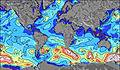 | 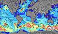 | 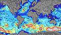 | 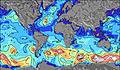 | 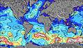 | 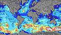 | 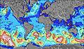 | 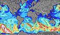 | |||||||||||||
Wave Height (m) Direction Period (s) | — | — | — | — | — | — | — | — | — | — | — | — | — | — | — | — | — | — | — | — | — |
Wave Graph | |||||||||||||||||||||
0 | 0 | 0 | 0 | 0 | 0 | 0 | 0 | 0 | 0 | 0 | 0 | 0 | 0 | 0 | 0 | 0 | 0 | 0 | 0 | 0 | |
Wind (km/h) | |||||||||||||||||||||
Wind State on-shore cross-onshore cross-shore cross-offshore off-shore glassy | cross-on | on | cross-on | cross-on | on | cross-on | cross-off | glassy | cross-off | cross-off | off | off | cross-on | cross-on | glassy | cross | cross-on | cross-on | cross-on | cross-on | cross-off |
High Tide | |||||||||||||||||||||
Low Tide | |||||||||||||||||||||
— | 5:52 | — | — | 5:54 | — | — | 5:54 | — | — | 5:56 | — | — | 5:56 | — | — | 5:56 | — | — | 5:58 | — | |
9:30 | — | — | 9:29 | — | — | 9:29 | — | — | 9:29 | — | — | 9:28 | — | — | 9:28 | — | — | 9:27 | — | 9:27 | |
mm | — | — | — | — | — | — | — | — | — | — | — | 7 | 9 | — | — | — | — | — | — | — | — |
Temp °C | 21 | 18 | 21 | 22 | 18 | 22 | 23 | 21 | 21 | 22 | 22 | 20 | 20 | 18 | 23 | 23 | 19 | 23 | 20 | 18 | 22 |
Feels °C | 22 | 15 | 18 | 21 | 17 | 21 | 22 | 21 | 21 | 21 | 21 | 20 | 22 | 18 | 23 | 22 | 17 | 22 | 15 | 16 | 20 |
Swell 1 Height (m) Direction Period (s) | — | — | — | — | — | — | — | — | — | — | — | — | — | — | — | — | — | — | — | — | — |
— | — | — | — | — | — | — | — | — | — | — | — | — | — | — | — | — | — | — | — | — | |
Swell 2 Height (m) Direction Period (s) | — | — | — | — | — | — | — | — | — | — | — | — | — | — | — | — | — | — | — | — | — |
— | — | — | — | — | — | — | — | — | — | — | — | — | — | — | — | — | — | — | — | — | |
Swell 3 Height (m) Direction Period (s) | — | — | — | — | — | — | — | — | — | — | — | — | — | — | — | — | — | — | — | — | — |
— | — | — | — | — | — | — | — | — | — | — | — | — | — | — | — | — | — | — | — | — | |
Wind waves Height (m) Direction Period (s) | — | — | — | — | — | — | — | — | — | — | — | — | — | — | — | — | — | — | — | — | — |
— | — | — | — | — | — | — | — | — | — | — | — | — | — | — | — | — | — | — | — | — | |
Nearest Offshore or Glassy | |||||||||||||||||||||
Distance (km) | 1065 | 1133 | 2236 | 1065 | 1454 | 2236 | 1082 | 1116 | 2217 | 1042 | 1036 | 1172 | 1035 | 1043 | 1842 | 1042 | 1042 | 1045 | 1029 | 1029 | 1129 |
Best forecast wave conditions in Lake Huron - United States | |||||||||||||||||||||
Best forecast wave conditions in United States | |||||||||||||||||||||
Header Global | |||||||||||||||||||||
- Map Icons:
 Break
Break Live Wave Height (m)
 Live Wind Speed (km/h)
 Surf Rating (10 Max)
 Ocean Swells (m)
- Wind Speed (km/h)


FREE! Surf-Forecast.com widget for your website
The surf report / weather widget below is available to embed on third party websites free of charge and provides a summary of our Mackinac Island surf forecast. Simply grab the html code snippet that we provide and paste it into your own site. You can choose your preferred language and metric/imperial units for the surf forecast feed to suit users of your site. Click here to get the code.
Information about the Mackinac Island Surf forecast
The above surf forecast table for Mackinac Island provides essential information for determining whether the surfing conditions will be good over the next 16 days. A general guide to surfing at Mackinac Island can be found by selecting the local surf guide option on the grey menu. Our Mackinac Island surf forecast is unique since it includes wave energy (power) that defines the real feel of the surf rather than just the height or the period. If you surf the same spot (Mackinac Island) regularly then make a mental note of the wave energy from the surf forecast table each time you go. Very soon you may start to choose your surf days based on the wave energy alone combined with our forecast of favourable offshore wind conditions. Our star ratings will help here and of course you will also find the usual wave height and period predictions on our surf forecasts as well as a full break down of the swell components under our advanced users option (to reveal that, click the little Einstein character under the tide times).
Further information to help with frequently asked questions about our surf forecast for Mackinac Island may be found under the help tab on the top menu and also by moving your mouse over the question marks on the surf forecast table itself. Please always bear in mind that the forecast is for near-shore open water and local factors at each surf break influence the actual breaking wave height, such as the beach / reef profile, water depths offshore and shelter.
Are you planning a vacation in Lake Huron - United States? If you are looking for accommodation near Mackinac Island, camping, hotels and condos and appartments in Lake Huron - United States, consider staying in Sault Sainte Marie which is 84 km (52 miles) away.
 Nearest