
Surf Forecasts:

Cabrillo Point surf forecast from 2 Aug 2026:
- Best quality surf: Sunday 9 Aug, 5AM (local time) - 2ft (0.6m), 16s period, SSW swell with glassy winds.
- Most powerful swell: Saturday 8 Aug, 5AM (local time) - 2ft (0.6m), 18s period, SSW swell with 240 kJ wave energy.
- Next surfable swell (1★+): Sunday 9 Aug, 5AM (local time) - 2ft (0.6m), 16s period with SSW swell.
Best Forecast Surf Conditions for Cabrillo Point this week:
The surf forecast for Cabrillo Point over the next 16 days: The first swell (rated 1 star or higher) is forecast to arrive on Sunday (Aug 09) at 5AM. The primary swell is predicted to be 0.6m and 16s period with a secondary swell of 0.4m and 12s. The wind is predicted to be glassy as the swell arrives.
The most powerful waves expected at Cabrillo Point in the next 16 days are 0.6m 18s and forecast to arrive on Saturday (Aug 08) at 5AM. Winds are predicted to be cross-onshore at the time the swell arrives.
| Wave Type | Time (PDT) & Date | Wave Height & Period |
|---|---|---|
| Next good surf (1 star+) | 5AM (Sun 9th Aug) | 2ft (0.6m) 16s |
| Best Surf | 5AM (Sun 9th Aug) | 2ft (0.6m) 16s |
| Most Powerful | 5AM (Sat 8th Aug) | 2ft (0.6m) 18s |
Table - best surf conditions forecast for Cabrillo Point over the next 16 days.
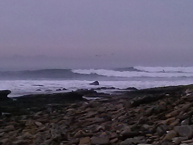
The Lowdown
Well, grab a coffee, because this is going to be a quiet one. I’ve scanned the full 16-day window for Cabrillo Point, and honestly, it’s a tough stretch. The forecast is a flat spell with nothing rideable worth paddling out for. The swell is tiny, barely scraping 2 ft at best, and the wave energy is weak to moderate at best—most days you’re looking at combined energy around 94 to 115 (moderate), and even the slightly higher pulses like 233 or 331 are still paired with poor surf conditions. The water temperature is about average for the time of year, nothing unusual there.
The winds are a constant issue too. It’s mostly cross-onshore or onshore, with a few afternoons going cross-shore, but the surf quality is labelled “poor” every single day. The swell direction is mostly from the SW, which is what this sheltered point needs, but there’s just no size or power to work with. The swell periods are long, up to 18–20 seconds, but with heights under 2 ft for most of the first week, it’s just a long-period groundswell that doesn’t have enough oomph to break properly. The waves will be mushy, short, and hard to catch.
The only real change comes around the second week. From Friday, August 14th, the swell height edges up to 2 ft–2 ft, still from the SSW, and the combined energy jumps into the 200–300 range, which is moderate. But the wind stays westerly, often cross or cross-onshore, and the surf quality remains poor. The period is still long—15–18 seconds—so for a point break like this, the long period might help shape a bit, but with such small swell, it’s still a non-starter.
There’s no standout here. No day where the stars align. If you’re desperate for a paddle, maybe the morning of Sunday, August 16th, with light winds and a 2 ft SW swell, but even then, it’s just a flat, messy affair. For a spot that’s inconsistent and rarely breaks, this is just a typical blank run. The forecast can change, but right now, there’s nothing to get excited about. I’d save your energy and check back in a week or so.
Rusty.
Short Range ForecastMostly dry. Warm (max 24°C on Mon afternoon, min 20°C on Sat night). Wind will be generally light. | Days 5-7 Weather SummaryMostly dry. Warm (max 23°C on Wed afternoon, min 20°C on Wed night). Wind will be generally light. | ||||||||||||||||||
Sunday 2 | Monday 3 | Tuesday 4 | Wednesday 5 | Thursday 6 | Friday 7 | ||||||||||||||
Night | AM | PM | Night | AM | PM | Night | AM | PM | Night | AM | PM | Night | AM | PM | Night | AM | PM | Night | |
Swell Height Map |  |  |  |  |  |  |  | ||||||||||||
Wave Height (m) Direction Period (s) | SSW 10 | SW 14 | SW 18 | SW 13 | SW 13 | SW 13 | SW 12 | SW 15 | SW 15 | SW 14 | SW 14 | SW 14 | SW 14 | SW 13 | SW 13 | SW 18 | SSW 19 | SSW 19 | SSW 18 |
Wave Graph | |||||||||||||||||||
32 | 47 | 49 | 44 | 43 | 42 | 41 | 60 | 56 | 102 | 71 | 70 | 69 | 62 | 61 | 81 | 146 | 143 | 174 | |
Wind (km/h) | |||||||||||||||||||
Wind State on-shore cross-onshore cross-shore cross-offshore off-shore glassy | cross-on | on | cross-on | glassy | on | cross-on | glassy | cross-on | cross | glassy | cross-on | cross | cross-on | cross-on | cross-on | cross-on | on | on | on |
High Tide | 11:25PM1.58m | 12:38PM1.43m | 00:06AM1.39m | 1:11PM1.49m | 00:59AM1.17m | 1:50PM1.55m | 2:18AM0.95m | 2:42PM1.61m | 4:41AM0.83m | 3:47PM1.67m | 7:07AM0.91m | 5:01PM1.77m | |||||||
Low Tide | 6:08AM0.09m | 6:21PM0.57m | 6:33AM0.24m | 7:24PM0.55m | 7:00AM0.41m | 8:47PM0.49m | 7:30AM0.58m | 10:28PM0.37m | 8:13AM0.74m | 11:58PM0.18m | 9:43AM0.86m | 1:03AM-0.03m | |||||||
— | 6:05 | — | — | 6:05 | — | — | 6:07 | — | — | 6:07 | — | — | 6:07 | — | — | 6:09 | — | — | |
— | — | 7:52 | — | — | 7:51 | — | — | 7:51 | — | — | 7:50 | — | — | 7:49 | — | — | 7:47 | — | |
mm | — | — | — | — | — | — | — | — | — | — | — | — | — | — | — | — | — | — | — |
Temp °C | 22 | 22 | 23 | 23 | 22 | 24 | 22 | 22 | 23 | 22 | 22 | 23 | 22 | 21 | 22 | 21 | 21 | 21 | 21 |
Feels °C | 22 | 23 | 23 | 24 | 23 | 24 | 22 | 23 | 22 | 22 | 23 | 22 | 21 | 21 | 22 | 22 | 21 | 21 | 21 |
Swell 1 Height (m) Direction Period (s) | W 6 | W 6 | W 6 | W 6 | W 6 | SW 13 | W 5 | W 5 | SW 12 | W 5 | W 5 | SW 14 | W 5 | SW 13 | SW 13 | SW 13 | SSW 19 | SSW 13 | SSW 18 |
15 | 17 | 16 | 23 | 22 | 42 | 13 | 8 | 37 | 16 | 11 | 70 | 17 | 62 | 61 | 60 | 146 | 65 | 174 | |
Swell 2 Height (m) Direction Period (s) | SSW 10 | SW 14 | SW 13 | SW 13 | SW 13 | SW 16 | SW 12 | SW 12 | SW 15 | SW 14 | SW 14 | SSW 11 | SW 14 | W 5 | WSW 5 | W 5 | SW 13 | SSW 19 | SW 12 |
32 | 47 | 45 | 44 | 43 | 41 | 38 | 37 | 56 | 102 | 71 | 12 | 69 | 7 | 4 | 7 | 83 | 143 | 36 | |
Swell 3 Height (m) Direction Period (s) | SSW 13 | SSW 12 | SW 18 | SSW 12 | SW 16 | S 11 | SW 16 | SW 15 | — | S 10 | SSW 13 | S 12 | SW 20 | SSW 20 | SSW 20 | SW 18 | W 5 | WSW 4 | SSW 13 |
32 | 30 | 49 | 28 | 42 | 9 | 41 | 60 | — | 2 | 16 | 3 | 15 | 37 | 39 | 81 | 4 | 4 | 35 | |
Wind waves Height (m) Direction Period (s) | — | — | — | — | — | W 6 | — | — | W 5 | — | — | W 4 | — | — | W 5 | — | — | W 4 | — |
— | — | — | — | — | 15 | — | — | 13 | — | — | 12 | — | — | 11 | — | — | 4 | — | |
Nearest Offshore or Glassy | |||||||||||||||||||
Distance (km) | 31 | 15 | 77 | 15 | 15 | 132 | 14 | 15 | 56 | 4 | 151 | 151 | 15 | 15 | 69 | 15 | 15 | 15 | 15 |
Best forecast wave conditions in Los Angeles County | |||||||||||||||||||
Best forecast wave conditions in United States | |||||||||||||||||||
Header Global | |||||||||||||||||||
- Map Icons:
 Break
Break Live Wave Height (m)
 Live Wind Speed (km/h)
 Surf Rating (10 Max)
 Ocean Swells (m)
- Wind Speed (km/h)
Latest Updates


FREE! Surf-Forecast.com widget for your website
The surf report / weather widget below is available to embed on third party websites free of charge and provides a summary of our Cabrillo Point surf forecast. Simply grab the html code snippet that we provide and paste it into your own site. You can choose your preferred language and metric/imperial units for the surf forecast feed to suit users of your site. Click here to get the code.
Information about the Cabrillo Point Surf forecast
The above surf forecast table for Cabrillo Point provides essential information for determining whether the surfing conditions will be good over the next 16 days. A general guide to surfing at Cabrillo Point can be found by selecting the local surf guide option on the grey menu. Our Cabrillo Point surf forecast is unique since it includes wave energy (power) that defines the real feel of the surf rather than just the height or the period. If you surf the same spot (Cabrillo Point) regularly then make a mental note of the wave energy from the surf forecast table each time you go. Very soon you may start to choose your surf days based on the wave energy alone combined with our forecast of favourable offshore wind conditions. Our star ratings will help here and of course you will also find the usual wave height and period predictions on our surf forecasts as well as a full break down of the swell components under our advanced users option (to reveal that, click the little Einstein character under the tide times).
Further information to help with frequently asked questions about our surf forecast for Cabrillo Point may be found under the help tab on the top menu and also by moving your mouse over the question marks on the surf forecast table itself. Please always bear in mind that the forecast is for near-shore open water and local factors at each surf break influence the actual breaking wave height, such as the beach / reef profile, water depths offshore and shelter.
Cabrillo Point is 9 km (6 miles) from Long Beach. If you plan a vacation in Los Angeles County, look for hotels and other accommodation in Long Beach. Long Beach has rooms for a wide range of budgets as well as car hire and transport links.
 Nearest