

Surf Forecasts:

Short Range ForecastMostly dry. Warm (max 34°C on Mon afternoon, min 25°C on Mon morning). Wind will be generally light. | |||||||||||||||||||||||
Monday 3 | Tuesday 4 | Wednesday 5 | |||||||||||||||||||||
5 AM | 8 AM | 11 AM | 2 PM | 5 PM | 8 PM | 11 PM | 2 AM | 5 AM | 8 AM | 11 AM | 2 PM | 5 PM | 8 PM | 11 PM | 2 AM | 5 AM | 8 AM | 11 AM | 2 PM | 5 PM | 8 PM | 11 PM | |
Swell Height Map |  |  |  |  | 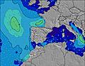 |  |  | 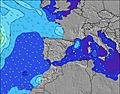 |  | ||||||||||||||
Wave Height (m) Direction Period (s) | SE 4 | SE 4 | SE 4 | SSE 3 | SSE 4 | S 4 | S 4 | ESE 4 | SSW 3 | S 5 | SW 5 | S 5 | NNE 2 | N 3 | N 4 | N 4 | N 4 | N 4 | N 4 | NNE 2 | NNE 3 | NNE 4 | NNE 4 |
Wave Graph | |||||||||||||||||||||||
0 | 0 | 0 | 0 | 0 | 0 | 0 | 2 | 0 | 0 | 0 | 0 | 1 | 1 | 1 | 1 | 1 | 1 | 1 | 1 | 1 | 1 | 3 | |
Wind (km/h) | |||||||||||||||||||||||
Wind State on-shore cross-onshore cross-shore cross-offshore off-shore glassy | glassy | glassy | cross | cross-off | cross-off | cross-on | cross-off | cross-on | glassy | cross | on | on | on | cross-on | glassy | on | on | on | on | cross-on | cross-on | cross-on | cross-off |
High Tide | 12:25PM0.12m | 00:51AM0.18m | 1:25PM0.12m | 1:20AM0.16m | 2:37PM0.13m | ||||||||||||||||||
Low Tide | 7:08AM0.05m | 6:02PM0.04m | 7:38AM0.05m | 6:51PM0.06m | 8:14AM0.04m | 7:56PM0.08m | |||||||||||||||||
6:47 | — | — | — | — | — | — | — | 6:48 | — | — | — | — | — | — | — | 6:48 | — | — | — | — | — | — | |
— | — | — | — | — | 8:58 | — | — | — | — | — | — | — | 8:57 | — | — | — | — | — | — | — | 8:55 | — | |
mm | — | — | — | — | — | — | — | — | — | — | — | — | — | — | — | — | — | — | — | — | — | — | — |
Temp °C | 25 | 25 | 30 | 34 | 34 | 29 | 28 | 27 | 26 | 26 | 28 | 28 | 29 | 28 | 27 | 27 | 26 | 26 | 28 | 29 | 30 | 29 | 28 |
Feels °C | 30 | 29 | 33 | 34 | 36 | 32 | 30 | 31 | 31 | 31 | 31 | 31 | 31 | 32 | 32 | 31 | 30 | 29 | 30 | 30 | 31 | 31 | 31 |
Swell 1 Height (m) Direction Period (s) | SE 4 | SE 4 | — | — | — | SE 4 | — | SSW 4 | SSW 3 | SE 4 | SE 4 | SE 4 | NNE 2 | N 3 | N 4 | N 4 | SSW 7 | SSW 6 | SSW 6 | SSW 6 | NNE 3 | NNE 4 | NNE 4 |
4 | 4 | — | — | — | 3 | — | 2 | 1 | 1 | 1 | 1 | 1 | 1 | 1 | 1 | 4 | 4 | 3 | 3 | 1 | 1 | 3 | |
Swell 2 Height (m) Direction Period (s) | — | — | — | — | — | — | — | ESE 4 | SE 4 | — | SW 5 | S 5 | — | — | — | SSW 7 | N 4 | — | — | — | S 5 | — | — |
— | — | — | — | — | — | — | 2 | 1 | — | 1 | 1 | — | — | — | 5 | 1 | — | — | — | 1 | — | — | |
Swell 3 Height (m) Direction Period (s) | — | — | — | — | — | — | — | — | — | S 5 | — | — | S 5 | — | — | — | — | W 9 | — | — | SW 8 | — | — |
— | — | — | — | — | — | — | — | — | 1 | — | — | 1 | — | — | — | — | 2 | — | — | 2 | — | — | |
Wind waves Height (m) Direction Period (s) | — | — | SE 4 | SSE 3 | SSE 4 | S 4 | S 4 | SW 4 | — | — | — | — | — | — | — | — | — | N 4 | N 4 | NNE 2 | — | — | — |
— | — | 4 | 8 | 14 | 10 | 7 | 6 | — | — | — | — | — | — | — | — | — | 1 | 1 | 1 | — | — | — | |
Nearest Offshore or Glassy | |||||||||||||||||||||||
Distance (km) | 527 | 527 | 574 | 1056 | 1002 | 947 | 598 | 583 | 527 | 599 | 527 | 1056 | 1074 | 870 | 527 | 527 | 527 | 574 | 574 | 878 | 731 | 731 | 640 |
Best forecast wave conditions in Balearic Islands (Islas Baleares) | |||||||||||||||||||||||
Best forecast wave conditions in Spain (Europe) | |||||||||||||||||||||||
Header Global | |||||||||||||||||||||||
- Map Icons:
 Break
Break Live Wave Height (m)
 Live Wind Speed (km/h)
 Surf Rating (10 Max)
 Ocean Swells (m)
- Wind Speed (km/h)
Latest Updates


FREE! Surf-Forecast.com widget for your website
The surf report / weather widget below is available to embed on third party websites free of charge and provides a summary of our Mallorca - Son Serra Nova surf forecast. Simply grab the html code snippet that we provide and paste it into your own site. You can choose your preferred language and metric/imperial units for the surf forecast feed to suit users of your site. Click here to get the code.
 Nearest