

Surf Forecasts:

Mallorca - Son Serra Nova surf forecast from 3 Aug 2026:
- Best quality surf: Friday 7 Aug, 2AM (local time) - 2.5ft (0.8m), 6s period, N swell with glassy winds.
- Most powerful swell: Thursday 6 Aug, 11PM (local time) - 2.5ft (0.8m), 7s period, NNE swell with 58 kJ wave energy.
- Next surfable swell (1★+): Friday 7 Aug, 2AM (local time) - 2.5ft (0.8m), 6s period with N swell.
Best Forecast Surf Conditions for Mallorca - Son Serra Nova this week:
The surf forecast for Mallorca - Son Serra Nova over the next 16 days: The first swell (rated 1 star or higher) is forecast to arrive on Friday (Aug 07) at 2AM. The primary swell is predicted to be 0.8m and 6s period. The wind is predicted to be glassy as the swell arrives.
The most powerful waves expected at Mallorca - Son Serra Nova in the next 16 days are 0.8m 7s and forecast to arrive on Thursday (Aug 06) at 11PM. Winds are predicted to be cross-onshore at the time the swell arrives. The largest open ocean swell (not directed at the beach) is 0.7m 4s period and expected on Monday (Aug 03) at 5PM.
| Wave Type | Time (CEST) & Date | Wave Height & Period |
|---|---|---|
| Next good surf (1 star+) | 2AM (Fri 7th Aug) | 2.5ft (0.8m) 6s |
| Best Surf | 2AM (Fri 7th Aug) | 2.5ft (0.8m) 6s |
| Most Powerful | 11PM (Thu 6th Aug) | 2.5ft (0.8m) 7s |
Table - best surf conditions forecast for Mallorca - Son Serra Nova over the next 16 days.
The Lowdown
Alright folks, Rusty here. Let’s be straight with you – it’s a tough stretch for the island. There’s a long, quiet gap from now until the second week, so patience is the name of the game.
We’re looking at Mallorca - Son Serra Nova (Spain) and honestly, the first week and a half is a write-off. The water is very warm, sitting at 84°F which is a huge 6°F warmer than usual for this time of year – feels like a bath, but the ocean is flat. From Monday 3rd of August through to Friday 14th, we’re staring at a desert. The swell is either non-existent or tiny—0.7ft to 2ft at best—with periods so short (2 to 6 seconds) they barely qualify as waves. The combined energy is laughable, well under 100 (0-44) for the whole period. Even on the mornings where the wind goes glassy, there’s just nothing to ride. It’s a frustrating stretch of flat, clean, glassy water with no push.
The only glimmer of hope, and it’s a long-shot, comes on Saturday 15th August. The morning sees a jump in swell to 7ft from the NNE with a period of 7 seconds. The combined energy finally hits a respectable 403. This is a solid pulse, but it’s big. At 7ft, with that short period, it’s going to be a lumpy, powerful shorebreak. This is strictly for experienced surfers only. The wind is light cross-onshore from the NNW, which will keep it from being totally clean. The afternoon pushes 6ft and 438 energy, but it turns onshore from the NE. Honestly, at this size with that wind, this spot might be more fun for the kite surfers than a paddle surfer. For a surf, it’s a high-risk, low-quality option.
Later in the window, on Monday 18th August, the swell drops away again. It’s a real shame because the 17th has a nice SSW offshore wind in the morning (9 mph) but the swell is tiny and weak. The whole 16-day outlook is a bust. We’ve got a huge gap of flatness, then one day of messy, big swell, then back to nothing. Sometimes it’s just like this.
Rusty.
Short Range ForecastMostly dry. Warm (max 35°C on Mon afternoon, min 26°C on Mon morning). Wind will be generally light. | Days 4-6 Weather SummaryMostly dry. Warm (max 33°C on Sat afternoon, min 26°C on Thu night). Wind will be generally light. | ||||||||||||||||||||
Monday 3 | Tuesday 4 | Wednesday 5 | Thursday 6 | Friday 7 | Saturday 8 | Sunday 9 | |||||||||||||||
AM | PM | Night | AM | PM | Night | AM | PM | Night | AM | PM | Night | AM | PM | Night | AM | PM | Night | AM | PM | Night | |
Swell Height Map |  |  |  | 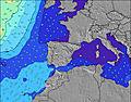 | 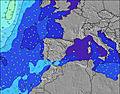 | 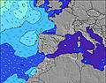 | 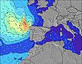 | ||||||||||||||
Wave Height (m) Direction Period (s) | SE 4 | SSE 3 | SE 4 | SW 5 | S 6 | SSW 7 | N 2 | NNE 3 | NNE 5 | N 5 | NNE 4 | N 6 | N 6 | NNE 5 | NNE 6 | NNE 5 | NNE 5 | SSE 4 | SSE 4 | SE 5 | SE 5 |
Wave Graph | |||||||||||||||||||||
0 | 0 | 0 | 0 | 0 | 0 | 1 | 2 | 8 | 4 | 2 | 51 | 16 | 8 | 10 | 5 | 2 | 0 | 0 | 0 | 0 | |
Wind (km/h) | |||||||||||||||||||||
Wind State on-shore cross-onshore cross-shore cross-offshore off-shore glassy | glassy | cross-off | glassy | glassy | on | glassy | on | cross-on | glassy | on | cross-on | glassy | glassy | cross-on | off | off | cross | off | off | cross-off | off |
High Tide | 12:25PM0.12m | 00:51AM0.18m | 1:25PM0.12m | 1:20AM0.16m | 2:37PM0.13m | 1:55AM0.15m | 4:04PM0.14m | 2:40AM0.13m | 5:36PM0.16m | 6:50PM0.18m | 5:25AM0.10m | 7:49PM0.20m | |||||||||
Low Tide | 6:02PM0.04m | 7:38AM0.05m | 6:51PM0.06m | 8:14AM0.04m | 7:56PM0.08m | 8:57AM0.04m | 9:41PM0.10m | 9:53AM0.03m | 00:03AM0.10m | 10:57AM0.03m | 1:52AM0.09m | 12:03PM0.02m | 2:51AM0.08m | ||||||||
6:47 | — | — | 6:48 | — | — | 6:48 | — | — | 6:50 | — | — | 6:50 | — | — | 6:52 | — | — | 6:52 | — | — | |
— | 8:58 | — | — | 8:57 | — | — | 8:55 | — | — | 8:54 | — | — | 8:53 | — | — | 8:52 | — | — | 8:51 | — | |
mm | — | — | — | — | — | — | — | — | — | — | — | — | — | — | — | — | — | — | — | — | — |
Temp °C | 30 | 35 | 29 | 29 | 29 | 29 | 28 | 29 | 28 | 28 | 29 | 28 | 29 | 30 | 30 | 30 | 33 | 30 | 32 | 36 | 32 |
Feels °C | 32 | 34 | 33 | 32 | 31 | 31 | 30 | 30 | 31 | 29 | 28 | 30 | 31 | 32 | 31 | 32 | 32 | 29 | 33 | 33 | 31 |
Swell 1 Height (m) Direction Period (s) | SE 4 | — | SE 4 | SE 4 | — | SSW 7 | SSW 6 | SSW 6 | NNE 5 | N 5 | E 5 | N 6 | N 6 | NNE 5 | NNE 6 | NNE 5 | NNE 5 | SSE 4 | — | SSE 5 | SE 5 |
4 | — | 2 | 1 | — | 5 | 4 | 3 | 8 | 4 | 1 | 51 | 16 | 8 | 10 | 5 | 2 | 3 | — | 8 | 18 | |
Swell 2 Height (m) Direction Period (s) | — | — | — | — | S 6 | — | — | — | — | — | SW 6 | — | — | — | — | — | — | — | — | — | — |
— | — | — | — | 1 | — | — | — | — | — | 1 | — | — | — | — | — | — | — | — | — | — | |
Swell 3 Height (m) Direction Period (s) | — | — | — | SW 5 | — | — | — | — | — | E 6 | SW 5 | SW 6 | — | — | — | — | — | — | — | — | — |
— | — | — | 1 | — | — | — | — | — | 1 | 1 | 1 | — | — | — | — | — | — | — | — | — | |
Wind waves Height (m) Direction Period (s) | — | SSE 3 | SSW 4 | — | — | — | N 2 | NNE 3 | — | — | NNE 4 | — | — | — | — | — | SE 3 | — | SSE 4 | SE 5 | — |
— | 9 | 2 | — | — | — | 1 | 2 | — | — | 2 | — | — | — | — | — | 2 | — | 7 | 11 | — | |
Nearest Offshore or Glassy | |||||||||||||||||||||
Distance (km) | 527 | 1002 | 579 | 527 | 1021 | 574 | 574 | 698 | 575 | 574 | 640 | 0 | 433 | 640 | 434 | 434 | 1066 | 228 | 663 | 1007 | 583 |
Best forecast wave conditions in Balearic Islands (Islas Baleares) | |||||||||||||||||||||
Best forecast wave conditions in Spain (Europe) | |||||||||||||||||||||
Header Global | |||||||||||||||||||||
- Map Icons:
 Break
Break Live Wave Height (m)
 Live Wind Speed (km/h)
 Surf Rating (10 Max)
 Ocean Swells (m)
- Wind Speed (km/h)
Latest Updates


FREE! Surf-Forecast.com widget for your website
The surf report / weather widget below is available to embed on third party websites free of charge and provides a summary of our Mallorca - Son Serra Nova surf forecast. Simply grab the html code snippet that we provide and paste it into your own site. You can choose your preferred language and metric/imperial units for the surf forecast feed to suit users of your site. Click here to get the code.
Information about the Mallorca - Son Serra Nova Surf forecast
The above surf forecast table for Mallorca - Son Serra Nova provides essential information for determining whether the surfing conditions will be good over the next 16 days. A general guide to surfing at Mallorca - Son Serra Nova can be found by selecting the local surf guide option on the grey menu. Our Mallorca - Son Serra Nova surf forecast is unique since it includes wave energy (power) that defines the real feel of the surf rather than just the height or the period. If you surf the same spot (Mallorca - Son Serra Nova) regularly then make a mental note of the wave energy from the surf forecast table each time you go. Very soon you may start to choose your surf days based on the wave energy alone combined with our forecast of favourable offshore wind conditions. Our star ratings will help here and of course you will also find the usual wave height and period predictions on our surf forecasts as well as a full break down of the swell components under our advanced users option (to reveal that, click the little Einstein character under the tide times).
Further information to help with frequently asked questions about our surf forecast for Mallorca - Son Serra Nova may be found under the help tab on the top menu and also by moving your mouse over the question marks on the surf forecast table itself. Please always bear in mind that the forecast is for near-shore open water and local factors at each surf break influence the actual breaking wave height, such as the beach / reef profile, water depths offshore and shelter.
Mallorca - Son Serra Nova is 15 km (9 miles) from Alcudia. If you plan a holiday in Balearic Islands (Islas Baleares), look for hotels and other accommodation in Alcudia. Alcudia has rooms for a wide range of budgets as well as car hire and transport links.
 Nearest