

Surf Forecasts:

Segundinha surf forecast from 5 Jul 2026:
- Best quality surf: Sunday 5 Jul, 6PM (local time) - 7ft (2.1m), 12s period, S swell with glassy winds.
- Most powerful swell: Sunday 5 Jul, 3AM (local time) - 7ft (2.1m), 13s period, S swell with 1,468 kJ wave energy.
- Next surfable swell (1★+): Sunday 5 Jul, 6PM (local time) - 7ft (2.1m), 12s period with S swell.
Best Forecast Surf Conditions for Segundinha this week:
The surf forecast for Segundinha over the next 16 days: The first swell (rated 1 star or higher) is forecast to arrive on Sunday (Jul 05) at 6PM. The primary swell is predicted to be 2.1m and 12s period with a secondary swell of 0.2m and 8s. The wind is predicted to be glassy as the swell arrives.
The most powerful waves expected at Segundinha in the next 16 days are 2.1m 13s and forecast to arrive on Sunday (Jul 05) at 3AM. Winds are predicted to be cross-onshore at the time the swell arrives. The largest open ocean swell (not directed at the beach) is 0.7m 4s period and expected on Tuesday (Jul 07) at 3AM.
| Wave Type | Time (-03) & Date | Wave Height & Period |
|---|---|---|
| Next good surf (1 star+) | 6PM (Sun 5th Jul) | 7ft (2.1m) 12s |
| Best Surf | 6PM (Sun 5th Jul) | 7ft (2.1m) 12s |
| Most Powerful | 3AM (Sun 5th Jul) | 7ft (2.1m) 13s |
Table - best surf conditions forecast for Segundinha over the next 16 days.
Updates in hr min s Forecast update imminent
Alright folks, Rusty here. Let's get into it. This forecast for our local spot is a real wait-and-see situation. There's a lot of onshore wind and marginal conditions to sit through, but a couple of sessions are shaping up to be well worth it, especially for a spot that rarely breaks.
The next few days are a write-off for Sunday and most of Monday. Sunday has a solid 7ft south swell but with a cross-onshore wind and questionable conditions, so it's not one to paddle for. The combined swell energy is strong at 1303, but the wind just kills it. Monday morning is our first real glimmer of hope. We’ve got a clean 6ft south swell with 11-second period and glassy winds. This will be surfable and clean, and for a point break like this, that's a good combo. The energy is moderate at 878.
Tuesday and Wednesday are a mess with strong onshore winds and dropping swell, so you can leave the board in the car. Thursday morning the 9th of July sees a return of glassy conditions with a 5ft swell from the southwest, but it’s only rated as ordinary. The energy is moderate at 794.
The real standout arrives on the morning of Saturday, 12th July. We’ve got glassy winds, a 4ft swell from the south with a long 13-second period, and the energy is solid at 835. This is a rare chance to get a clean, glassy session at a spot that doesn't often line up. For a rarely breaking point break, that south-swell direction in the optimum range is a major plus. It’s the best on offer in the first week, but be aware, crowds are possible on a good day here.
The second week is more of a mixed bag, with many small, poor days. However, looking way ahead, the weekend of the 18th and 19th of July is promising, though less certain. Saturday, the 18th of July, has a promising morning with a 5ft south swell and 14-second period in glassy conditions, with strong energy at 877. By Sunday the 19th of July, we've got a clean 5ft to 5ft south swell with a very long 14-second period in clean cross-offshore winds. The energy is very strong, hitting 866 in the morning and 1057 in the afternoon. That 14-second period groundswell will be perfect for this point break, offering proper shape and power. For the second week, that Sunday 19th session is the one to circle on the calendar.
No big call-outs needed, but for a spot that rarely breaks consistently, having two good windows is a win.
Rusty.
Short Range ForecastLight rain (total 4mm), mostly falling on Sat night. Warm (max 23°C on Tue morning, min 18°C on Sun night). Wind will be generally light. | Days 5-7 Weather SummaryLight rain (total 7mm), mostly falling on Tue night. Warm (max 25°C on Fri afternoon, min 17°C on Wed night). Wind will be generally light. | ||||||||||||||||||||
Sunday 5 | Monday 6 | Tuesday 7 | Wednesday 8 | Thursday 9 | Friday 10 | Sat 11 | |||||||||||||||
Night | AM | PM | Night | AM | PM | Night | AM | PM | Night | AM | PM | Night | AM | PM | Night | AM | PM | Night | AM | PM | |
Swell Height Map |  |  |  |  |  |  |  | 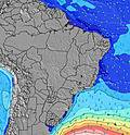 | |||||||||||||
Wave Height (m) Direction Period (s) | S 12 | S 12 | S 12 | S 11 | S 11 | S 11 | S 18 | SSE 10 | SSE 10 | SSE 10 | SE 10 | SE 10 | SE 10 | SSW 12 | SSW 11 | S 10 | SSW 9 | SE 13 | SE 13 | SE 13 | SE 13 |
Wave Graph | |||||||||||||||||||||
1356 | 1290 | 1249 | 850 | 651 | 698 | 600 | 356 | 269 | 188 | 275 | 260 | 188 | 560 | 356 | 234 | 115 | 106 | 235 | 231 | 269 | |
Wind (km/h) | |||||||||||||||||||||
Wind State on-shore cross-onshore cross-shore cross-offshore off-shore glassy | on | cross-on | on | glassy | glassy | cross | cross-off | glassy | on | on | on | on | glassy | glassy | cross | cross-off | glassy | cross-off | cross-on | glassy | on |
High Tide | 8:32AM2.44m | 8:53PM2.65m | 8:53AM2.73m | 9:10PM2.85m | 9:12AM2.94m | 9:25PM2.97m | 9:28AM3.07m | 9:34PM3.02m | 9:39AM3.12m | 9:38PM3.04m | 9:49AM3.11m | 9:45PM3.05m | 10:01AM3.06m | ||||||||
Low Tide | 1:35AM1.13m | 1:50PM0.69m | 2:08AM0.72m | 2:23PM0.35m | 2:39AM0.37m | 2:55PM0.11m | 3:09AM0.11m | 3:25PM-0.01m | 3:37AM-0.05m | 3:53PM0.00m | 4:05AM-0.10m | 4:19PM0.12m | 4:30AM-0.06m | 4:42PM0.32m | |||||||
— | 6:33 | — | — | 6:33 | — | — | 6:33 | — | — | 6:33 | — | — | 6:33 | — | — | 6:33 | — | — | 6:33 | — | |
— | — | 5:20 | — | — | 5:20 | — | — | 5:20 | — | — | 5:21 | — | — | 5:21 | — | — | 5:22 | — | — | 5:22 | |
mm | 4 | — | — | — | — | — | — | — | — | 5 | 2 | — | — | — | — | — | — | — | — | — | — |
Temp °C | 19 | 19 | 20 | 19 | 21 | 22 | 20 | 23 | 22 | 20 | 19 | 20 | 19 | 21 | 21 | 19 | 24 | 25 | 23 | 22 | 22 |
Feels °C | 19 | 20 | 20 | 19 | 21 | 22 | 20 | 23 | 20 | 19 | 19 | 20 | 19 | 21 | 21 | 19 | 26 | 25 | 25 | 22 | 22 |
Swell 1 Height (m) Direction Period (s) | S 12 | S 12 | S 12 | S 11 | S 11 | S 11 | S 11 | SSE 10 | SSE 10 | SSE 10 | SSW 8 | SE 10 | SSW 8 | SSW 12 | SSW 11 | S 10 | SSW 9 | SSW 9 | SE 13 | SE 13 | SE 13 |
1356 | 1290 | 1249 | 850 | 651 | 698 | 516 | 356 | 269 | 188 | 151 | 260 | 113 | 560 | 356 | 234 | 115 | 62 | 235 | 231 | 269 | |
Swell 2 Height (m) Direction Period (s) | E 9 | E 9 | E 9 | E 8 | S 21 | S 19 | S 18 | S 16 | S 15 | S 14 | SE 10 | SSW 8 | SE 10 | SE 10 | SE 10 | SE 10 | SE 10 | SE 13 | SSW 8 | SSW 8 | SSW 8 |
14 | 13 | 13 | 6 | 222 | 598 | 600 | 321 | 153 | 140 | 275 | 155 | 188 | 117 | 117 | 80 | 84 | 106 | 39 | 38 | 24 | |
Swell 3 Height (m) Direction Period (s) | — | — | — | S 24 | E 8 | E 8 | E 8 | E 8 | E 8 | E 8 | S 13 | S 12 | S 10 | SE 10 | S 16 | S 15 | SE 14 | SE 10 | E 5 | E 6 | E 6 |
— | — | — | 11 | 5 | 5 | 5 | 1 | 1 | 1 | 84 | 71 | 104 | 117 | 5 | 17 | 65 | 45 | 5 | 2 | 1 | |
Wind waves Height (m) Direction Period (s) | — | — | — | — | — | — | E 4 | — | SW 2 | SSW 5 | SSW 8 | — | — | — | — | ENE 4 | — | E 5 | — | — | SW 3 |
— | — | — | — | — | — | 10 | — | 1 | 28 | 256 | — | — | — | — | 15 | — | 12 | — | — | 3 | |
Nearest Offshore or Glassy | |||||||||||||||||||||
Distance (km) | 113 | 125 | 125 | 0 | 0 | 2 | 0 | 0 | 113 | 113 | 125 | 113 | 0 | 0 | 2 | 0 | 0 | 0 | 41 | 0 | 113 |
Best forecast wave conditions in Rio de Janeiro | |||||||||||||||||||||
Best forecast wave conditions in Brazil | |||||||||||||||||||||
Header Global | |||||||||||||||||||||
- Map Icons:
 Break
Break Live Wave Height (m)
 Live Wind Speed (km/h)
 Surf Rating (10 Max)
 Ocean Swells (m)
- Wind Speed (km/h)


FREE! Surf-Forecast.com widget for your website
The surf report / weather widget below is available to embed on third party websites free of charge and provides a summary of our Segundinha surf forecast. Simply grab the html code snippet that we provide and paste it into your own site. You can choose your preferred language and metric/imperial units for the surf forecast feed to suit users of your site. Click here to get the code.
Information about the Segundinha Surf forecast
The above surf forecast table for Segundinha provides essential information for determining whether the surfing conditions will be good over the next 16 days. A general guide to surfing at Segundinha can be found by selecting the local surf guide option on the grey menu. Our Segundinha surf forecast is unique since it includes wave energy (power) that defines the real feel of the surf rather than just the height or the period. If you surf the same spot (Segundinha) regularly then make a mental note of the wave energy from the surf forecast table each time you go. Very soon you may start to choose your surf days based on the wave energy alone combined with our forecast of favourable offshore wind conditions. Our star ratings will help here and of course you will also find the usual wave height and period predictions on our surf forecasts as well as a full break down of the swell components under our advanced users option (to reveal that, click the little Einstein character under the tide times).
Further information to help with frequently asked questions about our surf forecast for Segundinha may be found under the help tab on the top menu and also by moving your mouse over the question marks on the surf forecast table itself. Please always bear in mind that the forecast is for near-shore open water and local factors at each surf break influence the actual breaking wave height, such as the beach / reef profile, water depths offshore and shelter.
Are you planning a holiday in Rio de Janeiro? If you are looking for accommodation near Segundinha, camping, hotels and holiday cottages in Rio de Janeiro, consider staying in Niteroi which is 4 km (2 miles) away. Other places in and around Rio de Janeiro where you can find information about places to rent, and car hire include Sao Goncalo which is 13 km (8 miles) away, Rio de Janeiro, Duque de Caxias and Sao Joao de Meriti.
 Nearest