

Surf Forecasts:

Malhão surf forecast from 8 Jul 2026:
- Best quality surf: Sunday 12 Jul, 1AM (local time) - 2ft (0.6m), 10s period, NW swell with cross-offshore winds.
- Most powerful swell: Sunday 12 Jul, 4PM (local time) - 3.5ft (1.0m), 8s period, WNW swell with 137 kJ wave energy.
- Next surfable swell (1★+): Sunday 12 Jul, 1AM (local time) - 2ft (0.6m), 10s period with NW swell.
Best Forecast Surf Conditions for Malhão this week:
The surf forecast for Malhão over the next 16 days: The first swell (rated 1 star or higher) is forecast to arrive on Sunday (Jul 12) at 1AM. The primary swell is predicted to be 0.6m and 10s period with a secondary swell of 0.5m and 8s. Another secondary swell of 0.4m and 3s is also forecast. The wind is predicted to be cross-offshore as the swell arrives.
The most powerful waves expected at Malhão in the next 16 days are 1.0m 8s and forecast to arrive on Sunday (Jul 12) at 4PM. Winds are predicted to be cross-shore at the time the swell arrives. The largest open ocean swell (not directed at the beach) is 1.1m 5s period and expected on Wednesday (Jul 08) at 10PM.
| Wave Type | Time (WEST) & Date | Wave Height & Period |
|---|---|---|
| Next good surf (1 star+) | 1AM (Sun 12th Jul) | 2ft (0.6m) 10s |
| Best Surf | 1AM (Sun 12th Jul) | 2ft (0.6m) 10s |
| Most Powerful | 4PM (Sun 12th Jul) | 3.5ft (1.0m) 8s |
Table - best surf conditions forecast for Malhão over the next 16 days.
G’day, it’s Rusty. Let’s have a look at what we’ve got on the horizon for Malhão over the next couple of weeks. I gotta be straight with you, the outlook is pretty grim. There’s a long stretch of nothing worth paddling out for, and when the swell does try to show, the winds and conditions just aren’t playing ball. This is one of those runs where the setup looks more interesting for kite surfing than paddle surfing for most of it, especially with the consistent cross and cross-onshore winds.
We start off on Wednesday 8 July with tiny, short-period NW swell around 3ft, but it’s a cross-off wind early on at 6 mph, so the morning is at least clean. The energy is weak (58), and the waves are straight-up poor. That theme carries through Wednesday afternoon and all of Thursday 9 July, Friday 10 July, and Saturday 11 July—swell barely ticks over 1ft to 2ft, winds are mostly cross or cross-on, and the combined energy never cracks three digits. It’s flat and forgettable.
Sunday 12 July morning is the first time we see a flicker of hope. The morning has a clean 3ft NW groundswell (9-second period) with light cross-off winds from the NNW at 6 mph. The combined energy bumps up to 159 (moderate). It’s surfable but very ordinary—nothing to get excited about, but if you’re desperate, you could get a few grovelly ones. The afternoon goes back to poor.
Monday 13 July and Tuesday 14 July drop right off again—tiny swell, weak energy, poor conditions. Wednesday 15 July is more of the same. Thursday 16 July morning shows another clean window with a 3ft W swell, light NNW cross-off at 9 mph, and combined energy of 113 (moderate). The waves are still labelled poor, so don’t expect much.
Friday 17 July morning is clean again with 3ft WNW swell, but the energy is weak (56). That’s the theme for most of the second week—Saturday 18 July has a 1ft NW groundswell with a period of 11 seconds, but near-zero energy (47). Sunday 19 July morning sees the swell push up to 3ft NW, but the period drops to 6 seconds—short-period slop. The combined energy hits 125 (moderate), but the wind is cross-shore and the waves are poor. Sunday afternoon sees the biggest swell of the whole outlook at 5ft NW, with energy jumping to 203 (strong), but the wind is a moderate cross-shore at 16 mph, making it a lumpy, unappealing mess. That size is getting into the too-big-for-beginners range, but the quality is so poor it’s really only of interest to someone with a kite.
Monday 20 July through to Wednesday 22 July sees a bit more size—4ft to 6ft NW—but with moderate to fresh cross-shore winds, lots of chop, and poor surf conditions every session. The 6ft on Wednesday 22 July afternoon hits energy of 245 (strong), but with a short 6-second period and messy cross-shore wind, it’s a choppy, blown-out zone. The morning of Wednesday 22 July is clean with a tiny 0.3ft NW groundswell (12-second period) – effectively flat.
Thursday 23 July morning offers a clean, tiny 0.7ft WNW groundswell (10-second period) with light cross-off winds – again, basically flat.
As for the water, it’s about average for this time of year here at Malhão. No standout sessions, no real recommendations—just a long, frustrating stretch of poor surf. Keep an eye on the charts, but for now, I’d leave the board at home.
Rusty.
Short Range ForecastMostly dry. Warm (max 29°C on Wed morning, min 17°C on Wed night). Wind will be generally light. | Days 4-6 Weather SummaryMostly dry. Warm (max 23°C on Sun morning, min 17°C on Fri night). Wind will be generally light. | ||||||||||||||||||||
Wednesday 8 | Thursday 9 | Friday 10 | Saturday 11 | Sunday 12 | Monday 13 | Tuesday 14 | |||||||||||||||
AM | PM | Night | AM | PM | Night | AM | PM | Night | AM | PM | Night | AM | PM | Night | AM | PM | Night | AM | PM | Night | |
Swell Height Map |  |  | 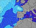 | 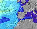 | 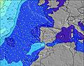 | 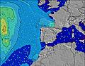 | 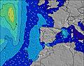 | ||||||||||||||
Wave Height (m) Direction Period (s) | NW 6 | NW 10 | WNW 10 | NW 10 | WNW 9 | WNW 9 | WNW 9 | WNW 9 | WNW 9 | WNW 8 | WNW 8 | NW 10 | NW 9 | WNW 8 | NW 8 | NW 8 | NW 8 | WNW 7 | WNW 7 | WNW 7 | WNW 10 |
Wave Graph | |||||||||||||||||||||
38 | 29 | 38 | 47 | 59 | 55 | 55 | 54 | 50 | 27 | 45 | 64 | 103 | 137 | 70 | 66 | 78 | 10 | 18 | 20 | 19 | |
Wind (km/h) | |||||||||||||||||||||
Wind State on-shore cross-onshore cross-shore cross-offshore off-shore glassy | cross-off | cross | cross | cross-on | cross | cross | cross-on | cross-on | cross | cross | cross-on | cross-off | cross-off | cross | cross-off | cross | cross | cross | cross | cross-on | cross |
High Tide | 9:04AM2.22m | 9:27PM2.32m | 10:11AM2.24m | 10:40PM2.31m | 11:22AM2.34m | 11:54PM2.37m | 12:29PM2.49m | 1:02AM2.49m | 1:30PM2.68m | 2:02AM2.63m | 2:25PM2.88m | 2:57AM2.74m | 3:16PM3.04m | 3:47AM2.80m | |||||||
Low Tide | 3:06PM0.77m | 3:48AM0.66m | 4:19PM0.75m | 4:58AM0.64m | 5:36PM0.65m | 6:08AM0.57m | 6:46PM0.48m | 7:11AM0.45m | 7:48PM0.29m | 8:08AM0.31m | 8:44PM0.11m | 8:59AM0.20m | 9:35PM-0.01m | ||||||||
6:20 | — | — | 6:20 | — | — | 6:20 | — | — | 6:22 | — | — | 6:22 | — | — | 6:22 | — | — | 6:24 | — | — | |
— | 8:59 | — | — | 8:59 | — | — | 8:59 | — | — | 8:58 | — | — | 8:58 | — | — | 8:58 | — | — | 8:57 | — | |
mm | — | — | — | — | — | — | — | — | — | — | — | — | — | — | — | — | — | — | — | — | — |
Temp °C | 29 | 26 | 18 | 22 | 21 | 18 | 22 | 21 | 18 | 22 | 22 | 18 | 23 | 23 | 18 | 22 | 22 | 18 | 22 | 22 | 19 |
Feels °C | 26 | 23 | 19 | 21 | 20 | 18 | 21 | 20 | 18 | 21 | 21 | 18 | 22 | 21 | 17 | 20 | 20 | 18 | 21 | 21 | 20 |
Swell 1 Height (m) Direction Period (s) | NW 6 | NW 10 | WNW 10 | NW 10 | WNW 9 | WNW 9 | WNW 9 | WNW 9 | WNW 9 | WNW 8 | WNW 8 | NW 10 | NW 9 | WNW 8 | NW 8 | NW 8 | NW 8 | NNW 8 | WNW 7 | WNW 7 | NW 7 |
38 | 25 | 38 | 47 | 59 | 55 | 55 | 54 | 50 | 27 | 45 | 64 | 103 | 137 | 70 | 66 | 78 | 25 | 18 | 20 | 12 | |
Swell 2 Height (m) Direction Period (s) | NW 10 | W 7 | — | W 7 | S 16 | S 16 | S 16 | S 16 | NW 13 | NW 12 | NW 11 | WNW 8 | W 9 | SW 15 | W 8 | W 6 | SW 13 | WNW 7 | NNW 8 | WNW 11 | WNW 10 |
16 | 4 | — | 1 | 5 | 5 | 5 | 5 | 7 | 37 | 43 | 38 | 54 | 8 | 10 | 7 | 7 | 10 | 6 | 12 | 19 | |
Swell 3 Height (m) Direction Period (s) | W 8 | NW 12 | — | S 16 | — | — | — | — | S 16 | W 6 | WSW 6 | WSW 6 | NW 4 | SW 19 | SW 14 | NNW 4 | SW 18 | SW 13 | WNW 12 | NNW 8 | NW 8 |
4 | 6 | — | 5 | — | — | — | — | 5 | 1 | 3 | 3 | 2 | 15 | 8 | 1 | 12 | 7 | 13 | 6 | 2 | |
Wind waves Height (m) Direction Period (s) | — | NW 5 | NW 5 | NW 5 | NW 5 | NW 5 | NW 5 | NW 5 | NW 4 | NW 4 | NW 4 | NW 3 | — | NNW 4 | NNW 4 | — | NW 3 | NW 4 | NW 4 | NW 3 | NW 4 |
— | 29 | 74 | 20 | 16 | 31 | 14 | 7 | 14 | 5 | 5 | 4 | — | 1 | 10 | — | 1 | 20 | 3 | 2 | 10 | |
Nearest Offshore or Glassy | |||||||||||||||||||||
Distance (km) | 434 | 533 | 38 | 110 | 192 | 178 | 112 | 143 | 112 | 112 | 174 | 0 | 0 | 601 | 0 | 86 | 601 | 203 | 93 | 539 | 203 |
Best forecast wave conditions in Portugal - Alentejo | |||||||||||||||||||||
Best forecast wave conditions in Portugal | |||||||||||||||||||||
Header Global | |||||||||||||||||||||
- Map Icons:
 Break
Break Live Wave Height (m)
 Live Wind Speed (km/h)
 Surf Rating (10 Max)
 Ocean Swells (m)
- Wind Speed (km/h)


FREE! Surf-Forecast.com widget for your website
The surf report / weather widget below is available to embed on third party websites free of charge and provides a summary of our Malhão surf forecast. Simply grab the html code snippet that we provide and paste it into your own site. You can choose your preferred language and metric/imperial units for the surf forecast feed to suit users of your site. Click here to get the code.
Information about the Malhão Surf forecast
The above surf forecast table for Malhão provides essential information for determining whether the surfing conditions will be good over the next 16 days. A general guide to surfing at Malhão can be found by selecting the local surf guide option on the grey menu. Our Malhão surf forecast is unique since it includes wave energy (power) that defines the real feel of the surf rather than just the height or the period. If you surf the same spot (Malhão) regularly then make a mental note of the wave energy from the surf forecast table each time you go. Very soon you may start to choose your surf days based on the wave energy alone combined with our forecast of favourable offshore wind conditions. Our star ratings will help here and of course you will also find the usual wave height and period predictions on our surf forecasts as well as a full break down of the swell components under our advanced users option (to reveal that, click the little Einstein character under the tide times).
Further information to help with frequently asked questions about our surf forecast for Malhão may be found under the help tab on the top menu and also by moving your mouse over the question marks on the surf forecast table itself. Please always bear in mind that the forecast is for near-shore open water and local factors at each surf break influence the actual breaking wave height, such as the beach / reef profile, water depths offshore and shelter.
Malhão is 20 km (12 miles) from Sines. If you plan a holiday in Portugal - Alentejo, look for hotels and other accommodation in Sines. Sines has rooms for a wide range of budgets as well as car hire and transport links.
 Nearest