uk es it fr pt nl
Malhão ratings
Quality on a good day: 3.7
Consistency of Surf: 3.7
Difficulty Level: 2.0
Wind and Kite Surfing: 2.5
Crowds: 2.7

Overall: 3.6

See all 18 ratings

Based on 4 votes. Vote


Surf Report Feed
Malhão surf break
Icon beach
Beach
Icon  s4
Malhão location mapGet alerts  temp

Malhão Surf Forecast / Alentejo / Portugal

48hr Weather and Surf, issued 12 pm Friday 02 Apr 2021 WEST
Forecast update in  hr  min  s Update imminent
Malhão surf forecast is for near shore open water. Breaking waves will often be smaller at less exposed spots.
Today's Malhão sea temperature is 15.5 °C (Statistics for 02 Apr 1981-2005 - mean: 16.0 max: 17.3 min: 15.0 °C)
Icon breakBreak
Icon legend buoysLive Wave Height (m)
Icon legend windLive Wind Speed (km/h)
Malhão surf forecast is for near shore open water. Breaking waves will often be smaller at less exposed spots.
Today's Malhão sea temperature is 15.5 °C (Statistics for 02 Apr 1981-2005 - mean: 16.0 max: 17.3 min: 15.0 °C)

Eyeball surf reportRecent Eyeball Surf Reports for Alentejo

  1. weather stationWind Update Recent cross-shore wind 19 km from Malhão has fallen light (light winds from the WNW at San Valentino). Waves should be turning clean at Malhão.

    Malhão
Expand
<
>
View all

19 km away, 1 h 7 min ago

Light
9 km/h
WNW
15.2
15.5
Air / Water (°C)
Please reload the page to see if there are any updates.


How big are the waves at Malhão today?

The current surf forecast for Malhão at 8PM is: 0.7m 11s primary swell from a Northwest direction and 0.9m 8s secondary swell from a West-southwest direction (forecast issued at 12:00pm April 02). The wind direction is predicted to be cross-shore.

Time (WEST) & DateWave HeightWave Period
Morning (02 Apr)0.9m (3ft)12s
Afternoon (02 Apr)0.8m (2.5ft)11s
Evening (02 Apr)0.9m (3ft)8s

Table - waves today at Malhão. (Swell directed towards the surf break)

Updates in  hr  min  s Update imminent
Rating
(10 max)
Swell
Height Map
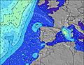
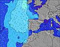
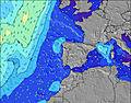
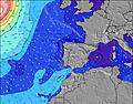
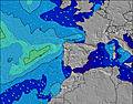
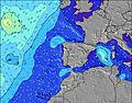
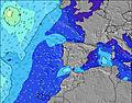
Wave Height (m) & direction (?)
Period(s) (?)
Wave
Graph
(?)Metric surfscale
Energy (?)
Wind
(km/h)
Wind State (?)
onshore
cross-onshore
cross-shore
cross-offshore
offshore
glassy
High Tide
/ height (m)
Low Tide
/ height (m)
Summary
Rain (mm)
Temp. °C
Chill °C (?)
Sunrise
Sunset
Friday
02
Saturday
03
Sunday
04
Monday
05
Tuesday
06
Wednesday
07
Thursday
08
Friday
09
10AM1PM4PM7PM10PM1AM4AM7AM10AM1PM4PM7PM10PM1AM4AM7AM10AM1PM4PM7PM10PM1AM4AM7AM10AM1PM4PM7PM10PM1AM4AM7AM10AM1PM4PM7PM10PM1AM4AM7AM10AM1PM4PM7PM10PM1AM4AM7AM10AM1PM4PM7PM10PM1AM4AM7AM10AM1PM4PM7PM
111101112101321211112220100111011101113211011101001011101000
T portugal.htsgw.metric.6.cc23T portugal.htsgw.metric.12.cc23
T portugal.htsgw.metric.18.cc23T portugal.htsgw.metric.24.cc23T portugal.htsgw.metric.36.cc23
T portugal.htsgw.metric.42.cc23T portugal.htsgw.metric.48.cc23T portugal.htsgw.metric.60.cc23
T portugal.htsgw.metric.66.cc23T portugal.htsgw.metric.72.cc23T portugal.htsgw.metric.84.cc23
T portugal.htsgw.metric.90.cc23T portugal.htsgw.metric.96.cc23T portugal.htsgw.metric.108.cc23
T portugal.htsgw.metric.114.cc23T portugal.htsgw.metric.120.cc23T portugal.htsgw.metric.132.cc23
T portugal.htsgw.metric.138.cc23T portugal.htsgw.metric.144.cc23T portugal.htsgw.metric.156.cc23
T portugal.htsgw.metric.162.cc23T portugal.htsgw.metric.168.cc23T portugal.htsgw.metric.180.cc23
1.1
WSW
0.8
NW
0.8
NW
0.7
NW
0.6
NW
0.8
WSW
0.8
WSW
0.7
NW
1.1
NW
1.1
NW
1.1
NW
1.2
NW
1.3
NW
0.6
WNW
0.7
WNW
0.7
WNW
0.8
WNW
0.7
WNW
0.8
WNW
0.9
WNW
0.7
WNW
0.7
WNW
0.7
WNW
0.6
WNW
0.6
WNW
0.6
W
0.6
W
0.6
W
0.5
W
0.5
W
0.4
W
0.4
W
0.5
W
0.8
W
0.8
W
0.9
W
0.9
W
0.8
W
1.2
NW
0.8
W
0.7
W
0.7
W
0.7
W
0.7
W
0.6
W
0.6
W
0.6
W
0.6
W
0.5
W
0.5
W
0.6
W
0.6
WNW
0.6
W
0.6
W
0.6
W
0.6
WNW
0.6
W
0.5
W
0.5
W
0.5
W
81111111088109999912121212121212121111111111101010101014131212111111810101010109999991010109979999
18017114211287837990190178168225275121152147167142183193137128126939182787752492858841931772021911432111339692908864636059413973676764612959413938
10
NW
15
WNW
15
W
15
WNW
10
NW
5
W
5
WNW
5
NE
10
NE
15
NW
20
NW
20
NW
15
NNW
10
NNW
10
NW
5
NNW
5
NW
10
WNW
15
WNW
15
WNW
10
WNW
5
WNW
5
SSE
5
SE
5
SSE
10
WSW
10
W
5
WNW
5
NW
5
NNW
5
NNW
5
E
5
NNW
15
WNW
15
NW
15
NW
15
NW
15
NW
10
N
5
NE
5
ENE
5
WNW
15
W
10
W
5
SSE
10
SSE
15
SSE
10
SE
10
E
10
ENE
10
WNW
20
NW
10
NNW
10
NW
10
NNE
5
NE
0
NNE
15
NW
20
NW
20
NW
crosscross-
on
cross-
on
crosscrossglassglassoffoffcrosscrosscrosscross-
off
cross-
off
crosscross-
off
crosscross-
on
crosscross-
on
cross-
on
glassglasscrosscross-
on
oncross-
on
cross-
on
glassglassglassglassglasscrosscrosscrosscrosscrosscross-
off
offoffcross-
on
cross-
on
cross-
on
cross-
on
cross-
on
crosscross-
off
cross-
off
cross-
off
cross-
on
crosscross-
off
cross-
off
cross-
off
offglasscrosscrosscross
6:52PM
2.63
7:26AM
2.39
7:52PM
2.40
8:40AM
2.14
9:13PM
2.24
10:17AM
2.02
10:48PM
2.21
11:48AM
2.08
12:08AM
2.33
12:52PM
2.22
1:05AM
2.49
1:37PM
2.38
1:48AM
2.63
2:14PM
2.52
12:38PM
0.37
1:11AM
0.41
1:34PM
0.65
2:21AM
0.64
2:48PM
0.87
3:53AM
0.78
4:24PM
0.96
5:27AM
0.74
5:50PM
0.87
6:37AM
0.61
6:52PM
0.71
7:27AM
0.46
7:37PM
0.55
8:06AM
0.34

Note: the tide data above is for Praia dos Aivados which is 1 km away. Surf properties and timing are calculated for Malhão.New forecast is published every 6 hours at www.surf-forecast.com. See detailed tide info and graph
Offshore winds at Malhão blow from the NE

Friday
02
Saturday
03
Sunday
04
Monday
05
Tuesday
06
Wednesday
07
Thursday
08
Friday
09
10AM1PM4PM7PM10PM1AM4AM7AM10AM1PM4PM7PM10PM1AM4AM7AM10AM1PM4PM7PM10PM1AM4AM7AM10AM1PM4PM7PM10PM1AM4AM7AM10AM1PM4PM7PM10PM1AM4AM7AM10AM1PM4PM7PM10PM1AM4AM7AM10AM1PM4PM7PM10PM1AM4AM7AM10AM1PM4PM7PM
clear
clear
clear
clear
clear
partially cloudy
cloudy
cloudy
clear
clear
clear
clear
clear
clear
clear
clear
clear
clear
clear
clear
clear
clear
clear
clear
clear
clear
clear
clear
partially cloudy
partially cloudy
cloudy
cloudy
partially cloudy
cloudy
cloudy
partially cloudy
partially cloudy
partially cloudy
partially cloudy
cloudy
partially cloudy
clear
partially cloudy
partially cloudy
partially cloudy
partially cloudy
cloudy
clear
clear
partially cloudy
partially cloudy
partially cloudy
clear
partially cloudy
clear
clear
clear
partially cloudy
cloudy
cloudy
clearclearclearclearclearsome cloudscloudycloudyclearclearclearclearclearclearclearclearclearclearclearclearclearclearclearclearclearclearclearclearsome cloudssome cloudscloudycloudysome cloudscloudycloudysome cloudssome cloudssome cloudssome cloudscloudysome cloudsclearsome cloudssome cloudssome cloudssome cloudscloudyclearclearsome cloudssome cloudssome cloudsclearsome cloudsclearclearclearsome cloudscloudycloudy
------------------------------------------------------------
151616151414151415171715141313131618181614141312151919161514141416181715121211101318171514131513161919161515141215181615
15151514131415141517161413131313161818151414131215191916151414141618161411111091318171514121412161919151514131215181514
--------7:16-------7:15-------7:13-------7:11-------7:11-------7:09-------7:07---
---7:59-------8:00-------8:00-------8:00-------8:01-------8:02-------8:04-------8:05

FREE! Surf-Forecast.com widget for your website

The surf report / weather widget below is available to embed on third party websites free of charge and provides a summary of our Malhão surf forecast. Simply grab the html code snippet that we provide and paste it into your own site. You can choose your preferred language and metric/imperial units for the surf forecast feed to suit users of your site. Click here to get the code.


We hope you find the new 12-day forecasts and additional details useful.

Kudos to everyone who helped us debug this over the past 3 months.

Be sure to click on the Advanced Surf option to see extra details about the sea-state. Look out for crossing swells and short period local wind swells and chop that will often spoil a groundswell even if the wind is perfect. As yet there is no allowance for this in the swell rating. This is something we are working on.

In a week or so, we plan to ask you to register for free to access these extra features. We only do this so that we have the option of letting you know about new features or problems. Those of you who have already signed up will know that in 20 years we have yet to bother you with any emails apart from the surf and wind alerts you configured, which have always been free from ads.

As long as site ad-income continues to cover our server and development costs, ALL of surf-forecast.com will remain free for everyone.