

Surf Forecasts:

Porto Batel surf forecast from 3 Aug 2026:
- Best quality surf: Tuesday 4 Aug, 4AM (local time) - 3.5ft (1.0m), 9s period, W swell with glassy winds.
- Most powerful swell: Thursday 6 Aug, 1AM (local time) - 5.5ft (1.7m), 10s period, NNW swell with 539 kJ wave energy.
- Next surfable swell (1★+): Tuesday 4 Aug, 4AM (local time) - 3.5ft (1.0m), 9s period with W swell.
Best Forecast Surf Conditions for Porto Batel this week:
The surf forecast for Porto Batel over the next 16 days: The first swell (rated 1 star or higher) is forecast to arrive on Tuesday (Aug 04) at 4AM. The primary swell is predicted to be 1.0m and 9s period with a secondary swell of 0.2m and 8s. The wind is predicted to be glassy as the swell arrives.
The most powerful waves expected at Porto Batel in the next 16 days are 1.7m 10s and forecast to arrive on Thursday (Aug 06) at 1AM. Winds are predicted to be cross-offshore at the time the swell arrives. The largest open ocean swell (not directed at the beach) is 0.7m 4s period and expected on Wednesday (Aug 05) at 4PM.
| Wave Type | Time (WEST) & Date | Wave Height & Period |
|---|---|---|
| Next good surf (1 star+) | 4AM (Tue 4th Aug) | 3.5ft (1.0m) 9s |
| Best Surf | 4AM (Tue 4th Aug) | 3.5ft (1.0m) 9s |
| Most Powerful | 1AM (Thu 6th Aug) | 5.5ft (1.7m) 10s |
Table - best surf conditions forecast for Porto Batel over the next 16 days.
The Lowdown
Alright, folks, Rusty here. Let’s take a look at what’s shaping up for Porto Batel over the next couple of weeks.
Honestly, it’s a slow start. We’ve got a long patch of nothing much to get excited about through the first week of August. The surf is small and the conditions are just ordinary. The wind is mostly cross-off or cross, which is okay, but the swell is tiny and weak. You’ll see the combined energy sitting around 70 to 206 (moderate) for the first few days, but the wave heights are barely 3 feet, and the period is short. It’s not really worth paddling out for.
The first real glimmer of hope comes on the morning of Thursday, August 6th. The swell bumps up to 6 feet from the NNW, with a 9-second period, and the combined energy jumps to 514 (moderate). The wind is a clean cross-off from the north at 15 mph. Porto Batel is a point break, so it can handle that direction. It’s still a bit raw – the afternoon drops off to a 5 feet – but that morning session is the best we’ve seen so far. For a point break, a 6 foot swell is solid, but not too big for intermediates. It’s a good one to look at, but keep in mind the forecast is still a few days out.
The following morning, Friday the 7th, is similar. Another 6 feet from the NNW, but this time the period drops to a short 7 seconds. That’s a bit of a bummer – it’ll be a bit lumpy and less powerful. The combined energy is 337 (moderate). Not a standout, but it’s rideable.
The real standout, the one that’s worth marking on your calendar, is the morning of Friday, August 14th. We’ve got a solid 6 feet from the NNW, with an 8-second period, and the combined energy hits 448 (moderate). The wind is a clean cross-off from the north, 15 mph. This is the biggest and most consistent we’ll see during the whole run. For a point break like Porto Batel, that’s a proper swell. It’s not huge, but it’s got enough push. The morning is the window; the afternoon gets a bit messy with the same size but a poor surf rating. The 14th is a long way off, so treat it as promising but not locked in.
The rest of the run into the second week is a mixed bag. The 15th of August has 5 feet from the NNW, but the wind swings cross-shore, which will bring some chop. The 16th drops off quickly. And by the 17th and 18th, we’re back to tiny waves and strong winds. The wind hits 22 mph from the NNW on the 17th afternoon, which is too strong for a clean surf – that’s more of a kite-surfing breeze.
The water temperature is about average for the time of year, nothing unusual going on there.
So, to wrap it up: the best bet is the morning of Friday, August 14th. That’s the one to aim for. The morning of Thursday the 6th is a decent warm-up, but the 14th has the size and the clean wind. If you’re an intermediate, you’ll be fine. If you’re a beginner, the 6 feet might be a bit much, but it’s not a total washout. The crowds are sometimes an issue at Porto Batel, so expect a few others with the same idea on that day.
Rusty.
Short Range ForecastMostly dry. Warm (max 24°C on Tue morning, min 19°C on Sun night). Winds increasing (calm on Mon night, fresh winds from the NNW by Wed afternoon). | Days 4-6 Weather SummaryMostly dry. Warm (max 21°C on Fri afternoon, min 18°C on Wed night). Mainly fresh winds. | ||||||||||||||||||||
Monday 3 | Tuesday 4 | Wednesday 5 | Thursday 6 | Friday 7 | Saturday 8 | Sunday 9 | |||||||||||||||
AM | PM | Night | AM | PM | Night | AM | PM | Night | AM | PM | Night | AM | PM | Night | AM | PM | Night | AM | PM | Night | |
Swell Height Map |  |  | 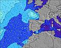 | 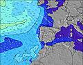 | 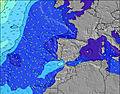 | 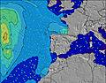 | 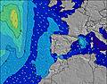 | ||||||||||||||
Wave Height (m) Direction Period (s) | W 9 | W 9 | W 9 | WNW 9 | WNW 8 | WNW 8 | WNW 8 | NNW 10 | NNW 10 | NNW 9 | NNW 9 | NNW 7 | NNW 7 | NNW 10 | NNW 10 | NNW 9 | NNW 9 | N 8 | W 7 | W 7 | W 7 |
Wave Graph | |||||||||||||||||||||
57 | 158 | 154 | 126 | 94 | 90 | 85 | 138 | 539 | 464 | 405 | 286 | 302 | 407 | 282 | 129 | 77 | 32 | 47 | 34 | 34 | |
Wind (km/h) | |||||||||||||||||||||
Wind State on-shore cross-onshore cross-shore cross-offshore off-shore glassy | on | cross-on | cross | on | cross | cross-off | cross-off | cross-off | cross-off | cross-off | cross-off | cross-off | cross-off | cross-off | cross-off | cross-off | cross-off | cross-off | cross-off | cross-off | cross-off |
High Tide | 6:20AM3.16m | 6:34PM3.33m | 6:59AM3.10m | 7:16PM3.20m | 7:46AM3.01m | 8:07PM3.05m | 8:44AM2.91m | 9:13PM2.89m | 9:57AM2.86m | 10:36PM2.80m | 11:20AM2.91m | 00:04AM2.85m | 12:38PM3.07m | 1:18AM3.00m | |||||||
Low Tide | 12:17PM0.95m | 00:46AM0.92m | 12:58PM1.05m | 1:30AM1.03m | 1:48PM1.18m | 2:23AM1.16m | 2:52PM1.30m | 3:30AM1.29m | 4:15PM1.36m | 4:53AM1.34m | 5:46PM1.28m | 6:15AM1.26m | 7:02PM1.08m | ||||||||
6:37 | — | — | 6:39 | — | — | 6:39 | — | — | 6:41 | — | — | 6:41 | — | — | 6:43 | — | — | 6:43 | — | — | |
— | 8:47 | — | — | 8:46 | — | — | 8:45 | — | — | 8:44 | — | — | 8:43 | — | — | 8:42 | — | — | 8:40 | — | |
mm | — | — | — | — | — | — | — | — | — | — | — | — | — | — | — | — | — | — | — | — | — |
Temp °C | 21 | 22 | 21 | 24 | 23 | 21 | 20 | 19 | 18 | 20 | 20 | 18 | 20 | 21 | 19 | 21 | 21 | 20 | 21 | 21 | 19 |
Feels °C | 21 | 22 | 23 | 23 | 23 | 22 | 19 | 16 | 15 | 17 | 17 | 15 | 19 | 19 | 18 | 20 | 20 | 20 | 20 | 20 | 19 |
Swell 1 Height (m) Direction Period (s) | W 9 | W 9 | W 9 | WNW 9 | WNW 8 | WNW 8 | WNW 8 | NNW 10 | WNW 6 | WNW 10 | W 10 | WNW 9 | NNW 7 | WNW 9 | NNW 10 | NNW 9 | NNW 9 | N 8 | W 7 | W 7 | W 7 |
57 | 158 | 154 | 126 | 94 | 90 | 85 | 138 | 13 | 37 | 47 | 29 | 302 | 28 | 282 | 129 | 77 | 32 | 47 | 34 | 34 | |
Swell 2 Height (m) Direction Period (s) | NNW 7 | NNW 8 | N 8 | N 8 | NNW 11 | NNW 10 | NNW 9 | W 7 | WNW 10 | W 6 | SW 12 | SW 13 | WNW 9 | S 12 | WNW 9 | WNW 9 | WNW 9 | WNW 8 | NW 10 | NW 10 | NW 9 |
11 | 11 | 5 | 5 | 13 | 63 | 73 | 39 | 33 | 7 | 6 | 7 | 28 | 3 | 26 | 26 | 15 | 21 | 25 | 23 | 19 | |
Swell 3 Height (m) Direction Period (s) | N 4 | S 14 | SW 13 | N 10 | N 10 | SW 12 | NW 12 | WNW 9 | SW 12 | SW 12 | — | — | SW 13 | — | S 12 | — | — | NNW 11 | N 7 | N 7 | N 6 |
2 | 4 | 7 | 2 | 7 | 6 | 35 | 29 | 6 | 6 | — | — | 7 | — | 3 | — | — | 11 | 9 | 4 | 1 | |
Wind waves Height (m) Direction Period (s) | — | — | — | — | — | — | — | NNW 4 | NNW 10 | NNW 9 | NNW 9 | NNW 7 | — | NNW 10 | — | — | — | — | — | — | — |
— | — | — | — | — | — | — | 13 | 539 | 464 | 405 | 286 | — | 407 | — | — | — | — | — | — | — | |
Nearest Offshore or Glassy | |||||||||||||||||||||
Distance (km) | 106 | 367 | 70 | 4 | 257 | 0 | 70 | 391 | 194 | 267 | 268 | 158 | 102 | 410 | 70 | 158 | 406 | 0 | 158 | 369 | 158 |
Best forecast wave conditions in Peniche | |||||||||||||||||||||
Best forecast wave conditions in Portugal | |||||||||||||||||||||
Header Global | |||||||||||||||||||||
- Map Icons:
 Break
Break Live Wave Height (m)
 Live Wind Speed (km/h)
 Surf Rating (10 Max)
 Ocean Swells (m)
- Wind Speed (km/h)
Latest Updates


FREE! Surf-Forecast.com widget for your website
The surf report / weather widget below is available to embed on third party websites free of charge and provides a summary of our Porto Batel surf forecast. Simply grab the html code snippet that we provide and paste it into your own site. You can choose your preferred language and metric/imperial units for the surf forecast feed to suit users of your site. Click here to get the code.
Information about the Porto Batel Surf forecast
The above surf forecast table for Porto Batel provides essential information for determining whether the surfing conditions will be good over the next 16 days. A general guide to surfing at Porto Batel can be found by selecting the local surf guide option on the grey menu. Our Porto Batel surf forecast is unique since it includes wave energy (power) that defines the real feel of the surf rather than just the height or the period. If you surf the same spot (Porto Batel) regularly then make a mental note of the wave energy from the surf forecast table each time you go. Very soon you may start to choose your surf days based on the wave energy alone combined with our forecast of favourable offshore wind conditions. Our star ratings will help here and of course you will also find the usual wave height and period predictions on our surf forecasts as well as a full break down of the swell components under our advanced users option (to reveal that, click the little Einstein character under the tide times).
Further information to help with frequently asked questions about our surf forecast for Porto Batel may be found under the help tab on the top menu and also by moving your mouse over the question marks on the surf forecast table itself. Please always bear in mind that the forecast is for near-shore open water and local factors at each surf break influence the actual breaking wave height, such as the beach / reef profile, water depths offshore and shelter.
Porto Batel is 4 km (2 miles) from Peniche. If you plan a holiday in Peniche, look for hotels and other accommodation in Peniche. Peniche has rooms for a wide range of budgets as well as car hire and transport links.
 Nearest