

Surf Forecasts:

Baleal Sul surf forecast from 2 Aug 2026:
- Best quality surf: Tuesday 4 Aug, 4AM (local time) - 3.5ft (1.0m), 9s period, W swell with glassy winds.
- Most powerful swell: Thursday 6 Aug, 4AM (local time) - 5.5ft (1.7m), 10s period, NNW swell with 497 kJ wave energy.
- Next surfable swell (1★+): Tuesday 4 Aug, 4AM (local time) - 3.5ft (1.0m), 9s period with W swell.
Best Forecast Surf Conditions for Baleal Sul this week:
The surf forecast for Baleal Sul over the next 16 days: The first swell (rated 1 star or higher) is forecast to arrive on Tuesday (Aug 04) at 4AM. The primary swell is predicted to be 1.0m and 9s period with a secondary swell of 0.2m and 8s. The wind is predicted to be glassy as the swell arrives.
The most powerful waves expected at Baleal Sul in the next 16 days are 1.7m 10s and forecast to arrive on Thursday (Aug 06) at 4AM. Winds are predicted to be onshore at the time the swell arrives. The largest open ocean swell (not directed at the beach) is 0.4m 3s period and expected on Monday (Aug 03) at 1PM.
| Wave Type | Time (WEST) & Date | Wave Height & Period |
|---|---|---|
| Next good surf (1 star+) | 4AM (Tue 4th Aug) | 3.5ft (1.0m) 9s |
| Best Surf | 4AM (Tue 4th Aug) | 3.5ft (1.0m) 9s |
| Most Powerful | 4AM (Thu 6th Aug) | 5.5ft (1.7m) 10s |
Table - best surf conditions forecast for Baleal Sul over the next 16 days.
The Lowdown
Alright, surfers, Rusty here. Let’s have a look at what’s cooking for the next couple of weeks.
Honestly, amigos, it’s a tough stretch ahead for Baleal Sul. The forecast is pretty grim for anything worth paddling out for. The whole first week is a write-off with onshore winds and weak, messy energy. We’re looking at a long, dry spell with no real green lights until the middle of the second week.
The pattern is dominated by onshore winds, mostly from the north and northwest, which just smashes the wave quality. The water is sitting around 67°F, which is about normal for this time of year, so at least you won’t need a thick suit.
The first sniff of anything half-decent doesn’t come until the morning of Tuesday, the 5th of August. But even then, it’s a struggle. The cleanest we get is that Tuesday morning with a glassy 3ft WNW swell, but the combined energy is weak (133). It’s surfable, but very ordinary. The south-west wind on the morning of Sunday, the 17th of August, finally turns cross-off, combing out a 7ft NNW swell (499 energy). That’s your best bet for a clean face, but it’s still a long way off.
The only real standout, and I mean the only one worth setting your alarm for, is the morning of Monday, the 18th of August. We’ve got big 10ft NNW swell pumping in with a combined energy of 1486. That’s a serious amount of grunt. The wind is light from the NNW, so it’s onshore, but it’s light. This is expert-only territory – that size will be a washing machine. For the experienced crew, there could be some bombs, but it’s a high-risk, low-probability session. The long period (9 seconds) suggests it’ll be a bit lumpy, but with that much energy, it’s the only moment in the whole 16 days with real power.
For the rest of the time, you’re looking at onshore slop. Several days with no real options. If you’re a beginner, forget it – the swell is either too small and onshore, or when it gets big (over 8ft) it’s dangerous. The consistent onshore wind means the beach break setup is more interesting for the kite surfers than for paddle surfing.
Stay patient, or look for a different coast.
Rusty.
Short Range ForecastMostly dry. Warm (max 24°C on Tue morning, min 19°C on Sun night). Wind will be generally light. | Days 5-7 Weather SummaryMostly dry. Warm (max 21°C on Sat morning, min 18°C on Wed night). Mainly fresh winds. | |||||||||||||||||||
Sun 2 | Monday 3 | Tuesday 4 | Wednesday 5 | Thursday 6 | Friday 7 | Saturday 8 | ||||||||||||||
PM | Night | AM | PM | Night | AM | PM | Night | AM | PM | Night | AM | PM | Night | AM | PM | Night | AM | PM | Night | |
Swell Height Map |  |  |  |  | 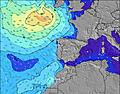 | 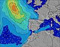 | 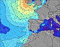 | |||||||||||||
Wave Height (m) Direction Period (s) | W 10 | W 9 | W 9 | W 9 | W 9 | WNW 9 | WNW 8 | WNW 8 | WNW 8 | NNW 9 | NNW 6 | NNW 9 | NNW 9 | NNW 6 | NNW 7 | NNW 7 | NNW 7 | NNW 7 | NNW 7 | NNW 7 |
Wave Graph | ||||||||||||||||||||
68 | 64 | 57 | 158 | 154 | 126 | 94 | 90 | 79 | 103 | 173 | 406 | 343 | 212 | 278 | 247 | 171 | 212 | 208 | 177 | |
Wind (km/h) | ||||||||||||||||||||
Wind State on-shore cross-onshore cross-shore cross-offshore off-shore glassy | on | cross-on | cross-off | cross | cross-on | glassy | cross-on | on | on | on | on | on | on | on | on | on | on | on | on | on |
High Tide | 5:58PM3.41m | 6:20AM3.16m | 6:34PM3.33m | 6:59AM3.10m | 7:16PM3.20m | 7:46AM3.01m | 8:07PM3.05m | 8:44AM2.91m | 9:13PM2.89m | 9:57AM2.86m | 10:36PM2.80m | 11:20AM2.91m | 00:04AM2.85m | |||||||
Low Tide | 00:09AM0.85m | 12:17PM0.95m | 00:46AM0.92m | 12:58PM1.05m | 1:30AM1.03m | 1:48PM1.18m | 2:23AM1.16m | 2:52PM1.30m | 3:30AM1.29m | 4:15PM1.36m | 4:53AM1.34m | 5:46PM1.28m | ||||||||
— | — | 6:37 | — | — | 6:39 | — | — | 6:39 | — | — | 6:41 | — | — | 6:41 | — | — | 6:43 | — | — | |
8:49 | — | — | 8:47 | — | — | 8:46 | — | — | 8:45 | — | — | 8:44 | — | — | 8:43 | — | — | 8:42 | — | |
mm | — | — | — | — | — | — | — | — | — | — | — | — | — | — | — | — | — | — | — | — |
Temp °C | 21 | 20 | 21 | 22 | 21 | 24 | 23 | 21 | 20 | 20 | 18 | 20 | 20 | 18 | 20 | 20 | 19 | 21 | 21 | 19 |
Feels °C | 21 | 21 | 21 | 22 | 23 | 24 | 23 | 22 | 19 | 17 | 15 | 18 | 17 | 15 | 18 | 18 | 17 | 20 | 19 | 18 |
Swell 1 Height (m) Direction Period (s) | NNW 6 | W 9 | W 9 | W 9 | W 9 | WNW 9 | WNW 8 | WNW 8 | WNW 8 | NNW 9 | WNW 10 | W 10 | W 10 | WNW 9 | WNW 9 | WNW 9 | N 10 | WNW 9 | WNW 9 | WNW 8 |
27 | 64 | 57 | 158 | 154 | 126 | 94 | 90 | 79 | 103 | 104 | 48 | 48 | 28 | 28 | 16 | 96 | 26 | 15 | 14 | |
Swell 2 Height (m) Direction Period (s) | W 10 | NNW 5 | NNW 7 | NNW 8 | N 8 | N 8 | NNW 11 | NNW 11 | NNW 9 | W 7 | SW 12 | SW 12 | SW 12 | SW 13 | SW 13 | W 6 | WNW 9 | — | — | S 11 |
68 | 9 | 11 | 11 | 5 | 5 | 13 | 66 | 76 | 39 | 6 | 6 | 6 | 7 | 7 | 2 | 26 | — | — | 2 | |
Swell 3 Height (m) Direction Period (s) | NNW 8 | NNW 7 | W 15 | S 14 | SW 13 | N 10 | N 8 | SW 12 | SW 12 | WNW 9 | — | SW 12 | — | — | — | S 12 | SW 12 | — | — | S 11 |
11 | 11 | 4 | 4 | 7 | 2 | 5 | 6 | 6 | 29 | — | 5 | — | — | — | 3 | 6 | — | — | 2 | |
Wind waves Height (m) Direction Period (s) | — | — | WNW 4 | — | — | — | — | — | — | NNW 3 | NNW 6 | NNW 9 | NNW 9 | NNW 6 | NNW 7 | NNW 7 | NNW 7 | NNW 7 | NNW 7 | NNW 7 |
— | — | 2 | — | — | — | — | — | — | 6 | 173 | 406 | 343 | 212 | 278 | 247 | 171 | 212 | 208 | 177 | |
Nearest Offshore or Glassy | ||||||||||||||||||||
Distance (km) | 363 | 36 | 102 | 363 | 36 | 0 | 261 | 2 | 74 | 358 | 167 | 263 | 453 | 223 | 223 | 451 | 98 | 98 | 453 | 98 |
Best forecast wave conditions in Peniche | ||||||||||||||||||||
Best forecast wave conditions in Portugal | ||||||||||||||||||||
Header Global | ||||||||||||||||||||
- Map Icons:
 Break
Break Live Wave Height (m)
 Live Wind Speed (km/h)
 Surf Rating (10 Max)
 Ocean Swells (m)
- Wind Speed (km/h)
Latest Updates


FREE! Surf-Forecast.com widget for your website
The surf report / weather widget below is available to embed on third party websites free of charge and provides a summary of our Baleal Sul surf forecast. Simply grab the html code snippet that we provide and paste it into your own site. You can choose your preferred language and metric/imperial units for the surf forecast feed to suit users of your site. Click here to get the code.
Information about the Baleal Sul Surf forecast
The above surf forecast table for Baleal Sul provides essential information for determining whether the surfing conditions will be good over the next 16 days. A general guide to surfing at Baleal Sul can be found by selecting the local surf guide option on the grey menu. Our Baleal Sul surf forecast is unique since it includes wave energy (power) that defines the real feel of the surf rather than just the height or the period. If you surf the same spot (Baleal Sul) regularly then make a mental note of the wave energy from the surf forecast table each time you go. Very soon you may start to choose your surf days based on the wave energy alone combined with our forecast of favourable offshore wind conditions. Our star ratings will help here and of course you will also find the usual wave height and period predictions on our surf forecasts as well as a full break down of the swell components under our advanced users option (to reveal that, click the little Einstein character under the tide times).
Further information to help with frequently asked questions about our surf forecast for Baleal Sul may be found under the help tab on the top menu and also by moving your mouse over the question marks on the surf forecast table itself. Please always bear in mind that the forecast is for near-shore open water and local factors at each surf break influence the actual breaking wave height, such as the beach / reef profile, water depths offshore and shelter.
Baleal Sul is 2 km (1 miles) from Peniche. If you plan a holiday in Peniche, look for hotels and other accommodation in Peniche. Peniche has rooms for a wide range of budgets as well as car hire and transport links.
 Nearest