

Surf Forecasts:

Grand Haven surf forecast from 23 Jul 2026:
- Most powerful swell: Tuesday 28 Jul, 8PM (local time) - 4ft (1.2m), 6s period, N swell with 98 kJ wave energy.
Best Forecast Surf Conditions for Grand Haven this week:
The most powerful waves expected at Grand Haven in the next 16 days are 1.2m 6s and forecast to arrive on Tuesday (Jul 28) at 8PM. Winds are predicted to be cross-shore at the time the swell arrives. The largest open ocean swell (not directed at the beach) is 0.8m 5s period and expected on Wednesday (Jul 29) at 2AM.
| Wave Type | Time (EDT) & Date | Wave Height & Period |
|---|---|---|
| Next good surf (1 star+) | - | - |
| Best Surf | - | - |
| Most Powerful | 8PM (Tue 28th Jul) | 4ft (1.2m) 6s |
Table - best surf conditions forecast for Grand Haven over the next 16 days.
The Lowdown
Alright folks, Rusty here. Let’s be straight with you – it’s a tough stretch ahead for Grand Haven. We’ve got a long, dry spell on the cards, so don’t get your hopes up for any proper surf sessions.
Right now, there’s just nothing doing. We’re looking at a big gap with no worthwhile waves from today, all the way through to early August. The main problem is a total lack of any decent swell energy. We’re seeing tiny, weak waves that barely register on the energy scale (2), and they’re mostly coming in on messy, cross-onshore winds. The water temp is sitting at a touch warmer than normal for this time of year, about 71.8°, but that’s about the only positive. The conditions are just poor for surfing, with small, choppy slop.
Even when we do see a little bump in energy around the 28th of July – with a 3.3ft swell from the north and energy climbing to (51) – the wind is howling from the NNW at 18.6 mph, making it a lumpy, cross-shore mess. It’s not surfable. After that, it all just drops off to zero. The region is an exposed beach and pier setup, so it's wide open to the wind, but the swell just isn't cooperating. Honestly, for the next couple of weeks, this setup looks more interesting for kite surfing than for paddle surfing, especially with those strong cross-shore breezes kicking up.
We don't get any rideable waves showing up until the very end of the forecast. On August 7th, things are still flat with a zero score and more strong cross-shore wind. So, to put it plainly: there are no good surf options whatsoever in this 16-day window for Grand Haven. Put the board away and maybe go for a swim instead.
Short Range ForecastLight rain (total 5mm), mostly falling on Sat night. Warm (max 23°C on Fri afternoon, min 17°C on Thu morning). Winds increasing (light winds from the WSW on Thu night, fresh winds from the SSW by Sat afternoon). | Days 4-6 Weather SummaryLight rain (total 9mm), mostly falling on Mon night. Warm (max 27°C on Mon night, min 16°C on Tue night). Winds increasing (calm on Sun morning, strong winds from the NNW by Tue afternoon). | ||||||||||||||||||||
Thursday 23 | Friday 24 | Saturday 25 | Sunday 26 | Monday 27 | Tuesday 28 | Wednesday 29 | |||||||||||||||
AM | PM | Night | AM | PM | Night | AM | PM | Night | AM | PM | Night | AM | PM | Night | AM | PM | Night | AM | PM | Night | |
Swell Height Map |  |  |  |  | 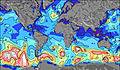 | 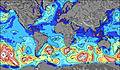 | 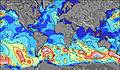 | ||||||||||||||
Wave Height (m) Direction Period (s) | WNW 4 | WNW 3 | — | SW 3 | SSW 3 | SSW 4 | SW 4 | SSW 4 | SW 4 | WNW 4 | NW 4 | N 4 | S 4 | SW 4 | NNW 5 | N 5 | N 6 | N 5 | — | — | — |
Wave Graph | |||||||||||||||||||||
2 | 1 | 0 | 3 | 1 | 10 | 18 | 21 | 16 | 18 | 12 | 1 | 17 | 21 | 80 | 51 | 80 | 0 | 0 | 0 | 0 | |
Wind (km/h) | |||||||||||||||||||||
Wind State on-shore cross-onshore cross-shore cross-offshore off-shore glassy | cross-on | on | cross | cross-on | on | cross-on | cross-on | cross-on | cross-on | on | cross-on | cross-off | cross-on | glassy | cross-off | cross | cross-on | cross-off | cross-off | cross-on | cross |
High Tide | |||||||||||||||||||||
Low Tide | |||||||||||||||||||||
6:26 | — | — | 6:26 | — | — | 6:28 | — | — | 6:28 | — | — | 6:30 | — | — | 6:31 | — | — | 6:31 | — | — | |
— | — | 9:15 | — | — | 9:14 | — | — | 9:13 | — | — | 9:12 | — | — | 9:10 | — | — | 9:09 | — | — | 9:08 | |
mm | — | — | — | — | — | — | — | — | 5 | — | — | 2 | 1 | 2 | 4 | — | — | — | — | — | — |
Temp °C | 21 | 22 | 21 | 22 | 23 | 22 | 22 | 23 | 23 | 25 | 25 | 23 | 23 | 25 | 27 | 22 | 23 | 22 | 23 | 24 | 22 |
Feels °C | 19 | 20 | 20 | 20 | 22 | 21 | 19 | 21 | 22 | 27 | 27 | 25 | 24 | 25 | 29 | 19 | 17 | 16 | 21 | 22 | 21 |
Swell 1 Height (m) Direction Period (s) | — | WNW 3 | — | — | — | — | — | — | — | — | — | N 4 | — | — | SW 4 | — | — | — | — | — | — |
— | 1 | — | — | — | — | — | — | — | — | — | 1 | — | — | 1 | — | — | — | — | — | — | |
Swell 2 Height (m) Direction Period (s) | — | — | — | — | — | — | — | — | — | — | — | — | — | — | — | — | — | — | — | — | — |
— | — | — | — | — | — | — | — | — | — | — | — | — | — | — | — | — | — | — | — | — | |
Swell 3 Height (m) Direction Period (s) | — | — | — | — | — | — | — | — | — | — | — | — | — | — | — | — | — | — | — | — | — |
— | — | — | — | — | — | — | — | — | — | — | — | — | — | — | — | — | — | — | — | — | |
Wind waves Height (m) Direction Period (s) | WNW 4 | — | — | SW 3 | SSW 3 | SSW 4 | SW 4 | SSW 4 | SW 4 | WNW 4 | NW 4 | SE 3 | S 4 | SW 4 | NNW 5 | N 5 | N 6 | N 5 | — | — | — |
2 | — | — | 3 | 1 | 10 | 18 | 21 | 16 | 18 | 12 | 5 | 17 | 21 | 80 | 51 | 80 | 36 | — | — | — | |
Nearest Offshore or Glassy | |||||||||||||||||||||
Distance (km) | 1045 | 1040 | 1055 | 1221 | 1227 | 1073 | 1202 | 1202 | 1044 | 1098 | 1998 | 1074 | 1227 | 1223 | 1188 | 1171 | 1093 | 1051 | 1200 | 1049 | 1057 |
Best forecast wave conditions in Lake Michigan | |||||||||||||||||||||
Best forecast wave conditions in United States | |||||||||||||||||||||
Header Global | |||||||||||||||||||||
- Map Icons:
 Break
Break Live Wave Height (m)
 Live Wind Speed (km/h)
 Surf Rating (10 Max)
 Ocean Swells (m)
- Wind Speed (km/h)


FREE! Surf-Forecast.com widget for your website
The surf report / weather widget below is available to embed on third party websites free of charge and provides a summary of our Grand Haven surf forecast. Simply grab the html code snippet that we provide and paste it into your own site. You can choose your preferred language and metric/imperial units for the surf forecast feed to suit users of your site. Click here to get the code.
Information about the Grand Haven Surf forecast
The above surf forecast table for Grand Haven provides essential information for determining whether the surfing conditions will be good over the next 16 days. A general guide to surfing at Grand Haven can be found by selecting the local surf guide option on the grey menu. Our Grand Haven surf forecast is unique since it includes wave energy (power) that defines the real feel of the surf rather than just the height or the period. If you surf the same spot (Grand Haven) regularly then make a mental note of the wave energy from the surf forecast table each time you go. Very soon you may start to choose your surf days based on the wave energy alone combined with our forecast of favourable offshore wind conditions. Our star ratings will help here and of course you will also find the usual wave height and period predictions on our surf forecasts as well as a full break down of the swell components under our advanced users option (to reveal that, click the little Einstein character under the tide times).
Further information to help with frequently asked questions about our surf forecast for Grand Haven may be found under the help tab on the top menu and also by moving your mouse over the question marks on the surf forecast table itself. Please always bear in mind that the forecast is for near-shore open water and local factors at each surf break influence the actual breaking wave height, such as the beach / reef profile, water depths offshore and shelter.
Are you planning a vacation in Lake Michigan? If you are looking for accommodation near Grand Haven, camping, hotels and condos and appartments in Lake Michigan, consider staying in Holland which is 12 km (7 miles) away. Other places in and around Lake Michigan where you can find information about places to rent, and car hire include Grand Haven which is 24 km (15 miles) away, Muskegon County, Norton Shores and Jenison.
 Nearest