

Surf Forecasts:

Furadouro surf forecast from 6 Jul 2026:
- Best quality surf: Thursday 9 Jul, 4AM (local time) - 1.5ft (0.5m), 10s period, WNW swell with glassy winds.
- Most powerful swell: Saturday 11 Jul, 7PM (local time) - 3.5ft (1.0m), 10s period, WNW swell with 179 kJ wave energy.
- Next surfable swell (1★+): Thursday 9 Jul, 4AM (local time) - 1.5ft (0.5m), 10s period with WNW swell.
Best Forecast Surf Conditions for Furadouro this week:
The surf forecast for Furadouro over the next 16 days: The first swell (rated 1 star or higher) is forecast to arrive on Thursday (Jul 09) at 4AM. The primary swell is predicted to be 0.5m and 10s period with a secondary swell of 0.7m and 5s. The wind is predicted to be glassy as the swell arrives.
The most powerful waves expected at Furadouro in the next 16 days are 1.0m 10s and forecast to arrive on Saturday (Jul 11) at 7PM. Winds are predicted to be cross-onshore at the time the swell arrives.
| Wave Type | Time (WEST) & Date | Wave Height & Period |
|---|---|---|
| Next good surf (1 star+) | 4AM (Thu 9th Jul) | 1.5ft (0.5m) 10s |
| Best Surf | 4AM (Thu 9th Jul) | 1.5ft (0.5m) 10s |
| Most Powerful | 7PM (Sat 11th Jul) | 3.5ft (1.0m) 10s |
Table - best surf conditions forecast for Furadouro over the next 16 days.
Updates in hr min s Forecast update imminent
Alright folks, Rusty here. Let’s be real, this is a quiet stretch for the coast. The next week and a half is mostly a write-off for getting a proper wave. We’re looking at tiny, weak swell that’s all over the place, and the wind is mostly onshore or cross-onshore, making a mess of things. The first real surf recommendation doesn't even show up until Saturday the 11th of July, and even then it’s only just surfable. There’s a big gap of nothing before that.
Saturday morning the 11th brings a bit of a tease. The swell is still tiny at 1 ft from the WNW with a period of 11 seconds – that’s a long period for a wave that small. The combined energy is weak at 91, but it’s glassy. That’s a rare window of clean, oily conditions. For a beginner break like Furadouro, it’s about the best you can ask for given the circumstances, but don’t expect much push. The water temp is about average for the time of year.
We get another glassy window on Monday morning the 13th. Swell has bumped up a touch to 3 ft from the WNW, but the period has dropped to 8 seconds, so it’s windswell. The energy is moderate at 130, but it’s still weak. Again, clean conditions at a beginner-friendly spot.
The only real standout in this whole 16-day window looks like Sunday the 19th of July. The morning is the pick. The swell jumps to 5 ft from the NW with a 7-second period, giving a strong energy reading of 266. That’s a lot of power for Furadouro, but it’s a short period, so it’ll be a bit crumbly and fat. The wind is cross from the north at 6 mph, so it won’t be clean, but it’s the biggest swell we’ve seen. The afternoon gets bigger at 7 ft but the wind cranks onshore, turning it into a lumpy mess. This size is getting into the zone where it’s for more experienced surfers, not beginners.
Later on, Tuesday morning the 21st of July finally shows a return to glassy conditions with a 4 ft NW swell, period 7 seconds and energy at 157. It’s surfable, but nothing special.
So, bottom line: if you’re desperate, the glassy mornings on the 11th and 13th will give you something to do. The best bet for a bit of size is the morning of the 19th, but it’s not going to be pretty. Mostly, it’s a waiting game.
Rusty.
Short Range ForecastMostly dry. Warm (max 27°C on Sun night, min 16°C on Mon night). Wind will be generally light. | Days 4-6 Weather SummaryMostly dry. Warm (max 21°C on Sat morning, min 16°C on Wed night). Wind will be generally light. | ||||||||||||||||||||
Monday 6 | Tuesday 7 | Wednesday 8 | Thursday 9 | Friday 10 | Saturday 11 | Sunday 12 | |||||||||||||||
AM | PM | Night | AM | PM | Night | AM | PM | Night | AM | PM | Night | AM | PM | Night | AM | PM | Night | AM | PM | Night | |
Swell Height Map |  |  | 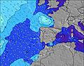 | 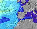 | 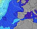 | 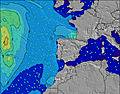 | 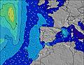 | ||||||||||||||
Wave Height (m) Direction Period (s) | WNW 10 | WNW 10 | WNW 9 | WNW 8 | W 8 | NW 5 | NW 6 | WNW 10 | WNW 10 | WNW 9 | WNW 9 | WNW 9 | WNW 9 | WNW 9 | WNW 8 | WNW 11 | WNW 10 | WNW 9 | WNW 8 | WNW 8 | WNW 8 |
Wave Graph | |||||||||||||||||||||
18 | 31 | 16 | 14 | 12 | 25 | 24 | 37 | 55 | 49 | 47 | 46 | 71 | 45 | 40 | 47 | 140 | 154 | 111 | 100 | 140 | |
Wind (km/h) | |||||||||||||||||||||
Wind State on-shore cross-onshore cross-shore cross-offshore off-shore glassy | cross-on | cross-on | cross | cross-on | cross-on | cross | cross-on | cross-on | cross | on | cross-on | glassy | cross-on | cross-on | glassy | glassy | on | cross | cross | cross-on | glassy |
High Tide | 7:40AM2.39m | 7:56PM2.57m | 8:30AM2.35m | 8:48PM2.49m | 9:28AM2.33m | 9:51PM2.43m | 10:34AM2.36m | 11:03PM2.42m | 11:45AM2.45m | 00:17AM2.48m | 12:52PM2.61m | 1:26AM2.60m | 1:54PM2.81m | 2:27AM2.74m | |||||||
Low Tide | 1:37PM0.67m | 2:15AM0.59m | 2:29PM0.74m | 3:08AM0.64m | 3:31PM0.79m | 4:12AM0.68m | 4:44PM0.78m | 5:22AM0.67m | 6:00PM0.68m | 6:32AM0.59m | 7:10PM0.51m | 7:35AM0.47m | 8:12PM0.30m | ||||||||
6:09 | — | — | 6:09 | — | — | 6:09 | — | — | 6:09 | — | — | 6:11 | — | — | 6:11 | — | — | 6:11 | — | — | |
— | — | 9:08 | — | — | 9:08 | — | — | 9:07 | — | — | 9:07 | — | — | 9:07 | — | — | 9:07 | — | — | 9:07 | |
mm | — | — | — | — | — | — | — | — | — | — | — | — | — | — | — | — | — | — | — | — | — |
Temp °C | 26 | 24 | 19 | 20 | 20 | 17 | 21 | 20 | 17 | 20 | 20 | 17 | 20 | 20 | 18 | 21 | 21 | 19 | 21 | 21 | 18 |
Feels °C | 25 | 23 | 19 | 19 | 19 | 17 | 19 | 18 | 17 | 19 | 19 | 18 | 20 | 19 | 19 | 21 | 21 | 19 | 20 | 19 | 19 |
Swell 1 Height (m) Direction Period (s) | WNW 10 | WNW 10 | WNW 9 | WNW 8 | W 8 | WNW 10 | WNW 10 | WNW 10 | WNW 10 | NW 6 | WNW 9 | NW 6 | WNW 9 | WNW 9 | WNW 8 | WNW 11 | WNW 10 | WNW 9 | WNW 8 | WNW 8 | WNW 8 |
18 | 31 | 16 | 14 | 12 | 11 | 19 | 37 | 55 | 30 | 47 | 30 | 71 | 45 | 40 | 47 | 140 | 154 | 111 | 100 | 140 | |
Swell 2 Height (m) Direction Period (s) | NW 9 | NNW 8 | NW 8 | NW 8 | NW 8 | W 8 | W 7 | W 7 | W 7 | WNW 9 | W 17 | WNW 9 | NW 5 | W 14 | NW 4 | WNW 8 | W 16 | W 21 | W 15 | SW 19 | W 15 |
12 | 7 | 3 | 3 | 2 | 5 | 4 | 1 | 4 | 49 | 6 | 46 | 17 | 4 | 5 | 36 | 5 | 9 | 4 | 15 | 4 | |
Swell 3 Height (m) Direction Period (s) | W 13 | W 13 | — | — | W 12 | NW 7 | — | — | — | — | — | W 16 | W 17 | — | WNW 12 | NW 5 | — | W 15 | — | W 15 | W 19 |
3 | 3 | — | — | 3 | 2 | — | — | — | — | — | 5 | 6 | — | 29 | 8 | — | 4 | — | 4 | 7 | |
Wind waves Height (m) Direction Period (s) | — | WNW 2 | NW 3 | WNW 4 | NW 3 | NW 5 | NW 6 | NW 5 | NW 5 | — | NW 5 | — | — | NW 5 | — | — | NW 4 | — | — | — | — |
— | 1 | 1 | 3 | 5 | 25 | 24 | 25 | 25 | — | 22 | — | — | 11 | — | — | 4 | — | — | — | — | |
Nearest Offshore or Glassy | |||||||||||||||||||||
Distance (km) | 50 | 266 | 83 | 1041 | 192 | 50 | 88 | 188 | 69 | 27 | 188 | 0 | 254 | 188 | 0 | 0 | 188 | 1 | 67 | 180 | 0 |
Best forecast wave conditions in Beira | |||||||||||||||||||||
Best forecast wave conditions in Portugal | |||||||||||||||||||||
Header Global | |||||||||||||||||||||
- Map Icons:
 Break
Break Live Wave Height (m)
 Live Wind Speed (km/h)
 Surf Rating (10 Max)
 Ocean Swells (m)
- Wind Speed (km/h)


FREE! Surf-Forecast.com widget for your website
The surf report / weather widget below is available to embed on third party websites free of charge and provides a summary of our Furadouro surf forecast. Simply grab the html code snippet that we provide and paste it into your own site. You can choose your preferred language and metric/imperial units for the surf forecast feed to suit users of your site. Click here to get the code.
Information about the Furadouro Surf forecast
The above surf forecast table for Furadouro provides essential information for determining whether the surfing conditions will be good over the next 16 days. A general guide to surfing at Furadouro can be found by selecting the local surf guide option on the grey menu. Our Furadouro surf forecast is unique since it includes wave energy (power) that defines the real feel of the surf rather than just the height or the period. If you surf the same spot (Furadouro) regularly then make a mental note of the wave energy from the surf forecast table each time you go. Very soon you may start to choose your surf days based on the wave energy alone combined with our forecast of favourable offshore wind conditions. Our star ratings will help here and of course you will also find the usual wave height and period predictions on our surf forecasts as well as a full break down of the swell components under our advanced users option (to reveal that, click the little Einstein character under the tide times).
Further information to help with frequently asked questions about our surf forecast for Furadouro may be found under the help tab on the top menu and also by moving your mouse over the question marks on the surf forecast table itself. Please always bear in mind that the forecast is for near-shore open water and local factors at each surf break influence the actual breaking wave height, such as the beach / reef profile, water depths offshore and shelter.
Furadouro is 7 km (4 miles) from Ovar. If you plan a holiday in Beira, look for hotels and other accommodation in Ovar. Ovar has rooms for a wide range of budgets as well as car hire and transport links.
 Nearest