

Surf Forecasts:

China Walls surf forecast from 4 Jul 2026:
- Most powerful swell: Saturday 4 Jul, 11PM (local time) - 2.5ft (0.8m), 19s period, SSW swell with 502 kJ wave energy.
Best Forecast Surf Conditions for China Walls this week:
The most powerful waves expected at China Walls in the next 16 days are 0.8m 19s and forecast to arrive on Saturday (Jul 04) at 11PM. Winds are predicted to be cross-offshore at the time the swell arrives. The largest open ocean swell (not directed at the beach) is 2.3m 8s period and expected on Tuesday (Jul 07) at 11PM.
| Wave Type | Time (HST) & Date | Wave Height & Period |
|---|---|---|
| Next good surf (1 star+) | - | - |
| Best Surf | - | - |
| Most Powerful | 11PM (Sat 4th Jul) | 2.5ft (0.8m) 19s |
Table - best surf conditions forecast for China Walls over the next 16 days.
Updates in hr min s Forecast update imminent
Alright, Rusty here again, looking at the same forecast through a different lens.
It’s a tough stretch, no way around it. The long-range outlook is a real grind, with no proper green light days. The swell is tiny, the wind is a persistent cross-off from the ENE or NE, and it’s just not shaping up for anything worth paddling out for.
China Walls is the only spot in the picture, and it’s a classic reef set-up that needs the right direction to work. The optimum is a south swell, and we do see some pulses from the SSW and S, but they’re weak and the wind just doesn’t let up. The water temperature is roughly 80°, which is about average for this time of year.
Friday July 3rd through Monday July 6th: The swell is a joke. We’re looking at 2 ft to 3 ft from the SSW and S, with periods that bounce around between 15 and 21 seconds. The energy is low to moderate. The wind is a fresh breeze at 18 – 25 mph, which is cross-off. It’s clean, but the surf is basically flat and “poor.” There’s nothing here to get excited about.
Tuesday July 7th through Thursday July 16th: The story doesn’t change much. Small, weak swell continues, with heights from 1 ft to 3 ft. The energy values are still low to moderate. The wind stays a fresh breeze, 12 – 22 mph. The wave comments are all “poor” or “marginal,” and the scores are zip. There might be a little bump in energy around July 14th from the west, but it’s still only 3 ft and the wind doesn’t favor it. This is a long, quiet period.
Friday July 17th and Saturday July 18th: The final two days of the outlook. Same story. 2 ft to 2 ft from the S and SSW, period around 18 seconds. Energy is moderate. The wind is still a fresh breeze. It’s just more of the same “poor” conditions.
So, to sum it up: there are no standout days, no real windows of opportunity. The wind is too strong and the swell is too small and inconsistent. The set-up looks more interesting for kite surfing than paddle surfing, honestly.
Forget it for now, keep your gear in the car and wait for a change.
Rusty
Short Range ForecastMostly dry. Warm (max 25°C on Fri afternoon, min 24°C on Fri night). Mainly strong winds. | Days 5-7 Weather SummaryMostly dry. Warm (max 25°C on Wed afternoon, min 24°C on Mon afternoon). Mainly strong winds. | ||||||||||||||||||||
Fri 3 | Saturday 4 | Sunday 5 | Monday 6 | Tuesday 7 | Wednesday 8 | Thursday 9 | |||||||||||||||
PM | Night | AM | PM | Night | AM | PM | Night | AM | PM | Night | AM | PM | Night | AM | PM | Night | AM | PM | Night | AM | |
Swell Height Map |  |  |  |  |  |  |  | 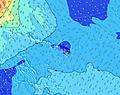 | |||||||||||||
Wave Height (m) Direction Period (s) | SSW 16 | SSW 16 | S 21 | S 20 | SSW 19 | SSW 18 | SSW 18 | SSW 16 | SSW 16 | SSW 15 | SSW 15 | SSW 14 | SSW 14 | SSW 14 | SSW 14 | SSW 13 | S 13 | S 12 | S 12 | S 12 | S 12 |
Wave Graph | |||||||||||||||||||||
208 | 146 | 326 | 377 | 486 | 418 | 408 | 371 | 337 | 402 | 284 | 280 | 273 | 250 | 189 | 187 | 125 | 112 | 112 | 75 | 71 | |
Wind (km/h) | |||||||||||||||||||||
Wind State on-shore cross-onshore cross-shore cross-offshore off-shore glassy | cross-off | cross-off | cross-off | cross-off | cross-off | cross-off | cross-off | cross-off | cross-off | cross-off | cross-off | cross-off | cross-off | cross-off | cross-off | cross-off | cross-off | cross-off | cross-off | cross-off | cross-off |
High Tide | 5:31PM0.62m | 6:20AM0.24m | 6:04PM0.58m | 7:31AM0.29m | 6:38PM0.51m | 8:45AM0.37m | 7:16PM0.44m | 9:53AM0.45m | 8:03PM0.36m | 10:53AM0.55m | 9:06PM0.28m | 11:46AM0.64m | 10:28PM0.22m | 12:36PM0.72m | |||||||
Low Tide | 1:11AM0.05m | 11:08AM0.12m | 1:41AM0.04m | 12:14PM0.19m | 2:11AM0.02m | 1:48PM0.25m | 2:44AM0.01m | 3:55PM0.27m | 3:22AM-0.01m | 6:02PM0.24m | 4:05AM-0.03m | 7:30PM0.18m | 4:54AM-0.05m | ||||||||
— | — | 5:52 | — | — | 5:52 | — | — | 5:54 | — | — | 5:54 | — | — | 5:54 | — | — | 5:54 | — | — | 5:54 | |
7:15 | — | — | 7:15 | — | — | 7:15 | — | — | 7:15 | — | — | 7:15 | — | — | 7:15 | — | — | 7:15 | — | 7:15 | |
mm | — | — | — | — | — | — | — | — | — | — | — | — | — | — | — | — | — | — | — | — | — |
Temp °C | 25 | 24 | 24 | 24 | 25 | 24 | 24 | 24 | 24 | 24 | 24 | 24 | 24 | 24 | 24 | 25 | 24 | 24 | 25 | 24 | 24 |
Feels °C | 23 | 21 | 20 | 21 | 23 | 21 | 20 | 21 | 20 | 19 | 19 | 19 | 20 | 19 | 20 | 21 | 20 | 21 | 22 | 21 | 20 |
Swell 1 Height (m) Direction Period (s) | SSW 16 | ENE 8 | SSW 16 | S 20 | SSW 19 | SSW 18 | SSW 18 | SSW 16 | SSW 16 | SSW 15 | SSW 15 | SSW 14 | SSW 14 | SSW 14 | SSW 14 | SSW 13 | S 13 | S 12 | S 12 | S 12 | S 12 |
208 | 310 | 212 | 377 | 486 | 418 | 408 | 371 | 337 | 402 | 284 | 280 | 273 | 250 | 189 | 187 | 125 | 112 | 112 | 75 | 71 | |
Swell 2 Height (m) Direction Period (s) | SSW 12 | SSW 16 | S 21 | SSW 16 | SSW 14 | SSW 14 | SSW 14 | SSW 13 | SSE 9 | SSE 10 | SW 9 | SSE 8 | SE 8 | SE 10 | SSE 8 | SSE 8 | W 16 | W 15 | SSE 7 | W 14 | W 14 |
60 | 146 | 326 | 162 | 69 | 138 | 79 | 34 | 8 | 10 | 3 | 7 | 3 | 4 | 7 | 7 | 20 | 39 | 11 | 59 | 58 | |
Swell 3 Height (m) Direction Period (s) | S 12 | SSW 12 | SSW 16 | SSW 11 | SW 15 | SSE 11 | SSE 11 | SSE 10 | SSW 13 | SE 8 | SW 9 | NW 9 | S 10 | — | W 18 | W 17 | SSE 8 | SSE 8 | W 14 | S 15 | SSW 21 |
11 | 59 | 25 | 23 | 54 | 11 | 11 | 10 | 17 | 3 | 3 | 3 | 2 | — | 6 | 6 | 7 | 6 | 36 | 17 | 45 | |
Wind waves Height (m) Direction Period (s) | ENE 8 | — | ENE 8 | ENE 8 | ENE 7 | ENE 7 | ENE 7 | ENE 7 | ENE 7 | ENE 8 | ENE 7 | ENE 8 | ENE 7 | ENE 8 | ENE 7 | ENE 7 | ENE 7 | ENE 7 | ENE 7 | ENE 7 | ENE 7 |
271 | — | 336 | 310 | 310 | 359 | 389 | 503 | 503 | 531 | 498 | 487 | 516 | 588 | 400 | 294 | 417 | 271 | 229 | 312 | 191 | |
Nearest Offshore or Glassy | |||||||||||||||||||||
Distance (km) | 43 | 54 | 43 | 43 | 51 | 43 | 51 | 56 | 51 | 114 | 114 | 43 | 54 | 58 | 51 | 51 | 54 | 43 | 45 | 51 | 44 |
Best forecast wave conditions in Oahu | |||||||||||||||||||||
Best forecast wave conditions in United States | |||||||||||||||||||||
Header Global | |||||||||||||||||||||
- Map Icons:
 Break
Break Live Wave Height (m)
 Live Wind Speed (km/h)
 Surf Rating (10 Max)
 Ocean Swells (m)
- Wind Speed (km/h)


FREE! Surf-Forecast.com widget for your website
The surf report / weather widget below is available to embed on third party websites free of charge and provides a summary of our China Walls surf forecast. Simply grab the html code snippet that we provide and paste it into your own site. You can choose your preferred language and metric/imperial units for the surf forecast feed to suit users of your site. Click here to get the code.
Information about the China Walls Surf forecast
The above surf forecast table for China Walls provides essential information for determining whether the surfing conditions will be good over the next 16 days. A general guide to surfing at China Walls can be found by selecting the local surf guide option on the grey menu. Our China Walls surf forecast is unique since it includes wave energy (power) that defines the real feel of the surf rather than just the height or the period. If you surf the same spot (China Walls) regularly then make a mental note of the wave energy from the surf forecast table each time you go. Very soon you may start to choose your surf days based on the wave energy alone combined with our forecast of favourable offshore wind conditions. Our star ratings will help here and of course you will also find the usual wave height and period predictions on our surf forecasts as well as a full break down of the swell components under our advanced users option (to reveal that, click the little Einstein character under the tide times).
Further information to help with frequently asked questions about our surf forecast for China Walls may be found under the help tab on the top menu and also by moving your mouse over the question marks on the surf forecast table itself. Please always bear in mind that the forecast is for near-shore open water and local factors at each surf break influence the actual breaking wave height, such as the beach / reef profile, water depths offshore and shelter.
China Walls is 13 km (8 miles) from Honolulu. If you plan a vacation in Oahu, look for hotels and other accommodation in Honolulu. Honolulu has rooms for a wide range of budgets as well as car hire and transport links.
 Nearest