

Surf Forecasts:

Andrew Molera State Park surf forecast from 27 Jul 2026:
- Best quality surf: Sunday 2 Aug, 11PM (local time) - 10ft (3.0m), 10s period, NW swell with cross-offshore winds.
- Most powerful swell: Monday 3 Aug, 2AM (local time) - 10ft (3.0m), 10s period, NW swell with 1,462 kJ wave energy.
- Next surfable swell (1★+): Sunday 2 Aug, 11PM (local time) - 10ft (3.0m), 10s period with NW swell.
Best Forecast Surf Conditions for Andrew Molera State Park this week:
The surf forecast for Andrew Molera State Park over the next 16 days: The first swell (rated 1 star or higher) is forecast to arrive on Sunday (Aug 02) at 11PM. The primary swell is predicted to be 3.0m and 10s period with a secondary swell of 2.4m and 10s. Another secondary swell of 0.4m and 13s is also forecast. The wind is predicted to be cross-offshore as the swell arrives.
The most powerful waves expected at Andrew Molera State Park in the next 16 days are 3.0m 10s and forecast to arrive on Monday (Aug 03) at 2AM. Winds are predicted to be cross-offshore at the time the swell arrives. The largest open ocean swell (not directed at the beach) is 0.9m 14s period and expected on Thursday (Jul 30) at 11PM.
| Wave Type | Time (PDT) & Date | Wave Height & Period |
|---|---|---|
| Next good surf (1 star+) | 11PM (Sun 2nd Aug) | 10ft (3.0m) 10s |
| Best Surf | 11PM (Sun 2nd Aug) | 10ft (3.0m) 10s |
| Most Powerful | 2AM (Mon 3rd Aug) | 10ft (3.0m) 10s |
Table - best surf conditions forecast for Andrew Molera State Park over the next 16 days.
The Lowdown
Alright folks, Rusty here. Let’s have a look at what’s cooking for Andrew Molera State Park over the next couple of weeks.
First off, the water is a bit chilly for this time of year, sitting at 56°F with an anomaly of -3°F, so it’s running a bit colder than usual. Throw on the extra rubber.
We’ve got a pretty long stretch of nothing special to start. That first record shows no real surf to get excited about right now. The real story is that we’re looking at a gap of several days with no decent recommendations. For the first week, it’s mostly small, messy swells with cross-off winds that aren’t doing us any favours. The combined energy is weak, mostly in the 700-1000 range, which is just not enough to get the heart pumping.
The one period that stands out as the best on offer is Sunday, August 2nd. The swell is coming from the NW at 8ft to 10ft, with a period of 10 seconds. That’s a solid, moderate groundswell. The combined energy jumps to 1243 and then 2460, which is strong. But here’s the catch: the wind is cross, not offshore, and the waves are going to be a bit lumpy. Still, this is the biggest swell we’ll see, and it’s a proper beach and point setup. For the morning, it’s 8ft, and by the afternoon it’s pushing 10ft – that’s expert territory, way too big for beginners. The NW direction is a good match for the optimum swell direction from the west.
Following that, the surf drops off again. We get a few days of smaller, weaker NW swell with light cross-on winds, but the energy is fading fast. The combined energy sits in the 200-600 range, which is just weak. The wave heights are around 1ft to 5ft, and the periods are short, around 8 to 10 seconds. Nothing to write home about.
There is a small window on Friday, August 7th, where the wind goes glassy in the morning, with a 2ft swell from the SSW and a very long period of 19 seconds. That’s a long-period groundswell, but it’s tiny. The combined energy is only 298, so it’s weak. The break is a beach and point, and with that long period, it might be a bit too straight for the beach break, but the point could be interesting for a longboard if you’re desperate. But honestly, it’s not a standout.
So, the bottom line: if you’re an expert looking for a big, powerful session, keep an eye on Sunday, August 2nd. The rest of the window is a write-off for quality surf. The setup with the cross-off winds and small waves might be more interesting for kite surfing than paddle surfing during the weaker days.
Stay patient, and keep checking the charts.
Rusty.
Short Range ForecastMostly dry. Warm (max 24°C on Tue afternoon, min 17°C on Mon night). Wind will be generally light. | Days 4-6 Weather SummaryMostly dry. Warm (max 26°C on Sat afternoon, min 19°C on Thu night). Mainly fresh winds. | ||||||||||||||||||||
Monday 27 | Tuesday 28 | Wednesday 29 | Thursday 30 | Friday 31 | Saturday 1 | Sunday 2 | |||||||||||||||
AM | PM | Night | AM | PM | Night | AM | PM | Night | AM | PM | Night | AM | PM | Night | AM | PM | Night | AM | PM | Night | |
Swell Height Map |  |  |  |  |  |  | 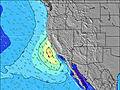 | ||||||||||||||
Wave Height (m) Direction Period (s) | SSW 18 | SSW 19 | SSW 17 | SSW 18 | SSW 17 | SSW 16 | SSW 16 | SSW 16 | NW 8 | NW 9 | NW 8 | NW 8 | NW 8 | S 14 | S 13 | NW 8 | NW 8 | NW 9 | NW 10 | NW 10 | NW 10 |
Wave Graph | |||||||||||||||||||||
854 | 963 | 594 | 943 | 807 | 667 | 539 | 525 | 459 | 535 | 532 | 448 | 373 | 553 | 314 | 392 | 439 | 1052 | 1059 | 1375 | 1462 | |
Wind (km/h) | |||||||||||||||||||||
Wind State on-shore cross-onshore cross-shore cross-offshore off-shore glassy | cross-off | cross-off | cross-off | cross-off | cross-off | cross-off | cross | cross-off | cross-off | cross | cross-off | cross-off | cross | cross | cross-off | cross-off | cross-off | cross-off | cross | cross | cross-off |
High Tide | 11:14AM1.51m | 9:25PM2.14m | 11:43AM1.54m | 10:03PM2.15m | 12:10PM1.57m | 10:40PM2.13m | 12:38PM1.61m | 11:17PM2.06m | 1:04PM1.66m | 11:56PM1.95m | 1:31PM1.72m | 00:38AM1.80m | 1:58PM1.78m | 1:27AM1.64m | |||||||
Low Tide | 3:16PM1.24m | 4:54AM0.22m | 3:57PM1.21m | 5:26AM0.21m | 4:38PM1.17m | 5:56AM0.24m | 5:21PM1.13m | 6:25AM0.31m | 6:06PM1.09m | 6:52AM0.41m | 6:56PM1.04m | 7:19AM0.53m | 7:52PM0.97m | ||||||||
6:09 | — | — | 6:09 | — | — | 6:11 | — | — | 6:11 | — | — | 6:13 | — | — | 6:13 | — | — | 6:13 | — | — | |
— | 8:16 | — | — | 8:15 | — | — | 8:15 | — | — | 8:14 | — | — | 8:14 | — | — | 8:13 | — | — | 8:12 | — | |
mm | — | — | — | — | — | — | — | — | — | — | — | — | — | — | — | — | — | — | — | — | — |
Temp °C | 22 | 23 | 18 | 23 | 24 | 19 | 23 | 24 | 20 | 23 | 24 | 21 | 23 | 24 | 21 | 25 | 26 | 21 | 24 | 24 | 21 |
Feels °C | 18 | 19 | 14 | 19 | 21 | 16 | 20 | 21 | 16 | 20 | 20 | 17 | 21 | 21 | 18 | 21 | 22 | 17 | 21 | 22 | 18 |
Swell 1 Height (m) Direction Period (s) | SSW 18 | SSW 19 | SSW 17 | SSW 18 | SSW 17 | NW 8 | SSW 16 | SSW 16 | SSW 16 | SSW 16 | SSW 15 | SSE 14 | SSE 13 | S 14 | NW 8 | S 13 | S 12 | NW 9 | S 11 | NW 10 | NW 10 |
854 | 963 | 594 | 943 | 807 | 276 | 539 | 525 | 337 | 435 | 318 | 304 | 225 | 553 | 223 | 171 | 236 | 844 | 58 | 1007 | 1126 | |
Swell 2 Height (m) Direction Period (s) | SSW 11 | SSW 12 | SSW 12 | S 10 | S 20 | SSW 16 | SSE 16 | SSE 15 | SW 16 | SSE 13 | SSE 15 | S 14 | SSW 14 | — | S 13 | S 11 | SW 15 | S 11 | SSW 14 | SW 13 | SSW 13 |
23 | 28 | 56 | 2 | 194 | 667 | 138 | 188 | 196 | 102 | 288 | 153 | 183 | — | 314 | 123 | 54 | 127 | 75 | 46 | 68 | |
Swell 3 Height (m) Direction Period (s) | S 10 | SSW 10 | NW 9 | SE 18 | SW 11 | S 20 | S 18 | S 18 | SSE 14 | SSE 16 | SSW 15 | SW 15 | S 15 | S 21 | SW 14 | SSW 15 | SW 19 | SW 14 | S 13 | SSW 10 | SSW 9 |
8 | 9 | 14 | 12 | 31 | 119 | 155 | 155 | 110 | 90 | 144 | 104 | 218 | 9 | 53 | 84 | 15 | 53 | 51 | 32 | 16 | |
Wind waves Height (m) Direction Period (s) | NW 7 | NW 6 | NW 6 | NW 7 | NW 7 | NW 8 | NW 8 | NW 8 | NW 8 | NW 9 | NW 8 | NW 8 | NW 8 | NW 8 | NW 7 | NW 8 | NW 8 | NW 9 | NW 10 | NW 10 | NW 10 |
138 | 126 | 134 | 169 | 285 | 385 | 314 | 355 | 459 | 535 | 532 | 448 | 373 | 268 | 309 | 392 | 439 | 1052 | 1059 | 1375 | 1462 | |
Nearest Offshore or Glassy | |||||||||||||||||||||
Distance (km) | 14 | 76 | 14 | 76 | 76 | 14 | 76 | 76 | 14 | 76 | 75 | 14 | 76 | 76 | 14 | 76 | 75 | 14 | 76 | 76 | 0 |
Best forecast wave conditions in Monterey | |||||||||||||||||||||
Best forecast wave conditions in United States | |||||||||||||||||||||
Header Global | |||||||||||||||||||||
- Map Icons:
 Break
Break Live Wave Height (m)
 Live Wind Speed (km/h)
 Surf Rating (10 Max)
 Ocean Swells (m)
- Wind Speed (km/h)


FREE! Surf-Forecast.com widget for your website
The surf report / weather widget below is available to embed on third party websites free of charge and provides a summary of our Andrew Molera State Park surf forecast. Simply grab the html code snippet that we provide and paste it into your own site. You can choose your preferred language and metric/imperial units for the surf forecast feed to suit users of your site. Click here to get the code.
Information about the Andrew Molera State Park Surf forecast
The above surf forecast table for Andrew Molera State Park provides essential information for determining whether the surfing conditions will be good over the next 16 days. A general guide to surfing at Andrew Molera State Park can be found by selecting the local surf guide option on the grey menu. Our Andrew Molera State Park surf forecast is unique since it includes wave energy (power) that defines the real feel of the surf rather than just the height or the period. If you surf the same spot (Andrew Molera State Park) regularly then make a mental note of the wave energy from the surf forecast table each time you go. Very soon you may start to choose your surf days based on the wave energy alone combined with our forecast of favourable offshore wind conditions. Our star ratings will help here and of course you will also find the usual wave height and period predictions on our surf forecasts as well as a full break down of the swell components under our advanced users option (to reveal that, click the little Einstein character under the tide times).
Further information to help with frequently asked questions about our surf forecast for Andrew Molera State Park may be found under the help tab on the top menu and also by moving your mouse over the question marks on the surf forecast table itself. Please always bear in mind that the forecast is for near-shore open water and local factors at each surf break influence the actual breaking wave height, such as the beach / reef profile, water depths offshore and shelter.
Andrew Molera State Park is 33 km (20 miles) from Monterey. If you plan a vacation in Monterey, look for hotels and other accommodation in Monterey. Monterey has rooms for a wide range of budgets as well as car hire and transport links.
 Nearest