

Surf Forecasts:

Makaha surf forecast from 5 Jul 2026:
- Best quality surf: Sunday 5 Jul, 2AM (local time) - 2.5ft (0.8m), 19s period, SSW swell with cross-offshore winds.
- Most powerful swell: Saturday 4 Jul, 11PM (local time) - 3ft (0.9m), 19s period, SSW swell with 627 kJ wave energy.
- Next surfable swell (1★+): Sunday 5 Jul, 2AM (local time) - 2.5ft (0.8m), 19s period with SSW swell.
Best Forecast Surf Conditions for Makaha this week:
The surf forecast for Makaha over the next 16 days: The first swell (rated 1 star or higher) is forecast to arrive on Sunday (Jul 05) at 2AM. The primary swell is predicted to be 0.8m and 19s period. The wind is predicted to be cross-offshore as the swell arrives.
The most powerful waves expected at Makaha in the next 16 days are 0.9m 19s and forecast to arrive on Saturday (Jul 04) at 11PM. Winds are predicted to be cross-offshore at the time the swell arrives. The largest open ocean swell (not directed at the beach) is 1.6m 8s period and expected on Monday (Jul 06) at 2PM.
| Wave Type | Time (HST) & Date | Wave Height & Period |
|---|---|---|
| Next good surf (1 star+) | 2AM (Sun 5th Jul) | 2.5ft (0.8m) 19s |
| Best Surf | 2AM (Sun 5th Jul) | 2.5ft (0.8m) 19s |
| Most Powerful | 11PM (Sat 4th Jul) | 3ft (0.9m) 19s |
Table - best surf conditions forecast for Makaha over the next 16 days.
Updates in hr min s Forecast update imminent
Alright folks, Rusty here with the lowdown in feet and miles per hour.
This whole run is all about one spot: Makaha. It’s a beach and reef setup that breaks consistently and is wide open to the west. The water is sitting at 80°F, right on the money for this time of year. Crowds are a possibility, so be ready to share.
The real standout kicks off on Saturday the 4th of July. Saturday afternoon we’ve got a clean 3ft south swell with a very long 20-second period. The wind is a moderate offshore breeze from the northeast. The combined energy is a solid 656 (moderate), and the overall call is very good surf. This is the one to circle – that long period groundswell with clean offshore wind is going to be a treat.
Sunday the 5th keeps it going. Morning offers 3ft from the south-southwest, 18-second period, moderate offshore wind. Another very good call. The afternoon steps down, but the morning is gold.
From Monday the 6th through Wednesday the 8th, we stay around 3ft to 3ft but the period drops off. The energy fades from 450 down to 246. Still offshore winds, but conditions become more marginal. Surfable, but not the magic of the first weekend.
Thursday the 9th and Friday the 10th get small – around 1ft to 2ft. Short to moderate period, weak energy. Just ordinary.
Then a second pulse rolls in. Saturday the 11th and Sunday the 12th bring back 2ft to 3ft from the south-southwest and southwest. Period climbs to 16-18 seconds, energy jumps to 416-563. Winds stay offshore. It’s a solid run, but not as crisp as the first window.
Now for the second week, with a bit of caution since it’s further out. Monday the 13th afternoon has 3ft from the south-southwest, 15 seconds, and very good conditions. Tuesday the 14th morning brings 2ft from the west with a long 16-second period and gentle offshore wind, energy at 627. But the real highlight of that far week is Wednesday morning the 15th of July: 3ft from the west, 16-second period, and a whisper-light 5 mph offshore from the north-northeast. It’s clean, glassy, with energy at 633. That could be a beauty if it holds.
After that, it fades. Thursday the 16th and Friday the 17th still have some clean to glassy conditions with 1ft to 2ft. But by Saturday the 18th and Sunday the 19th, it’s small and ordinary.
Bottom line: don’t sleep on that first weekend – Saturday the 4th and Sunday the 5th of July. That’s the absolute best on offer. Keep your eye on Wednesday the 15th too, it’s got the recipe for a very special session.
Rusty.
Short Range ForecastMostly dry. Warm (max 27°C on Sun afternoon, min 24°C on Sat night). Mainly fresh winds. | Days 5-7 Weather SummaryMostly dry. Warm (max 29°C on Fri afternoon, min 24°C on Tue night). Wind will be generally light. | ||||||||||||||||||||
Sunday 5 | Monday 6 | Tuesday 7 | Wednesday 8 | Thursday 9 | Friday 10 | Sat 11 | |||||||||||||||
Night | AM | PM | Night | AM | PM | Night | AM | PM | Night | AM | PM | Night | AM | PM | Night | AM | PM | Night | AM | PM | |
Swell Height Map |  |  |  |  |  |  |  | 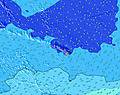 | |||||||||||||
Wave Height (m) Direction Period (s) | SSW 19 | SSW 18 | SSW 18 | SSW 16 | SSW 16 | SSW 15 | SSW 15 | SSW 14 | SSW 14 | SSW 14 | SSW 14 | SSW 13 | S 13 | S 12 | S 12 | S 12 | S 12 | SW 21 | SSW 19 | SSW 18 | SW 18 |
Wave Graph | |||||||||||||||||||||
486 | 522 | 510 | 432 | 421 | 402 | 355 | 350 | 341 | 254 | 243 | 187 | 168 | 112 | 110 | 75 | 71 | 108 | 251 | 218 | 316 | |
Wind (km/h) | |||||||||||||||||||||
Wind State on-shore cross-onshore cross-shore cross-offshore off-shore glassy | cross-off | off | off | off | off | off | cross-off | off | off | cross-off | off | cross-off | cross-off | off | off | off | off | off | cross-off | off | off |
High Tide | 8:51AM0.25m | 8:00PM0.46m | 10:02AM0.32m | 8:37PM0.38m | 11:10AM0.40m | 9:21PM0.30m | 12:11PM0.49m | 10:20PM0.23m | 1:05PM0.58m | 11:38PM0.17m | 1:56PM0.66m | 1:00AM0.14m | 2:44PM0.73m | ||||||||
Low Tide | 2:44AM0.02m | 1:23PM0.17m | 3:14AM0.01m | 2:53PM0.23m | 3:47AM-0.00m | 4:53PM0.25m | 4:24AM-0.02m | 7:01PM0.23m | 5:06AM-0.04m | 8:35PM0.17m | 5:54AM-0.06m | 9:36PM0.12m | 6:46AM-0.08m | ||||||||
— | 5:54 | — | — | 5:54 | — | — | 5:56 | — | — | 5:56 | — | — | 5:56 | — | — | 5:56 | — | — | 5:56 | — | |
7:19 | — | 7:19 | — | — | 7:19 | — | — | 7:19 | — | — | 7:19 | — | — | 7:19 | — | — | 7:19 | — | — | 7:19 | |
mm | — | — | — | — | — | — | — | — | — | — | — | — | — | — | — | — | — | — | — | — | — |
Temp °C | 25 | 26 | 27 | 24 | 26 | 26 | 24 | 25 | 26 | 24 | 26 | 26 | 25 | 27 | 27 | 25 | 28 | 29 | 26 | 26 | 26 |
Feels °C | 24 | 25 | 26 | 22 | 23 | 22 | 22 | 21 | 23 | 23 | 25 | 24 | 25 | 27 | 25 | 25 | 29 | 31 | 27 | 26 | 25 |
Swell 1 Height (m) Direction Period (s) | NE 8 | SSW 18 | SSW 18 | SSW 16 | SSW 16 | SSW 15 | SSW 15 | SSW 14 | SSW 14 | SSW 14 | SSW 14 | SSW 13 | S 13 | S 12 | S 12 | S 12 | S 12 | SSW 11 | SSW 19 | SSW 18 | SW 18 |
125 | 522 | 510 | 432 | 421 | 402 | 355 | 350 | 341 | 254 | 243 | 187 | 168 | 112 | 110 | 75 | 71 | 40 | 251 | 218 | 316 | |
Swell 2 Height (m) Direction Period (s) | SSW 19 | SSW 14 | SSW 14 | SSW 13 | SSE 9 | SSE 8 | SSE 8 | SSE 8 | SE 8 | SSE 10 | SSE 9 | SE 8 | SE 8 | SE 8 | SE 6 | SSE 6 | SSW 21 | SW 21 | S 11 | W 14 | W 14 |
486 | 183 | 78 | 67 | 8 | 7 | 7 | 7 | 3 | 9 | 8 | 18 | 18 | 16 | 9 | 6 | 45 | 108 | 40 | 63 | 57 | |
Swell 3 Height (m) Direction Period (s) | SSW 15 | NW 11 | NW 11 | SSE 10 | SSW 13 | S 10 | NW 9 | NW 9 | S 10 | NW 8 | N 8 | S 18 | W 15 | W 14 | W 14 | W 13 | W 14 | S 13 | W 13 | S 12 | S 12 |
188 | 42 | 18 | 18 | 17 | 8 | 3 | 3 | 2 | 3 | 1 | 6 | 17 | 15 | 33 | 13 | 16 | 29 | 56 | 44 | 44 | |
Wind waves Height (m) Direction Period (s) | E 6 | NE 8 | NE 7 | NE 7 | NE 7 | NE 7 | NE 8 | NE 7 | NE 7 | NE 7 | NE 7 | NE 7 | NE 7 | NE 7 | NE 7 | NE 7 | NE 7 | NE 7 | NE 8 | NE 7 | NE 7 |
91 | 125 | 189 | 156 | 237 | 260 | 179 | 262 | 217 | 152 | 136 | 115 | 109 | 130 | 139 | 94 | 123 | 147 | 221 | 167 | 162 | |
Nearest Offshore or Glassy | |||||||||||||||||||||
Distance (km) | 0 | 0 | 0 | 155 | 2 | 155 | 155 | 0 | 155 | 2 | 2 | 0 | 0 | 0 | 0 | 0 | 2 | 0 | 0 | 2 | 0 |
Best forecast wave conditions in Oahu | |||||||||||||||||||||
Best forecast wave conditions in United States | |||||||||||||||||||||
Header Global | |||||||||||||||||||||
- Map Icons:
 Break
Break Live Wave Height (m)
 Live Wind Speed (km/h)
 Surf Rating (10 Max)
 Ocean Swells (m)
- Wind Speed (km/h)


FREE! Surf-Forecast.com widget for your website
The surf report / weather widget below is available to embed on third party websites free of charge and provides a summary of our Makaha surf forecast. Simply grab the html code snippet that we provide and paste it into your own site. You can choose your preferred language and metric/imperial units for the surf forecast feed to suit users of your site. Click here to get the code.
Information about the Makaha Surf forecast
The above surf forecast table for Makaha provides essential information for determining whether the surfing conditions will be good over the next 16 days. A general guide to surfing at Makaha can be found by selecting the local surf guide option on the grey menu. Our Makaha surf forecast is unique since it includes wave energy (power) that defines the real feel of the surf rather than just the height or the period. If you surf the same spot (Makaha) regularly then make a mental note of the wave energy from the surf forecast table each time you go. Very soon you may start to choose your surf days based on the wave energy alone combined with our forecast of favourable offshore wind conditions. Our star ratings will help here and of course you will also find the usual wave height and period predictions on our surf forecasts as well as a full break down of the swell components under our advanced users option (to reveal that, click the little Einstein character under the tide times).
Further information to help with frequently asked questions about our surf forecast for Makaha may be found under the help tab on the top menu and also by moving your mouse over the question marks on the surf forecast table itself. Please always bear in mind that the forecast is for near-shore open water and local factors at each surf break influence the actual breaking wave height, such as the beach / reef profile, water depths offshore and shelter.
Makaha is 21 km (13 miles) from Makakilo City. If you plan a vacation in Oahu, look for hotels and other accommodation in Makakilo City. Makakilo City has rooms for a wide range of budgets as well as car hire and transport links.
 Nearest