

Surf Forecasts:

Keaau surf forecast from 15 Jul 2026:
- Best quality surf: Tuesday 14 Jul, 11PM (local time) - 2.5ft (0.7m), 15s period, W swell with offshore winds.
- Most powerful swell: Wednesday 15 Jul, 5AM (local time) - 2.5ft (0.8m), 15s period, W swell with 298 kJ wave energy.
- Next surfable swell (1★+): Tuesday 14 Jul, 11PM (local time) - 2.5ft (0.7m), 15s period with W swell.
Best Forecast Surf Conditions for Keaau this week:
The surf forecast for Keaau over the next 16 days: The first swell (rated 1 star or higher) is forecast to arrive on Tuesday (Jul 14) at 11PM. The primary swell is predicted to be 0.7m and 15s period with a secondary swell of 0.9m and 8s. The wind is predicted to be offshore as the swell arrives.
The most powerful waves expected at Keaau in the next 16 days are 0.8m 15s and forecast to arrive on Wednesday (Jul 15) at 5AM. Winds are predicted to be cross-offshore at the time the swell arrives. The largest open ocean swell (not directed at the beach) is 1.3m 8s period and expected on Sunday (Jul 19) at 11AM.
| Wave Type | Time (HST) & Date | Wave Height & Period |
|---|---|---|
| Next good surf (1 star+) | 11PM (Tue 14th Jul) | 2.5ft (0.7m) 15s |
| Best Surf | 11PM (Tue 14th Jul) | 2.5ft (0.7m) 15s |
| Most Powerful | 5AM (Wed 15th Jul) | 2.5ft (0.8m) 15s |
Table - best surf conditions forecast for Keaau over the next 16 days.
The Lowdown
Alright, this is Rusty, and I’m looking at the surf for Keaau over the next couple of weeks. Honestly, there’s nothing here that’s gonna get your heart racing. The whole 16-day window is pretty flat and ordinary, with only a few windows that are vaguely surfable. It’s a long stretch of small, weak energy, and you’ll be scratching for anything decent.
The first real chance to get wet is on Tuesday afternoon, the 14th. We’ve got a 2ft swell from the west, with a long period of 16 seconds – that’s proper groundswell energy, but the total wave energy is only moderate at 371. The wind is a cross-off from the NE at 12 mph, so the surface will be clean. The water temp is sitting at 79°, which is pretty much spot on for this time of year. It’s a marginal session, though, and nothing to get excited about.
Wednesday the 15th is a write-off with poor conditions and onshore wind. Thursday the 16th has a small window in the afternoon with some offshore wind from the ENE at 9 mph, and the same 2ft west swell, but the energy is dropping to 262. It’s clean, but still small.
Friday the 17th is probably the best of a very average bunch. Morning and afternoon both have clean offshore winds from the NE, with the swell still at 2ft from the west, period 14 seconds. The energy is moderate (326 in the morning, 209 in the afternoon). You’ll get some long-period lines, but it’s tiny. This is a good break for an intermediate, but don’t expect much push.
After that, the surf just fades away. From Saturday the 18th right through to the end of the month, we’re looking at tiny, weak swells, mostly under 3ft, with short periods of 7 seconds or less. The wind stays offshore most of the time, which is actually a shame because the waves are just too small to care about. The energy readings drop into the double digits, and everything is marked as “surfable but very ordinary” or just plain poor. There’s a little bump on Saturday the 25th morning with a 4ft swell from the NE and decent energy (204), but the wind is howling at 16 mph in the afternoon, and the whole thing is just messy.
Honestly, if you’re a paddle surfer, you’re looking at a long, flat run. The consistent offshore winds and small, weak swell might actually make this more interesting for a kite surfer than a surfer on a proper board. The best advice is to keep an eye on the forecast, because it’s so small right now that anything is an improvement.
Rusty.
Short Range ForecastLight rain (total 3mm), mostly falling on Tue afternoon. Warm (max 28°C on Thu afternoon, min 24°C on Tue night). Wind will be generally light. | Days 5-7 Weather SummaryMostly dry. Warm (max 29°C on Fri afternoon, min 23°C on Sun night). Wind will be generally light. | ||||||||||||||||||||
Tue 14 | Wednesday 15 | Thursday 16 | Friday 17 | Saturday 18 | Sunday 19 | Monday 20 | |||||||||||||||
PM | Night | AM | PM | Night | AM | PM | Night | AM | PM | Night | AM | PM | Night | AM | PM | Night | AM | PM | Night | AM | |
Swell Height Map |  |  |  |  |  |  |  | 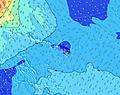 | |||||||||||||
Wave Height (m) Direction Period (s) | W 16 | W 15 | W 15 | W 15 | W 15 | W 14 | W 14 | W 14 | W 14 | W 14 | W 13 | W 13 | NE 7 | NE 7 | NE 7 | NE 7 | NE 6 | NE 7 | NE 7 | NE 7 | NE 7 |
Wave Graph | |||||||||||||||||||||
257 | 229 | 291 | 283 | 275 | 203 | 203 | 200 | 144 | 140 | 90 | 87 | 75 | 86 | 54 | 67 | 40 | 42 | 62 | 45 | 37 | |
Wind (km/h) | |||||||||||||||||||||
Wind State on-shore cross-onshore cross-shore cross-offshore off-shore glassy | cross-off | cross-off | on | on | cross-off | cross-on | off | off | off | off | off | off | off | off | off | off | off | cross-off | off | off | cross-off |
High Tide | 4:59PM0.77m | 5:05AM0.19m | 5:40PM0.73m | 6:01AM0.23m | 6:19PM0.66m | 7:01AM0.27m | 6:56PM0.58m | 8:04AM0.31m | 7:31PM0.49m | 9:13AM0.35m | 8:05PM0.40m | 10:24AM0.40m | 8:39PM0.31m | 11:33AM0.46m | |||||||
Low Tide | 00:17AM0.01m | 10:15AM-0.04m | 00:52AM0.01m | 11:07AM0.01m | 1:26AM0.01m | 12:02PM0.08m | 2:00AM0.01m | 1:04PM0.16m | 2:33AM0.02m | 2:21PM0.22m | 3:06AM0.03m | 4:10PM0.27m | 3:41AM0.04m | ||||||||
— | — | 5:58 | — | — | 5:58 | — | — | 6:00 | — | — | 6:00 | — | — | 6:00 | — | — | 6:01 | — | — | 6:01 | |
7:17 | — | — | 7:17 | — | — | 7:17 | — | — | 7:16 | — | — | 7:16 | — | — | 7:16 | — | — | 7:16 | — | 7:15 | |
mm | 1 | — | — | 2 | — | — | — | — | — | — | — | — | — | — | — | — | — | — | — | — | — |
Temp °C | 27 | 25 | 25 | 25 | 25 | 27 | 28 | 26 | 27 | 29 | 25 | 27 | 29 | 25 | 27 | 28 | 25 | 27 | 28 | 25 | 27 |
Feels °C | 27 | 24 | 25 | 26 | 28 | 29 | 28 | 27 | 27 | 29 | 25 | 28 | 29 | 25 | 28 | 28 | 24 | 27 | 26 | 25 | 29 |
Swell 1 Height (m) Direction Period (s) | NNE 7 | NNE 7 | W 15 | NNE 7 | SSW 16 | W 14 | NE 7 | W 14 | W 14 | SSW 16 | NE 7 | SSW 13 | SSW 14 | SSW 12 | NE 7 | S 13 | NE 6 | NE 7 | S 16 | S 15 | S 14 |
114 | 86 | 291 | 70 | 314 | 203 | 59 | 200 | 144 | 196 | 77 | 141 | 210 | 121 | 54 | 126 | 40 | 42 | 325 | 163 | 329 | |
Swell 2 Height (m) Direction Period (s) | SSW 14 | W 15 | NNE 7 | W 15 | NNE 8 | NE 7 | W 14 | SSW 14 | SSW 12 | W 14 | SSW 14 | W 13 | WNW 13 | WNW 12 | SSW 13 | S 19 | SSW 11 | S 16 | SW 18 | S 13 | NE 7 |
232 | 229 | 68 | 283 | 74 | 53 | 203 | 178 | 56 | 140 | 192 | 87 | 57 | 51 | 92 | 110 | 74 | 193 | 81 | 87 | 37 | |
Swell 3 Height (m) Direction Period (s) | W 16 | SW 13 | SW 13 | SSW 13 | W 15 | SSW 13 | SSW 13 | SSW 17 | SW 16 | SSW 12 | W 13 | SW 15 | SE 9 | SE 8 | ENE 7 | WNW 12 | S 18 | SSW 12 | SSE 7 | SSW 16 | SW 17 |
257 | 170 | 162 | 106 | 275 | 113 | 149 | 170 | 125 | 55 | 90 | 54 | 20 | 18 | 18 | 29 | 98 | 78 | 4 | 105 | 73 | |
Wind waves Height (m) Direction Period (s) | ENE 8 | — | — | — | — | — | — | NE 7 | NE 7 | NE 7 | ENE 6 | NE 7 | NE 7 | NE 7 | E 8 | NE 7 | E 8 | — | NE 7 | NE 7 | ENE 7 |
77 | — | — | — | — | — | — | 55 | 57 | 69 | 62 | 65 | 75 | 86 | 219 | 67 | 104 | — | 62 | 45 | 65 | |
Nearest Offshore or Glassy | |||||||||||||||||||||
Distance (km) | 2 | 0 | 10 | 2 | 0 | 1 | 0 | 0 | 0 | 0 | 0 | 0 | 0 | 0 | 0 | 0 | 1 | 2 | 0 | 1 | 2 |
Best forecast wave conditions in Oahu | |||||||||||||||||||||
Best forecast wave conditions in United States | |||||||||||||||||||||
Header Global | |||||||||||||||||||||
- Map Icons:
 Break
Break Live Wave Height (m)
 Live Wind Speed (km/h)
 Surf Rating (10 Max)
 Ocean Swells (m)
- Wind Speed (km/h)


FREE! Surf-Forecast.com widget for your website
The surf report / weather widget below is available to embed on third party websites free of charge and provides a summary of our Keaau surf forecast. Simply grab the html code snippet that we provide and paste it into your own site. You can choose your preferred language and metric/imperial units for the surf forecast feed to suit users of your site. Click here to get the code.
Information about the Keaau Surf forecast
The above surf forecast table for Keaau provides essential information for determining whether the surfing conditions will be good over the next 16 days. A general guide to surfing at Keaau can be found by selecting the local surf guide option on the grey menu. Our Keaau surf forecast is unique since it includes wave energy (power) that defines the real feel of the surf rather than just the height or the period. If you surf the same spot (Keaau) regularly then make a mental note of the wave energy from the surf forecast table each time you go. Very soon you may start to choose your surf days based on the wave energy alone combined with our forecast of favourable offshore wind conditions. Our star ratings will help here and of course you will also find the usual wave height and period predictions on our surf forecasts as well as a full break down of the swell components under our advanced users option (to reveal that, click the little Einstein character under the tide times).
Further information to help with frequently asked questions about our surf forecast for Keaau may be found under the help tab on the top menu and also by moving your mouse over the question marks on the surf forecast table itself. Please always bear in mind that the forecast is for near-shore open water and local factors at each surf break influence the actual breaking wave height, such as the beach / reef profile, water depths offshore and shelter.
Keaau is 22 km (14 miles) from Wahiawa. If you plan a vacation in Oahu, look for hotels and other accommodation in Wahiawa. Wahiawa has rooms for a wide range of budgets as well as car hire and transport links.
 Nearest