

Surf Forecasts:

Sunabe Seawall surf forecast from 14 Jul 2026:
- Most powerful swell: Saturday 18 Jul, 9AM (local time) - 4ft (1.2m), 6s period, SW swell with 89 kJ wave energy.
Best Forecast Surf Conditions for Sunabe Seawall this week:
The most powerful waves expected at Sunabe Seawall in the next 16 days are 1.2m 6s and forecast to arrive on Saturday (Jul 18) at 9AM. Winds are predicted to be cross-onshore at the time the swell arrives. The largest open ocean swell (not directed at the beach) is 1.3m 8s period and expected on Sunday (Jul 19) at 3AM.
| Wave Type | Time (JST) & Date | Wave Height & Period |
|---|---|---|
| Next good surf (1 star+) | - | - |
| Best Surf | - | - |
| Most Powerful | 9AM (Sat 18th Jul) | 4ft (1.2m) 6s |
Table - best surf conditions forecast for Sunabe Seawall over the next 16 days.
The Lowdown
Alright, let’s break it down. The next couple of weeks are looking pretty quiet for surf around here. There’s a long stretch of flat or poor conditions before things start to show some life late in the second week. The first real surf recommendation doesn’t pop up until the final few days, so we’re talking about a gap of well over a week with nothing worth paddling out for.
Right now, through the middle of July and into the third week, it’s mostly small, weak, and chopped up. Winds are cross or cross-on, and the swell is tiny – often under 2 feet, with periods barely reaching 9 seconds. The combined energy is low, so there’s just no push. The water temp is sitting at 82°, which is a bit colder than normal for this time of year, about 3° cooler than average.
By Thursday the 23rd of July, we start to see a little improvement, but it’s still marginal. The swell is small – around 2 feet from the west, with periods of 7 seconds, and the combined energy is only 31. That’s not going to get most people excited. But the wind turns light and offshore, so it’s clean. That’s something.
The one standout window comes right at the end of the forecast period. On Monday the 27th of July, Sunabe Seawall (Okinawa) starts to see a proper pulse. The morning brings 2 feet from the east, but here’s the kicker – the period is 16 seconds. That’s long-period groundswell, and the combined energy jumps to 118, which is moderate. The wind is clean and cross-off, so the wave faces should be tidy. By the afternoon, the swell holds at 2 feet from the east, still 15 seconds, and energy rises to 170. This is a point/reef break, so that long period will actually wrap in nicely and create some proper shape. It’s not big, but the quality will be there.
Then Tuesday the 28th of July morning looks even better. Swell is 3 feet from the east, a long 16-second period, and combined energy hits 310 – strong wave energy. The wind is a fresh cross-off from the north-northeast, so it’s clean. This is the best of the bunch. The afternoon gets a bit messy with a strong cross-shore breeze, so hit the morning session.
Even Wednesday the 29th of July has some serious energy, with 4 to 4 feet from the east, 17-second periods, and energy readings over 800. But that also comes with a violent storm force wind and gale force wind, so while it’s technically clean, the wind is extreme. That’s more of a watch-and-see situation, and honestly, for most surfers, it’ll be too dangerous. For experts only, and even then, caution is the word.
So, the best call: Monday 27th July and Tuesday 28th July mornings at Sunabe Seawall. The swell direction is east, which matches the optimum, the wind is offshore or cross-off, and the long period will deliver some real quality. It’s not huge, but it’s clean and consistent. Crowds are often there, so expect company.
Everything before that? A long flat spell. Hang tight.
Rusty.
Short Range ForecastMostly dry. Warm (max 28°C on Tue morning, min 26°C on Tue night). Wind will be generally light. | Days 4-6 Weather SummaryMostly dry. Warm (max 29°C on Fri morning, min 26°C on Sun night). Wind will be generally light. | ||||||||||||||||||||
Tuesday 14 | Wednesday 15 | Thursday 16 | Friday 17 | Saturday 18 | Sunday 19 | Monday 20 | |||||||||||||||
AM | PM | Night | AM | PM | Night | AM | PM | Night | AM | PM | Night | AM | PM | Night | AM | PM | Night | AM | PM | Night | |
Swell Height Map |  |  |  | 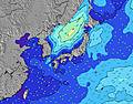 | 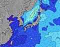 | 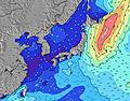 | 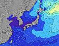 | ||||||||||||||
Wave Height (m) Direction Period (s) | E 9 | E 9 | SW 9 | SW 5 | WSW 5 | E 10 | WSW 4 | E 9 | E 10 | E 10 | WSW 6 | W 7 | SW 6 | W 7 | W 7 | W 8 | E 10 | E 9 | S 4 | E 10 | E 9 |
Wave Graph | |||||||||||||||||||||
7 | 6 | 0 | 17 | 15 | 7 | 18 | 7 | 7 | 8 | 55 | 9 | 89 | 37 | 8 | 29 | 7 | 7 | 11 | 7 | 7 | |
Wind (km/h) | |||||||||||||||||||||
Wind State on-shore cross-onshore cross-shore cross-offshore off-shore glassy | cross | cross-on | cross-on | cross-on | cross-on | cross-on | cross-on | on | cross | cross-on | cross-on | cross-on | cross-on | cross-on | cross | cross-on | cross-on | cross | cross | cross-on | cross |
High Tide | 8:01PM2.04m | 7:16AM2.21m | 8:39PM2.07m | 8:02AM2.23m | 9:14PM2.08m | 8:47AM2.19m | 9:49PM2.07m | 9:32AM2.11m | 10:23PM2.04m | 10:17AM1.97m | 10:58PM1.99m | 11:06AM1.81m | 11:36PM1.93m | ||||||||
Low Tide | 1:22PM0.04m | 1:34AM0.95m | 2:05PM0.03m | 2:17AM0.87m | 2:46PM0.08m | 2:59AM0.79m | 3:25PM0.18m | 3:41AM0.75m | 4:02PM0.33m | 4:25AM0.73m | 4:39PM0.51m | 5:13AM0.73m | 5:16PM0.71m | ||||||||
5:45 | — | — | 5:45 | — | — | 5:45 | — | — | 5:46 | — | — | 5:46 | — | — | 5:47 | — | — | 5:47 | — | — | |
— | 7:23 | — | — | 7:23 | — | — | 7:22 | — | — | 7:22 | — | — | 7:22 | — | — | 7:22 | — | — | 7:22 | — | |
mm | — | — | — | — | — | — | — | — | — | — | — | — | — | — | — | — | — | — | — | — | — |
Temp °C | 28 | 28 | 27 | 28 | 28 | 27 | 28 | 28 | 28 | 29 | 29 | 28 | 29 | 29 | 28 | 28 | 29 | 27 | 29 | 28 | 27 |
Feels °C | 31 | 31 | 31 | 31 | 31 | 31 | 31 | 31 | 32 | 31 | 31 | 30 | 30 | 31 | 31 | 30 | 31 | 32 | 32 | 30 | 32 |
Swell 1 Height (m) Direction Period (s) | SSW 8 | S 8 | SW 9 | SW 10 | SW 10 | E 10 | SW 10 | E 9 | E 10 | W 8 | W 6 | W 7 | W 7 | W 7 | W 7 | W 8 | WSW 8 | SW 8 | SW 8 | SW 9 | SW 9 |
122 | 68 | 83 | 79 | 77 | 7 | 60 | 7 | 7 | 5 | 13 | 9 | 37 | 37 | 8 | 29 | 99 | 147 | 108 | 132 | 107 | |
Swell 2 Height (m) Direction Period (s) | SW 9 | SW 10 | S 8 | S 7 | ESE 11 | SSW 10 | E 9 | S 7 | SW 9 | E 10 | SW 9 | ESE 9 | SE 9 | E 10 | W 9 | E 10 | E 10 | E 9 | E 9 | WSW 8 | E 9 |
31 | 76 | 35 | 4 | 22 | 9 | 7 | 4 | 3 | 8 | 19 | 8 | 3 | 7 | 6 | 7 | 7 | 7 | 7 | 21 | 7 | |
Swell 3 Height (m) Direction Period (s) | E 9 | E 9 | S 8 | E 9 | S 7 | S 8 | SSW 9 | SE 10 | SE 10 | SE 9 | E 10 | E 10 | E 10 | SE 8 | E 10 | SE 9 | SE 9 | SE 9 | SE 9 | E 10 | SE 8 |
7 | 6 | 10 | 7 | 10 | 4 | 8 | 4 | 4 | 3 | 8 | 8 | 8 | 3 | 7 | 3 | 3 | 3 | 3 | 7 | 3 | |
Wind waves Height (m) Direction Period (s) | — | — | — | SW 5 | WSW 5 | SW 10 | WSW 4 | WSW 9 | SW 9 | WSW 9 | WSW 6 | SW 7 | SW 6 | SW 8 | SW 8 | SW 8 | SSW 8 | S 7 | S 4 | — | — |
— | — | — | 17 | 15 | 115 | 18 | 110 | 81 | 132 | 55 | 116 | 89 | 138 | 147 | 201 | 92 | 1 | 11 | — | — | |
Nearest Offshore or Glassy | |||||||||||||||||||||
Distance (km) | 5 | 77 | 77 | 600 | 600 | 609 | 609 | 700 | 609 | 684 | 600 | 77 | 658 | 600 | 63 | 63 | 77 | 5 | 658 | 77 | 5 |
Best forecast wave conditions in Okinawa | |||||||||||||||||||||
Best forecast wave conditions in Japan | |||||||||||||||||||||
Header Global | |||||||||||||||||||||
- Map Icons:
 Break
Break Live Wave Height (m)
 Live Wind Speed (km/h)
 Surf Rating (10 Max)
 Ocean Swells (m)
- Wind Speed (km/h)


FREE! Surf-Forecast.com widget for your website
The surf report / weather widget below is available to embed on third party websites free of charge and provides a summary of our Sunabe Seawall surf forecast. Simply grab the html code snippet that we provide and paste it into your own site. You can choose your preferred language and metric/imperial units for the surf forecast feed to suit users of your site. Click here to get the code.
Information about the Sunabe Seawall Surf forecast
The above surf forecast table for Sunabe Seawall provides essential information for determining whether the surfing conditions will be good over the next 16 days. A general guide to surfing at Sunabe Seawall can be found by selecting the local surf guide option on the grey menu. Our Sunabe Seawall surf forecast is unique since it includes wave energy (power) that defines the real feel of the surf rather than just the height or the period. If you surf the same spot (Sunabe Seawall) regularly then make a mental note of the wave energy from the surf forecast table each time you go. Very soon you may start to choose your surf days based on the wave energy alone combined with our forecast of favourable offshore wind conditions. Our star ratings will help here and of course you will also find the usual wave height and period predictions on our surf forecasts as well as a full break down of the swell components under our advanced users option (to reveal that, click the little Einstein character under the tide times).
Further information to help with frequently asked questions about our surf forecast for Sunabe Seawall may be found under the help tab on the top menu and also by moving your mouse over the question marks on the surf forecast table itself. Please always bear in mind that the forecast is for near-shore open water and local factors at each surf break influence the actual breaking wave height, such as the beach / reef profile, water depths offshore and shelter.
Sunabe Seawall is 6 km (4 miles) from Misato. If you plan a holiday in Okinawa, look for hotels and other accommodation in Misato. Misato has rooms for a wide range of budgets as well as car hire and transport links.
 Nearest