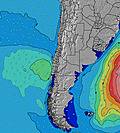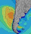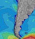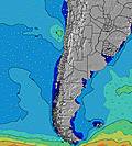
- Forecast
- Maps
- Live
- Weather State
- Spot Information
Surf Forecasts:

Punta Topocalma surfForecast / Santiago / Chile
Forecast update in hr min s Forecast update imminent
Punta Topocalma surf forecast is for near shore open water. Breaking waves will often be smaller at less exposed spots.
Today's Punta Topocalma sea temperature is
12.0° C
(Which is 2.7°C colder than average for this time of year)How big are the waves at Punta Topocalma today?
The current surf forecast for Punta Topocalma at 6PM is: 1.9m 12s primary swell from a Southwest direction and 0.4m 19s secondary swell from a Southwest direction (forecast issued at 01:00pm May 05). The wind direction is predicted to be cross-offshore and the swell rating is 4.
| Time (-04) & Date | Wave Height | Wave Period |
|---|---|---|
| Morning (05 May) | 8ft (2.5m) | 13s |
| Afternoon (05 May) | 7ft (2.1m) | 12s |
| Evening (05 May) | 5.5ft (1.7m) | 12s |
Table - waves today at Punta Topocalma. (Swell directed towards the surf break)
Updates in hr min s Forecast update imminent
Short Range ForecastModerate rain (total 10mm), heaviest on Wed morning. Very mild (max 16°C on Tue afternoon, min 9°C on Fri morning). Winds increasing (calm on Tue afternoon, strong winds from the N by Wed morning). | ||||||||||||||||||||||||
Tue 5 | Wednesday 6 | Thursday 7 | Fri 8 | |||||||||||||||||||||
11 AM | 2 PM | 5 PM | 8 PM | 11 PM | 2 AM | 5 AM | 8 AM | 11 AM | 2 PM | 5 PM | 8 PM | 11 PM | 2 AM | 5 AM | 8 AM | 11 AM | 2 PM | 5 PM | 8 PM | 11 PM | 2 AM | 5 AM | 8 AM | |
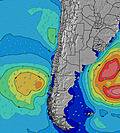
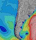
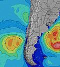
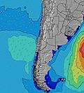
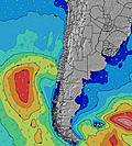
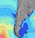
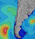
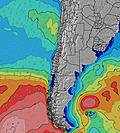
Swell Height Map | ||||||||||||||||||||||||
SW 13 | SW 12 | SW 12 | SW 12 | SW 12 | SW 12 | WSW 11 | SW 11 | W 10 | W 10 | W 10 | SW 20 | WSW 11 | SW 19 | SW 18 | SW 18 | SW 18 | SW 17 | SW 17 | SW 16 | SW 16 | SW 16 | SW 16 | SW 16 | |
1650 | 1366 | 1082 | 977 | 747 | 660 | 681 | 406 | 437 | 535 | 669 | 1682 | 2211 | 2611 | 3090 | 3348 | 3681 | 3404 | 3248 | 3022 | 2736 | 2548 | 2354 | 2157 | |
Wind (km/h) | ||||||||||||||||||||||||
cross-on | glassy | cross | cross-off | cross-off | cross-off | cross-off | cross-off | cross | cross | cross-on | cross | cross | cross | cross | cross | cross | cross-on | cross | cross | cross | cross-off | cross | cross-off | |
High Tide | 12:27PM1.31m | 1:04AM0.79m | 1:09PM1.25m | 1:54AM0.73m | 1:57PM1.18m | 2:59AM0.69m | ||||||||||||||||||
Low Tide | 7:23PM0.27m | 6:19AM0.39m | 8:17PM0.32m | 6:56AM0.45m | 9:20PM0.36m | 7:45AM0.50m | ||||||||||||||||||
— | — | — | — | — | — | 7:26 | — | — | — | — | — | — | — | 7:26 | — | — | — | — | — | — | — | 7:28 | — | |
— | — | 6:01 | — | — | — | — | — | — | — | 6:00 | — | — | — | — | — | — | — | 6:00 | — | — | — | — | 6:00 | |
— | — | — | — | — | — | — | 1 | 6 | 2 | 1 | — | — | — | — | — | — | — | — | — | — | — | — | — | |
Temp °C | 15 | 15 | 16 | 15 | 15 | 15 | 15 | 15 | 15 | 15 | 13 | 13 | 13 | 12 | 11 | 11 | 13 | 13 | 12 | 12 | 11 | 11 | 10 | 9 |
14 | 14 | 14 | 12 | 12 | 11 | 9 | 8 | 8 | 10 | 9 | 9 | 8 | 6 | 6 | 6 | 8 | 6 | 4 | 6 | 5 | 5 | 3 | 2 | |
Swell 1 Height (m) Direction Period (s) | SW 13 | SW 12 | SW 12 | SW 12 | SW 12 | SW 12 | WSW 11 | SW 11 | W 10 | W 10 | W 10 | WSW 11 | WSW 11 | SW 19 | SW 10 | SW 10 | SW 18 | SW 17 | SW 17 | SW 16 | SW 16 | SW 16 | SW 16 | SW 16 |
1650 | 1366 | 1082 | 977 | 747 | 660 | 681 | 406 | 432 | 535 | 652 | 1150 | 2211 | 2611 | 1352 | 1160 | 3681 | 3404 | 3248 | 3022 | 2736 | 2548 | 2354 | 2157 | |
Swell 2 Height (m) Direction Period (s) | NW 16 | SW 20 | SW 19 | SW 18 | SW 18 | SW 18 | SW 17 | W 10 | SW 11 | N 6 | SW 11 | SW 20 | SW 19 | W 12 | SW 18 | SW 18 | SW 10 | W 11 | W 11 | WNW 13 | WNW 13 | NW 13 | WNW 13 | NW 16 |
63 | 60 | 91 | 155 | 252 | 304 | 362 | 284 | 315 | 118 | 391 | 1682 | 2125 | 374 | 3090 | 3348 | 951 | 83 | 55 | 17 | 17 | 27 | 17 | 10 | |
Swell 3 Height (m) Direction Period (s) | SW 20 | NW 12 | NW 12 | NW 12 | NW 12 | NW 12 | WNW 15 | SW 16 | SW 16 | SW 11 | SW 16 | SW 11 | SW 15 | SW 14 | W 12 | W 12 | W 11 | NW 18 | WNW 13 | NW 18 | NW 18 | NW 13 | — | NW 13 |
60 | 23 | 23 | 23 | 23 | 23 | 21 | 380 | 437 | 350 | 669 | 447 | 269 | 453 | 396 | 276 | 151 | 49 | 17 | 12 | 12 | 28 | — | 7 | |
Wind waves Height (m) Direction Period (s) | — | — | — | — | NNE 3 | NNE 4 | N 4 | N 5 | N 6 | — | — | — | — | SW 11 | — | — | — | SW 10 | SW 10 | SW 9 | SW 9 | SW 8 | SW 8 | SSW 8 |
— | — | — | — | 5 | 19 | 50 | 119 | 185 | — | — | — | — | 1780 | — | — | — | 742 | 752 | 872 | 703 | 567 | 553 | 469 | |
Nearest Offshore or Glassy | ||||||||||||||||||||||||
Distance (km) | 28 | 0 | 34 | 22 | 34 | 65 | 65 | 140 | 179 | 343 | 268 | 343 | 143 | 207 | 28 | 65 | 143 | 343 | 413 | 207 | 143 | 142 | 143 | 207 |
Best forecast wave conditions in Santiago | ||||||||||||||||||||||||
Best forecast wave conditions in Chile | ||||||||||||||||||||||||
Header Global | ||||||||||||||||||||||||
- Map Icons:
Break
Live Wave Height (m)
Live Wind Speed (km/h)
Surf Rating (10 Max)
Ocean Swells (m)
Wind Speed (km/h)


