

Surf Forecasts:

Papa Tangaroa surf forecast from 3 Aug 2026:
- Best quality surf: Monday 3 Aug, 6PM (local time) - 8ft (2.5m), 16s period, SW swell with offshore winds.
- Most powerful swell: Monday 3 Aug, 12PM (local time) - 8ft (2.5m), 16s period, SW swell with 3,694 kJ wave energy.
- Next surfable swell (1★+): Monday 3 Aug, 9AM (local time) - 5.5ft (1.7m), 17s period with SW swell.
Best Forecast Surf Conditions for Papa Tangaroa this week:
The surf forecast for Papa Tangaroa over the next 16 days: The first swell (rated 1 star or higher) is forecast to arrive on Monday (Aug 03) at 9AM. The primary swell is predicted to be 1.7m and 17s period with a secondary swell of 1.8m and 13s. The wind is predicted to be glassy as the swell arrives.
The most powerful waves expected at Papa Tangaroa in the next 16 days are 2.5m 16s and forecast to arrive on Monday (Aug 03) at 12PM. Winds are predicted to be cross-onshore at the time the swell arrives. The largest open ocean swell (not directed at the beach) is 2.5m 7s period and expected on Thursday (Aug 06) at 12AM.
| Wave Type | Time (-06) & Date | Wave Height & Period |
|---|---|---|
| Next good surf (1 star+) | 9AM (Mon 3rd Aug) | 5.5ft (1.7m) 17s |
| Best Surf | 6PM (Mon 3rd Aug) | 8ft (2.5m) 16s |
| Most Powerful | 12PM (Mon 3rd Aug) | 8ft (2.5m) 16s |
Table - best surf conditions forecast for Papa Tangaroa over the next 16 days.
The Lowdown
Alright, Rusty here. Let’s talk about what’s on the menu at Papa Tangaroa.
This is a heavy, exposed reef break that only the advanced crew should even think about. The water temperature is running about average for the time of year, so no surprises there.
The week starts rough. Monday morning, 3rd August, is the only real window early on. We’ve got a 6ft swell from the southwest, a very long 17-second period, and glassy conditions. Combined energy is a massive 3623, so there’s plenty of grunt. This is excellent surf for experienced surfers, but it’s a reef setup, so that long period means the waves will be thumping and lining up, not mush. After that, it goes to hell. Tuesday through to Saturday morning is a write-off – strong winds, big messy swell, nothing but blown-out junk. The swell is over 8ft all that time, so it’s expert-only even if the wind was good, which it isn’t.
Sunday the 9th August offers a brief reprieve. Morning shows 5ft from the southeast with a 10-second period and glassy conditions. That’s clean, but the energy is only 664, so it’s a lot weaker. It’s a solid option if you’re desperate.
Now, the real standout. Monday the 10th August. The morning session is the pick of the whole forecast. We’re looking at 5ft from the southwest, but with an 18-second period – that’s very long period groundswell. Winds are calm, glassy as a mirror. Combined energy is 3150. This is excellent surf for experienced surfers. The long period will make it powerful and lined up on the reef, but the size is manageable. Get on it.
Tuesday the 11th gets messy again with onshore winds, and the rest of that week is a mixed bag. Thursday the 13th August morning is worth a mention: 6ft from the southwest, 13-second period, with a gentle offshore wind from the north. That’s clean and fun, energy is 1656. It’s a solid runner-up.
After that, the second week from the 14th onward is mostly marginal. There’s surf, but the wind is rarely cooperating fully. A few sessions have cross-offshore winds, but the swell is either too big or the wind is too strong. Nothing screams “drop everything and go.”
So, bottom line: Monday 10th August morning is the one. If you can’t make that, Thursday 13th August morning is your next best bet. The rest of the 16 days is mostly a battle with the wind.
Rusty.
Short Range ForecastHeavy rain (total 27mm), heaviest during Mon morning. Warm (max 20°C on Mon afternoon, min 17°C on Mon morning). Winds increasing (calm on Mon morning, strong winds from the SE by Wed night). | Days 4-6 Weather SummaryLight rain (total 4mm), mostly falling on Thu morning. Very mild (max 19°C on Thu morning, min 18°C on Thu morning). Winds decreasing (near gales from the ESE on Thu afternoon, light winds from the SW by Sat night). | ||||||||||||||||||||
Monday 3 | Tuesday 4 | Wednesday 5 | Thursday 6 | Friday 7 | Saturday 8 | Sunday 9 | |||||||||||||||
AM | PM | Night | AM | PM | Night | AM | PM | Night | AM | PM | Night | AM | PM | Night | AM | PM | Night | AM | PM | Night | |
Swell Height Map | 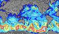 | 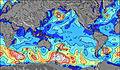 | 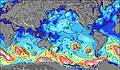 | 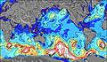 |  |  |  | ||||||||||||||
Wave Height (m) Direction Period (s) | SW 17 | SW 16 | SW 15 | SE 10 | SE 10 | SSE 10 | SSE 10 | SSE 11 | SSE 10 | E 8 | ESE 9 | ESE 9 | ESE 9 | SE 10 | SE 11 | SE 10 | SE 10 | SE 10 | SE 9 | SE 9 | SW 15 |
Wave Graph | |||||||||||||||||||||
1638 | 3668 | 2594 | 2291 | 2806 | 2358 | 1808 | 1597 | 1358 | 2469 | 2799 | 2898 | 1920 | 1745 | 1428 | 981 | 701 | 469 | 294 | 235 | 360 | |
Wind (km/h) | |||||||||||||||||||||
Wind State on-shore cross-onshore cross-shore cross-offshore off-shore glassy | glassy | cross | off | off | off | off | cross-off | cross-off | cross-on | cross | cross-on | cross-on | on | on | on | cross-on | cross-on | cross-on | on | on | on |
High Tide | 10:51AM0.60m | 11:46PM0.64m | 11:40AM0.60m | 00:24AM0.72m | 12:23PM0.60m | 1:01AM0.80m | 1:02PM0.61m | 1:38AM0.87m | 1:40PM0.61m | 2:17AM0.91m | 2:19PM0.61m | 2:58AM0.94m | 3:01PM0.61m | ||||||||
Low Tide | 5:16PM0.26m | 5:54AM0.30m | 5:50PM0.22m | 6:44AM0.26m | 6:22PM0.17m | 7:27AM0.22m | 6:56PM0.13m | 8:08AM0.19m | 7:33PM0.09m | 8:49AM0.17m | 8:12PM0.07m | 9:32AM0.16m | 8:53PM0.07m | ||||||||
7:56 | — | — | 7:56 | — | — | 7:54 | — | — | 7:54 | — | — | 7:52 | — | — | 7:52 | — | — | 7:52 | — | — | |
— | 6:50 | — | — | 6:51 | — | — | 6:51 | — | — | 6:52 | — | — | 6:52 | — | — | 6:52 | — | — | 6:52 | — | |
mm | 8 | 1 | 3 | 3 | 3 | — | 2 | 5 | 2 | 1 | 1 | 2 | — | — | — | — | — | — | — | — | — |
Temp °C | 18 | 20 | 20 | 20 | 20 | 20 | 19 | 20 | 20 | 19 | 18 | 18 | 18 | 19 | 19 | 19 | 19 | 19 | 19 | 19 | 18 |
Feels °C | 18 | 21 | 18 | 14 | 16 | 15 | 15 | 17 | 15 | 14 | 9 | 9 | 12 | 14 | 15 | 17 | 17 | 19 | 18 | 19 | 17 |
Swell 1 Height (m) Direction Period (s) | SW 13 | SW 16 | SW 15 | SE 10 | SE 10 | SSE 10 | SSE 10 | SSE 11 | SSE 10 | SW 13 | SW 13 | SW 13 | SW 12 | SW 18 | SE 11 | SE 10 | SE 10 | SE 10 | SE 9 | SE 9 | SE 8 |
1094 | 3668 | 2594 | 1584 | 1730 | 2358 | 1808 | 1597 | 1358 | 628 | 628 | 529 | 335 | 1227 | 1428 | 981 | 701 | 469 | 294 | 235 | 120 | |
Swell 2 Height (m) Direction Period (s) | SW 17 | SSE 8 | SE 9 | SW 14 | SW 14 | SW 13 | SW 12 | SW 13 | SW 14 | SSW 22 | SW 20 | SW 21 | SW 19 | SW 12 | SW 16 | SW 15 | SW 14 | SW 14 | ENE 8 | ENE 8 | SW 15 |
1638 | 356 | 769 | 1626 | 1154 | 552 | 449 | 245 | 810 | 45 | 105 | 361 | 715 | 200 | 823 | 542 | 404 | 195 | 60 | 83 | 360 | |
Swell 3 Height (m) Direction Period (s) | NNW 7 | NNW 7 | NNW 8 | NNW 8 | N 7 | NNE 6 | S 12 | SW 16 | NNW 11 | NNW 11 | NNW 11 | NNW 10 | NNE 7 | NE 7 | ENE 8 | ENE 8 | ENE 7 | ENE 7 | SW 13 | SW 13 | ENE 8 |
257 | 249 | 287 | 302 | 148 | 54 | 100 | 371 | 12 | 11 | 11 | 10 | 94 | 71 | 52 | 50 | 46 | 47 | 176 | 162 | 89 | |
Wind waves Height (m) Direction Period (s) | — | SE 8 | SE 9 | SE 10 | SE 10 | N 6 | NNW 5 | NNW 6 | NE 7 | E 8 | ESE 9 | ESE 9 | ESE 9 | SE 10 | — | — | — | — | — | — | — |
— | 655 | 1109 | 2291 | 2806 | 221 | 87 | 288 | 543 | 2469 | 2799 | 2898 | 1920 | 1745 | — | — | — | — | — | — | — | |
Nearest Offshore or Glassy | |||||||||||||||||||||
Distance (km) | 3588 | 0 | 12 | 3541 | 3525 | 3525 | 3635 | 3635 | 3541 | 3525 | 3525 | 3541 | 3602 | 3562 | 3541 | 3541 | 6 | 6 | 6 | 0 | 6 |
Best forecast wave conditions in Easter Island | |||||||||||||||||||||
Best forecast wave conditions in Chile | |||||||||||||||||||||
Header Global | |||||||||||||||||||||
- Map Icons:
 Break
Break Live Wave Height (m)
 Live Wind Speed (km/h)
 Surf Rating (10 Max)
 Ocean Swells (m)
- Wind Speed (km/h)
Latest Updates


FREE! Surf-Forecast.com widget for your website
The surf report / weather widget below is available to embed on third party websites free of charge and provides a summary of our Papa Tangaroa surf forecast. Simply grab the html code snippet that we provide and paste it into your own site. You can choose your preferred language and metric/imperial units for the surf forecast feed to suit users of your site. Click here to get the code.
Information about the Papa Tangaroa Surf forecast
The above surf forecast table for Papa Tangaroa provides essential information for determining whether the surfing conditions will be good over the next 16 days. A general guide to surfing at Papa Tangaroa can be found by selecting the local surf guide option on the grey menu. Our Papa Tangaroa surf forecast is unique since it includes wave energy (power) that defines the real feel of the surf rather than just the height or the period. If you surf the same spot (Papa Tangaroa) regularly then make a mental note of the wave energy from the surf forecast table each time you go. Very soon you may start to choose your surf days based on the wave energy alone combined with our forecast of favourable offshore wind conditions. Our star ratings will help here and of course you will also find the usual wave height and period predictions on our surf forecasts as well as a full break down of the swell components under our advanced users option (to reveal that, click the little Einstein character under the tide times).
Further information to help with frequently asked questions about our surf forecast for Papa Tangaroa may be found under the help tab on the top menu and also by moving your mouse over the question marks on the surf forecast table itself. Please always bear in mind that the forecast is for near-shore open water and local factors at each surf break influence the actual breaking wave height, such as the beach / reef profile, water depths offshore and shelter.
Are you planning a holiday in Easter Island? If you are looking for accommodation near Tanga Roa, camping, hotels and holiday cottages in Easter Island, consider staying in Caleton which is 7 km (4 miles) away. Alternatively, find information about places to stay and car hire in Easter Island which is 11 km (7 miles) away
 Nearest