

Surf Forecasts:

Tongo Reef surf forecast from 3 Aug 2026:
- Best quality surf: Friday 7 Aug, 12AM (local time) - 4.5ft (1.4m), 16s period, SW swell with cross-offshore winds.
- Most powerful swell: Friday 7 Aug, 12AM (local time) - 4.5ft (1.4m), 16s period, SW swell with 1,044 kJ wave energy.
- Next surfable swell (1★+): Thursday 6 Aug, 6PM (local time) - 3.5ft (1.0m), 16s period with SSW swell.
Best Forecast Surf Conditions for Tongo Reef this week:
The surf forecast for Tongo Reef over the next 16 days: The first swell (rated 1 star or higher) is forecast to arrive on Thursday (Aug 06) at 6PM. The primary swell is predicted to be 1.0m and 16s period with a secondary swell of 0.9m and 8s. The wind is predicted to be cross-offshore as the swell arrives.
The most powerful waves expected at Tongo Reef in the next 16 days are 1.4m 16s and forecast to arrive on Friday (Aug 07) at 12AM. Winds are predicted to be cross-offshore at the time the swell arrives. The largest open ocean swell (not directed at the beach) is 0.3m 8s period and expected on Monday (Aug 03) at 3PM.
| Wave Type | Time (-06) & Date | Wave Height & Period |
|---|---|---|
| Next good surf (1 star+) | 6PM (Thu 6th Aug) | 3.5ft (1.0m) 16s |
| Best Surf | 12AM (Fri 7th Aug) | 4.5ft (1.4m) 16s |
| Most Powerful | 12AM (Fri 7th Aug) | 4.5ft (1.4m) 16s |
Table - best surf conditions forecast for Tongo Reef over the next 16 days.
The Lowdown
Alright, Rusty here. Let’s talk about what’s cooking at Tongo Reef.
Right out of the gate, the water is sitting at a balmy 80° – that’s a whopping 10° warmer than normal for this time of year, so you’ll be surfing in boardies for sure.
The next few days are nothing to write home about. We’ve got a weak, short-period SSE swell in the 5 ft to 5 ft range, with a period of only 8 seconds. The combined energy stays moderate (between 372 and 517) but it’s mostly a cross-off wind, so the waves will be a bit wonky and lacking power. The forecast calls it marginal, and I’d agree – not really worth paddling out for unless you’re desperate for a splash.
Wednesday the 5th sees a shift to a small SW swell at 3 ft, but the period stretches to 14 seconds, giving it a bit more shape. Still, the energy is moderate (around 530) and the wind is still cross-off – it’s clean but tiny. Thursday the 6th keeps the same trend: SW swell, 3 ft to 3 ft, with a long period (16–18 seconds), and energy is climbing into the moderate range (681 to 863). Still not a standout.
Now, Friday the 7th is where things start to get interesting. The swell is 4 ft to 4 ft from the SSW, period pushing 15 seconds – that’s a proper groundswell. The combined energy is solid (760–804), and the wind is light, 6–9 mph from the SSE, keeping it clean. The forecast says “expect very good surf conditions,” and I’m feeling it – this is your best bet early on. Tongo Reef is a reef break, so that long-period groundswell will wrap in nicely, offering some punchy, well-shaped waves. Just keep in mind, longer period means longer gaps between sets, but it’ll make paddling out easier.
Then we hit a bit of a dry spell from Saturday the 8th through to Tuesday the 12th. Swell drops back to 2 ft–3 ft, period varies, and the wind picks up to a fresh breeze (19 mph) on the 10th and 11th. The energy stays moderate but the quality is not there. It’s a gap of a few days where it’s not really worth it.
But hold on – Thursday the 13th looks promising. Swell jumps to 4 ft–4 ft from the SW, with a long period of 18 seconds. The combined energy spikes to 1418–1547, which is strong. Wind is a clean 12 mph SSE cross-off, so the waves will be well-groomed. This is a classic long-period groundswell that will work beautifully on this reef. The 14th and 15th hold similar quality, with 4 ft SW swell, 16-second period, and energy still high (1348–1378). Light winds on the 14th, too.
The 17th looks like another solid day, with 5 ft SW swell, 16-second period, strong energy (1159–1198), and clean conditions. So if you’re planning ahead, the week of the 13th to the 17th is your window.
The standout for me? Friday the 7th – it’s the first real taste of quality, and it’s backed by good conditions. The second standout is the 13th and 14th – bigger energy, long period, and that reef will handle it beautifully. Crowds are sometimes an issue at Tongo, but with these kind of conditions, it’s worth the company.
Rusty.
Short Range ForecastMostly dry. Warm (max 25°C on Sun afternoon, min 24°C on Sun night). Wind will be generally light. | Days 5-7 Weather SummaryMostly dry. Warm (max 25°C on Wed afternoon, min 24°C on Wed afternoon). Wind will be generally light. | |||||||||||||||||||
Sun 2 | Monday 3 | Tuesday 4 | Wednesday 5 | Thursday 6 | Friday 7 | Saturday 8 | ||||||||||||||
PM | Night | AM | PM | Night | AM | PM | Night | AM | PM | Night | AM | PM | Night | AM | PM | Night | AM | PM | Night | |
Swell Height Map |  | 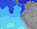 | 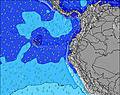 | 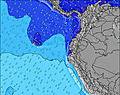 | 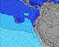 | 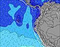 | 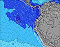 | |||||||||||||
Wave Height (m) Direction Period (s) | SSE 8 | SSE 8 | SSE 8 | SSE 8 | SSE 8 | SSE 8 | SSE 8 | SSE 8 | SW 14 | SW 13 | SW 13 | SSW 18 | SSW 16 | SW 16 | SSW 15 | SSW 15 | SSW 14 | SW 14 | SSW 13 | SSW 13 |
Wave Graph | ||||||||||||||||||||
314 | 264 | 246 | 240 | 226 | 244 | 244 | 206 | 293 | 257 | 245 | 390 | 566 | 1044 | 608 | 711 | 545 | 431 | 357 | 290 | |
Wind (km/h) | ||||||||||||||||||||
Wind State on-shore cross-onshore cross-shore cross-offshore off-shore glassy | cross-off | cross-off | cross-off | cross-off | cross-off | cross-off | cross-off | cross-off | cross-off | cross-off | cross | cross-off | cross-off | cross-off | cross-off | cross-off | cross-off | cross-off | cross-off | cross-off |
High Tide | 5:08PM1.88m | 5:32AM2.01m | 5:46PM1.84m | 6:09AM1.98m | 6:29PM1.78m | 6:52AM1.92m | 7:20PM1.71m | 7:42AM1.85m | 8:22PM1.64m | 8:45AM1.79m | 9:36PM1.62m | 9:58AM1.75m | 10:56PM1.66m | |||||||
Low Tide | 11:15PM0.28m | 11:45AM0.35m | 11:52PM0.33m | 12:25PM0.37m | 00:32AM0.40m | 1:11PM0.42m | 1:20AM0.49m | 2:06PM0.46m | 2:19AM0.59m | 3:13PM0.50m | 3:34AM0.65m | 4:30PM0.49m | ||||||||
— | — | 6:01 | — | — | 6:01 | — | — | 6:01 | — | — | 6:01 | — | — | 6:01 | — | — | 6:01 | — | — | |
6:07 | — | — | 6:07 | — | — | 6:06 | — | — | 6:06 | — | — | 6:06 | — | — | 6:06 | — | — | 6:06 | — | |
mm | — | — | — | — | — | — | — | — | — | — | — | — | — | — | — | — | — | — | — | — |
Temp °C | 25 | 25 | 25 | 25 | 24 | 24 | 24 | 24 | 25 | 25 | 24 | 24 | 24 | 24 | 25 | 25 | 24 | 25 | 25 | 24 |
Feels °C | 24 | 24 | 25 | 25 | 25 | 24 | 24 | 24 | 25 | 26 | 24 | 24 | 24 | 25 | 27 | 26 | 25 | 26 | 26 | 25 |
Swell 1 Height (m) Direction Period (s) | SW 13 | SSW 12 | SW 12 | SW 12 | SW 12 | SW 11 | SSW 14 | SSE 8 | SSE 8 | SSE 8 | SSE 8 | SSE 8 | SSW 16 | SW 16 | SSW 15 | SSW 15 | SSW 14 | SW 14 | SSW 13 | SSW 13 |
84 | 101 | 74 | 120 | 36 | 46 | 121 | 206 | 176 | 176 | 147 | 144 | 566 | 1044 | 608 | 711 | 545 | 431 | 357 | 290 | |
Swell 2 Height (m) Direction Period (s) | SW 13 | SW 16 | SW 15 | N 8 | SW 15 | SW 14 | S 12 | SW 13 | SW 14 | SW 13 | SW 13 | SSW 18 | SW 12 | SSE 8 | SSE 8 | SSE 8 | SSE 8 | S 10 | SSW 18 | SW 16 |
84 | 64 | 57 | 12 | 54 | 54 | 44 | 162 | 293 | 257 | 245 | 390 | 144 | 92 | 94 | 73 | 66 | 17 | 31 | 129 | |
Swell 3 Height (m) Direction Period (s) | SSW 10 | SW 12 | N 9 | WSW 12 | SW 12 | S 13 | SW 10 | S 12 | S 11 | S 12 | SW 18 | SW 12 | SW 12 | S 11 | SW 11 | S 11 | S 10 | SSW 18 | S 10 | S 10 |
35 | 40 | 14 | 14 | 21 | 28 | 17 | 69 | 61 | 66 | 161 | 147 | 37 | 21 | 58 | 20 | 18 | 31 | 8 | 16 | |
Wind waves Height (m) Direction Period (s) | SSE 8 | SSE 8 | SSE 8 | SSE 8 | SSE 8 | SSE 8 | SSE 8 | — | — | — | — | — | SSE 8 | — | — | — | — | SSE 8 | SSE 8 | SSE 8 |
314 | 264 | 246 | 240 | 226 | 244 | 244 | — | — | — | — | — | 116 | — | — | — | — | 83 | 85 | 107 | |
Nearest Offshore or Glassy | ||||||||||||||||||||
Distance (km) | 1285 | 996 | 977 | 1285 | 980 | 977 | 1324 | 1047 | 977 | 1253 | 94 | 976 | 94 | 0 | 0 | 0 | 0 | 977 | 1271 | 0 |
Best forecast wave conditions in Galapagos - San Cristobal | ||||||||||||||||||||
Best forecast wave conditions in Ecuador | ||||||||||||||||||||
Header Global | ||||||||||||||||||||
- Map Icons:
 Break
Break Live Wave Height (m)
 Live Wind Speed (km/h)
 Surf Rating (10 Max)
 Ocean Swells (m)
- Wind Speed (km/h)
Latest Updates


FREE! Surf-Forecast.com widget for your website
The surf report / weather widget below is available to embed on third party websites free of charge and provides a summary of our Tongo Reef surf forecast. Simply grab the html code snippet that we provide and paste it into your own site. You can choose your preferred language and metric/imperial units for the surf forecast feed to suit users of your site. Click here to get the code.
Information about the Tongo Reef Surf forecast
The above surf forecast table for Tongo Reef provides essential information for determining whether the surfing conditions will be good over the next 16 days. A general guide to surfing at Tongo Reef can be found by selecting the local surf guide option on the grey menu. Our Tongo Reef surf forecast is unique since it includes wave energy (power) that defines the real feel of the surf rather than just the height or the period. If you surf the same spot (Tongo Reef) regularly then make a mental note of the wave energy from the surf forecast table each time you go. Very soon you may start to choose your surf days based on the wave energy alone combined with our forecast of favourable offshore wind conditions. Our star ratings will help here and of course you will also find the usual wave height and period predictions on our surf forecasts as well as a full break down of the swell components under our advanced users option (to reveal that, click the little Einstein character under the tide times).
Further information to help with frequently asked questions about our surf forecast for Tongo Reef may be found under the help tab on the top menu and also by moving your mouse over the question marks on the surf forecast table itself. Please always bear in mind that the forecast is for near-shore open water and local factors at each surf break influence the actual breaking wave height, such as the beach / reef profile, water depths offshore and shelter.
Are you planning a holiday in Galapagos - San Cristobal? If you are looking for accommodation near Tongo Reef, camping, hotels and holiday cottages in Galapagos - San Cristobal, consider staying in Galapagos Islands which is 3 km (2 miles) away. Other places in and around Galapagos - San Cristobal where you can find information about places to rent, and car hire include San Cristobal which is 53 km (33 miles) away and Bahia de la Academia, 79 km (49 miles) away.
 Nearest