

Surf Forecasts:

El Murcielago surf forecast from 3 Aug 2026:
- Best quality surf: Monday 3 Aug, 7AM (local time) - 2.5ft (0.8m), 13s period, SW swell with cross-offshore winds.
- Most powerful swell: Monday 3 Aug, 7AM (local time) - 2.5ft (0.8m), 13s period, SW swell with 212 kJ wave energy.
- Next surfable swell (1★+): Monday 3 Aug, 7AM (local time) - 2.5ft (0.8m), 13s period with SW swell.
Best Forecast Surf Conditions for El Murcielago this week:
The surf forecast for El Murcielago over the next 16 days: The first swell (rated 1 star or higher) is forecast to arrive on Monday (Aug 03) at 7AM. The primary swell is predicted to be 0.8m and 13s period with a secondary swell of 0.3m and 11s. The wind is predicted to be cross-offshore as the swell arrives.
The most powerful waves expected at El Murcielago in the next 16 days are 0.8m 13s and forecast to arrive on Monday (Aug 03) at 7AM. Winds are predicted to be cross-offshore at the time the swell arrives. The largest open ocean swell (not directed at the beach) is 0.6m 4s period and expected on Monday (Aug 10) at 1AM.
| Wave Type | Time (-05) & Date | Wave Height & Period |
|---|---|---|
| Next good surf (1 star+) | 7AM (Mon 3rd Aug) | 2.5ft (0.8m) 13s |
| Best Surf | 7AM (Mon 3rd Aug) | 2.5ft (0.8m) 13s |
| Most Powerful | 7AM (Mon 3rd Aug) | 2.5ft (0.8m) 13s |
Table - best surf conditions forecast for El Murcielago over the next 16 days.
The Lowdown
Alright, folks, Rusty here. Let’s talk about what’s on the table for the next couple of weeks. It’s not a massive swell window, but there’s a real little beauty hiding in there if you’re patient.
The overall pattern is pretty quiet to start, with small, cleanish waves but nothing that’ll get your heart racing. We’ve got a gap of a few days of just ordinary, small surf before the real magic shows up.
We kick off Monday, August 3rd, at El Murcielago. Morning looks clean with a light cross-off breeze, but the swell is tiny, just 2ft from the SW at 10 seconds. Combined wave energy is weak (180), so it’s a longboard or a big fish kind of day. The water temp is about average for this time of year, so no surprises there. The afternoons are a write-off with a strong cross-breeze messing things up.
Tuesday and Wednesday mornings are similar story – small, clean surf, but wave heights are down around 1ft to 2ft, and energy is real low (63 to 85). It’s surfable but very ordinary, so don’t expect much.
Now, here’s where it gets interesting. The standout window is the morning of Thursday, August 6th, through the morning of Friday, August 7th. Thursday morning brings a jump in energy to 200 (moderate) with a 2ft SW swell at 13 seconds. The wind is a light cross-off, keeping it clean. That’s a solid improvement.
But the real crown jewel is the morning of Friday, August 7th. We’re looking at a 2ft SW groundswell, but the period jumps to a very long 16 seconds, and the energy is up at 203 (moderate). The best part? The wind is dead glassy – zero knots. That’s a major positive. This is a true stand-out session. The swell direction is NW optimum, and we’re getting SW, so it’s a little off the ideal, but with that period and glassy conditions, El Murcielago will be offering long, clean lines. The water is still about average.
After Friday, the energy stays moderate through the weekend, but the wind gets messy again in the afternoons. Mornings on Saturday and Sunday, August 8th and 9th, are still clean with cross-off winds, and the swell holds around 2ft to 2ft from the SW, with decent periods (13-14 seconds). It’s good, but not as special as that Friday glass-off.
The second week is a bit of a mixed bag. The week starting August 10th sees a drop in quality, with more cross-off and cross winds, and the swell energy fading back to weak (100-128). The mornings are still occasionally clean, but the waves are small and ordinary. The only thing to note is the morning of Thursday, August 13th, where we get another glassy period with a 1ft SW swell, but the period is a massive 20 seconds. That’s a very long period groundswell, which means it’ll be super clean but the sets could be spread out, and it might break a bit straight on the beach. Worth a look if you’re keen on a glassy, long-period mellow session.
The final weekend (August 15-16) sees a bit more size, with waves up to 3ft, but the winds are mostly cross or cross-on, making it messy. The energy is strong (308), but the quality isn’t there for a clean paddle session.
If you’re a beginner, this whole forecast is pretty gentle, with nothing over 3ft, so it’s all safe. If you’re an expert, that Friday morning glass-off is your only real target.
So, overall, the standout is undeniably the morning of Friday, August 7th at El Murcielago – glassy, clean, long-period swell. Get on it.
Rusty.
Short Range ForecastMostly dry. Warm (max 27°C on Mon morning, min 24°C on Sun night). Wind will be generally light. | Days 4-6 Weather SummaryMostly dry. Warm (max 27°C on Thu morning, min 24°C on Wed night). Wind will be generally light. | ||||||||||||||||||||
Monday 3 | Tuesday 4 | Wednesday 5 | Thursday 6 | Friday 7 | Saturday 8 | Sunday 9 | |||||||||||||||
AM | PM | Night | AM | PM | Night | AM | PM | Night | AM | PM | Night | AM | PM | Night | AM | PM | Night | AM | PM | Night | |
Swell Height Map | 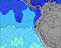 | 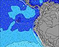 | 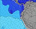 | 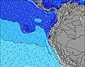 | 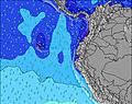 | 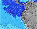 | 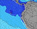 | ||||||||||||||
Wave Height (m) Direction Period (s) | SW 10 | WSW 13 | SW 10 | SW 12 | SW 12 | SW 12 | SW 13 | SW 12 | SW 14 | SW 13 | SW 13 | SW 18 | SW 16 | SW 16 | SW 15 | SW 14 | SW 14 | SW 13 | SW 13 | SW 13 | SW 12 |
Wave Graph | |||||||||||||||||||||
77 | 66 | 76 | 38 | 36 | 35 | 42 | 37 | 57 | 140 | 84 | 120 | 127 | 124 | 107 | 130 | 162 | 87 | 82 | 58 | 44 | |
Wind (km/h) | |||||||||||||||||||||
Wind State on-shore cross-onshore cross-shore cross-offshore off-shore glassy | cross-off | cross | cross-off | cross-off | cross | cross-off | cross-off | cross-on | cross-off | cross-off | cross | cross-off | glassy | cross-on | cross | cross-off | cross | cross-off | cross-off | cross | cross |
High Tide | 6:37AM2.61m | 6:53PM2.40m | 7:14AM2.58m | 7:35PM2.34m | 7:56AM2.52m | 8:24PM2.26m | 8:44AM2.43m | 9:23PM2.18m | 9:43AM2.34m | 10:34PM2.14m | 10:54AM2.27m | 11:54PM2.17m | 12:12PM2.28m | 1:10AM2.29m | |||||||
Low Tide | 12:51PM0.45m | 00:58AM0.43m | 1:32PM0.47m | 1:39AM0.52m | 2:18PM0.51m | 2:28AM0.63m | 3:12PM0.56m | 3:28AM0.75m | 4:17PM0.60m | 4:40AM0.82m | 5:30PM0.59m | 6:01AM0.82m | 6:44PM0.51m | ||||||||
6:26 | — | — | 6:26 | — | — | 6:26 | — | — | 6:26 | — | — | 6:26 | — | — | 6:26 | — | — | 6:26 | — | — | |
— | 6:30 | — | — | 6:30 | — | — | 6:30 | — | — | 6:30 | — | — | 6:30 | — | — | 6:30 | — | — | 6:30 | — | |
mm | — | — | — | — | — | — | — | — | — | — | — | — | — | — | — | — | — | — | — | — | — |
Temp °C | 27 | 26 | 24 | 27 | 27 | 24 | 27 | 26 | 24 | 27 | 27 | 24 | 27 | 27 | 24 | 25 | 26 | 24 | 26 | 26 | 24 |
Feels °C | 27 | 25 | 25 | 28 | 27 | 25 | 28 | 26 | 25 | 28 | 27 | 26 | 29 | 28 | 26 | 27 | 26 | 26 | 28 | 26 | 25 |
Swell 1 Height (m) Direction Period (s) | WSW 13 | WSW 13 | SW 12 | SW 9 | SW 12 | SW 12 | SW 5 | SW 12 | SW 14 | SW 13 | SW 13 | SW 12 | SW 12 | SW 16 | WSW 12 | SW 14 | SW 14 | SW 13 | SW 13 | SW 13 | SW 12 |
68 | 66 | 39 | 38 | 36 | 35 | 12 | 37 | 46 | 140 | 84 | 120 | 71 | 124 | 93 | 130 | 162 | 87 | 82 | 58 | 36 | |
Swell 2 Height (m) Direction Period (s) | WNW 11 | SW 10 | WNW 11 | SW 12 | WNW 10 | WNW 10 | SW 13 | WNW 9 | NW 9 | SW 19 | SW 18 | SW 18 | SW 16 | SW 12 | SW 15 | SW 11 | NW 9 | SW 18 | SW 16 | SW 16 | WSW 15 |
25 | 16 | 11 | 37 | 10 | 10 | 42 | 8 | 3 | 57 | 50 | 108 | 127 | 71 | 107 | 18 | 3 | 12 | 11 | 41 | 22 | |
Swell 3 Height (m) Direction Period (s) | SW 16 | WNW 11 | — | WNW 10 | SW 15 | — | WNW 10 | SW 15 | SW 20 | NW 9 | NW 9 | NW 9 | W 8 | NW 10 | NW 9 | NW 9 | — | NW 8 | W 8 | W 8 | WSW 21 |
10 | 25 | — | 10 | 9 | — | 9 | 9 | 15 | 3 | 3 | 3 | 5 | 4 | 3 | 3 | — | 3 | 1 | 1 | 44 | |
Wind waves Height (m) Direction Period (s) | SW 10 | SW 4 | SW 10 | — | SW 3 | SW 4 | — | WSW 6 | SW 11 | — | WSW 4 | — | — | SW 3 | — | SW 4 | SW 4 | SW 3 | SW 4 | SW 4 | SW 4 |
77 | 17 | 76 | — | 9 | 12 | — | 19 | 57 | — | 8 | — | — | 5 | — | 2 | 11 | 3 | 6 | 19 | 10 | |
Nearest Offshore or Glassy | |||||||||||||||||||||
Distance (km) | 0 | 910 | 0 | 0 | 856 | 464 | 0 | 799 | 0 | 0 | 144 | 0 | 0 | 936 | 141 | 0 | 910 | 0 | 0 | 857 | 176 |
Best forecast wave conditions in Manabi | |||||||||||||||||||||
Best forecast wave conditions in Ecuador | |||||||||||||||||||||
Header Global | |||||||||||||||||||||
- Map Icons:
 Break
Break Live Wave Height (m)
 Live Wind Speed (km/h)
 Surf Rating (10 Max)
 Ocean Swells (m)
- Wind Speed (km/h)
Latest Updates


FREE! Surf-Forecast.com widget for your website
The surf report / weather widget below is available to embed on third party websites free of charge and provides a summary of our El Murcielago surf forecast. Simply grab the html code snippet that we provide and paste it into your own site. You can choose your preferred language and metric/imperial units for the surf forecast feed to suit users of your site. Click here to get the code.
Information about the El Murcielago Surf forecast
The above surf forecast table for El Murcielago provides essential information for determining whether the surfing conditions will be good over the next 16 days. A general guide to surfing at El Murcielago can be found by selecting the local surf guide option on the grey menu. Our El Murcielago surf forecast is unique since it includes wave energy (power) that defines the real feel of the surf rather than just the height or the period. If you surf the same spot (El Murcielago) regularly then make a mental note of the wave energy from the surf forecast table each time you go. Very soon you may start to choose your surf days based on the wave energy alone combined with our forecast of favourable offshore wind conditions. Our star ratings will help here and of course you will also find the usual wave height and period predictions on our surf forecasts as well as a full break down of the swell components under our advanced users option (to reveal that, click the little Einstein character under the tide times).
Further information to help with frequently asked questions about our surf forecast for El Murcielago may be found under the help tab on the top menu and also by moving your mouse over the question marks on the surf forecast table itself. Please always bear in mind that the forecast is for near-shore open water and local factors at each surf break influence the actual breaking wave height, such as the beach / reef profile, water depths offshore and shelter.
Are you planning a holiday in Manabi? If you are looking for accommodation near El Murcielago, camping, hotels and holiday cottages in Manabi, consider staying in Manta which is 5 km (3 miles) away. Other places in and around Manabi where you can find information about places to rent, and car hire include Montecristi which is 14 km (9 miles) away, Portoviejo, Jipijapa and Sucre.
 Nearest