

Surf Forecasts:

Frente A Bahia surf forecast from 1 Aug 2026:
- Best quality surf: Thursday 6 Aug, 10AM (local time) - 2.5ft (0.8m), 13s period, SW swell with glassy winds.
- Most powerful swell: Friday 7 Aug, 10PM (local time) - 3.5ft (1.0m), 16s period, SW swell with 468 kJ wave energy.
- Next surfable swell (1★+): Tuesday 4 Aug, 7AM (local time) - 1.5ft (0.5m), 12s period with SW swell.
Best Forecast Surf Conditions for Frente A Bahia this week:
The surf forecast for Frente A Bahia over the next 16 days: The first swell (rated 1 star or higher) is forecast to arrive on Tuesday (Aug 04) at 7AM. The primary swell is predicted to be 0.5m and 12s period with a secondary swell of 0.6m and 9s. The wind is predicted to be glassy as the swell arrives.
The most powerful waves expected at Frente A Bahia in the next 16 days are 1.0m 16s and forecast to arrive on Friday (Aug 07) at 10PM. Winds are predicted to be cross-onshore at the time the swell arrives.
| Wave Type | Time (-05) & Date | Wave Height & Period |
|---|---|---|
| Next good surf (1 star+) | 7AM (Tue 4th Aug) | 1.5ft (0.5m) 12s |
| Best Surf | 10AM (Thu 6th Aug) | 2.5ft (0.8m) 13s |
| Most Powerful | 10PM (Fri 7th Aug) | 3.5ft (1.0m) 16s |
Table - best surf conditions forecast for Frente A Bahia over the next 16 days.
The Lowdown
Alright folks, Rusty here.
First up, the water at Frente A Bahia is running much warmer than normal for this time of year, sitting at 81°F with a 7°F anomaly. That’s unusual, so you’ll be surfing in a very warm bath.
Right off the bat, we’re looking at a pretty quiet start. The first few days are a bit of a write-off. Saturday the 1st and Sunday the 2nd are small and messy, with light cross-onshore winds ruining any chance of quality. The combined swell energy is weak to moderate (245–437), so this is a period to sit out.
The first real glimmer comes on Wednesday morning the 5th. The wind drops to glassy, and we get a 2ft SW swell with a 13-second period (moderate energy of 160). It’s surfable but very ordinary. Not a standout, but a step in the right direction.
Now, Thursday morning the 6th is where it starts to get interesting. The wind is glassy, the swell is 3ft from the SW at 13 seconds, and the energy jumps to 376. This is a solid green light for a clean, fun session on a longboard or a fish. The waves will be small but clean, and that glassy wind is a major positive.
Then Friday morning the 7th is another cracker. Again, glassy conditions, a 2ft SW swell, but the period is a very long 16 seconds. The energy is up to 436. This is proper groundswell, and with those conditions, it’ll be a dream for a point break or reef. Keep in mind that long period can make beach breaks close out, but here it’s likely to offer some lined-up waves.
The real standout, though, is the morning of Thursday the 13th. The wind is glassy, calm, and the swell is 2ft from the SW at 14 seconds. The energy is 290. It’s not big, but it’s clean, and the wind is dead calm. For a small-wave specialist, this is the best on offer – a true glass-out session.
The other big highlight, but with a caveat, is the morning of August 14th. The swell jumps to 4ft from the SW with a very long period of 18 seconds. The energy is a strong 803. This is a lot of power. However, the wind is light cross-onshore, so it won’t be perfect. That’s a session for experienced surfers who know the break, as the long period and increased size could make it punchy. It’s promising but less certain.
Outside of those mornings, the afternoons are consistently blown out by a 12 mph cross-onshore wind from the W. So, the window is narrow: mostly early mornings. The break is inconsistent, so when it’s good, you’ll want to be in the water. Crowds are possible here, especially on those clean morning windows.
In summary: the first week is a slow burn. The best windows are Thursday the 6th, Friday the 7th, and Thursday the 13th mornings for clean, small, glassy conditions. The 14th of August morning offers a bigger, more powerful swell but with a less-than-perfect wind.
Rusty out.
Short Range ForecastMostly dry. Warm (max 27°C on Sat morning, min 23°C on Mon night). Wind will be generally light. | Days 4-6 Weather SummaryMostly dry. Warm (max 27°C on Tue morning, min 24°C on Tue night). Wind will be generally light. | ||||||||||||||||||||
Saturday 1 | Sunday 2 | Monday 3 | Tuesday 4 | Wednesday 5 | Thursday 6 | Friday 7 | |||||||||||||||
AM | PM | Night | AM | PM | Night | AM | PM | Night | AM | PM | Night | AM | PM | Night | AM | PM | Night | AM | PM | Night | |
Swell Height Map | 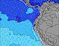 | 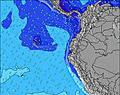 | 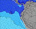 | 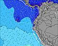 | 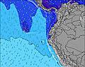 |  | 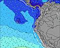 | ||||||||||||||
Wave Height (m) Direction Period (s) | SW 12 | SW 12 | WSW 15 | SW 12 | SW 11 | SW 11 | SW 10 | SW 10 | SW 10 | SW 12 | SW 9 | SW 8 | SW 13 | SW 14 | SW 14 | SW 13 | SW 13 | SW 18 | SW 16 | SW 16 | SW 15 |
Wave Graph | |||||||||||||||||||||
137 | 108 | 148 | 232 | 273 | 224 | 140 | 141 | 141 | 72 | 76 | 61 | 108 | 73 | 189 | 246 | 286 | 300 | 254 | 361 | 427 | |
Wind (km/h) | |||||||||||||||||||||
Wind State on-shore cross-onshore cross-shore cross-offshore off-shore glassy | cross-on | cross-on | cross-on | cross-on | cross-on | cross | cross | cross-on | cross | cross | cross-on | cross-on | glassy | cross-on | cross-on | glassy | cross-on | cross-on | glassy | cross-on | cross-on |
High Tide | 5:49PM2.49m | 6:11AM2.71m | 6:24PM2.48m | 6:46AM2.70m | 7:02PM2.45m | 7:23AM2.66m | 7:45PM2.40m | 8:04AM2.60m | 8:33PM2.34m | 8:53AM2.51m | 9:31PM2.28m | 9:51AM2.42m | 10:39PM2.24m | ||||||||
Low Tide | 12:01PM0.48m | 00:07AM0.37m | 12:36PM0.46m | 00:41AM0.42m | 1:13PM0.47m | 1:17AM0.49m | 1:51PM0.50m | 1:56AM0.58m | 2:34PM0.55m | 2:43AM0.68m | 3:24PM0.60m | 3:39AM0.79m | 4:26PM0.63m | ||||||||
6:24 | — | — | 6:24 | — | — | 6:24 | — | — | 6:24 | — | — | 6:24 | — | — | 6:24 | — | — | 6:24 | — | — | |
— | 6:30 | — | — | 6:30 | — | — | 6:30 | — | — | 6:30 | — | — | 6:30 | — | — | 6:30 | — | — | 6:30 | — | |
mm | — | — | — | — | — | — | — | — | — | — | — | — | — | — | — | — | — | — | — | — | — |
Temp °C | 27 | 26 | 25 | 26 | 26 | 24 | 26 | 26 | 24 | 27 | 26 | 25 | 26 | 26 | 25 | 27 | 26 | 25 | 27 | 26 | 25 |
Feels °C | 28 | 27 | 27 | 27 | 27 | 25 | 27 | 26 | 26 | 29 | 27 | 27 | 30 | 27 | 27 | 29 | 27 | 28 | 28 | 27 | 27 |
Swell 1 Height (m) Direction Period (s) | SW 12 | SW 12 | SW 12 | SW 12 | WSW 14 | WSW 13 | SW 13 | SW 13 | SW 13 | SW 9 | SW 12 | SW 12 | SW 8 | SW 14 | SW 14 | SW 13 | SW 13 | SW 12 | SW 12 | SW 16 | SW 15 |
137 | 108 | 112 | 232 | 140 | 120 | 140 | 83 | 78 | 67 | 50 | 48 | 40 | 73 | 189 | 246 | 286 | 210 | 172 | 361 | 427 | |
Swell 2 Height (m) Direction Period (s) | SW 16 | WSW 16 | WSW 15 | WSW 15 | WNW 10 | WNW 11 | WNW 12 | WNW 11 | WNW 11 | SW 12 | WNW 10 | SW 14 | SW 13 | SW 12 | WSW 20 | SW 19 | SW 18 | SW 18 | SW 16 | SW 12 | WSW 12 |
66 | 102 | 148 | 142 | 10 | 22 | 26 | 25 | 11 | 72 | 10 | 33 | 108 | 49 | 40 | 127 | 113 | 300 | 254 | 139 | 56 | |
Swell 3 Height (m) Direction Period (s) | WNW 11 | WNW 11 | WNW 11 | NW 11 | WNW 12 | WNW 10 | WNW 11 | SW 16 | SW 12 | WNW 10 | WSW 15 | WNW 10 | WSW 11 | WNW 9 | WNW 9 | NW 9 | NW 9 | NW 8 | WNW 10 | WNW 10 | WNW 9 |
12 | 25 | 23 | 30 | 14 | 22 | 25 | 10 | 6 | 10 | 21 | 10 | 12 | 8 | 8 | 3 | 3 | 3 | 10 | 9 | 8 | |
Wind waves Height (m) Direction Period (s) | SW 6 | SW 7 | SW 7 | — | SW 11 | SW 11 | SW 10 | SW 10 | SW 10 | — | SW 9 | SW 8 | — | SW 4 | SW 7 | — | W 4 | — | — | W 3 | W 4 |
30 | 65 | 54 | — | 273 | 224 | 113 | 141 | 141 | — | 76 | 61 | — | 10 | 33 | — | 6 | — | — | 1 | 2 | |
Nearest Offshore or Glassy | |||||||||||||||||||||
Distance (km) | 394 | 873 | 321 | 51 | 877 | 50 | 48 | 843 | 48 | 48 | 885 | 186 | 0 | 186 | 186 | 0 | 186 | 48 | 0 | 811 | 152 |
Best forecast wave conditions in Manabi | |||||||||||||||||||||
Best forecast wave conditions in Ecuador | |||||||||||||||||||||
Header Global | |||||||||||||||||||||
- Map Icons:
 Break
Break Live Wave Height (m)
 Live Wind Speed (km/h)
 Surf Rating (10 Max)
 Ocean Swells (m)
- Wind Speed (km/h)
Latest Updates


FREE! Surf-Forecast.com widget for your website
The surf report / weather widget below is available to embed on third party websites free of charge and provides a summary of our Frente A Bahia surf forecast. Simply grab the html code snippet that we provide and paste it into your own site. You can choose your preferred language and metric/imperial units for the surf forecast feed to suit users of your site. Click here to get the code.
Information about the Frente A Bahia Surf forecast
The above surf forecast table for Frente A Bahia provides essential information for determining whether the surfing conditions will be good over the next 16 days. A general guide to surfing at Frente A Bahia can be found by selecting the local surf guide option on the grey menu. Our Frente A Bahia surf forecast is unique since it includes wave energy (power) that defines the real feel of the surf rather than just the height or the period. If you surf the same spot (Frente A Bahia) regularly then make a mental note of the wave energy from the surf forecast table each time you go. Very soon you may start to choose your surf days based on the wave energy alone combined with our forecast of favourable offshore wind conditions. Our star ratings will help here and of course you will also find the usual wave height and period predictions on our surf forecasts as well as a full break down of the swell components under our advanced users option (to reveal that, click the little Einstein character under the tide times).
Further information to help with frequently asked questions about our surf forecast for Frente A Bahia may be found under the help tab on the top menu and also by moving your mouse over the question marks on the surf forecast table itself. Please always bear in mind that the forecast is for near-shore open water and local factors at each surf break influence the actual breaking wave height, such as the beach / reef profile, water depths offshore and shelter.
Frente A Bahia is 2 km (1 miles) from Bahia de Caraques. If you plan a holiday in Manabi, look for hotels and other accommodation in Bahia de Caraques. Bahia de Caraques has rooms for a wide range of budgets as well as car hire and transport links.
 Nearest