

Surf Forecasts:

San Mateo surf forecast from 3 Aug 2026:
- Best quality surf: Friday 7 Aug, 10AM (local time) - 2.5ft (0.8m), 16s period, SW swell with glassy winds.
- Most powerful swell: Friday 7 Aug, 4PM (local time) - 4ft (1.2m), 16s period, SW swell with 739 kJ wave energy.
- Next surfable swell (1★+): Tuesday 4 Aug, 7AM (local time) - 3ft (0.9m), 9s period with SW swell.
Best Forecast Surf Conditions for San Mateo this week:
The surf forecast for San Mateo over the next 16 days: The first swell (rated 1 star or higher) is forecast to arrive on Tuesday (Aug 04) at 7AM. The primary swell is predicted to be 0.9m and 9s period with a secondary swell of 0.6m and 12s. The wind is predicted to be cross-offshore as the swell arrives.
The most powerful waves expected at San Mateo in the next 16 days are 1.2m 16s and forecast to arrive on Friday (Aug 07) at 4PM. Winds are predicted to be cross-onshore at the time the swell arrives. The largest open ocean swell (not directed at the beach) is 1.1m 7s period and expected on Monday (Aug 03) at 1PM.
| Wave Type | Time (-05) & Date | Wave Height & Period |
|---|---|---|
| Next good surf (1 star+) | 7AM (Tue 4th Aug) | 3ft (0.9m) 9s |
| Best Surf | 10AM (Fri 7th Aug) | 2.5ft (0.8m) 16s |
| Most Powerful | 4PM (Fri 7th Aug) | 4ft (1.2m) 16s |
Table - best surf conditions forecast for San Mateo over the next 16 days.
The Lowdown
Alright, folks, Rusty here, checking in on San Mateo for the next couple of weeks. Let’s be real: the first few days are a total washout—choppy, onshore, and not worth your time. You’re gonna have to wait for things to clean up.
The first sign of life is Wednesday morning, August 5th. The wind is light and cross-offshore, making it clean. The swell is tiny, just 0.6m from the SW, but it’s got a long 13-second period. Combined energy is moderate (182). It’s surfable, but only just. This one’s for the die-hards.
Things start to get interesting on Thursday morning, August 6th. The wind is still light and cross-off, and the swell bumps up to 0.8m from the SW, period around 13 seconds. The energy jumps to a moderate 376. It’s clean, and the forecast says ‘expect good surf conditions’. This is your first real session.
Now, Friday morning, August 7th, is the absolute standout. The wind goes glassy—dead calm. The swell is 0.8m from the SW, but the period is a very long 16 seconds. That’s pure groundswell, and the combined energy is a strong 614. It’s going to be clean, glassy, and the sets will have real power. For a point break like San Mateo, that long period is a dream. It’s an advanced wave and it’s inconsistent, so you gotta be patient, but when it lines up, it’ll be firing. The water temp is about average for this time of year, so a spring suit should be fine.
The weekend (Saturday 8th and Sunday 9th) gets messy again with cross and cross-on winds chopping it up. The swell is there, but the quality drops. The following week is a tease: the mornings are often cleaner with light winds, but the swell is small and the tides are tricky. The afternoons get blown out by a moderate cross-onshore breeze. You’ll see a few mornings around the 11th, 12th, and 13th with tiny, weak swells, but nothing to get excited about.
Looking into the second week, there’s a bit more size. The morning of Friday, August 14th, has a 1.1m SW swell, a 17-second period, and light cross-shore wind. The energy is a strong 734, but it’s called ‘marginal’ due to tide. The same goes for the morning of Saturday, August 15th—1.2m SW, 15-second period, but again, marginal. These are promising but less certain. You’ll need to be on the right tide to make it work.
Bottom line: your best bet is the morning of Friday, August 7th. Get there early for the glass, and you’ll be in for a treat. If you miss that, keep an eye on the mornings of the 14th and 15th, but watch the tide.
Rusty.
Short Range ForecastMostly dry. Warm (max 26°C on Mon morning, min 23°C on Tue night). Wind will be generally light. | Days 4-6 Weather SummaryMostly dry. Warm (max 26°C on Thu morning, min 24°C on Wed night). Wind will be generally light. | ||||||||||||||||||||
Monday 3 | Tuesday 4 | Wednesday 5 | Thursday 6 | Friday 7 | Saturday 8 | Sunday 9 | |||||||||||||||
AM | PM | Night | AM | PM | Night | AM | PM | Night | AM | PM | Night | AM | PM | Night | AM | PM | Night | AM | PM | Night | |
Swell Height Map | 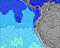 | 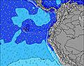 | 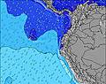 | 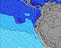 | 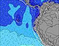 | 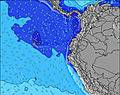 | 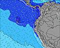 | ||||||||||||||
Wave Height (m) Direction Period (s) | SW 13 | SW 13 | SW 13 | SW 12 | SW 7 | SW 7 | SW 13 | SW 14 | SW 14 | SW 13 | SW 12 | SW 17 | SW 16 | SW 16 | SW 15 | SW 14 | SW 14 | SW 13 | SW 13 | SW 13 | SW 15 |
Wave Graph | |||||||||||||||||||||
140 | 134 | 78 | 72 | 67 | 73 | 130 | 130 | 179 | 246 | 187 | 362 | 366 | 739 | 479 | 459 | 393 | 250 | 202 | 161 | 107 | |
Wind (km/h) | |||||||||||||||||||||
Wind State on-shore cross-onshore cross-shore cross-offshore off-shore glassy | cross | cross-on | cross | cross | cross-on | cross | cross-off | cross-on | cross | cross-off | cross-on | cross | glassy | cross-on | cross | cross | cross | cross-off | cross | cross-on | cross |
High Tide | 6:36AM2.50m | 6:52PM2.27m | 7:12AM2.46m | 7:35PM2.20m | 7:53AM2.39m | 8:24PM2.12m | 8:42AM2.30m | 9:24PM2.04m | 9:42AM2.21m | 10:37PM2.00m | 10:55AM2.16m | 11:58PM2.05m | 12:13PM2.19m | 1:12AM2.18m | |||||||
Low Tide | 12:50PM0.45m | 00:56AM0.44m | 1:30PM0.47m | 1:36AM0.54m | 2:16PM0.50m | 2:25AM0.64m | 3:11PM0.54m | 3:24AM0.74m | 4:16PM0.57m | 4:38AM0.80m | 5:31PM0.54m | 6:01AM0.78m | 6:45PM0.44m | ||||||||
6:26 | — | — | 6:26 | — | — | 6:26 | — | — | 6:26 | — | — | 6:26 | — | — | 6:26 | — | — | 6:26 | — | — | |
— | 6:30 | — | — | 6:30 | — | — | 6:30 | — | — | 6:30 | — | — | 6:30 | — | — | 6:30 | — | — | 6:30 | — | |
mm | — | — | — | — | — | — | — | — | — | — | — | — | — | — | — | — | — | — | — | — | — |
Temp °C | 26 | 26 | 24 | 26 | 26 | 24 | 26 | 26 | 24 | 26 | 26 | 24 | 26 | 26 | 24 | 25 | 25 | 24 | 26 | 25 | 24 |
Feels °C | 26 | 26 | 25 | 27 | 26 | 24 | 27 | 26 | 25 | 28 | 26 | 26 | 30 | 27 | 25 | 26 | 25 | 26 | 26 | 24 | 25 |
Swell 1 Height (m) Direction Period (s) | SW 13 | SW 13 | SW 13 | SW 12 | SW 12 | SW 14 | SW 13 | SW 6 | SW 14 | SW 13 | SW 12 | SW 17 | SW 12 | SW 16 | SW 15 | SW 14 | SW 14 | SW 13 | SW 13 | SW 13 | SW 12 |
140 | 134 | 78 | 72 | 49 | 48 | 130 | 35 | 179 | 246 | 187 | 362 | 240 | 739 | 479 | 459 | 393 | 250 | 202 | 161 | 87 | |
Swell 2 Height (m) Direction Period (s) | SW 10 | WNW 11 | WNW 11 | WNW 10 | SW 15 | SW 12 | SSW 9 | SW 14 | SW 7 | SW 19 | SW 18 | SSW 12 | SW 16 | WSW 12 | NW 9 | NW 9 | NW 9 | SW 18 | SW 16 | SW 16 | SW 15 |
34 | 13 | 11 | 10 | 34 | 47 | 9 | 130 | 44 | 127 | 155 | 93 | 366 | 54 | 3 | 3 | 3 | 49 | 42 | 93 | 107 | |
Swell 3 Height (m) Direction Period (s) | WNW 12 | SSW 16 | SSW 12 | S 13 | WNW 10 | WNW 10 | WNW 9 | SW 12 | SW 11 | NW 9 | SW 13 | SW 12 | NW 8 | NW 10 | — | — | W 24 | NW 8 | SW 23 | SW 22 | SW 21 |
13 | 25 | 14 | 3 | 10 | 10 | 9 | 47 | 30 | 3 | 46 | 73 | 3 | 4 | — | — | 11 | 3 | 20 | 19 | 70 | |
Wind waves Height (m) Direction Period (s) | SSW 7 | SW 7 | SSW 10 | SSW 9 | SW 7 | SW 7 | SSW 6 | — | — | SSW 7 | SW 7 | SW 7 | SW 4 | — | SSW 4 | SSW 4 | SSW 5 | SSW 5 | SSW 4 | SSW 6 | SSW 6 |
85 | 103 | 161 | 96 | 67 | 73 | 43 | — | — | 36 | 42 | 23 | 5 | — | 5 | 6 | 21 | 17 | 16 | 51 | 77 | |
Nearest Offshore or Glassy | |||||||||||||||||||||
Distance (km) | 7 | 912 | 11 | 7 | 857 | 461 | 0 | 805 | 11 | 0 | 141 | 7 | 0 | 938 | 138 | 11 | 912 | 0 | 7 | 864 | 183 |
Best forecast wave conditions in Manabi | |||||||||||||||||||||
Best forecast wave conditions in Ecuador | |||||||||||||||||||||
Header Global | |||||||||||||||||||||
- Map Icons:
 Break
Break Live Wave Height (m)
 Live Wind Speed (km/h)
 Surf Rating (10 Max)
 Ocean Swells (m)
- Wind Speed (km/h)
Latest Updates


FREE! Surf-Forecast.com widget for your website
The surf report / weather widget below is available to embed on third party websites free of charge and provides a summary of our San Mateo surf forecast. Simply grab the html code snippet that we provide and paste it into your own site. You can choose your preferred language and metric/imperial units for the surf forecast feed to suit users of your site. Click here to get the code.
Information about the San Mateo Surf forecast
The above surf forecast table for San Mateo provides essential information for determining whether the surfing conditions will be good over the next 16 days. A general guide to surfing at San Mateo can be found by selecting the local surf guide option on the grey menu. Our San Mateo surf forecast is unique since it includes wave energy (power) that defines the real feel of the surf rather than just the height or the period. If you surf the same spot (San Mateo) regularly then make a mental note of the wave energy from the surf forecast table each time you go. Very soon you may start to choose your surf days based on the wave energy alone combined with our forecast of favourable offshore wind conditions. Our star ratings will help here and of course you will also find the usual wave height and period predictions on our surf forecasts as well as a full break down of the swell components under our advanced users option (to reveal that, click the little Einstein character under the tide times).
Further information to help with frequently asked questions about our surf forecast for San Mateo may be found under the help tab on the top menu and also by moving your mouse over the question marks on the surf forecast table itself. Please always bear in mind that the forecast is for near-shore open water and local factors at each surf break influence the actual breaking wave height, such as the beach / reef profile, water depths offshore and shelter.
Are you planning a holiday in Manabi? If you are looking for accommodation near San Mateo, camping, hotels and holiday cottages in Manabi, consider staying in Manta which is 11 km (7 miles) away. Other places in and around Manabi where you can find information about places to rent, and car hire include Montecristi which is 21 km (13 miles) away, Portoviejo, Jipijapa and Sucre.
 Nearest