

Surf Forecasts:

Punta Huanchaco surf forecast from 3 Aug 2026:
- Best quality surf: Friday 7 Aug, 1AM (local time) - 5ft (1.5m), 16s period, SW swell with cross-offshore winds.
- Most powerful swell: Friday 7 Aug, 1AM (local time) - 5ft (1.5m), 16s period, SW swell with 1,129 kJ wave energy.
- Next surfable swell (1★+): Monday 3 Aug, 7AM (local time) - 2ft (0.6m), 13s period with SW swell.
Best Forecast Surf Conditions for Punta Huanchaco this week:
The surf forecast for Punta Huanchaco over the next 16 days: The first swell (rated 1 star or higher) is forecast to arrive on Monday (Aug 03) at 7AM. The primary swell is predicted to be 0.6m and 13s period with a secondary swell of 1.0m and 7s. The wind is predicted to be cross-offshore as the swell arrives.
The most powerful waves expected at Punta Huanchaco in the next 16 days are 1.5m 16s and forecast to arrive on Friday (Aug 07) at 1AM. Winds are predicted to be cross-offshore at the time the swell arrives. The largest open ocean swell (not directed at the beach) is 0.6m 4s period and expected on Saturday (Aug 08) at 1AM.
| Wave Type | Time (-05) & Date | Wave Height & Period |
|---|---|---|
| Next good surf (1 star+) | 7AM (Mon 3rd Aug) | 2ft (0.6m) 13s |
| Best Surf | 1AM (Fri 7th Aug) | 5ft (1.5m) 16s |
| Most Powerful | 1AM (Fri 7th Aug) | 5ft (1.5m) 16s |
Table - best surf conditions forecast for Punta Huanchaco over the next 16 days.
The Lowdown
Alright folks, Rusty here. Let’s have a look at what’s shaping up for the next couple of weeks.
We’ve got a solid run of small but clean swell on the way, with no real gap to speak of – just some quieter afternoons here and there. The first week looks particularly tidy, with a long-period groundswell pushing in mid-week that will really juice things up. Overall, the energy builds nicely from about 288 (moderate) up past 900 (strong) by Friday the 7th, so there’s plenty of push for a point break like this.
Let’s talk standouts. Wednesday the 5th afternoon sees the swell bumping to 3.3 ft from the SW with a 13 second period and a combined energy of 611 – that’s proper moderate energy. Winds are light and cross-offshore, so the waves will be peeling clean. That session is the pick of the early week. Then, Friday the 7th morning is a real gem: 4.6 ft of SW groundswell with a 15-second period and energy hitting 938, making for some of the strongest, most consistent waves of the whole outlook. Light cross-off winds should keep the faces crisp. That’s the big one for experienced surfers.
For the second week, Monday the 10th morning is another clean one with 3.9 ft SSW swell and light winds, though the period drops to 9 seconds, so it’ll be a bit softer. The following Wednesday afternoon (12th) sees 4.6 ft SSW groundswell again with good shape from a cross-off breeze. Thursday the 13th morning brings a very long period 19-second SW swell at 2.3 ft – super clean but with long gaps between sets, so you’ll need patience. Friday the 14th morning is also solid with 3.6 ft SW groundswell at 16 seconds and moderate energy (828).
The standout break is Punta Huanchaco – a consistent, exposed point break that loves a SSW to SW swell. When the waves get over 4.9 ft, it starts getting a bit much for beginners, but we don’t see that here. The bigger days around 4.6 ft still have plenty of push for a point break, and the long-period stuff (over 15 seconds) will wrap in nicely, keeping the lines clean and the paddling easier. Crowds can be an issue here sometimes, but the quality of the surf should make it worth sharing a few.
Don’t expect any dramatic water temperature changes – it’s sitting about average for this time of year. Winds stay light and mainly cross-offshore all the way through, so you’ll see clean faces most mornings. The afternoons get a bit bumpier with a moderate breeze, but the mornings are where it’s at.
That’s the story. Get out early, pick your peaks, and enjoy the ride.
Short Range ForecastMostly dry. Warm (max 23°C on Mon morning, min 20°C on Sun night). Wind will be generally light. | Days 4-6 Weather SummaryMostly dry. Warm (max 23°C on Thu morning, min 20°C on Fri night). Wind will be generally light. | ||||||||||||||||||||
Monday 3 | Tuesday 4 | Wednesday 5 | Thursday 6 | Friday 7 | Saturday 8 | Sunday 9 | |||||||||||||||
AM | PM | Night | AM | PM | Night | AM | PM | Night | AM | PM | Night | AM | PM | Night | AM | PM | Night | AM | PM | Night | |
Swell Height Map |  |  | 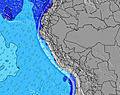 | 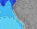 | 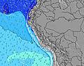 | 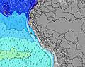 | 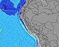 | ||||||||||||||
Wave Height (m) Direction Period (s) | SW 13 | SW 12 | SSW 8 | SW 13 | SW 12 | SW 12 | SW 13 | SW 13 | SW 12 | SW 18 | SW 17 | SW 16 | SW 15 | SW 14 | SW 14 | SW 13 | SW 13 | S 8 | S 9 | S 9 | S 9 |
Wave Graph | |||||||||||||||||||||
161 | 153 | 137 | 202 | 220 | 169 | 286 | 330 | 295 | 300 | 413 | 1129 | 860 | 528 | 520 | 295 | 242 | 199 | 186 | 190 | 230 | |
Wind (km/h) | |||||||||||||||||||||
Wind State on-shore cross-onshore cross-shore cross-offshore off-shore glassy | cross-off | cross-off | cross-off | cross-off | cross-off | cross-off | cross-off | cross-off | cross-off | cross-off | cross-off | cross-off | cross-off | cross-off | cross-off | cross-off | cross-off | cross-off | cross-off | cross-off | cross-off |
High Tide | 7:19AM1.25m | 7:39PM1.01m | 7:50AM1.20m | 8:32PM0.99m | 8:28AM1.13m | 9:38PM0.97m | 9:18AM1.05m | 11:00PM0.98m | 10:25AM0.98m | 00:28AM1.03m | 11:49AM0.95m | 1:44AM1.12m | 1:10PM0.96m | 2:46AM1.23m | |||||||
Low Tide | 1:45PM0.34m | 1:30AM0.38m | 2:23PM0.32m | 2:14AM0.46m | 3:08PM0.31m | 3:10AM0.55m | 4:06PM0.30m | 4:32AM0.62m | 5:19PM0.29m | 6:25AM0.63m | 6:41PM0.24m | 8:01AM0.57m | 7:53PM0.16m | ||||||||
6:28 | — | — | 6:28 | — | — | 6:28 | — | — | 6:28 | — | — | 6:28 | — | — | 6:28 | — | — | 6:26 | — | — | |
— | 6:15 | — | — | 6:15 | — | — | 6:15 | — | — | 6:15 | — | — | 6:15 | — | — | 6:15 | — | — | 6:15 | — | |
mm | — | — | — | — | — | — | — | — | — | — | — | — | — | — | — | — | — | — | — | — | — |
Temp °C | 23 | 22 | 21 | 23 | 22 | 21 | 23 | 22 | 21 | 23 | 22 | 21 | 23 | 22 | 21 | 23 | 22 | 20 | 22 | 21 | 20 |
Feels °C | 23 | 22 | 22 | 23 | 21 | 22 | 23 | 22 | 23 | 24 | 22 | 21 | 23 | 21 | 21 | 23 | 21 | 20 | 23 | 20 | 20 |
Swell 1 Height (m) Direction Period (s) | S 8 | SW 12 | SSW 8 | S 8 | SW 12 | SSW 8 | SW 13 | SW 13 | SW 12 | SW 12 | SW 12 | SW 16 | SW 15 | SW 14 | SW 14 | SW 13 | SW 13 | S 8 | S 9 | SW 11 | S 9 |
115 | 153 | 137 | 131 | 220 | 101 | 286 | 330 | 295 | 277 | 325 | 1129 | 860 | 528 | 520 | 295 | 242 | 140 | 186 | 79 | 230 | |
Swell 2 Height (m) Direction Period (s) | SW 13 | SW 9 | SSW 12 | SW 13 | W 11 | SW 12 | SSW 8 | SW 19 | S 8 | SW 18 | SW 17 | S 8 | S 8 | SSW 9 | S 8 | S 8 | SW 18 | SW 12 | SW 12 | SW 15 | SW 15 |
161 | 12 | 55 | 202 | 2 | 169 | 120 | 55 | 57 | 300 | 413 | 82 | 78 | 15 | 76 | 84 | 49 | 151 | 112 | 139 | 134 | |
Swell 3 Height (m) Direction Period (s) | SW 9 | W 10 | SW 12 | SSW 10 | — | SW 15 | WSW 21 | SW 18 | SW 19 | S 8 | S 8 | — | — | — | — | SW 18 | — | SW 16 | SW 16 | SW 21 | SW 11 |
12 | 2 | 37 | 10 | — | 104 | 43 | 121 | 181 | 41 | 102 | — | — | — | — | 13 | — | 42 | 90 | 71 | 43 | |
Wind waves Height (m) Direction Period (s) | — | S 8 | — | — | S 8 | — | — | S 8 | — | — | S 3 | — | — | S 7 | S 4 | — | S 8 | S 8 | — | S 9 | — |
— | 115 | — | — | 127 | — | — | 105 | — | — | 3 | — | — | 51 | 12 | — | 105 | 199 | — | 190 | — | |
Nearest Offshore or Glassy | |||||||||||||||||||||
Distance (km) | 0 | 203 | 0 | 0 | 44 | 0 | 0 | 0 | 0 | 0 | 509 | 0 | 0 | 439 | 0 | 0 | 509 | 0 | 0 | 509 | 0 |
Best forecast wave conditions in La Libertad and Lambayeque | |||||||||||||||||||||
Best forecast wave conditions in Peru | |||||||||||||||||||||
Header Global | |||||||||||||||||||||
- Map Icons:
 Break
Break Live Wave Height (m)
 Live Wind Speed (km/h)
 Surf Rating (10 Max)
 Ocean Swells (m)
- Wind Speed (km/h)
Latest Updates


FREE! Surf-Forecast.com widget for your website
The surf report / weather widget below is available to embed on third party websites free of charge and provides a summary of our Punta Huanchaco surf forecast. Simply grab the html code snippet that we provide and paste it into your own site. You can choose your preferred language and metric/imperial units for the surf forecast feed to suit users of your site. Click here to get the code.
Information about the Punta Huanchaco Surf forecast
The above surf forecast table for Punta Huanchaco provides essential information for determining whether the surfing conditions will be good over the next 16 days. A general guide to surfing at Punta Huanchaco can be found by selecting the local surf guide option on the grey menu. Our Punta Huanchaco surf forecast is unique since it includes wave energy (power) that defines the real feel of the surf rather than just the height or the period. If you surf the same spot (Punta Huanchaco) regularly then make a mental note of the wave energy from the surf forecast table each time you go. Very soon you may start to choose your surf days based on the wave energy alone combined with our forecast of favourable offshore wind conditions. Our star ratings will help here and of course you will also find the usual wave height and period predictions on our surf forecasts as well as a full break down of the swell components under our advanced users option (to reveal that, click the little Einstein character under the tide times).
Further information to help with frequently asked questions about our surf forecast for Punta Huanchaco may be found under the help tab on the top menu and also by moving your mouse over the question marks on the surf forecast table itself. Please always bear in mind that the forecast is for near-shore open water and local factors at each surf break influence the actual breaking wave height, such as the beach / reef profile, water depths offshore and shelter.
Punta Huanchaco is 14 km (9 miles) from Trujillo. If you plan a holiday in La Libertad and Lambayeque, look for hotels and other accommodation in Trujillo. Trujillo has rooms for a wide range of budgets as well as car hire and transport links.
 Nearest