

Surf Forecasts:

La Punta - La Bellaca surf forecast from 3 Aug 2026:
- Best quality surf: Thursday 6 Aug, 10PM (local time) - 2.5ft (0.8m), 18s period, SW swell with cross-offshore winds.
- Most powerful swell: Friday 7 Aug, 4PM (local time) - 4ft (1.2m), 16s period, SW swell with 719 kJ wave energy.
- Next surfable swell (1★+): Monday 3 Aug, 7AM (local time) - 2ft (0.6m), 13s period with SW swell.
Best Forecast Surf Conditions for La Punta - La Bellaca this week:
The surf forecast for La Punta - La Bellaca over the next 16 days: The first swell (rated 1 star or higher) is forecast to arrive on Monday (Aug 03) at 7AM. The primary swell is predicted to be 0.6m and 13s period with a secondary swell of 0.4m and 10s. Another secondary swell of 1.0m and 6s is also forecast. The wind is predicted to be cross-offshore as the swell arrives.
The most powerful waves expected at La Punta - La Bellaca in the next 16 days are 1.2m 16s and forecast to arrive on Friday (Aug 07) at 4PM. Winds are predicted to be cross-shore at the time the swell arrives. The largest open ocean swell (not directed at the beach) is 0.9m 6s period and expected on Sunday (Aug 09) at 1PM.
| Wave Type | Time (-05) & Date | Wave Height & Period |
|---|---|---|
| Next good surf (1 star+) | 7AM (Mon 3rd Aug) | 2ft (0.6m) 13s |
| Best Surf | 10PM (Thu 6th Aug) | 2.5ft (0.8m) 18s |
| Most Powerful | 4PM (Fri 7th Aug) | 4ft (1.2m) 16s |
Table - best surf conditions forecast for La Punta - La Bellaca over the next 16 days.
The Lowdown
Alright folks, Rusty here. Let’s have a look at what’s cooking for the next couple of weeks.
The overall pattern is a bit of a tease. We’ve got a solid run of south-west swell on the cards, but the wind is gonna be a constant battle. For most of the period, the afternoons get chewed up by a strong cross-shore breeze, so the mornings are where it’s at. The water is sitting at a very warm 80°F, which is way warmer than you’d expect for this time of year – feels like a tropical bath out there.
First up, the standout is Friday morning, August 7th at La Punta - La Bellaca. This is the one to circle. We’ve got a clean 3 ft swell from the SSW, but the wind is dead glass – 0 mph. That’s a rare treat. The swell period is a long 16 seconds, which is proper groundswell energy. The combined energy is a solid 609 (moderate), so there’s a decent amount of push. This is a point break, so it’ll handle that long period beautifully, giving you some proper, lined-up waves. It’s an inconsistent spot, so you’ll want to be patient, but when a set comes through, it’ll be worth the wait. Crowds are possible here, so get there early.
Moving into the next week, the mornings stay the best bet. Thursday morning, August 6th, offers a clean 3 ft from the SSW with a 13-second period and a light offshore breeze. The energy is 412 (moderate), and it’s looking good. Then Tuesday morning, August 11th, is a bit smaller at 2 ft and a 13-second period, but with light cross-offshore winds, it’ll be clean. Wednesday morning, August 12th, is similar with 2 ft and a 15-second period, again clean.
The real long-range promise is Sunday morning, August 16th. We’re looking at a 4 ft SW swell with a 14-second period and a light cross-offshore breeze. The combined energy is 547 (moderate), and the forecast says “expect very good surf conditions.” It’s still a ways out, so don’t lock it in, but it’s got my attention. The morning of Friday, August 14th, is also worth a mention: 4 ft from the SW with a 17-second period and light winds, but the energy is a massive 808 (strong) – that’s a lot of power. Just be aware that with that long period, it might be a bit too straight for the beach breaks, but at a point break like this, it’ll be perfect.
For the rest of the afternoons, honestly, it’s a write-off. The wind cranks up from the SW or WSW, and it turns into a lumpy, cross-shore mess. The swell is often there, but the quality is poor. Unless you’re a masochist, just sleep in or go for a paddle in the warm water.
Rusty.
Short Range ForecastLight rain (total 2mm), mostly falling on Tue night. Warm (max 27°C on Mon morning, min 23°C on Sun night). Wind will be generally light. | Days 5-7 Weather SummaryMostly dry. Warm (max 27°C on Wed afternoon, min 24°C on Wed night). Wind will be generally light. | |||||||||||||||||||
Sun 2 | Monday 3 | Tuesday 4 | Wednesday 5 | Thursday 6 | Friday 7 | Saturday 8 | ||||||||||||||
PM | Night | AM | PM | Night | AM | PM | Night | AM | PM | Night | AM | PM | Night | AM | PM | Night | AM | PM | Night | |
Swell Height Map |  | 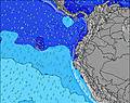 | 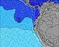 | 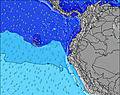 | 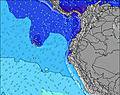 | 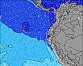 | 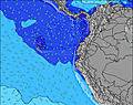 | |||||||||||||
Wave Height (m) Direction Period (s) | SSW 8 | SW 13 | SW 13 | SW 13 | SW 9 | SW 9 | SW 9 | SW 8 | SW 13 | SW 14 | SW 14 | SW 13 | SW 12 | SW 17 | SW 16 | SW 16 | SW 15 | SW 14 | SW 14 | SW 13 |
Wave Graph | ||||||||||||||||||||
166 | 144 | 140 | 134 | 162 | 115 | 112 | 102 | 130 | 130 | 147 | 246 | 187 | 362 | 366 | 719 | 479 | 667 | 393 | 246 | |
Wind (km/h) | ||||||||||||||||||||
Wind State on-shore cross-onshore cross-shore cross-offshore off-shore glassy | cross | cross-off | cross-off | cross | cross-off | cross-off | cross | cross-off | cross-off | cross-on | cross | cross-off | cross | cross-off | glassy | cross | cross | cross-off | cross | cross-off |
High Tide | 6:14PM2.44m | 6:37AM2.61m | 6:53PM2.40m | 7:14AM2.58m | 7:35PM2.34m | 7:56AM2.52m | 8:24PM2.26m | 8:44AM2.43m | 9:23PM2.18m | 9:43AM2.34m | 10:34PM2.14m | 10:54AM2.27m | 11:54PM2.17m | |||||||
Low Tide | 00:21AM0.36m | 12:51PM0.45m | 00:58AM0.43m | 1:32PM0.47m | 1:39AM0.52m | 2:18PM0.51m | 2:28AM0.63m | 3:12PM0.56m | 3:28AM0.75m | 4:17PM0.60m | 4:40AM0.82m | 5:30PM0.59m | ||||||||
— | — | 6:26 | — | — | 6:26 | — | — | 6:26 | — | — | 6:26 | — | — | 6:26 | — | — | 6:26 | — | — | |
6:30 | — | — | 6:30 | — | — | 6:30 | — | — | 6:30 | — | — | 6:30 | — | — | 6:30 | — | — | 6:30 | — | |
mm | — | — | — | — | — | — | — | 2 | — | — | — | — | — | — | — | — | — | — | — | — |
Temp °C | 25 | 24 | 27 | 26 | 24 | 27 | 26 | 24 | 27 | 27 | 24 | 27 | 27 | 24 | 27 | 26 | 24 | 26 | 26 | 24 |
Feels °C | 24 | 24 | 28 | 25 | 25 | 28 | 26 | 25 | 29 | 27 | 25 | 28 | 27 | 26 | 29 | 27 | 26 | 27 | 25 | 25 |
Swell 1 Height (m) Direction Period (s) | SW 14 | SW 13 | SW 13 | SW 13 | SW 13 | SW 9 | SW 12 | SW 14 | SW 13 | SW 6 | SW 14 | SW 13 | SW 12 | SW 17 | SW 12 | SW 16 | SW 15 | SW 14 | SW 14 | SW 13 |
164 | 144 | 140 | 134 | 78 | 115 | 50 | 48 | 130 | 34 | 147 | 246 | 187 | 362 | 240 | 719 | 479 | 667 | 393 | 246 | |
Swell 2 Height (m) Direction Period (s) | SW 11 | SW 10 | SW 10 | WNW 11 | WNW 11 | SW 12 | SW 15 | SW 12 | SSW 9 | SW 14 | SW 11 | SW 19 | SW 18 | SSW 12 | SW 16 | SW 12 | NW 9 | NW 9 | NW 9 | SW 18 |
73 | 69 | 34 | 13 | 11 | 72 | 34 | 34 | 9 | 130 | 41 | 127 | 155 | 93 | 366 | 67 | 3 | 3 | 3 | 49 | |
Swell 3 Height (m) Direction Period (s) | WNW 12 | WNW 11 | WNW 12 | SSW 16 | SSW 12 | WNW 10 | WNW 10 | WNW 10 | WNW 9 | SW 12 | SW 19 | NW 9 | SW 13 | SW 12 | NW 8 | NW 10 | — | — | W 24 | NW 8 |
26 | 11 | 13 | 25 | 14 | 10 | 10 | 10 | 9 | 65 | 56 | 3 | 46 | 73 | 3 | 4 | — | — | 11 | 3 | |
Wind waves Height (m) Direction Period (s) | SSW 8 | SSW 7 | SSW 7 | SW 7 | SW 9 | — | SW 9 | SW 8 | SSW 6 | — | SW 8 | SSW 7 | SW 7 | SW 7 | — | SW 4 | SW 3 | SSW 5 | SSW 5 | SW 5 |
166 | 108 | 91 | 106 | 162 | — | 112 | 102 | 43 | — | 45 | 36 | 43 | 25 | — | 5 | 6 | 20 | 33 | 30 | |
Nearest Offshore or Glassy | ||||||||||||||||||||
Distance (km) | 910 | 97 | 0 | 1147 | 112 | 0 | 1011 | 452 | 0 | 801 | 419 | 0 | 143 | 0 | 0 | 986 | 112 | 143 | 801 | 0 |
Best forecast wave conditions in Manabi | ||||||||||||||||||||
Best forecast wave conditions in Ecuador | ||||||||||||||||||||
Header Global | ||||||||||||||||||||
- Map Icons:
 Break
Break Live Wave Height (m)
 Live Wind Speed (km/h)
 Surf Rating (10 Max)
 Ocean Swells (m)
- Wind Speed (km/h)
Latest Updates


FREE! Surf-Forecast.com widget for your website
The surf report / weather widget below is available to embed on third party websites free of charge and provides a summary of our La Punta - La Bellaca surf forecast. Simply grab the html code snippet that we provide and paste it into your own site. You can choose your preferred language and metric/imperial units for the surf forecast feed to suit users of your site. Click here to get the code.
Information about the La Punta - La Bellaca Surf forecast
The above surf forecast table for La Punta - La Bellaca provides essential information for determining whether the surfing conditions will be good over the next 16 days. A general guide to surfing at La Punta - La Bellaca can be found by selecting the local surf guide option on the grey menu. Our La Punta - La Bellaca surf forecast is unique since it includes wave energy (power) that defines the real feel of the surf rather than just the height or the period. If you surf the same spot (La Punta - La Bellaca) regularly then make a mental note of the wave energy from the surf forecast table each time you go. Very soon you may start to choose your surf days based on the wave energy alone combined with our forecast of favourable offshore wind conditions. Our star ratings will help here and of course you will also find the usual wave height and period predictions on our surf forecasts as well as a full break down of the swell components under our advanced users option (to reveal that, click the little Einstein character under the tide times).
Further information to help with frequently asked questions about our surf forecast for La Punta - La Bellaca may be found under the help tab on the top menu and also by moving your mouse over the question marks on the surf forecast table itself. Please always bear in mind that the forecast is for near-shore open water and local factors at each surf break influence the actual breaking wave height, such as the beach / reef profile, water depths offshore and shelter.
Are you planning a holiday in Manabi? If you are looking for accommodation near La Punta - La Bellaca, camping, hotels and holiday cottages in Manabi, consider staying in Manta which is 6 km (4 miles) away. Other places in and around Manabi where you can find information about places to rent, and car hire include Montecristi which is 16 km (10 miles) away, Portoviejo, Jipijapa and Bahia de Caraques.
 Nearest