

Surf Forecasts:

Playa Venao surf forecast from 1 Aug 2026:
- Best quality surf: Saturday 1 Aug, 10AM (local time) - 2.5ft (0.7m), 13s period, SSW swell with offshore winds.
- Most powerful swell: Saturday 8 Aug, 1AM (local time) - 2ft (0.6m), 16s period, SSW swell with 201 kJ wave energy.
- Next surfable swell (1★+): Saturday 1 Aug, 4AM (local time) - 2ft (0.6m), 13s period with SSW swell.
Best Forecast Surf Conditions for Playa Venao this week:
The surf forecast for Playa Venao over the next 16 days: The first swell (rated 1 star or higher) is forecast to arrive on Saturday (Aug 01) at 4AM. The primary swell is predicted to be 0.6m and 13s period with a secondary swell of 0.3m and 6s. The wind is predicted to be offshore as the swell arrives.
The most powerful waves expected at Playa Venao in the next 16 days are 0.6m 16s and forecast to arrive on Saturday (Aug 08) at 1AM. Winds are predicted to be offshore at the time the swell arrives. The largest open ocean swell (not directed at the beach) is 0.6m 4s period and expected on Friday (Aug 07) at 10PM.
| Wave Type | Time (EST) & Date | Wave Height & Period |
|---|---|---|
| Next good surf (1 star+) | 4AM (Sat 1st Aug) | 2ft (0.6m) 13s |
| Best Surf | 10AM (Sat 1st Aug) | 2.5ft (0.7m) 13s |
| Most Powerful | 1AM (Sat 8th Aug) | 2ft (0.6m) 16s |
Table - best surf conditions forecast for Playa Venao over the next 16 days.
The Lowdown
Alright, let’s get into it.
The swell window’s open, but it’s gonna take a little patience before we see anything with real push. The first week is mostly small and ordinary, with a few clean windows but nothing that’s gonna get the heart rate up. The good stuff starts to build towards the end of the first week and into the second, with better energy and more consistent conditions.
Right now, on Friday afternoon at Playa Venao, we’re looking at a small 3ft SSW swell with a 13-second period. The energy is weak at 213, so it’s pretty limp out there. It’s clean, but marginal with some clouds and a cross-off breeze at 15 km/h. The water’s sitting at a warm 85°, which is a touch warmer than usual for this time of year.
Saturday morning brings a similar story – 2ft SSW at 13 seconds, with the energy dropping to 207. The wind is a moderate offshore from the north at 25 km/h, which will keep it clean, but there’s a risk of thunderstorms. It’s surfable, but you won’t be bragging about it.
The weekend stays in that same groove. Sunday morning is smaller at 2ft with a light offshore, and things get a bit messy in the afternoon with a cross-on breeze. The start of the week on Monday is tiny – 1ft with a short 8-second period on the afternoon session, which switches onshore. It’s pretty much a flat spell for a few days. Tuesday and Wednesday are similar, with weak energy and nothing over 2ft. There are some glassy moments, especially Wednesday afternoon when it goes dead calm with a 1ft pulse, but it’s barely a ripple.
Then, things start to change. On Friday the 7th, the energy jumps to 286 with a 2ft SSW swell, but the period is still a bit short. The real kicker is Friday afternoon – the period stretches out to 18 seconds and the energy hits 302. Now we’re talking. It’s still small at 2ft, but that long-period groundswell is going to offer some proper shape on the sandbar. This is the first real standout of the window.
The weekend of the 8th and 9th sees the swell build slightly. Saturday morning has 3ft SSW at 16 seconds, with energy at 368. It’s still a gentle offshore, so it should be clean. This is the best of the bunch up to this point, with good consistency and that long period making the waves feel better than the height suggests. Saturday afternoon holds at 3ft, the biggest of the window so far.
Sunday the 9th is a bit of a write-off in the afternoon, with onshore wind, but the morning has a fresh offshore at 30 km/h. The swell drops back a touch to 3ft at 14 seconds, and the energy is down to 247. It’s clean, but the wind is howling.
The following week keeps a similar theme. Monday the 10th has a decent morning session with 2ft at 13 seconds and moderate offshore wind. Tuesday the 11th morning is a clean 2ft with a 15-second period. But it’s not until Thursday the 13th that we see another true standout. Morning has 3ft at 14 seconds with an offshore breeze and energy climbing to 297. That’s a solid session. Friday the 14th morning has similar height at 2ft, but the period drops to 12 seconds, so it loses a little magic.
The last day on offer, Saturday the 15th, has a promising long-period swell – 2-2ft with a 17-16 second period. The energy is up at 273-279, and the wind is favorable, offshore or light cross-off. It’s a nice way to end the window, with clean, lined-up waves.
So here’s the deal: if you want waves, your best bets are the afternoon of the 7th and the morning of the 8th. That’s the combo of building energy, long period, and clean wind. The morning of the 13th is also worth a look, and the 15th shows promise, but those are a week and more out, so treat them as promising but less certain.
For a beginner, most of this window is fine, the swell rarely gets above 5ft. But the longer period swells, especially 15 seconds and beyond, are best handled on the sandbar at Playa Venao. They might be a little too straight for a beach break, but here, they should give you some nice runners. Watch for crowds, especially on the good days – they can be a factor.
Rusty.
Short Range ForecastHeavy rain (total 32mm), heaviest during Sat night. Warm (max 29°C on Fri afternoon, min 27°C on Fri night). Wind will be generally light. | Days 5-7 Weather SummaryHeavy rain (total 39mm), heaviest during Wed morning. Warm (max 29°C on Mon afternoon, min 26°C on Tue night). Wind will be generally light. | |||||||||||||||||||
Fri 31 | Saturday 1 | Sunday 2 | Monday 3 | Tuesday 4 | Wednesday 5 | Thursday 6 | ||||||||||||||
PM | Night | AM | PM | Night | AM | PM | Night | AM | PM | Night | AM | PM | Night | AM | PM | Night | AM | PM | Night | |
Swell Height Map |  |  |  | 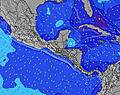 | 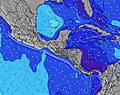 | 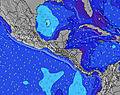 | 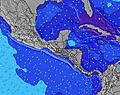 | |||||||||||||
Wave Height (m) Direction Period (s) | SSW 13 | SSW 13 | SSW 13 | SSW 13 | SSW 12 | SSW 12 | SSW 12 | SSW 12 | SSW 12 | SSW 8 | SSW 10 | SSW 10 | SSW 9 | SSW 7 | SSW 8 | SSW 14 | SSW 11 | SSW 14 | SSW 14 | S 13 |
Wave Graph | ||||||||||||||||||||
198 | 195 | 173 | 131 | 115 | 81 | 106 | 79 | 49 | 49 | 108 | 72 | 65 | 49 | 36 | 41 | 43 | 68 | 70 | 128 | |
Wind (km/h) | ||||||||||||||||||||
Wind State on-shore cross-onshore cross-shore cross-offshore off-shore glassy | cross-off | off | off | cross-off | off | off | cross-on | glassy | cross-off | on | cross | glassy | cross-on | glassy | cross-off | glassy | off | cross-off | cross-off | off |
High Tide | 5:03PM3.36m | 5:30AM3.46m | 5:39PM3.36m | 6:03AM3.50m | 6:15PM3.33m | 6:38AM3.50m | 6:53PM3.25m | 7:14AM3.47m | 7:34PM3.15m | 7:55AM3.40m | 8:22PM3.03m | 8:44AM3.30m | 9:18PM2.91m | |||||||
Low Tide | 11:15PM0.40m | 11:36AM0.61m | 11:48PM0.42m | 12:12PM0.58m | 00:22AM0.47m | 12:50PM0.58m | 00:58AM0.56m | 1:30PM0.61m | 1:38AM0.67m | 2:15PM0.67m | 2:24AM0.79m | 3:08PM0.74m | 3:20AM0.92m | |||||||
— | — | 6:13 | — | — | 6:13 | — | — | 6:13 | — | — | 6:13 | — | — | 6:13 | — | — | 6:13 | — | — | |
6:39 | — | — | 6:38 | — | — | 6:38 | — | — | 6:38 | — | — | 6:38 | — | — | 6:37 | — | — | 6:37 | — | |
mm | 3 | 8 | 4 | — | 9 | — | 2 | 2 | 4 | 1 | 9 | 6 | 1 | 7 | 11 | — | — | 4 | — | — |
Temp °C | 29 | 28 | 29 | 29 | 28 | 29 | 29 | 28 | 29 | 29 | 28 | 28 | 28 | 27 | 27 | 26 | 26 | 27 | 28 | 27 |
Feels °C | 31 | 31 | 31 | 32 | 33 | 32 | 33 | 32 | 33 | 33 | 31 | 32 | 30 | 30 | 30 | 31 | 30 | 30 | 31 | 30 |
Swell 1 Height (m) Direction Period (s) | SSW 13 | SSW 13 | SSW 13 | SSW 13 | SSW 12 | SSW 12 | SSW 12 | SSW 12 | SSW 8 | SSW 8 | SSW 10 | SSW 10 | SSW 9 | SSW 7 | SSW 8 | SSW 8 | S 8 | SSW 6 | SSW 6 | S 13 |
198 | 195 | 173 | 131 | 115 | 81 | 106 | 79 | 35 | 49 | 108 | 72 | 65 | 49 | 36 | 36 | 32 | 23 | 21 | 128 | |
Swell 2 Height (m) Direction Period (s) | SSW 8 | SSW 8 | SW 21 | SSW 5 | SSW 6 | SSW 6 | SSW 6 | SSW 6 | SSW 12 | SSW 11 | SSW 13 | SSW 13 | SSW 12 | SSW 12 | SSW 12 | SSW 14 | SSW 11 | SSW 14 | SSW 14 | SSW 7 |
6 | 11 | 17 | 6 | 7 | 12 | 12 | 14 | 49 | 42 | 35 | 33 | 29 | 30 | 15 | 41 | 43 | 68 | 70 | 15 | |
Swell 3 Height (m) Direction Period (s) | S 22 | — | SW 21 | S 20 | SW 16 | SW 16 | — | SSW 15 | SSW 15 | SSW 13 | SW 16 | SW 16 | S 15 | SW 10 | S 10 | S 10 | SSW 13 | S 12 | SSW 12 | SSW 19 |
9 | — | 17 | 8 | 10 | 10 | — | 21 | 21 | 18 | 10 | 10 | 4 | 23 | 8 | 8 | 35 | 24 | 48 | 69 | |
Wind waves Height (m) Direction Period (s) | NE 3 | N 3 | N 3 | NNE 3 | — | — | — | — | — | — | — | — | — | — | — | — | — | — | — | — |
3 | 1 | 4 | 4 | — | — | — | — | — | — | — | — | — | — | — | — | — | — | — | — | |
Nearest Offshore or Glassy | ||||||||||||||||||||
Distance (km) | 44 | 0 | 0 | 0 | 0 | 0 | 248 | 0 | 0 | 249 | 40 | 0 | 248 | 0 | 56 | 0 | 0 | 0 | 0 | 0 |
Best forecast wave conditions in Gulf of Panama | ||||||||||||||||||||
Best forecast wave conditions in Panama | ||||||||||||||||||||
Header Global | ||||||||||||||||||||
- Map Icons:
 Break
Break Live Wave Height (m)
 Live Wind Speed (km/h)
 Surf Rating (10 Max)
 Ocean Swells (m)
- Wind Speed (km/h)
Latest Updates


FREE! Surf-Forecast.com widget for your website
The surf report / weather widget below is available to embed on third party websites free of charge and provides a summary of our Playa Venao surf forecast. Simply grab the html code snippet that we provide and paste it into your own site. You can choose your preferred language and metric/imperial units for the surf forecast feed to suit users of your site. Click here to get the code.
Information about the Playa Venao Surf forecast
The above surf forecast table for Playa Venao provides essential information for determining whether the surfing conditions will be good over the next 16 days. A general guide to surfing at Playa Venao can be found by selecting the local surf guide option on the grey menu. Our Playa Venao surf forecast is unique since it includes wave energy (power) that defines the real feel of the surf rather than just the height or the period. If you surf the same spot (Playa Venao) regularly then make a mental note of the wave energy from the surf forecast table each time you go. Very soon you may start to choose your surf days based on the wave energy alone combined with our forecast of favourable offshore wind conditions. Our star ratings will help here and of course you will also find the usual wave height and period predictions on our surf forecasts as well as a full break down of the swell components under our advanced users option (to reveal that, click the little Einstein character under the tide times).
Further information to help with frequently asked questions about our surf forecast for Playa Venao may be found under the help tab on the top menu and also by moving your mouse over the question marks on the surf forecast table itself. Please always bear in mind that the forecast is for near-shore open water and local factors at each surf break influence the actual breaking wave height, such as the beach / reef profile, water depths offshore and shelter.
Are you planning a holiday in Gulf of Panama? If you are looking for accommodation near Playa Venao, camping, hotels and holiday cottages in Gulf of Panama, consider staying in Chitre which is 70 km (43 miles) away. Alternatively, find information about places to stay and car hire in Las Minas which is 85 km (53 miles) away
 Nearest