

Surf Forecasts:

Punta Brava surf forecast from 1 Aug 2026:
- Best quality surf: Friday 7 Aug, 10AM (local time) - 3ft (0.9m), 13s period, SSW swell with cross-offshore winds.
- Most powerful swell: Saturday 8 Aug, 1PM (local time) - 3.5ft (1.1m), 16s period, SSW swell with 612 kJ wave energy.
- Next surfable swell (1★+): Saturday 1 Aug, 1PM (local time) - 2.5ft (0.8m), 13s period with SSW swell.
Best Forecast Surf Conditions for Punta Brava this week:
The surf forecast for Punta Brava over the next 16 days: The first swell (rated 1 star or higher) is forecast to arrive on Saturday (Aug 01) at 1PM. The primary swell is predicted to be 0.8m and 13s period with a secondary swell of 0.4m and 6s. The wind is predicted to be glassy as the swell arrives.
The most powerful waves expected at Punta Brava in the next 16 days are 1.1m 16s and forecast to arrive on Saturday (Aug 08) at 1PM. Winds are predicted to be cross-offshore at the time the swell arrives.
| Wave Type | Time (EST) & Date | Wave Height & Period |
|---|---|---|
| Next good surf (1 star+) | 1PM (Sat 1st Aug) | 2.5ft (0.8m) 13s |
| Best Surf | 10AM (Fri 7th Aug) | 3ft (0.9m) 13s |
| Most Powerful | 1PM (Sat 8th Aug) | 3.5ft (1.1m) 16s |
Table - best surf conditions forecast for Punta Brava over the next 16 days.
The Lowdown
Alright folks, Rusty here. Let’s talk about what’s on the menu for Punta Brava over the next couple of weeks.
We’re kicking off a stretch of small but clean surf, with a few mornings that’ll be worth the early alarm. The first real standout is Thursday morning, the 6th of August. The water is a touch warmer than normal at 86° – feels like bathwater, but it’s nice. That morning, we’ve got a clean 1ft SSW groundswell with a period of 15 seconds, and the combined energy is moderate at 196. The wind is light and cross-offshore, making it tidy. It’s tiny, but it’ll be fun on a longboard or a foamie. The real gem comes the next day, Friday morning the 7th of August. The swell jumps to 3ft from the SSW with a period of 13 seconds, and the combined energy rockets up to 576 – that’s strong, punchy energy for such a small wave face. The wind is light from the NNE, offshore, and it’s clean. This is the best session of the first week. Crowds are possible here, so get out early.
The pattern holds through the weekend and into the next week. Saturday morning the 8th offers 3ft from the SSW with a 16-second period, and a gentle offshore NNE breeze at 9 mph. Combined energy is 452, strong. Sunday morning the 9th is similar at 3ft and 14 seconds, clean and offshore. Monday morning the 10th is a little smaller at 3ft, but still clean. All these mornings are good, but the 7th remains the top pick.
Now, looking further ahead to the second week, things get interesting. Friday morning the 14th of August brings a SW swell at 2ft, but the period hits 20 seconds – that’s a very long period groundswell. Combined energy is 377, moderate to strong. The wind is light and offshore from the NNE. That long period means the waves will be lined up and powerful for the size, but at a reef break like Punta Brava, that’s a good thing. It’s a promising session, though it’s a week and a half out, so keep an eye on it. Saturday morning the 15th is similar, 2ft from the SW with a 17-second period, light offshore wind, and combined energy 350. Another solid bet.
The afternoons, as you can see, are mostly a write-off with onshore winds and stormy conditions. Stick to the mornings. The standout is clear: Friday morning, August 7th. It’s the best combo of clean conditions, solid energy, and a manageable size for the reef. After that, the long-period groundswell on the 14th and 15th is worth a look for the more experienced crew.
– Rusty
Short Range ForecastHeavy rain (total 32mm), heaviest during Mon afternoon. Warm (max 31°C on Sat morning, min 26°C on Mon night). Wind will be generally light. | Days 4-6 Weather SummaryHeavy rain (total 37mm), heaviest during Wed morning. Warm (max 29°C on Thu afternoon, min 24°C on Wed afternoon). Wind will be generally light. | ||||||||||||||||||||
Saturday 1 | Sunday 2 | Monday 3 | Tuesday 4 | Wednesday 5 | Thursday 6 | Friday 7 | |||||||||||||||
AM | PM | Night | AM | PM | Night | AM | PM | Night | AM | PM | Night | AM | PM | Night | AM | PM | Night | AM | PM | Night | |
Swell Height Map |  |  |  | 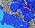 | 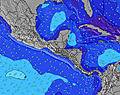 |  | 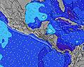 | ||||||||||||||
Wave Height (m) Direction Period (s) | SSW 13 | SSW 13 | SSW 12 | SSW 12 | SSW 11 | SSW 12 | SSW 14 | SSW 13 | SSW 10 | SSW 9 | SSW 9 | SSW 8 | SSW 12 | SSW 14 | SSW 13 | SSW 15 | SSW 14 | SSW 13 | SSW 13 | SSW 17 | SSW 16 |
Wave Graph | |||||||||||||||||||||
212 | 206 | 127 | 123 | 87 | 199 | 77 | 69 | 137 | 86 | 111 | 68 | 89 | 118 | 96 | 84 | 120 | 137 | 246 | 267 | 291 | |
Wind (km/h) | |||||||||||||||||||||
Wind State on-shore cross-onshore cross-shore cross-offshore off-shore glassy | off | cross-on | cross-off | off | on | cross-off | glassy | on | glassy | glassy | on | cross | cross-on | cross-on | cross-off | cross-off | cross-off | off | cross-off | on | glassy |
High Tide | 5:38PM3.19m | 6:04AM3.32m | 6:15PM3.16m | 6:38AM3.33m | 6:53PM3.09m | 7:14AM3.30m | 7:34PM2.99m | 7:55AM3.23m | 8:21PM2.87m | 8:43AM3.14m | 9:18PM2.75m | 9:42AM3.04m | 10:26PM2.67m | ||||||||
Low Tide | 11:36AM0.59m | 11:48PM0.40m | 12:12PM0.56m | 00:22AM0.45m | 12:49PM0.56m | 00:57AM0.53m | 1:30PM0.59m | 1:37AM0.63m | 2:15PM0.64m | 2:23AM0.75m | 3:09PM0.70m | 3:20AM0.87m | 4:13PM0.75m | ||||||||
6:16 | — | — | 6:16 | — | — | 6:16 | — | — | 6:18 | — | — | 6:18 | — | — | 6:18 | — | — | 6:18 | — | — | |
— | 6:44 | — | — | 6:44 | — | — | 6:44 | — | — | 6:44 | — | — | 6:43 | — | — | 6:43 | — | — | 6:43 | — | |
mm | — | 6 | 4 | 1 | 1 | 4 | 3 | 7 | 6 | 4 | 4 | 1 | 13 | 10 | 5 | — | — | — | — | 1 | 2 |
Temp °C | 31 | 29 | 28 | 30 | 29 | 27 | 29 | 29 | 27 | 28 | 28 | 27 | 27 | 25 | 25 | 28 | 29 | 27 | 30 | 30 | 28 |
Feels °C | 35 | 31 | 32 | 34 | 31 | 31 | 33 | 32 | 31 | 33 | 31 | 30 | 31 | 29 | 28 | 30 | 32 | 31 | 33 | 33 | 33 |
Swell 1 Height (m) Direction Period (s) | SSW 13 | SSW 13 | SSW 12 | SSW 12 | SSW 11 | SSW 12 | SSW 8 | SSW 8 | SSW 10 | SSW 9 | SSW 9 | SSW 8 | SSW 8 | SSW 6 | SSW 8 | SSW 7 | SSW 14 | SSW 13 | SSW 13 | SSW 12 | SSW 12 |
212 | 206 | 127 | 123 | 87 | 199 | 49 | 49 | 137 | 86 | 111 | 68 | 67 | 35 | 51 | 31 | 120 | 137 | 246 | 217 | 164 | |
Swell 2 Height (m) Direction Period (s) | SSW 6 | SW 16 | SSW 6 | S 6 | S 7 | SW 15 | SSW 12 | SSW 11 | SSW 13 | SW 13 | SSW 12 | SSW 12 | SSW 12 | SSW 14 | SSW 13 | SSW 12 | SSW 12 | SSW 11 | SSW 18 | SSW 17 | SSW 16 |
11 | 11 | 12 | 20 | 22 | 54 | 54 | 47 | 69 | 78 | 58 | 58 | 89 | 118 | 96 | 81 | 78 | 88 | 123 | 267 | 291 | |
Swell 3 Height (m) Direction Period (s) | SW 21 | SW 20 | SW 16 | SSW 16 | SSW 14 | SW 18 | SSW 14 | SSW 13 | SSW 16 | SSW 10 | SW 15 | S 15 | S 21 | S 22 | SSW 20 | SSW 15 | SSW 7 | SSW 18 | SSW 18 | SSW 12 | SSW 6 |
17 | 15 | 10 | 26 | 82 | 12 | 77 | 69 | 26 | 10 | 8 | 4 | 9 | 9 | 37 | 84 | 29 | 134 | 207 | 140 | 27 | |
Wind waves Height (m) Direction Period (s) | — | SSW 6 | — | — | — | — | — | — | — | — | — | — | — | — | WSW 6 | — | — | — | — | — | — |
— | 11 | — | — | — | — | — | — | — | — | — | — | — | — | 10 | — | — | — | — | — | — | |
Nearest Offshore or Glassy | |||||||||||||||||||||
Distance (km) | 0 | 86 | 0 | 0 | 68 | 0 | 0 | 86 | 0 | 0 | 291 | 41 | 131 | 41 | 41 | 0 | 0 | 0 | 0 | 86 | 0 |
Best forecast wave conditions in Veraguas | |||||||||||||||||||||
Best forecast wave conditions in Panama | |||||||||||||||||||||
Header Global | |||||||||||||||||||||
- Map Icons:
 Break
Break Live Wave Height (m)
 Live Wind Speed (km/h)
 Surf Rating (10 Max)
 Ocean Swells (m)
- Wind Speed (km/h)
Latest Updates


FREE! Surf-Forecast.com widget for your website
The surf report / weather widget below is available to embed on third party websites free of charge and provides a summary of our Punta Brava surf forecast. Simply grab the html code snippet that we provide and paste it into your own site. You can choose your preferred language and metric/imperial units for the surf forecast feed to suit users of your site. Click here to get the code.
Information about the Punta Brava Surf forecast
The above surf forecast table for Punta Brava provides essential information for determining whether the surfing conditions will be good over the next 16 days. A general guide to surfing at Punta Brava can be found by selecting the local surf guide option on the grey menu. Our Punta Brava surf forecast is unique since it includes wave energy (power) that defines the real feel of the surf rather than just the height or the period. If you surf the same spot (Punta Brava) regularly then make a mental note of the wave energy from the surf forecast table each time you go. Very soon you may start to choose your surf days based on the wave energy alone combined with our forecast of favourable offshore wind conditions. Our star ratings will help here and of course you will also find the usual wave height and period predictions on our surf forecasts as well as a full break down of the swell components under our advanced users option (to reveal that, click the little Einstein character under the tide times).
Further information to help with frequently asked questions about our surf forecast for Punta Brava may be found under the help tab on the top menu and also by moving your mouse over the question marks on the surf forecast table itself. Please always bear in mind that the forecast is for near-shore open water and local factors at each surf break influence the actual breaking wave height, such as the beach / reef profile, water depths offshore and shelter.
Are you planning a holiday in Veraguas? If you are looking for accommodation near Punta Brava, camping, hotels and holiday cottages in Veraguas, consider staying in Manzanillo which is 17 km (11 miles) away. Other places in and around Veraguas where you can find information about places to rent, and car hire include Las Minas which is 57 km (35 miles) away, Santiago de Veraguas and Chitre.
 Nearest